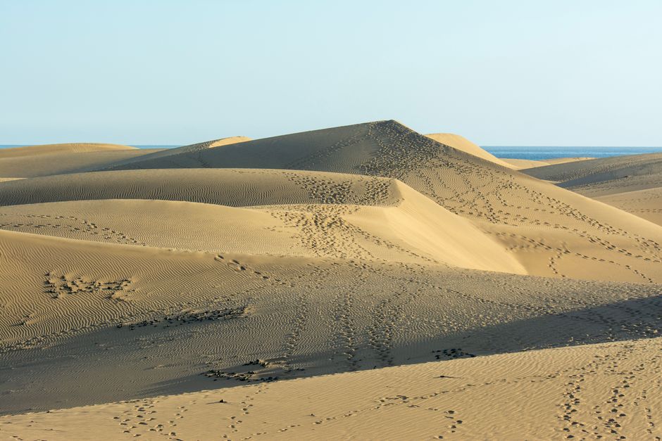
The Maspalomas Dunes are a small desert of golden sand on the south coast of Gran Canaria, between the resort of Playa del Inglés and the Maspalomas lighthouse. They are a protected nature reserve of about 404 hectares, open to everyone and free, with a long beach on their seaward side. You may walk across them, but only on the marked paths: the Cabildo and the town council ask you not to build stone windbreaks, not to disturb plants and animals, and not to camp (as of October 2026).
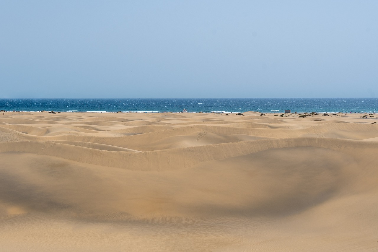
Right now in Maspalomas Dunes
- Wed23–27°C73–81°FMostly clear
- Thu22–25°C72–78°F1 mm rain
- Fri22–25°C71–76°FMostly clear
- Mon 12 Oct National Day of Spain (Fiesta Nacional de España)
Tickets and tours for Maspalomas Dunes
See all tours for Maspalomas Dunes →
From local operators, with prices and reviews; you check availability and book on Viator, our partner. We may earn a commission at no extra cost to you. How we earn money
What it is and why it matters
The Natural Dune Reserve of Maspalomas, protected since 1987 and a Special Nature Reserve since 1994, is made of three linked habitats that run parallel to the sea: the palm grove (Palmeral), the lagoon (La Charca) and the dunes themselves. Wind from the ocean keeps reshaping the sand, so the ridges and hollows change from year to year.
The dunes are also shrinking. The tourist board estimates that around 45,000 cubic metres of sand are lost each year, much of it ending up on the sea bed, after decades of building and trampling changed how the wind moves the sand. Since 2018 the Cabildo de Gran Canaria and San Bartolomé de Tirajana town council have run a recovery plan, Masdunas, with signposted routes and restored areas. Without it, they warn, the dunes could vanish within a generation. For the rest of the island, see our Gran Canaria travel guide.
What you’ll see
The dune field
Crests of fine, pale sand up to several metres high, rippled by the wind, with tufts of tough coastal plants in the hollows. Early and late in the day, low light and long shadows make it look like the Sahara, a few minutes from hotel pools.
The beach
On the sea side, one long beach curves from the Playa del Inglés end round the Punta de Maspalomas to the lighthouse; it simply changes name at the point. Locals and visitors walk it end to end. Surfers gather on the bend, and the quieter middle stretches are used for nude bathing: between beach kiosks 3 and 4 coming from the lighthouse, and between kiosks 5 and 6 coming from Playa del Inglés.
La Charca and the lighthouse
At the western edge, the brackish lagoon of La Charca is a resting place for birds migrating between Europe and Africa. Beyond it rises the Maspalomas lighthouse, 55 metres high, first lit on 1 February 1890 after 28 years of work, when this coast was empty sand. Today it marks the start of the Meloneras promenade, lined with restaurants and shops.
Rules and practical information (as of October 2026)
- Free and open: there is no ticket or booking. The dunes are not closed to the public.
- Keep to the marked paths and areas. The Masdunas plan restored about 8 km of paths and tracks across the reserve, marked by signs and posts.
- Don’t build windbreaks or other structures from stones, and don’t move plants or disturb wildlife.
- No camping anywhere in the reserve.
- Facilities are on the edges: beach kiosks, hotels and the promenades at Playa del Inglés and Meloneras. There is no shade, water or toilet on the sand itself.
Getting there
You can walk in from Playa del Inglés, Maspalomas or Meloneras. Popular starting points are the viewpoint at the top of the dunes at the Playa del Inglés end and the lighthouse at the western end. By bus, Global lines 66 and 90 run from Gran Canaria Airport to Faro de Maspalomas in about 40 minutes (€4.05), and lines 30 and 50 link Las Palmas with Maspalomas (as of October 2026). Global line 18 to the mountains and Roque Nublo starts at Faro de Maspalomas too.
When to go and how long to allow
The south of Gran Canaria is dry and sunny all year, so the dunes work in any season. Go in the first two hours after sunrise or the last two before sunset: the sand is cooler, the light is softer and there are fewer people. Crossing from Playa del Inglés to the lighthouse by the paths or along the shore takes about an hour; add time for a swim and a drink on the promenade.
Safety
- Heat: at midday the sand gets very hot and reflects the sun. Wear shoes or sandals, a hat and sunscreen, and carry water.
- Wind: strong trade winds can whip up the sand; protect your eyes and cameras.
- Don’t get lost: the dunes all look alike. Stick to the marked paths and use the lighthouse and the hotels as landmarks.
- Swimming: follow the flags and lifeguards’ advice, and take care on the open, wavier stretch near the point.
- In an emergency call 112.
Combine it with
End the day with dinner on the Meloneras promenade by the lighthouse. Next day, head up to the island’s centre for Roque Nublo and Tejeda, or west to the calm coves of Amadores and the harbour of Puerto de Mogán. Gran Canaria’s other great beach is Las Canteras in Las Palmas, good for snorkelling and surf lessons. More ideas are in our beaches guide; for desert-like volcanic scenery on the next island, see Teide National Park.
Maspalomas Dunes FAQ
Can you walk on the Maspalomas Dunes?
Yes. The dunes are open and free, but they are a protected reserve: walk only on the marked paths, follow the signs, don’t build stone windbreaks and don’t camp.
Do you have to pay to visit the Maspalomas Dunes?
No. There is no entrance fee or booking. You pay only for extras such as sunbeds, kiosks and parking in the resorts.
Is there a nudist beach at Maspalomas?
Yes. Nude bathing is common on the quieter middle stretches, between kiosks 3 and 4 coming from the lighthouse and between kiosks 5 and 6 coming from Playa del Inglés.
How long does it take to walk across the dunes?
About an hour from Playa del Inglés to the Maspalomas lighthouse, by the paths or along the shore. Go early or late, when the sand is cooler.
How do I get to the Maspalomas Dunes from the airport?
Take Global bus 66 or 90 from Gran Canaria Airport to Faro de Maspalomas, about 40 minutes and €4.05 (as of October 2026), then walk in from the lighthouse.
Sources
Researched and last reviewed by TravelerCenter on 4 October 2026. Reserve rules, the Masdunas plan, the lighthouse and the nudist areas come from the official Gran Canaria tourist board (Cabildo de Gran Canaria); the reserve’s size and protection dates from the Canary Government’s education wiki; buses from Global. Rules can change, so check the signs at the entrances.
Data: Weather: MET Norway (CC BY 4.0) · Rates: ECB · Holidays: Nager.Date · Costs: World Bank ICP and price levels · © OpenStreetMap contributors (ODBL) · Wikidata (CC0)