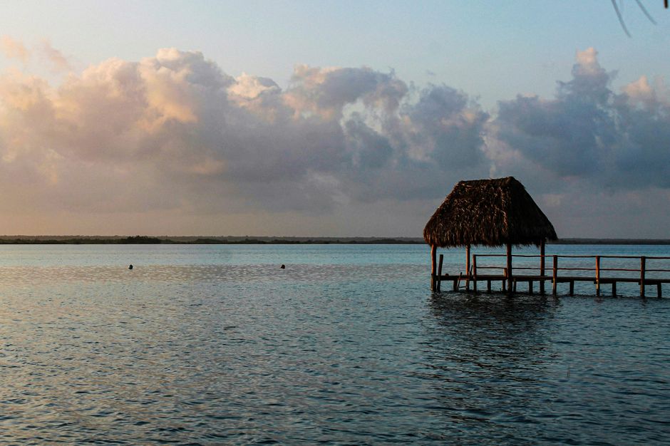
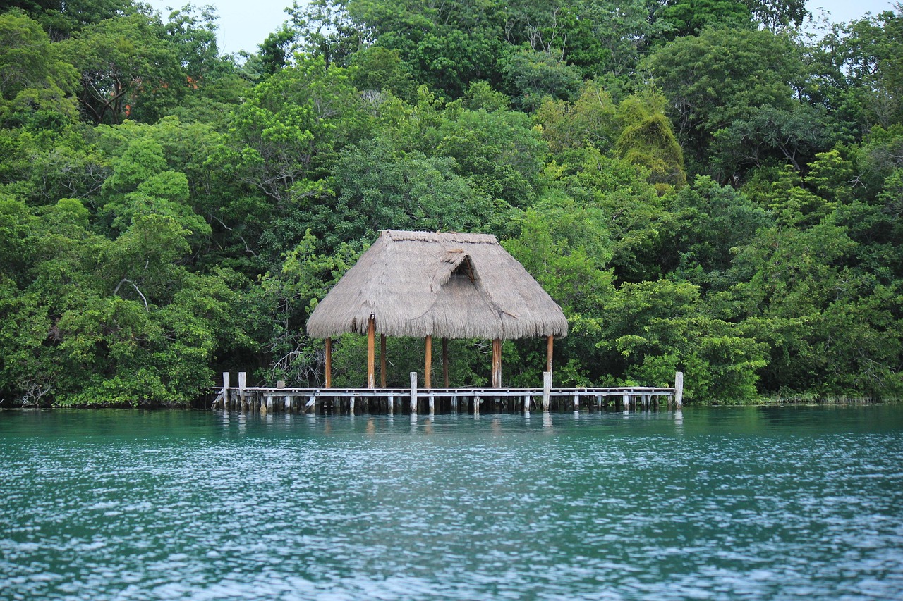
Bacalar is a small town in southern Quintana Roo on the shore of the Laguna de Bacalar, a long, narrow freshwater lagoon famous as the “lagoon of seven colors” for its bands of turquoise, blue and deep navy over white limestone sand. It lies about 40 km (25 miles) north of Chetumal and the border with Belize, far from the big resorts, and has a relaxed mix of small hotels on wooden piers, kayaks and sailboats, cenotes and some of the oldest living organisms on Earth, the stromatolites. Bacalar also has an 18th-century Spanish fort, Maya ruins nearby and a Tren Maya station. The dry months from December to April are the best time to visit, and the lagoon is not affected by the sargassum that reaches the Caribbean beaches.
Right now in Bacalar
- Tue 24–31°C 76–88°F 7 mm Showers
- Wed 25–32°C 77–89°F 4 mm Rain
- Thu 24–31°C 76–87°F 6 mm Rain
Weather: MET Norway (CC BY 4.0) · Rates: ECB
Top tours in Bacalar
See all tours for Bacalar →
From local operators, with prices and reviews; you check availability and book on Viator, our partner. We may earn a commission at no extra cost to you. How we earn money
Bacalar at a glance
- Best for: calm freshwater swimming, kayaking, paddleboarding and sailing, cenotes, a slow pace, and Maya sites in the forest.
- How long: 2–3 days for the lagoon and the town; 4–5 days to add Chacchoben, Mahahual or Kohunlich.
- Best time: December to April, with highs of 29–33 °C (84–92 °F) and fewer rainy days. June to October is hot and wet, and the Atlantic hurricane season runs from June 1 to November 30.
- Getting there: the Tren Maya or ADO bus from Cancún or Tulum, or about 40 minutes by road from Chetumal’s airport.
- Getting around: walking and bikes in town, taxis, and a car for cenotes and ruins.
- Before you go: pay the Quintana Roo VISITAX (MXN 293 per foreign visitor as of October 2026); entry rules, money and general safety are in our Mexico travel guide; for the north of the coast, see our Tulum guide.
Bacalar’s areas: where things are
The lagoon runs north to south for more than 40 km (25 miles), parallel to Highway 307. The town sits on its western shore, roughly in the middle; hotels and private piers stretch along the shore north and south of town.
The town center
A grid of low streets around the main square, the Fuerte de San Felipe and the costera, the lakeside road. It has restaurants, tour agencies, small hotels and the public piers, all within walking distance.
The costera and the southern shore
South of town, the lakeside road leads past hotels and guesthouses with their own piers, then to Cenote Azul by the highway and on toward Los Rápidos. Many of the nicest small hotels are here.
The northern shore
North of the center, quieter hotels and eco-lodges sit among the trees, closer to the Canal de los Piratas and the northern parts of the lagoon. You will want a bike, car or taxi.
Top things to see in Bacalar
Prices and hours below were checked on the official sites in October 2026, unless we say otherwise; check again before you go.
The lagoon of seven colors
The colors come from the lagoon’s varying depth over white sand, its clear fresh water and the sunlight; they are most vivid on sunny days around midday. Swim from public piers in town or from hotel docks, rent a kayak or paddleboard at sunrise when the water is glassy, or take a sailboat or pontoon tour. Boat tours usually stop at the Cenote Negro, a deep sinkhole inside the lagoon, the Isla de los Pájaros, a bird island seen from the water, and the Canal de los Piratas, a channel once used by pirates, where the sandy bottom lets you stand in the shallows and scrub with white clay.
Stromatolites and Los Rápidos
Bacalar has some of the largest freshwater stromatolite formations in the world: rock-like mounds built over thousands of years by microbial communities, among the oldest forms of life on Earth. They are fragile. Never stand on them or touch them, use only biodegradable sunscreen, or better none in the water, and choose non-motorized tours. At Los Rápidos, south of town, a gentle current flows through a narrow channel lined with stromatolites; you can float with a life jacket and kayak, entering only at the designated areas.
Cenote Azul
Just south of town by Highway 307, Cenote Azul is a large, round, very deep sinkhole of dark-blue water ringed by trees, with a restaurant and swimming platforms. The water is calm but very deep, so wear a life jacket if you are not a strong swimmer; there is a small entry fee.
Fuerte de San Felipe
This star-shaped Spanish fort, built in the 18th century above the lagoon to defend the town against pirates and British loggers from present-day Belize, has a small museum on the region’s history, including the Caste War of the 19th century, and lovely views over the water. There is a small entry fee.
More to see
- Balnearios: public and private bathing areas with piers, ladders and restaurants along the costera, such as the municipal balneario in town.
- The Bacalar church and square: evening life, food stalls and crafts.
- Sunrise on the water: the lagoon faces east, and early morning brings the calmest water and the best light.
Museums
- San Felipe Fortress, Bacalar
Nature
- Bacalar Lagoon (Lagoon of Seven Colors)
Archaeological sites
- Chacchoben
Activities and best months
- CultureINAH's Chacchoben archaeological zone, 9 km from the Highway 307 turn-off north of Bacalar, is open daily 9:00-17:00 (MXN 155). · source
Other things to do in Bacalar
Kayaking, paddleboarding and sailing
Bacalar’s flat water is perfect for paddling: rent a kayak or board by the hour, or join a guided sunrise tour. Sailboat tours are a quieter alternative to motorboats, and several operators run them from the town piers. Choose operators that follow the municipality’s rules on routes and speeds.
Cenotes, birds and food
Besides Cenote Azul, there are smaller cenotes in the forest around the lagoon, many run by local families. Herons, ospreys and kingfishers are easy to see from a kayak. In town, try Yucatecan food such as cochinita pibil and panuchos, fresh fish, and the marquesitas (rolled crepes) sold in the square at night.
Day trips from Bacalar
- Chacchoben: a Maya site of temples among tall trees about 45 minutes north. According to the National Institute of Anthropology and History (INAH), it opens daily from 9 a.m. to 5 p.m., and entry costs MXN 155 (about US$8.50); it is quietest when no cruise-ship tours from Mahahual are visiting.
- Mahahual: a small Caribbean fishing village and cruise port about 1.5 hours east, with a beach promenade and snorkeling on the reef; Banco Chinchorro, a coral atoll, lies offshore.
- Kohunlich and Dzibanché: Maya sites in the forest west of Chetumal; Kohunlich is famous for its large stucco masks.
- Chetumal: the state capital on the bay, 40 minutes south, with the Museum of Maya Culture and a seafront boulevard.
- Tulum: about 2.5 hours north by car or Tren Maya; see our Tulum guide.
Nearby destinations
- Ambergris Caye88 km
- Caye Caulker111 km
- Tulum196 km
- Tikal National Park208 km
- Placencia240 km
- Cozumel Island248 km
- Playa del Carmen257 km
- Riviera Maya257 km
Getting there and getting around
By the Tren Maya
Bacalar has a Tren Maya station outside town. According to the official timetable checked in October 2026, two trains a day each way run between Cancún (Estación Cancún, near the airport) and Chetumal via Tulum and Bacalar, leaving Cancún at 8:00 a.m. and 2:33 p.m. and Chetumal at 8:50 a.m. and 3:30 p.m., about 5 hours 15 minutes end to end; Bacalar is the stop before Chetumal. Foreign visitors pay the international fare, which varies with the date; book on the official site or app, carry your passport, and arrange a taxi from the station.
By bus, car and air
ADO buses run to Bacalar from Cancún, Playa del Carmen, Tulum and Chetumal; from Cancún the trip takes roughly five to six hours. Highway 307 links Bacalar with Tulum, about 2.5 hours north. The nearest airport is Chetumal International (CTM), about 40 minutes south, with domestic flights; Cancún (CUN) has far more international flights.
Getting around Bacalar
The center and the costera are walkable, and bikes are a good way to reach hotels along the shore. Taxis are cheap within town; agree on the fare first. A rental car makes it easy to reach Cenote Azul, Los Rápidos, Chacchoben and Mahahual.
When to go and how long to stay
Bacalar is warm all year. The table uses the National Meteorological Service’s (SMN-Conagua) 1991–2020 climate normals for the Chacchoben station, in the municipality of Bacalar about 30 km (19 miles) north of town: average daily highs and lows, and days with rain.
| Season | Average high / low | Rainy days per month | What it’s like | Good for |
|---|---|---|---|---|
| Winter (Dec–Feb) | 29–30 °C (84–86 °F) / 18–19 °C (64–66 °F) | 3–7 | Warm days, cooler nights; occasional northerly fronts | Kayaking, ruins, the best water colors on sunny days |
| Spring (Mar–May) | 32–34 °C (89–93 °F) / 19–22 °C (65–72 °F) | 2–6 | Dry and hot, with storms starting in May | Swimming, sailing, cenotes |
| Summer (Jun–Aug) | 32–34 °C (90–92 °F) / 23 °C (73–74 °F) | 10–11 | Hot and humid, with afternoon storms | Early-morning paddling, lower prices |
| Fall (Sep–Nov) | 33 °C falling to 30 °C (92 to 86 °F) / 23 °C falling to 20 °C (74 to 68 °F) | 13 in September and October, 8 in November | The wettest months and peak hurricane season | Quiet stays; watch the forecast |
The station records about 1,410 mm (55 in) of rain a year; September and October are the wettest months, with about 207 mm (8 in) each. Heavy rain can cloud the lagoon’s colors for a few days.
Hurricane season: according to NOAA’s National Hurricane Center, the Atlantic hurricane season runs from June 1 to November 30, peaking from mid-August to mid-October. If a storm threatens, follow the instructions of Quintana Roo’s civil protection authorities and your hotel, and check Mexico’s National Meteorological Service (SMN) and the National Hurricane Center; travel insurance that covers weather is wise.
2 to 3 days in Bacalar
Day one, a sunrise kayak or paddleboard, the Fuerte de San Felipe and a swim from a town pier. Day two, a sailboat tour to the Cenote Negro, Isla de los Pájaros and the Canal de los Piratas, then Cenote Azul. Day three, float at Los Rápidos or simply rest by the water.
4 to 5 days in Bacalar
Add Chacchoben in the morning, a day at Mahahual’s beach and reef, and Kohunlich or Chetumal’s Maya museum. With five days, continue north to Tulum by Tren Maya.
Where to stay in Bacalar and the hotel taxes
- The town center: hostels, guesthouses and small hotels near the square and public piers; the best value.
- The costera south of town: boutique hotels with their own piers and kayaks, walking or cycling distance from the center.
- The northern shore: quiet eco-lodges and cabins among the trees; you will need transport.
- Near Los Rápidos: a few remote lodges for total calm.
Rooms carry 16% federal IVA plus Quintana Roo’s lodging tax of 5% (6% when booked through a platform such as Airbnb), according to the state’s lodging tax law. The municipality of Bacalar also charges an environmental sanitation fee of 45% of Mexico’s daily UMA reference unit, MXN 52.79 (about US$3) per room per night as of 2026, collected by the hotel; lagoon boat tours and lakeside balnearios add MXN 23.46 per person (20% of the UMA), collected with the ticket. Residents of Quintana Roo are exempt. Every foreign visitor must also pay the state’s VISITAX of MXN 293 before leaving Quintana Roo.
Practical tips for Bacalar
- Cash: bring pesos for tours, balnearios, cenotes and small restaurants; there are a few ATMs in town.
- Protect the lagoon: no sunscreen or repellent in the water, never step on stromatolites, and prefer kayaks, paddleboards and sailboats to motorboats.
- Swim safely: the lagoon drops off suddenly in places, and Cenote Azul and the Cenote Negro are very deep; wear a life jacket if you are not a strong swimmer.
- Tipping: 10–15% in restaurants; tip boat captains and guides.
- Safety: Bacalar is a small, relaxed town. Keep valuables out of sight on piers and in kayaks, use lights on bikes at night, drive by day on the highway, and don’t buy drugs.
- Emergencies: call 911; the nearest large hospitals are in Chetumal.
What to pack for Bacalar
Bring swimwear, a hat, sunglasses and biodegradable sunscreen (to use away from the water), water shoes for sandy and rocky entries, a dry bag for kayaking and a light long-sleeved shirt for sun protection on the water. Pack strong insect repellent for the evenings, a light sweater for winter nights, a rain jacket from June to November and a headlamp. Plugs are the US type.
Bacalar travel FAQ
Why is Bacalar called the lagoon of seven colors?
Because its clear fresh water over white limestone sand shows bands of turquoise, blue and navy, depending on the depth and the light.
Does Bacalar have sargassum?
No. Bacalar is a freshwater lagoon, so the sargassum seaweed that can reach the Caribbean beaches does not affect it.
How do I get to Bacalar from Cancún?
By Tren Maya, with two trains a day each way between Cancún and Chetumal via Bacalar, by ADO bus in about five to six hours, or by car on Highway 307.
What are the stromatolites in Bacalar?
Rock-like structures built by microbial communities over thousands of years, among the oldest forms of life on Earth. They are fragile, so never stand on or touch them.
What fees are added in Bacalar?
16% IVA, Quintana Roo’s 5% lodging tax (6% via platforms), Bacalar’s fee of MXN 52.79 per room per night and MXN 23.46 per person for lagoon tours and balnearios. VISITAX is separate.
Do I need to pay VISITAX in Bacalar?
Yes. Bacalar is in Quintana Roo, so every foreign visitor pays VISITAX, MXN 293 as of October 2026, online at visitax.gob.mx.
How much is Chacchoben?
MXN 155 (about US$8.50), open daily from 9 a.m. to 5 p.m., according to INAH. It is about 45 minutes north of Bacalar.
Can you swim in Bacalar lagoon?
Yes, from public piers, balnearios and hotel docks. The water is calm and fresh, but it gets deep quickly in places, so wear a life jacket if needed.
What is the best time to visit Bacalar?
December to April for drier weather and bright colors. September and October are the wettest months and the peak of hurricane season.
What is the nearest airport to Bacalar?
Chetumal International Airport (CTM), about 40 minutes south, with domestic flights. Cancún has far more international flights.
Sources
- © OpenStreetMap contributors · ODbL · fetched 4 Oct 2026
- Wikidata · CC0 · fetched 4 Oct 2026
Sources and last review
Researched and last reviewed on 4 October 2026. Chacchoben: the National Institute of Anthropology and History (INAH); Tren Maya: the operator’s official timetable; the municipal environmental fees: the Bacalar municipal finance law, as published by the Quintana Roo congress; the lodging tax and VISITAX: Quintana Roo’s state laws and visitax.gob.mx; hurricane season: NOAA’s National Hurricane Center; climate: SMN-Conagua 1991–2020 normals for the Chacchoben station. Bus times, distances, the lagoon’s sights and rules, stromatolite facts, the fort’s history and fees, and Cenote Azul come from secondary sources or general knowledge and are flagged for checking. Prices and timetables change, so check the official sites before you go. For entry rules, money and general safety, see our Mexico travel guide.
Plan your trip
Partner links: TravelerCenter may earn a commission if you book, at no extra cost to you.
🇪🇸 Useful Spanish phrases for Bacalar
All 38 Spanish phrases: restaurant, hotel, emergencies, romance (printable) →