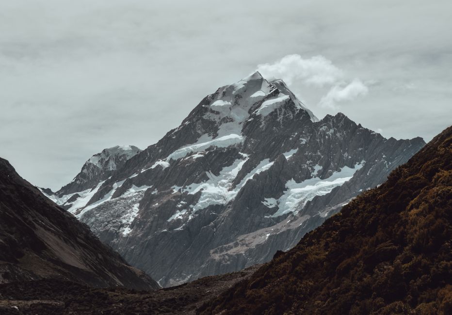
Aoraki/Mount Cook National Park protects the highest part of New Zealand’s Southern Alps, in the heart of the South Island. The Department of Conservation (DOC) calls it a rugged land of ice and rock: 19 peaks rise above 3,000 m (9,840 feet), glaciers cover about 40% of the park, and at its center stands Aoraki/Mount Cook, the country’s highest mountain at 3,724 m (12,218 feet). Aoraki is the most sacred ancestor of Ngāi Tahu, the main iwi of the South Island; in their tradition, Aoraki and his brothers were turned to stone and became the peaks of the Alps. The park is part of Te Wāhipounamu – South West New Zealand World Heritage Area and lies inside the Aoraki Mackenzie International Dark Sky Reserve, one of the best places in the world to see the southern night sky. You don’t have to be a mountaineer to enjoy it. A single road, State Highway 80, runs along the shore of turquoise Lake Pukaki to Aoraki/Mount Cook Village, where easy, well-made tracks lead to glacier lakes, swing bridges and views of the summit. The Hooker Valley Track, which gained a new 189 m (620-foot) swing bridge in July 2026, is one of New Zealand’s best short walks. Stay at least one night to see the mountain at dawn or dusk, and the stars after dark.
Right now in Aoraki / Mount Cook National Park (Aoraki/Mount Cook Village)
- Wed 3–7°C 38–44°F 6 mm Light rain
- Thu 5–8°C 41–46°F Cloudy
- Fri 1–8°C 33–47°F Mostly clear
Top tours in Aoraki / Mount Cook National Park
See all tours for Aoraki / Mount Cook National Park →
From local operators, with prices and reviews; you check availability and book on Viator, our partner. We may earn a commission at no extra cost to you. How we earn money
Aoraki/Mount Cook at a glance
- Best months: November to April for walking, with long days and wildflowers (Mount Cook lilies bloom in November and December); June to September for snow-covered scenery and the clearest night skies, with icy tracks.
- Time needed: one night at minimum; two or three days to add the Tasman Glacier, Sealy Tarns or Mueller Hut and stargazing.
- Getting there: about 3.5 to 4 hours (330 km, 205 miles) from Christchurch, 3 hours from Queenstown, 2.5 hours from Wānaka and 50 minutes from Twizel. There are no scheduled flights.
- Costs (as of October 2026): entry to the park is free; parking at the White Horse Hill car park (Hooker Valley Track) costs NZ$2.50 per half hour or NZ$25 a day (about US$14).
- Before you go: entry rules, the NZeTA and visitor levy, biosecurity and driving rules are in our New Zealand travel guide.
Park fees, parking and a proposed access charge (as of October 2026)
Traveler Tool – Money exchange →
There is no entry fee for the national park, and the day walks are free. DOC charges for parking at White Horse Hill car park, the start of the Hooker Valley Track and the route to Mueller Hut: NZ$2.50 per half hour or NZ$25 a day. Parking is free if you leave within 20 minutes; otherwise pay on arrival at the machines (card only, no cash) or online. If you arrive one day and leave the next, you pay for two days (NZ$50); locals and frequent visitors can buy an annual permit online. Overnight stays at White Horse Hill Campground and in DOC’s alpine huts, such as Mueller Hut, carry separate fees and must be booked.
The government’s Conservation Amendment Bill, introduced in May 2026, would allow DOC to charge international visitors for access to some popular sites, and Aoraki/Mount Cook is one of the four being investigated. As of October 2026, it was not law and no charge applied; check DOC before a 2027 visit.
Safety: alpine weather, avalanches, ice and glacial lakes
Traveler Tool – Local Safety Info →
- Weather: the park is exposed to fierce westerly storms, with very heavy rain, strong winds and snow possible in any month. Conditions can change within an hour. Check the NIWA and MetService park forecasts at the visitor center before setting out.
- Ice in winter: the Hooker Valley Track can be very icy in shaded areas and extremely slippery; DOC recommends microspikes and hiking poles in winter.
- Glacial lakes: stay out of the lakes. DOC says they are typically about 3 °C (37 °F) and can quickly cause hypothermia. Don’t walk on frozen lakes, as the ice can break, and don’t climb on icebergs, which can roll without warning.
- Avalanches: the main day tracks are designed to avoid avalanche paths; stay on them. Above the valleys, including the Mueller Hut Route in winter and spring, avalanche terrain is serious; check the New Zealand avalanche forecast and go only with skills and equipment.
- Alpine routes: climbing Aoraki and the higher peaks is technical mountaineering; many climbers have died here. Hire a guide, and register your plans at the visitor center.
- Driving: snow can close State Highway 80. Watch for ice in shaded corners, wind gusts along Lake Pukaki and one-lane bridges; drive on the left.
- No fuel or ATM in the village: fill up in Twizel or Tekapo.
- Emergencies: call 111; mobile coverage is limited outside the village, so carry a personal locator beacon on longer walks.
Top things to see in Aoraki/Mount Cook National Park
Hooker Valley Track
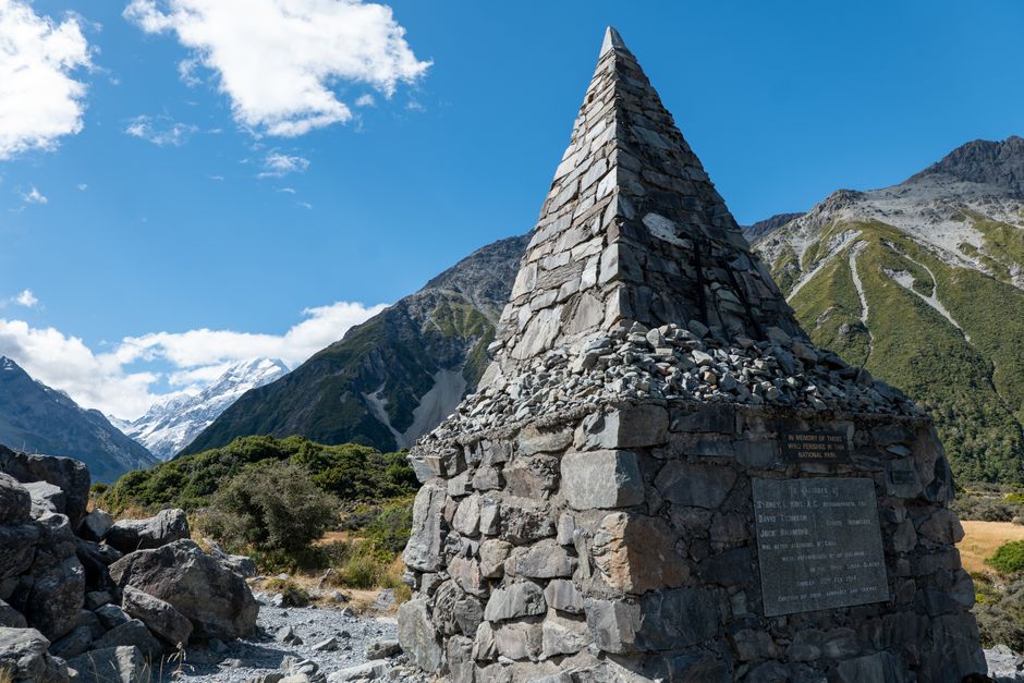
DOC calls it one of New Zealand’s best day walks: a 10 km (6.2-mile) return walk of about 3 hours on a gravel track with some steps, from White Horse Hill car park up the Hooker Valley to Hooker Lake, which lies at the foot of Aoraki/Mount Cook and is speckled with icebergs in summer. The walk is graded easy to intermediate and passes the Alpine Memorial and Freda’s Rock in the first 15 minutes, then crosses three swing bridges. The new second swing bridge, opened in July 2026, is 189 m long, the longest suspension bridge in New Zealand. Toilets are about 15 minutes past the second bridge. The area is sacred to Ngāi Tahu and has Tōpuni status, a symbolic cloak of protection. Drones are prohibited without a permit, and dogs are not allowed. Go early or late in the day for fewer people and softer light, and bring a warm layer: the wind off the glacier can be bitter.
Tasman Glacier and the Blue Lakes
The Tasman Glacier, New Zealand’s longest, is 23 km (14 miles) long and up to 3 km wide, with ice about 600 m deep near the Hochstetter Icefall, though its lower part is covered with rock. From the Tasman Valley car park, about 10 minutes’ drive from the village, the Tasman Glacier View Track climbs a set of steps (about 40 minutes return) to a viewpoint over the glacier’s terminal lake, passing the Blue Lakes, which are now green because they are fed by rainwater rather than glacial meltwater. The flatter Tasman Lake and River Track (about 50 minutes, 2.5 km return) reaches the lake shore. In summer, guided boat trips cruise among the icebergs on Tasman Lake.
Kea Point Track
An easy walk from White Horse Hill or the village through subalpine grassland and scrub to a viewing platform on the Mueller Glacier moraine wall, with views of Aoraki, Mount Sefton and the Mueller Lake; allow about 1 to 2 hours return.
Sealy Tarns and Mueller Hut
For a big view without a big expedition, the Sealy Tarns Track climbs about 2,200 steps from the Kea Point track to a set of small alpine tarns, about 2 hours one way from the village, with a panorama of the Hooker Valley and the peaks. Fit, experienced hikers can continue for about another 2 hours on the Mueller Hut Route, a steep route marked by orange poles every 200 m through tussock and boulders, to the red Mueller Hut on the Sealy Range ridge, where you can stay overnight with a booking. Use Sealy Tarns as a decision point: check the weather and your time, and turn back if in doubt. In winter and spring, the route is avalanche terrain needing alpine skills.
Aoraki/Mount Cook Village
The small village has the DOC visitor center (with displays on the park’s geology, history and climbers), the historic Hermitage Hotel and its Sir Edmund Hillary Alpine Centre, a museum and planetarium celebrating the New Zealander who first climbed Everest and trained here. There are also a few lodges, a backpacker hostel, a café and a bar, but no supermarket.
Stargazing in the dark sky reserve
On a clear night, the Milky Way, the Magellanic Clouds and the Southern Cross are spectacular. Guided stargazing tours with telescopes run from the village, and the hotels and lodges have little light pollution. New moon periods and the long, crisp nights of autumn and winter are best.
Other things to do in Aoraki/Mount Cook
- Scenic flights: helicopters and ski planes from the village airstrip and from Glentanner fly over the peaks and land on the snowfields of the Tasman Glacier.
- Heli-skiing and glacier skiing on the Tasman Glacier in winter and spring.
- Mountaineering and alpine courses with local guiding companies.
- Red Tarns Track: a steep 2-hour return climb from the village to small red-weeded tarns with mountain views.
- Governors Bush Walk: a 1-hour loop in the village through one of the park’s few remaining patches of silver beech forest.
- Cycling: the Alps 2 Ocean Cycle Trail starts in the village (with a helicopter or road shuttle across the Tasman River) and runs to Oamaru.
Getting there
Aoraki/Mount Cook Village is at the end of State Highway 80, a 55 km (34-mile) road that leaves State Highway 8 near Twizel and runs along Lake Pukaki, with the mountain at the end of the lake on a clear day; stop at the Peter’s Lookout and Lake Pukaki viewpoints. DOC lists travel times by car of 50 minutes from Twizel and 1 hour 30 minutes from Tekapo. Allow 3.5 to 4 hours from Christchurch, 3 hours from Queenstown and 2.5 hours from Wānaka.
Coach tours run from Christchurch, Queenstown and Tekapo, and InterCity coaches stop at the village on some routes. There is no public transport within the park.
Around the park
Everything in the village is walkable, and White Horse Hill car park (for the Hooker Valley and Kea Point tracks) is about 5 minutes’ drive or 30 to 40 minutes’ walk from the village. The Tasman Valley car park is about 10 minutes away by car along a partly unsealed road. Bring food and fuel from Twizel or Tekapo.
When to go and how long to stay
Aoraki/Mount Cook Village, at about 760 m (2,500 feet), is much wetter and cooler than the dry Mackenzie Basin just to the east. Summer (December to February) brings highs around 20 °C (68 °F), long days and the best walking. Autumn (March to May) is often more settled, with clear, cold mornings. Winter (June to August) brings frosts well below freezing, snow on the lower slopes and icy tracks, but also crystal-clear days and nights. Spring (September to November) is windy and changeable, with avalanches high up and the alpine flowers starting to bloom.
| Month | Average high | Average low | Rain | Rain days (≥1 mm) |
|---|---|---|---|---|
| Jan | 20 °C (69 °F) | 9 °C (48 °F) | 419 mm (16.5 in) | 11 |
| Feb | 21 °C (69 °F) | 8 °C (47 °F) | 272 mm (10.7 in) | 9 |
| Mar | 18 °C (65 °F) | 6 °C (44 °F) | 315 mm (12.4 in) | 10 |
| Apr | 15 °C (59 °F) | 4 °C (39 °F) | 336 mm (13.2 in) | 12 |
| May | 11 °C (52 °F) | 1 °C (34 °F) | 378 mm (14.9 in) | 15 |
| Jun | 8 °C (46 °F) | −1 °C (29 °F) | 291 mm (11.5 in) | 14 |
| Jul | 7 °C (45 °F) | −2 °C (28 °F) | 289 mm (11.4 in) | 13 |
| Aug | 9 °C (48 °F) | −1 °C (31 °F) | 284 mm (11.2 in) | 14 |
| Sep | 12 °C (53 °F) | 2 °C (35 °F) | 361 mm (14.2 in) | 15 |
| Oct | 14 °C (57 °F) | 3 °C (38 °F) | 394 mm (15.5 in) | 16 |
| Nov | 16 °C (61 °F) | 5 °C (41 °F) | 368 mm (14.5 in) | 14 |
| Dec | 18 °C (65 °F) | 7 °C (45 °F) | 426 mm (16.8 in) | 14 |
| Year | 14 °C (58 °F) | 3 °C (38 °F) | 4,132 mm (162.7 in) | 156 |
Figures are NIWA’s 1991–2020 climate normals for the Mt Cook station in the village. It records about 4,130 mm (163 in) of rain a year, while Lake Tekapo, an hour and a half east, gets only about 535 mm (21 in).
Aoraki in one day
Arrive early, walk the Hooker Valley Track in the morning, have lunch in the village, visit the Sir Edmund Hillary Alpine Centre or the DOC visitor center, then drive to the Tasman Glacier viewpoint for late-afternoon light. Stay for the sunset and the stars.
Two or three days
Add Sealy Tarns (or Mueller Hut with a booking), a boat trip on Tasman Lake or a scenic flight, and a stargazing tour; continue to Lake Tekapo or Wānaka.
Where to stay
- Aoraki/Mount Cook Village: the Hermitage Hotel, a few lodges and motels, and a hostel. Book well ahead in summer.
- White Horse Hill Campground: a DOC campground at the start of the Hooker Valley Track with toilets, a shelter and treated drinking water; book online.
- Glentanner: a holiday park and lodge on the shore of Lake Pukaki, 20 minutes from the village.
- Twizel and Tekapo: more motels, holiday homes and restaurants, 50 to 90 minutes away.
- Mueller Hut: an alpine hut for experienced hikers, booked through DOC.
Prices include 15% GST; there is no separate park or bed tax.
Typical costs in Aoraki/Mount Cook
| Item (as of October 2026) | New Zealand dollars | About US dollars |
|---|---|---|
| National park entry and day walks | Free | Free |
| White Horse Hill car park, per half hour / per day | NZ$2.50 / NZ$25 | US$1.40 / US$14 |
| Tasman Lake glacier boat trip | about NZ$200–260 | about US$110–145 |
| Scenic flight with a snow landing | about NZ$350–700 | about US$195–390 |
| Guided stargazing tour | about NZ$100–150 | about US$55–85 |
| Hotel or lodge room in the village, per night | about NZ$250–500 | about US$140–280 |
Parking fees are official DOC figures. Boat, flight, stargazing and accommodation prices are typical ranges, not official prices. Conversions use about US$0.56 to NZ$1.
Practical tips for Aoraki/Mount Cook
- Time zone: New Zealand Daylight Time (UTC+13) from 27 September 2026 to 4 April 2027.
- Fill up first: there is no fuel station in the village; Twizel is the last stop.
- Go early: the White Horse Hill car park fills by mid-morning in summer.
- Watch the clouds: Aoraki hides in cloud on many days; stay two nights to improve your chances of seeing it.
- Leave no trace: carry out all rubbish, and use toilets; there are no bins on the tracks.
What to pack for Aoraki/Mount Cook
Traveler Tool – Packing list →
Bring a windproof and waterproof jacket, warm layers (fleece or merino), a hat and gloves even in summer, sturdy walking shoes or boots, sunglasses and high-SPF sunscreen (the alpine sun is strong and reflects off snow), water and snacks, and a head torch for stargazing. In winter, add microspikes, poles and thermal layers.
Aoraki/Mount Cook National Park travel FAQ
Is there an entry fee for Aoraki/Mount Cook National Park?
No. Entry and day walks are free. Parking at White Horse Hill car park costs NZ$2.50 per half hour or NZ$25 a day. A proposed international visitor access charge was not in force in October 2026.
How long is the Hooker Valley Track?
10 km return, about 3 hours, according to DOC. It is mostly flat on a gravel track with three swing bridges, ending at Hooker Lake beneath Aoraki/Mount Cook.
What is the new swing bridge on the Hooker Valley Track?
The second swing bridge over the Hooker River, opened in July 2026. At 189 m, it is the longest suspension bridge in New Zealand.
Can I see Aoraki/Mount Cook from the village?
On a clear day, yes. The best views are from the Hooker Valley Track, Kea Point and the road along Lake Pukaki. Cloud often covers the summit, so allow time.
How high is Aoraki/Mount Cook?
3,724 m (12,218 feet), the highest mountain in New Zealand.
Can I walk on the Tasman Glacier?
Not on foot from the road; the lower glacier is covered in rock and its lake is dangerous. Ski-plane and helicopter flights land on the upper snowfields, and boat trips run on Tasman Lake in summer.
Is the Hooker Valley Track open in winter?
Yes, but it can be very icy; DOC recommends microspikes and hiking poles in winter, and snow can close the access road.
Is there fuel at Aoraki/Mount Cook Village?
No. Fill up in Twizel or Tekapo before you drive in.
Where can I stargaze near Aoraki/Mount Cook?
Anywhere away from lights in the village, and on guided tours. The park is part of the Aoraki Mackenzie International Dark Sky Reserve.
How far is Aoraki/Mount Cook from Queenstown?
About 3 hours by car (around 260 km, 160 miles) via the Lindis Pass and Twizel.
Plan your trip
Partner links: TravelerCenter may earn a commission if you book, at no extra cost to you.
Sources · last reviewed 5 October 2026
Researched and last reviewed on 5 October 2026. Park facts (peaks, glacier cover, Aoraki’s height, the Tasman Glacier’s dimensions), the Hooker Valley Track’s distance, time, bridges and the new swing bridge opened in July 2026, White Horse Hill parking fees, winter ice, lake temperatures, the Tasman Glacier View and Tasman Lake tracks, and the Mueller Hut Route times come from the Department of Conservation; the proposed access charge from DOC’s 2026 consultation page; climate from NIWA’s 1991–2020 normals for Mt Cook and Lake Tekapo; exchange rates from the European Central Bank. Drive times from Christchurch, Queenstown and Wānaka, the Sealy Tarns step count, Kea Point and other short-walk times, the village’s altitude, and boat, flight, stargazing and accommodation prices are general references and flagged for checking. Prices, schedules and conditions change, so check the official sites before you go. For entry rules, biosecurity and driving, see our New Zealand travel guide.