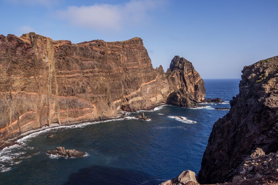
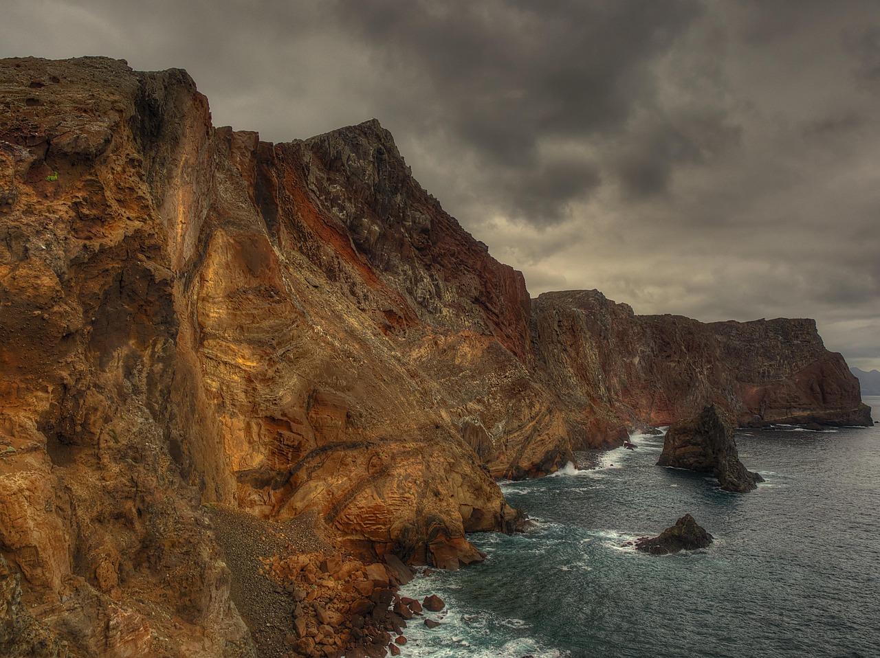
Ponta de São Lourenço is the long, bare peninsula at the eastern tip of Madeira, with red, ochre and black cliffs and the sea on both sides. The PR8 trail runs 4 km each way from the car park at Baía d’Abra to Casa do Sardinha. Visitors over 12 pay €4.50 to enter the protected area, booked and paid on the SIMplifica portal; it is free for children 12 and under and for Madeira residents (as of October 2026). Allow about three hours, and go early: there is no shade.
Right now in Ponta de São Lourenço
- Wed21–23°C70–73°F5 mm rain
- Thu21–23°C70–73°F7 mm rain
- Fri22–23°C71–73°F2 mm rain
Tickets and tours for Ponta de São Lourenço
See all tours for Ponta de São Lourenço →
From local operators, with prices and reviews; you check availability and book on Viator, our partner. We may earn a commission at no extra cost to you. How we earn money
What it is and why it matters
The peninsula stretches about nine kilometres into the Atlantic and ends in two islets: Ilhéu do Desembarcadouro and Ilhéu do Farol, which has a lighthouse. Unlike the green, wet north of the island, this end of Madeira is dry and almost treeless, shaped by wind and old volcanic layers that show as stripes of colour in the cliffs.
It is a Natural Monument and part of the Natura 2000 network, managed by IFCN, Madeira’s forestry and nature institute. The islets are fully protected; the peninsula is partially protected. Look for the island’s endemic lizards on the rocks, birds such as Berthelot’s pipit, and wild flowers in spring; IFCN counts 31 kinds of land snail here, two of them found nowhere else. On the north side near Prainha, the Piedade dunes hold fossils around 300,000 years old. For the rest of the island, see our Madeira travel guide.
The PR8 walk
PR8 Vereda da Ponta de São Lourenço is one of Madeira’s most popular trails, and one of the easiest to fit in: it is close to the airport and the town of Machico.
- Route: from the car park at Baía d’Abra to Casa do Sardinha, then back the same way.
- Distance and time: IFCN lists 4 km each way; the trailhead panel gives 2 h 30 for the walk. With stops, most people take about three hours.
- Terrain: a well-made path with stone steps and some steep, narrow sections near cliff edges, with handrails at the most exposed points. There is no shade and often strong wind.
- Views: the north coast cliffs on one side, the calmer south coast and Baía d’Abra on the other, and the islets ahead.
Near the end is Casa do Sardinha, a house built as a private retreat in the mid-twentieth century and now an IFCN reception centre with an exhibition about the protected area, plus a small bar alongside. Past it, a short, steep climb leads to the Morro do Furado viewpoint over the islets. The small pier below the house is a popular place for a swim in calm weather.
Fees and booking (as of October 2026)
Since 2026 IFCN charges for entry to the protected area: €4.50 per visitor over 12, free for children 12 and under and for Madeira residents (with proof of residence). Book and pay online on the regional SIMplifica portal (simplifica.madeira.gov.pt) before you start; IFCN does not sell tickets at its offices. On 2 October 2026 IFCN listed PR8 as open; check its trail status page on the day.
When to go
Early morning is best: it is cooler, the light on the cliffs is warm and the path is quieter. Any season works, as this is the driest part of Madeira, but avoid the middle of hot summer days and very windy days. Spring brings the most flowers.
Getting there
The trailhead is at the end of the road east of Caniçal, about 15 minutes from the airport and around 40 minutes from Funchal by car. The car park at Baía d’Abra is small and fills by mid-morning; people then park along the road, which adds to your walk. Buses on the SIGA network run from Funchal and Machico to Caniçal; check on siga.madeira.gov.pt whether your bus continues to Baía d’Abra, and the time of the last one back. Some boat trips from Funchal and Machico also sail along the peninsula.
What to bring
- At least 1.5 litres of water per person, more in summer.
- Sun hat, sunscreen and sunglasses: there is no shade at all.
- A windproof layer and shoes with good grip.
- Swimwear if the sea is calm and you want a dip at the pier.
Safety
- Stay on the marked path and behind handrails. The cliffs are high and crumbling, and gusts can be strong.
- IFCN advises against walking in heavy rain, strong wind or storms, and closes trails after rockfalls and fires.
- Swim only in calm seas; there are no lifeguards.
- In an emergency call 112.
Combine it with
Machico, where Madeira’s first settlers landed, has a sheltered sandy bay for a swim after the walk. Caniçal has a whale museum and seafood restaurants. Because the trail is so near the airport, it is a good last-morning walk. In the mountains, pair it on another day with sunrise at Pico do Areeiro or the waterfalls of the Levada das 25 Fontes.
Ponta de São Lourenço FAQ
Do you have to pay to walk at Ponta de São Lourenço?
Yes. As of October 2026, IFCN charges €4.50 per visitor over 12 to enter the protected area, booked and paid on SIMplifica. Children 12 and under and Madeira residents are free.
How long is the Ponta de São Lourenço hike?
IFCN lists PR8 as 4 km each way, from Baía d’Abra to Casa do Sardinha. The panel time is 2 h 30; allow about three hours with stops.
Is the PR8 hike difficult?
It is moderate: a good path, but with steps, a few steep climbs and exposed cliff edges, and no shade. The optional final climb to Morro do Furado is steeper.
Is there anywhere to buy food or water on the trail?
There is a small bar next to the Casa do Sardinha reception centre near the end, but don’t count on it: bring your own water.
Can you swim at Ponta de São Lourenço?
Many people swim from the small pier near Casa do Sardinha when the sea is calm. There are no lifeguards.
Sources
Researched and last reviewed by TravelerCenter on 4 October 2026. Fees, protection status, wildlife and the history of Casa do Sardinha come from IFCN’s protected-area pages; trail length and status from IFCN’s trail list (updated 2 October 2026) and the PR8 trailhead panel; the reception centre and bar from IFCN and visitor reports; access and parking from recent visitor guides. Trail status and fees change, so check IFCN before you go.
Data: Weather: MET Norway (CC BY 4.0) · Air quality: OpenAQ · Rates: ECB · Costs: World Bank ICP and price levels · Wikidata (CC0)