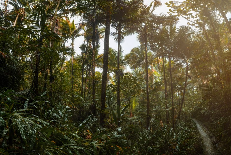
El Yunque National Forest is the only tropical rainforest in the US national forest system, a green, misty range of mountains rising behind Puerto Rico’s northeast coast, less than an hour from San Juan. According to the USDA Forest Service, it covers nearly 29,000 acres across eight municipalities, and although it is one of the smallest national forests, it is one of the most biologically diverse. Most visitors drive up the winding PR-191 road from Río Grande, past roadside waterfalls, an old stone observation tower and short trails through tree ferns and palms, listening to the two-note call of the coquí frog. The peaks rise to more than 3,000 feet (900 m), wrapped in cloud and much cooler and wetter than the coast. As of October 2026 the main recreation corridor is free and needs no reservation, but some favorite trails remain closed after years of storm repairs and new fees have been proposed. Come early in the morning, any time of year, and expect rain.
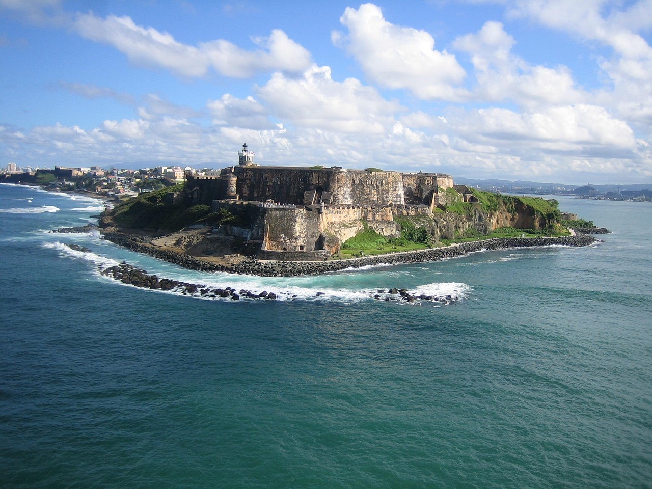
Right now in El Yunque National Forest (El Yunque)
- Wed19–25°C67–77°F7 mm rain
- Thu19–26°C66–79°F5 mm rain
- Fri20–26°C68–78°F4 mm rain
- Mon 12 Oct Columbus Day (Día de la Raza / Descubrimiento de América)
Top tours in El Yunque National Forest
See all tours for El Yunque National Forest →
From local operators, with prices and reviews; you check availability and book on Viator, our partner. We may earn a commission at no extra cost to you. How we earn money
El Yunque at a glance
- Best for: short rainforest walks, waterfalls, views from observation towers, birdwatching (including the endangered Puerto Rican parrot at El Portal) and a cool escape from the beach.
- How long: half a day for the main road and a short trail; a full day with a longer hike and a stop at Luquillo Beach.
- Best time: early morning on a weekday; February to April is the least rainy period, but it rains most days somewhere in the forest.
- Getting there: about 45 minutes to an hour by car from San Juan via PR-3 and PR-191 in Río Grande, or on a guided tour.
- Entry: as of October 2026, free and with no reservation for the PR-191 North recreation corridor, 8 a.m. to 5 p.m.; the El Portal visitor center charges $8 for adults.
- Before you go: entry rules, money, taxes and general safety for the whole island are in our Puerto Rico travel guide; for US entry rules, see our United States travel guide.
El Yunque’s areas and what each one offers
The forest stretches across the Sierra de Luquillo, but nearly all visitor facilities are along one road.
The PR-191 North recreation corridor (Río Grande)
According to the Forest Service, most of the forest’s recreation facilities are on Road 191 North in Río Grande. The road climbs from the gate near El Portal past La Coca Falls, the Yokahú tower, picnic areas, the La Mina recreation area and the trailheads for Mount Britton and El Yunque Peak. This is where you will spend almost all your time. The road no longer runs through the forest to the south side.
El Portal
The main visitor center, at the bottom of the corridor about 2.5 miles (4 km) up PR-191 from PR-3, with exhibits, a theater, a shop, a café and a short interpretive trail.
The Luquillo and Fajardo foothills
Outside the main corridor, rivers and swimming holes on the forest’s lower slopes, such as the Las Paylas area on the Mameyes River in Luquillo, are popular with local families at weekends. Access and parking are informal, rivers flood quickly after rain, and there are no lifeguards, so go only in dry weather and with local advice.
Top things to see in El Yunque
Fees, hours and closures below were checked on official sites in October 2026, unless we say otherwise; conditions change often, so check the Forest Service’s El Yunque alerts page before you go.
El Portal Rainforest Center
According to the Forest Service, El Portal opened in 1996, was badly damaged by Hurricanes Irma and Maria in 2017 and reopened in January 2022 after rebuilding, with wood from fallen trees used in some exhibits. It has visitor information, exhibits, a store, a café, a theater, ranger-led programs and a partly accessible interpretive trail, and it is a place to see the endangered Puerto Rican parrot and learn about its recovery. As of October 2026 it opens daily from 8 a.m. to 4 p.m., closed on Christmas Day, New Year’s Day and Three Kings Day (6 January), and entry costs $8 for adults, free for under-15s, payable in cash or by card; America the Beautiful and other national passes are accepted. The center also closes for about two weeks every September for maintenance; in 2026 that was from 8 to 20 September.
La Coca Falls and the Yokahú tower
La Coca Falls tumbles down a rock face right beside PR-191, a quick roadside photo stop with limited parking. A little higher, the Yokahú observation tower gives views across the forest canopy to the coast and the islands offshore on a clear day.
Mount Britton and El Yunque Peak
The Mount Britton trail climbs through palm and cloud forest to a small stone tower near the summit, about 45 minutes to an hour each way for most people, with sweeping views when the cloud lifts. The longer El Yunque trail leads toward El Yunque Peak, but according to the Forest Service it is open only as far as the Los Picachos spur: the section between Los Picachos and El Yunque Peak remains closed for safety after damage to a retaining wall. Trails are steep, muddy and slippery after rain; wear shoes with good grip.
Wildlife and plants
El Yunque is home to hundreds of tree species, giant tree ferns, bromeliads and orchids, lizards and many species of coquí, the tiny tree frogs whose “co-kee” call is Puerto Rico’s soundtrack. The Puerto Rican parrot, one of the most endangered birds in the world, is being bred and released here. Look but don’t touch, stay on trails and never feed animals.
More to see
- Juan Diego Falls: a short walk to a small series of cascades near the road.
- Sierra Palm and Palo Colorado: picnic areas among palms in the cloud forest.
- La Mina recreation area: the old trailhead for the La Mina waterfall; the trail itself has been closed for repairs.
- Rainforest views from the coast: El Yunque’s cloud-capped peaks are visible from Luquillo and the beaches east of San Juan.
Other things to do in El Yunque
Hiking: what is open and what is closed
According to the Forest Service’s trail alerts, the La Mina Trail and the Big Tree Trail remain closed, along with the Baño de Oro Trail, and the El Yunque Trail is open only as far as Los Picachos. Some of these trails have been closed for years, in part because of a Federal Highway emergency relief (ERFO) construction project. Open trails, such as Mount Britton and the short El Portal and Juan Diego walks, can also close at short notice after heavy rain or storms. Camping is not available until further notice. Before you go, check the “Forest trails status” and other alerts on the Forest Service’s El Yunque website; don’t cross closure barriers.
Guided tours
Licensed tour companies run half-day and full-day trips from San Juan, often combined with Luquillo Beach or a bio bay tour in Fajardo. The Forest Service recommends using authorized transportation, meaning private and rental cars, taxis, and tour and transport companies with permits to operate in El Yunque.
River and rain safety
Rain is part of the experience: the foothills get almost twice as much rain as San Juan, and the peaks even more. Rivers and waterfalls can rise suddenly and dangerously after rain upstream, even when it is sunny where you are. Get out of the water at once if it turns brown or muddy, or starts rising or roaring; don’t cross swollen streams; and don’t swim in rivers after heavy rain. Never drink untreated river water. The forest has no beaches, so there is no sargassum here; for sea conditions on the nearby coast, see the day trips below.
Day trips and onward travel
Luquillo Beach and the kiosks
Ten to fifteen minutes east of the PR-191 turnoff, the Balneario de Luquillo is a reef-sheltered, palm-lined public beach, good for swimming, with lifeguards in season. Next to it, dozens of numbered food kiosks on PR-3 serve fried snacks, seafood and cold drinks. Sargassum seaweed can reach the east coast, mostly from spring to late summer; according to the University of South Florida’s Sargassum Watch outlook for September 2026, 2026 is one of the largest sargassum years on record, but amounts were falling in September.
Fajardo, the bio bay and the islands
Fajardo, about 30 minutes east, has catamaran trips to the offshore cays and evening kayak tours of Laguna Grande, one of Puerto Rico’s three bioluminescent bays. Just south, the ferry terminal in Ceiba serves Vieques and Culebra; as of October 2026 an adult one-way ticket to Vieques costs $2.00, according to the operator Puerto Rico Ferry. See our Vieques travel guide.
San Juan
El Yunque is an easy day trip from the capital, about 45 minutes to an hour away. See our San Juan travel guide.
Nearby destinations
- San Juan39 km
- Vieques43 km
- Rincón155 km
- Punta Cana274 km
Getting there and getting around
By car
From San Juan, take PR-26 and PR-3 east toward Río Grande, then turn right onto PR-191 and drive about 2.5 miles (4 km) south to the gate by El Portal; allow 45 minutes to an hour, more at rush hour or on weekends. As of October 2026, according to the Forest Service, entry to the recreation corridor is free, no reservation is required, and it is open from 8 a.m. to 5 p.m. Visitor numbers are limited because of limited parking and ongoing construction, so the gate may close for a while when the corridor is full; arrive early, especially on weekends and holidays. Parking is permitted only in designated areas. The timed-entry reservation system the forest once used on Recreation.gov, suspended in August 2023, is no longer active.
Inside the corridor, the road is narrow and steep, with sharp bends and sections under construction, so drive slowly and give way to tour buses. There are no gas stations in the forest.
Ride apps and taxis
According to the Forest Service, the La Coca gate and El Portal are not authorized pick-up or drop-off points for ride-hailing apps, and visitors who arrive by app are often forced to walk for hours on the way out because the apps don’t mark a valid pick-up point. Use a rental car, a taxi you book for the return trip, or a permitted tour or transport company instead.
Proposed fees
In a notice published in the Federal Register on 8 September 2026, the Forest Service proposed new recreation fees: a $10 per person three-day pass at El Portal (or a $20 annual pass and a $30 family annual pass), and a special recreation permit at La Mina recreation area of $4 per person per day, with $10 three-day, $20 annual and $30 family annual options. The America the Beautiful pass would cover El Portal but not the La Mina permit. Under the notice, the fees could start no earlier than six months after publication, so not before March 2027; until then the corridor is free and El Portal charges $8.
When to go and how long to stay
El Yunque is green and wet all year, and much cooler at the top than on the coast. There is no NOAA climate station inside the main corridor, so the table uses NOAA’s 1991–2020 climate normals for two forest stations: temperatures from Pico del Este, one of the highest peaks at 3,448 feet (1,051 m), and days with at least 0.10 in (2.5 mm) of rain at Paraíso, on the northeastern foothills at 360 feet (110 m). Temperatures along the PR-191 corridor fall between those of the summit and the coast.
| Season | Average high / low (Pico del Este) | Rainy days per month (Paraíso) | What it’s like | Good for |
|---|---|---|---|---|
| Winter (Dec–Feb) | 66–67 °F (19 °C) / 59–60 °F (15–16 °C) | 12–16 | Cool and misty on the peaks, frequent showers; busy with visitors | Short trails, waterfalls, El Portal |
| Spring (Mar–May) | 67–69 °F (19–21 °C) / 59–62 °F (15–17 °C) | 11–15 | The least rainy months, wetter again from May | The best hiking conditions |
| Summer (Jun–Aug) | 70–71 °F (21–22 °C) / 63–64 °F (17–18 °C) | 14–15 | Warm and humid, with heavy afternoon downpours | Early-morning walks, cool relief from the coast |
| Fall (Sep–Nov) | 72 °F falling to 69 °F (22 to 21 °C) / 64 °F falling to 62 °F (18 to 17 °C) | 16–19 | The wettest season and peak hurricane season; rivers often high | Quiet visits; check closures first |
Paraíso averages about 100 in (2,550 mm) of rain a year, from about 4.8 in (121 mm) in February to about 13 in (330 mm) in November, with rain on about 178 days, and the peaks get more.
Hurricane season: according to NOAA’s National Hurricane Center (NHC), the Atlantic hurricane season runs from 1 June to 30 November, with most activity from mid-August to mid-October. Hurricanes Irma and Maria in September 2017 stripped much of the forest’s canopy, destroyed trails and damaged El Portal; the forest has largely recovered, but repairs to roads and trails are still going on, and Hurricane Fiona in 2022 brought more flooding and landslides to the island. As of 4 October 2026, the 2026 season had produced eight tropical storms and no hurricanes, according to the NHC. The forest closes when storms threaten; follow the Forest Service’s alerts and the National Weather Service in San Juan.
How long to stay: half a day, a full day, two days
Half a day: arrive at 8 a.m., visit El Portal when it opens, stop at La Coca Falls and the Yokahú tower, and walk to Juan Diego Falls. Full day: add the Mount Britton trail, then lunch at the Luquillo kiosks and a swim at Luquillo Beach. Two days: stay nearby, hike in the early morning when the trails are quiet, and add a kayak tour of the Fajardo bio bay in the evening.
Where to stay near El Yunque and the hotel tax
- Río Grande: large beach resorts and golf courses between the forest and the coast, 15–20 minutes from PR-191.
- Luquillo: condos, rentals and small hotels near Luquillo Beach and the kiosks.
- The foothills: eco-lodges, treehouse-style glamping and rentals in the forest’s lower slopes, with rain and frog song at night.
- Fajardo: hotels and rentals near the marinas, handy for boat trips and the Ceiba ferry.
As of October 2026, under Puerto Rico’s Room Occupancy Rate Tax Act, rooms carry a 9% room tax at most hotels, 11% at hotels with a casino and 7% at paradores, certified bed and breakfasts and short-term rentals. Big resorts usually add a daily resort fee; under the Federal Trade Commission’s fees rule, in force since May 2025, mandatory fees must be included in the total price advertised. Purchases and meals carry the 11.5% IVU sales tax.
Practical tips for El Yunque
- Arrive at 8 a.m.: parking fills by mid-morning, especially on weekends and holidays.
- Check the alerts: look at the Forest Service’s trail status and alerts the day before.
- Plan your ride home: ride apps can’t pick you up in the forest.
- Bring cash and a card: El Portal takes both; food options are limited.
- Leave nothing in the car: trailhead break-ins happen.
- Emergencies: call 911; phone signal is patchy in the forest.
What to pack for El Yunque
Pack a light rain jacket or poncho, quick-drying clothes, and walking shoes or sandals with good grip that you don’t mind getting muddy, plus a dry change of clothes and a towel for the car. Bring water, snacks, insect repellent, sunscreen for the coast, a dry bag or zip bags for your phone, and a light layer for the cooler, misty heights. If you plan to swim in a waterfall pool, wear water shoes, and only go in when the river is low and clear.
El Yunque National Forest travel FAQ
Do you need a reservation for El Yunque?
As of October 2026, no. According to the Forest Service, entry to the PR-191 North recreation corridor is free and needs no reservation; the old Recreation.gov timed-entry system is not active.
How much does it cost to enter El Yunque?
The recreation corridor is free. The El Portal visitor center costs $8 for adults and is free for under-15s. New fees have been proposed but could not start before March 2027.
What are El Yunque’s opening hours?
The PR-191 corridor is open from 8 a.m. to 5 p.m. El Portal opens daily from 8 a.m. to 4 p.m., except Christmas Day, New Year’s Day and Three Kings Day.
Is La Mina Falls open?
As of the Forest Service’s latest trail alerts, no: the La Mina Trail and the Big Tree Trail remain closed for repairs. Check the forest’s alerts page for updates before you go.
Can you hike to El Yunque Peak?
Only part of the way. The El Yunque Trail is open as far as the Los Picachos spur, but the section from there to El Yunque Peak remains closed for safety.
Can I take an Uber to El Yunque?
You can be dropped off, but the Forest Service says the La Coca gate and El Portal are not authorized pick-up points, and visitors often get stranded. Drive, book a taxi for the return or take a tour.
How far is El Yunque from San Juan?
About 45 minutes to an hour by car, via PR-3 east and PR-191 south in Río Grande.
What is the best time of day to visit El Yunque?
Right at 8 a.m., when the gate opens. Parking fills by mid-morning, and afternoon showers are more common.
Does it rain every day in El Yunque?
Often, but usually in short showers. The foothills average about 100 in (2,550 mm) of rain a year, and February to April are the least rainy months.
Can you swim in El Yunque’s rivers?
Only with great care, when the water is low and clear. Rivers can flood suddenly after rain upstream; get out at once if the water rises or turns muddy.
Plan your trip
Partner links: TravelerCenter may earn a commission if you book, at no extra cost to you.
🇪🇸 Useful Spanish phrases for El Yunque National Forest
All 38 Spanish phrases: restaurant, hotel, emergencies, romance (printable) →
Sources · last reviewed 4 October 2026
Researched and last reviewed on 4 October 2026. Access, hours, reservation status, rideshare and capacity rules, El Portal fees and hours, trail closures and the forest’s size: USDA Forest Service (El Yunque National Forest), read through archived copies of its pages from 2025–2026 because the live site blocked our requests; proposed fees: the Forest Service notice in the Federal Register of 8 September 2026; the inactive reservation system: Recreation.gov; ferry fares: Puerto Rico Ferry; hotel room tax: Puerto Rico’s Room Occupancy Rate Tax Act; hurricanes: NOAA’s National Hurricane Center; sargassum: University of South Florida’s Sargassum Watch; resort fees: Federal Trade Commission; climate: NOAA’s 1991–2020 normals for Pico del Este and Paraíso. The 2026 September closure dates, trail times, driving times and descriptions of sights are general references and flagged for checking. Conditions change often, so check the Forest Service’s alerts before you go. For US entry rules, see our United States travel guide.
Data: Weather: MET Norway (CC BY 4.0) · Rates: ECB · Holidays: Nager.Date · Costs: World Bank ICP and price levels · Wikidata (CC0)