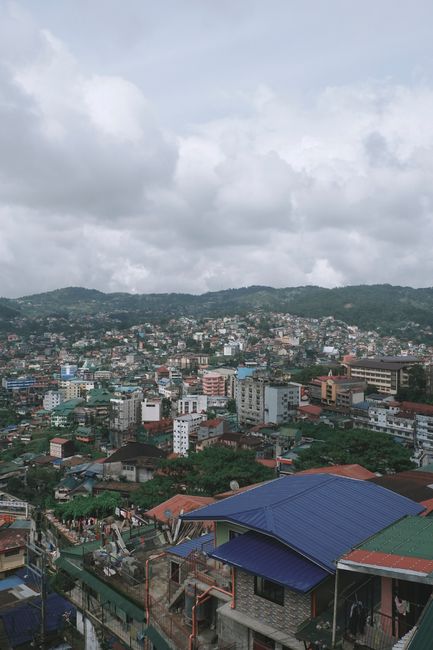
Baguio is a mountain city high in the Cordillera of northern Luzon, about 1,500 m (4,900 ft) above sea level, and the place Filipinos go to escape the heat. Built by the Americans in the early 1900s as a hill station and summer capital, it is known as the “City of Pines” and the “Summer Capital of the Philippines,” with cool air, pine-covered hills, parks, colonial-era cottages and a lively mix of students, artists and the indigenous Ibaloi, Kankanaey and other Cordillera peoples. Visitors come for Burnham Park and Session Road, the sprawling public market, strawberries and ube jam, art at the BenCab Museum and Tam-awan Village, and the flower floats of the Panagbenga festival in February. In 2017, UNESCO named Baguio a Creative City for Crafts and Folk Arts, the first in the Philippines. Baguio is also the gateway to the Cordillera: Mount Pulag’s sea of clouds, the hanging coffins of Sagada and the rice terraces of Ifugao. The dry season from November to April is pleasant and cool; from May to October Baguio is one of the wettest places in the country.
Right now in Baguio
- Wed 15–23°C 59–73°F 4 mm Showers
- Thu 16–23°C 60–73°F 14 mm Heavy rain
- Fri 16–22°C 60–71°F 3 mm Rain
Weather: MET Norway (CC BY 4.0)
Top tours in Baguio
See all tours for Baguio →
From local operators, with prices and reviews; you check availability and book on Viator, our partner. We may earn a commission at no extra cost to you. How we earn money
Baguio at a glance
- Best for: cool weather, parks and markets, crafts and art, food, festivals, and a base for the Cordillera.
- How long: 2 to 3 days for the city and La Trinidad; add more for Sagada, Mount Pulag or the rice terraces.
- Best time: November to April, when it is dry; January and February are the coolest months, with lows of about 13 °C (55 °F).
- Getting there: about 4 to 6 hours by bus or car from Manila, mostly on expressways.
- Getting around: on foot downtown, by taxi and Grab, and by jeepney.
- Good to know: weekends, Holy Week, Christmas and Panagbenga bring heavy traffic and full hotels; go on weekdays if you can.
- Before you go: eTravel registration, visa-free stays, money and general safety are in our Philippines travel guide.
Baguio’s areas and where to stay
Baguio is compact but hilly, spread over ridges and valleys around a central bowl.
Session Road and downtown
Session Road, the main street, climbs from the bottom of downtown with shops, cafés, bakeries and restaurants, and the cathedral above it. The public market and Burnham Park are at its foot. Downtown hotels are convenient for walking but can be noisy.
Burnham Park
The central park, with its lake, gardens and bike paths, is surrounded by budget and mid-range hotels and inns, an easy base close to Session Road.
Camp John Hay and the eastern hills
The former American military recreation camp, now a leafy area of hotels, cottages, golf and trails among the pines, is quieter and cooler, a few minutes by taxi from downtown. Nearby, Wright Park, The Mansion and Mines View Park draw tour groups.
Outskirts and La Trinidad
Guesthouses and inns on the outskirts and in La Trinidad, the Benguet capital just north of the city, are calmer and cheaper, but you need taxis to get around.
Top things to see in Baguio
Before the Americans arrived, the area was Kafagway, a grassy plateau of Ibaloi farmers and cattle herders. After 1900, the American colonial government chose it as a cool retreat from Manila’s heat, hired Daniel Burnham to plan a city, built a winding road up the mountain and, in 1909, made it a chartered city; government offices moved here every summer. That history explains Baguio’s parks, wide hillside lots, old cottages and the many schools and universities that still bring students from across the north. Most of the sights are within a few kilometers of downtown, and a taxi or a short Grab ride links them easily.
Burnham Park
According to the Department of Tourism, Burnham Park, named after the American planner Daniel Burnham who designed the city, is one of Baguio’s oldest parks, with a man-made lake for boating, paths for strolling and cycling, and flower gardens. It is busy and fun on weekends.
Session Road and the Baguio Cathedral
Walk Session Road for bakeries and coffee shops, then climb the steps to the pink twin-towered Baguio Cathedral, which the DOT calls the city’s most magnificent edifice, with views over downtown.
The public market
Baguio’s huge public market sells highland vegetables, strawberries, coffee, ube jam, peanut brittle, woven textiles, woodcarvings and silver, a good place for food and souvenirs.
BenCab Museum
Just outside the city on the road to Asin, the BenCab Museum, the private museum of the National Artist Benedicto Cabrera, displays his paintings, contemporary Filipino art, a gallery of Cordillera artifacts, and gardens and a pond in a forested valley.
Tam-awan Village
A reconstructed Ifugao and Kalinga village on a hillside, with traditional huts, galleries, artists at work and workshops, run as an arts center.
More classic sights
- Mines View Park: a viewpoint over the mountains and old mining valleys, with stalls.
- Wright Park and The Mansion: the presidential summer residence and the long pool facing it.
- Botanical Garden: pine-shaded gardens and walking paths.
- Camp John Hay: trails, the Bell Amphitheater and the “Cemetery of Negativism.”
- Diplomat Hotel ruins: a former hotel and seminary on Dominican Hill, with city views.
Other things to do in Baguio
Food and drink
Baguio’s cool climate grows vegetables and strawberries for the whole country, and its food reflects it. Try strawberry taho (silken tofu with syrup) from street vendors, fresh strawberries and strawberry jam, ube jam from the Good Shepherd convent, pinikpikan, a Cordillera chicken soup, highland coffee, and fresh vegetable dishes. Baguio has a strong café culture and some excellent bakeries, and Session Road and Legarda Road have bars with live music.
Panagbenga and other festivals
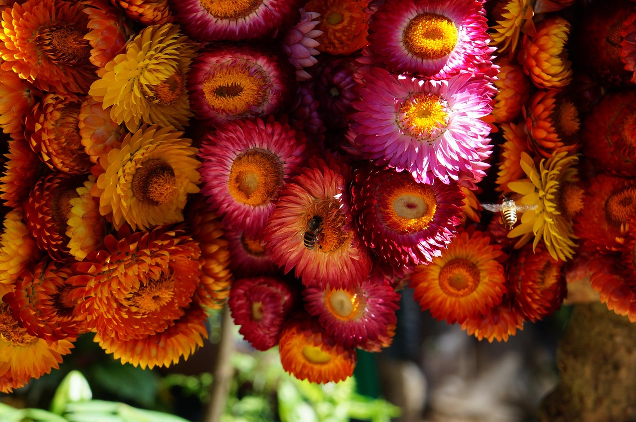
According to the DOT, Panagbenga, from a Kankanaey word meaning “season of blooming,” is Baguio’s flower festival, created as a tribute to the city’s recovery after the 1990 earthquake; it runs through February, with street dancing and a grand parade of flower-covered floats, and draws huge crowds. Christmas brings lights and markets, and Holy Week fills the city with visitors.
Strawberry picking in La Trinidad
According to the DOT, La Trinidad, in Benguet, is famous for its strawberries, and the best time to pick is from October to May, with the Strawberry Festival in March. The colorful StoBoSa mural, painted across houses on a hillside, is nearby.
Cordillera culture and crafts
Baguio is the commercial and cultural hub of the Cordillera, and its crafts are among the best in the country. Hand-woven textiles in bold red, black and white patterns, woodcarvings of rice gods (bul-ul), baskets and silver jewelry are sold at the public market, in shops and directly from weavers’ cooperatives, some of which welcome visitors to watch the looms. Tam-awan Village and the BenCab Museum host exhibitions, workshops and performances by Cordillera artists, and festivals such as Panagbenga feature traditional dances and gongs. Buying directly from makers keeps more of the money in the community.
Walks and parks
The pine forests of Camp John Hay have marked trails, and the Botanical Garden, Wright Park and the paths around Burnham Park make easy strolls. For longer hikes, the ridges around the city and in neighboring Benguet towns have trails with views of the mountains and, on clear mornings, of the lowlands and the sea to the west.
Day trips from Baguio
- La Trinidad: strawberry farms, vegetable trading posts and the StoBoSa mural, 20 minutes away.
- Mount Pulag: Luzon’s highest peak, known for its sea of clouds at sunrise, in Benguet; climbs require registration and an orientation with park staff, and most hikers leave Baguio around midnight. See our hiking guide.
- Sagada: about 5 to 6 hours north on mountain roads, with hanging coffins, caves and rice terraces; better for several days.
- Banaue and Batad: the Ifugao rice terraces, about 6 to 8 hours away, best for several days. See our Banaue guide.
- Vigan: the Spanish colonial town on the Ilocos coast, about 4 to 5 hours away. See our Vigan guide.
Getting there and getting around
By bus and car from Manila
Comfortable buses run around the clock from Manila to Baguio, with major companies leaving from terminals in Pasay, Cubao and the Parañaque Integrated Terminal Exchange (PITX); deluxe services take about 4 to 5 hours on the NLEX, SCTEX and TPLEX expressways, and regular buses longer. The final climb into the mountains follows Marcos Highway or Kennon Road; Kennon Road, the scenic old route, is often closed after heavy rain because of landslides. Driving yourself is straightforward, but parking is scarce, and the city restricts vehicles on some days by license-plate number.
By air
Baguio’s small Loakan Airport has had no regular commercial flights for years; most travelers fly to Manila or Clark and continue by bus.
Around the city
Downtown is walkable, but the hills are steep. White taxis are plentiful and use meters, and according to Grab, its car service operates in Baguio. Jeepneys run fixed routes from downtown terminals. Traffic is heavy on weekends and holidays.
When to go and how long to stay
Baguio is cool all year and very wet in the rainy season. According to PAGASA, the national weather agency, Baguio’s mean annual temperature is 18.3 °C (64.9 °F), well below the national average of 26.6 °C (79.9 °F), because of its elevation of about 1,500 m. The table uses PAGASA’s 1991–2020 normals for its Baguio City station, as submitted to the World Meteorological Organization (WMO).
| Month | Average high / low | Rain (days with 1 mm or more) | What to expect |
|---|---|---|---|
| January | 23 °C (74 °F) / 13 °C (55 °F) | 16 mm (0.6 in), 2 days | The coolest, driest month; chilly nights |
| February | 24 °C (75 °F) / 13 °C (56 °F) | 24 mm (0.9 in), 2 days | Dry; Panagbenga festival crowds |
| March | 25 °C (77 °F) / 14 °C (58 °F) | 50 mm (2.0 in), 4 days | Dry and sunny; Strawberry Festival in La Trinidad |
| April | 26 °C (78 °F) / 16 °C (61 °F) | 100 mm (3.9 in), 8 days | Warmest month; Holy Week and summer crowds |
| May | 25 °C (76 °F) / 16 °C (62 °F) | 340 mm (13.4 in), 18 days | Rainy season starts; afternoon storms |
| June | 24 °C (76 °F) / 16 °C (62 °F) | 406 mm (16.0 in), 20 days | Wet and foggy |
| July | 23 °C (74 °F) / 16 °C (61 °F) | 773 mm (30.4 in), 24 days | Very wet; typhoons possible |
| August | 22 °C (72 °F) / 16 °C (61 °F) | 963 mm (37.9 in), 25 days | The wettest month; landslides possible |
| September | 23 °C (73 °F) / 16 °C (61 °F) | 537 mm (21.2 in), 22 days | Very wet; typhoon peak |
| October | 24 °C (74 °F) / 16 °C (60 °F) | 490 mm (19.3 in), 13 days | Wet early, drying later |
| November | 24 °C (75 °F) / 15 °C (59 °F) | 96 mm (3.8 in), 7 days | Dry season begins; clear, crisp days |
| December | 24 °C (74 °F) / 14 °C (57 °F) | 42 mm (1.6 in), 4 days | Cool and dry; Christmas crowds |
Baguio gets about 3,840 mm (151 in) of rain a year, most of it from May to October, and typhoons crossing northern Luzon can bring extreme rainfall and landslides. PAGASA said in September 2026 that a strong El Niño was expected to bring below-normal rainfall to most of the country into early 2027.
2 days in Baguio
Day one, Burnham Park, Session Road, the cathedral and the public market, with dinner and live music downtown. Day two, Mines View Park, Wright Park and the Botanical Garden in the morning, then the BenCab Museum and Tam-awan Village in the afternoon.
3 to 4 days
Add strawberry picking and the StoBoSa mural in La Trinidad, a sunrise climb of Mount Pulag with an overnight trip, or continue to Sagada.
Where to stay in Baguio
- Session Road and downtown: hotels and inns in walking distance of restaurants and the market.
- Around Burnham Park: budget and mid-range hotels close to everything.
- Camp John Hay: quieter upscale hotels and cottages among the pines.
- Outskirts and La Trinidad: cheaper guesthouses and homestays.
Book well ahead for weekends in the dry season, Panagbenga and Holy Week. Many older hotels have no air conditioning, which is rarely needed; some have heaters.
What a trip to Baguio costs
Prices are approximate, for October 2026, converted at about ₱62.6 to the US dollar.
| Item | Typical cost |
|---|---|
| Deluxe bus from Manila, one way | ₱800–1,100 (about US$13–18) |
| Regular bus from Manila, one way | ₱500–750 (about US$8–12) |
| Taxi ride across town | ₱100–200 (about US$1.60–3.20) |
| Jeepney ride | from about ₱13 (about US$0.20) |
| BenCab Museum entrance | ₱200–300 (about US$3.20–4.80) |
| Strawberry taho | ₱30–60 (about US$0.50–1) |
| Meal at a local restaurant | ₱200–450 (about US$3.20–7.20) |
| Dinner in a mid-range restaurant | ₱600–1,200 (about US$10–19) per person |
| Mid-range hotel double, per night | ₱2,500–5,500 (about US$40–88) |
Practical tips for Baguio
- Bring warm layers: nights in December to February can drop close to 10 °C (50 °F), and many rooms are unheated.
- Avoid peak weekends: traffic into and around the city can add hours on long weekends and during Panagbenga.
- Check road conditions: after heavy rain, Kennon Road and mountain roads may close because of landslides.
- Respect Cordillera culture: ask before photographing people in traditional dress, and buy crafts from the makers.
- Use Grab or metered taxis: both work well in the city.
- Shop early at the market: vegetables and strawberries are freshest in the morning, and pasalubong stalls pack jams and peanut brittle for the bus ride home.
Safety
Baguio is a safe, friendly city. The main hazards are natural: in the rainy season, from about May to October, heavy rain and typhoons can cause landslides and close mountain roads, including Kennon Road, so follow PAGASA’s Tropical Cyclone Wind Signals and local road announcements before traveling. The city lies in an earthquake zone, and the 1990 earthquake caused major damage here. Fog can reduce visibility on mountain roads at night. Pickpockets operate in crowded markets and festivals, so keep valuables secure. Mount Pulag and other high trails get cold and wet; hike with registered guides and proper gear. In an emergency, call 911.
What to pack for Baguio
A warm jacket or fleece, long trousers, closed shoes for hilly streets and trails, a rain jacket and umbrella in the wet season, and layers for Mount Pulag if you plan to hike. The Philippines uses 220 V and mostly flat two-pin US-style plugs. See our rain jackets, hiking shoes and travel adapters guides.
Baguio travel FAQ
How cold is Baguio?
Cool all year, with a mean annual temperature of 18.3 °C (64.9 °F), according to PAGASA. In January and February, nights average about 13 °C (55 °F) and can be colder.
When is Panagbenga?
Baguio’s flower festival runs through February, with street dancing and a grand float parade, usually on the last weekends of the month; check the dates and book early.
How do I get from Manila to Baguio?
By bus, around the clock, from terminals in Pasay, Cubao and PITX, in about 4 to 6 hours depending on the service and traffic, or by car on the NLEX, SCTEX and TPLEX expressways.
Is there Grab in Baguio?
Yes. Grab lists Baguio among its service areas, and the city’s white taxis use meters.
What is the best time to visit Baguio?
November to April, the dry season; January and February are coolest. Avoid July to September, the wettest months, if you dislike rain and fog.
What is Baguio famous for?
Cool weather and pine trees, the Panagbenga flower festival, strawberries and ube jam, its public market, art and crafts, and its role as the gateway to the Cordillera.
How many days do I need in Baguio?
Two days for the city’s main sights, three or four with La Trinidad, Mount Pulag or a trip to Sagada.
Can I visit Sagada from Baguio?
Yes, but it is about 5 to 6 hours each way on mountain roads, so stay at least two nights.
Is Baguio a UNESCO site?
Baguio is a UNESCO Creative City for Crafts and Folk Arts, designated on October 31, 2017, according to the Department of Tourism; it is not a World Heritage Site.
Is Kennon Road open?
Kennon Road is often closed after heavy rain because of landslides; check local announcements, and use Marcos Highway or other routes when it is shut.
Sources and last review
Researched and last reviewed on 4 October 2026. Baguio’s titles, the UNESCO Creative City designation, Panagbenga, Burnham Park and the cathedral, and La Trinidad’s strawberry season and festival: the Department of Tourism; mean temperatures and elevation, climate normals and the El Niño outlook: PAGASA, with normals via the World Meteorological Organization; Grab coverage: Grab Philippines; exchange rate: the European Central Bank. History, the public market, museums and other sights, bus routes and times, the Loakan Airport status, Kennon Road, vehicle restrictions, the 1990 earthquake, Mount Pulag rules and typical prices are general references or estimates, flagged for checking. Prices and hours change, so check the official sites before you go. For entry rules, money and general safety, see our Philippines travel guide.
Plan your trip
Partner links: TravelerCenter may earn a commission if you book, at no extra cost to you.
🇵🇭 Useful Filipino phrases for Baguio
All 38 Filipino phrases: restaurant, hotel, emergencies, romance (printable) →