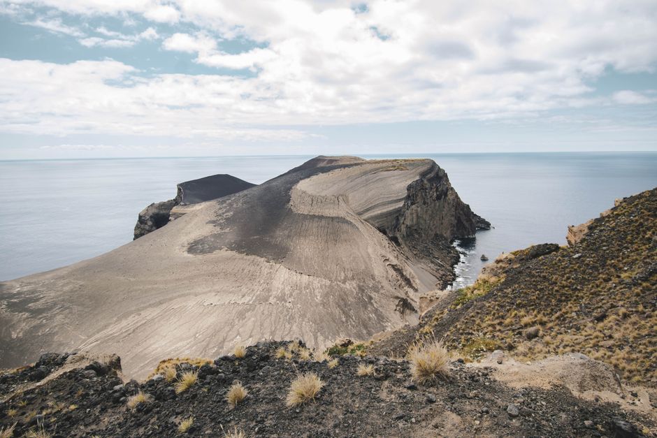
The Capelinhos volcano, at the western tip of Faial in the Azores, rose out of the sea in 1957–58 and left a bare grey landscape of ash and cinder, with an old lighthouse half buried in it. Walking around the outside is free. The underground Capelinhos Volcano Interpretation Centre, entered beside the lighthouse, costs €10 for adults (as of October 2026) and tells the story of the eruption in depth. Allow two to three hours.
Right now in Capelinhos
- Wed19–22°C67–71°FPartly cloudy
- Thu20–21°C67–69°FPartly cloudy
- Fri19–20°C67–68°FMostly clear
Tickets and tours for Capelinhos
See all tours for Capelinhos →
From local operators, with prices and reviews; you check availability and book on Viator, our partner. We may earn a commission at no extra cost to you. How we earn money
What it is and why it matters
On 27 September 1957, after days of earthquakes, the sea began to boil a few hundred metres off Ponta dos Capelinhos. The eruption went on for 13 months, until 24 October 1958, building a new cone that joined the island and added about 2.4 square kilometres of land. Ash buried fields and houses in the parishes of Capelo and Praia do Norte, and about 2,000 people were evacuated; many of them later emigrated to the United States and Canada. The lighthouse keepers had to abandon their tower.
Capelinhos was the first undersea eruption documented from beginning to end, studied closely by Portuguese and foreign scientists. In 2022 the International Union of Geological Sciences included it among its first 100 geological heritage sites in the world. Nearly seventy years later the land is still almost bare, which is what makes it so striking. For the islands as a whole, see our Azores travel guide.
What you’ll see
The landscape and the lighthouse
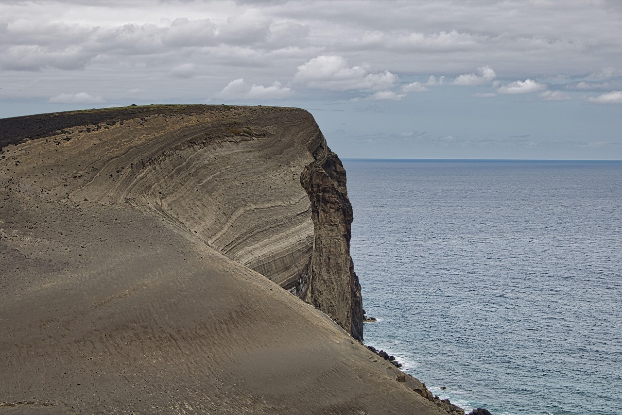
From the car park, the old lighthouse stands alone in a sweep of grey and ochre ash, with the new headland and its eroded cliffs beyond. Paths lead around the area and to viewpoints over the coast, and towards Costado da Nau, the older cliff the new volcano grew against. The ground is loose and slopes are unstable, so keep to the marked paths and to the areas that are open.
The Interpretation Centre
The centre was built underground beneath the ash so as not to spoil the landscape, and opened in 2008, fifty years after the eruption ended. Exhibitions explain the Capelinhos eruption with film, photographs and eyewitness accounts, how the Azores were formed, other famous volcanoes of the world and the history of the Azores lighthouses. The ticket includes climbing the old lighthouse tower for a view over the new land.
Opening hours and tickets (as of October 2026)
The centre is run by the Azores Natural Parks. Its published timetable:
- 1 April to 31 October: daily including holidays, 10:00–18:00.
- 1 November to 31 March: Tuesday to Saturday and holidays, 9:00–17:00; closed Sunday, Monday, 1 January and 25 December.
- Last entry 60 minutes before closing.
- Tickets: adults (15–64) €10; ages 7–14 and 65+ €5; children up to 6 free; family ticket (2 adults and children up to 14) €20; Azores residents free.
- Guided tours of about an hour run at set times (10:30, 14:30 and 16:00 in summer; 11:00 and 15:00 in winter).
Walking to Capelinhos
The long PR06FAI “Rota dos Dez Vulcões” (Ten Volcanoes) starts at the viewpoint of Faial’s great Caldeira and follows the island’s volcanic spine west to Capelinhos: 19.3 km, about 5 hours, rated hard, finishing at the Interpretation Centre car park. For something shorter, the PRC01FAI Cabeço do Canto circuit (2.5 km, about 2 hours) climbs a volcanic cone with a view straight over Capelinhos. Both are on the official Trails Azores network.
When to go
Any time of year, but pick a clear day for the landscape and the lighthouse view; the centre is a good refuge if it rains. Late afternoon light on the ash is beautiful in summer, when the centre stays open until 18:00. The west end of the island is very windy.
Getting there
Capelinhos is at the far western end of Faial, roughly half an hour’s drive from Horta, the island’s town and ferry port. A car or taxi is the easiest way; buses on Faial are infrequent. Pico, across the channel, is half an hour from Horta by ferry, so Capelinhos fits into a stay on either island.
Safety
- Keep to marked paths: the ash slopes and the cliff edges are unstable and erode quickly.
- There is almost no shade or shelter outside the centre; bring water, sun protection and a windproof layer.
- Hold on to hats and children on the lighthouse and cliff viewpoints, where the wind can be strong.
Combine it with
Spend the rest of the day on Faial: the huge Caldeira crater at the centre of the island, the Cabeço do Canto viewpoint, the natural pools at Varadouro and the marina and cafés of Horta. Across the water, climb Mount Pico, Portugal’s highest mountain. On Terceira, go inside a volcano at Algar do Carvão.
Capelinhos FAQ
How much does it cost to visit Capelinhos?
The landscape and viewpoints are free. The Interpretation Centre costs €10 for adults, €5 for ages 7–14 and over-65s, with children up to 6 and Azores residents free (as of October 2026).
Can you climb the Capelinhos lighthouse?
Yes, with a ticket to the Interpretation Centre, which includes access to the old lighthouse tower.
When did the Capelinhos volcano erupt?
From 27 September 1957 to 24 October 1958, about 13 months. It added about 2.4 square kilometres of land to Faial.
How long do you need at Capelinhos?
About two to three hours for the centre, the lighthouse and a short walk around the ash fields.
Is the Capelinhos Interpretation Centre open in winter?
Yes, from November to March it opens Tuesday to Saturday and on holidays, 9:00–17:00. It is closed on Sundays and Mondays in winter.
Sources
Researched and last reviewed by TravelerCenter on 4 October 2026. Hours and prices come from the Azores Natural Parks timetable page (read via search, as the site blocks automated access); trails from the official Trails Azores site; eruption dates, land area and IUGS listing from standard references; the centre’s opening year and lighthouse access from visitor guides. Check the Azores Natural Parks site before you go.
Data: Weather: MET Norway (CC BY 4.0) · Rates: ECB · Costs: World Bank ICP and price levels · © OpenStreetMap contributors (ODBL) · Wikidata (CC0)