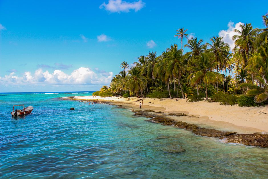
San Andrés is a small coral island far out in the western Caribbean, famous for a sea that shifts from deep blue to green, aqua and lilac over its reefs: the “sea of seven colors”. Although it belongs to Colombia, it lies about 750 km (465 miles) north of the Colombian mainland and about 230 km (143 miles) east of Central America, according to ProColombia, the country’s official tourism promoter. Together with Providencia and Santa Catalina, it forms an archipelago declared the Seaflower Biosphere Reserve by UNESCO in 2000. The island’s native Raizal people speak an English-based Creole as well as Spanish and English, and their Afro-Caribbean culture, reggae and calypso rhythms, and wooden houses give San Andrés a character all its own. Visitors come for white-sand cays, easy snorkeling and diving on some 40 dive sites, duty-free shopping and Caribbean food, and every non-resident visitor needs a tourist card to get in.
Right now in San Andrés
- Wed26–29°C79–83°F11 mm rain
- Thu26–29°C78–83°F13 mm rain
- Fri28–29°C82–83°F2 mm rain
- Mon 12 Oct Columbus Day (Día de la Raza)
Top tours in San Andrés
See all tours for San Andrés →
From local operators, with prices and reviews; you check availability and book on Viator, our partner. We may earn a commission at no extra cost to you. How we earn money
San Andrés at a glance
- Best for: beaches and cays, snorkeling and diving, boat trips, family vacations and Caribbean culture.
- How long: four or five days; a week with a side trip to Providencia.
- Best time: January to April, the driest months; October and November are the wettest.
- Getting there: about two hours by air from Bogotá; flights also from Medellín, Cartagena and Cali, and from Panama City.
- Entry: every non-resident visitor buys a tourist card before flying; see below.
- Before you go: entry rules, the Check-Mig form and money are in our Colombia travel guide.
The island: where things are
San Andrés is only about 12 km (7.5 miles) long, and a 30 km (19-mile) road circles it, so nothing is far.
North End (El Centro)
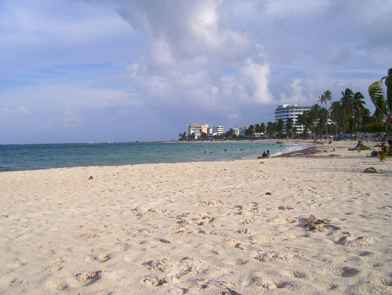
The town at the island’s northern tip, next to the airport, has most of the hotels, duty-free shops and restaurants. Its beach, Spratt Bight, runs for more than 2 km (1.2 miles) along a pedestrian boardwalk, with kitesurfing and water sports, according to ProColombia. Boats leave from here for Johnny Cay and the Aquarium.
La Loma (The Hill)
The island’s hilly center is the heart of Raizal culture, with traditional wooden houses and the First Baptist Church, built in 1844, with views over both coasts from its tower.
San Luis and the east coast
The east coast is lined with smaller beaches, guesthouses and Raizal restaurants. Sound Bay, away from the bustle, and the shallow reef at Cocoplum are here; from Cocoplum you can wade about 200 m (650 ft) to Rocky Cay, a rocky islet surrounded by marine life, according to ProColombia.
The south and west coasts
The southern tip has the Hoyo Soplador blowhole, where waves force water through the coral rock, and the west coast has West View and La Piscinita, natural pools with ladders into deep, clear water full of fish, ideal for snorkeling.
Top things to see in San Andrés
Johnny Cay
A small cay of white sand and coconut palms about 15 minutes by boat from Spratt Bight, Johnny Cay is the island’s most famous beach, with reggae music and fried-fish lunches. It is a protected area and can get crowded; currents can be strong, so swim only in marked areas.
The Aquarium (Acuario) and Haynes Cay
ProColombia describes the Aquarium as a group of cays including Haynes Cay, with restaurants and Caribbean wildlife, and Rose Cay, a sandbank that grows and shrinks with the tide. You can wade between them in waist-deep water, often among stingrays and fish. Water shoes help.
Snorkeling and diving on the Seaflower reef
The archipelago has nearly 40 dive sites, according to ProColombia, with walls, wrecks and coral gardens around the island and its barrier reef. Dive shops in the North End run courses and daily boat dives. For snorkeling, try West View, La Piscinita, Rocky Cay and the Aquarium. See our diving and snorkeling guides.
Beaches
Spratt Bight is the busy town beach; Cocoplum and Rocky Cay are shallow and calm, ideal for young children, according to ProColombia; and San Luis has quieter stretches. See our beaches guide.
Other things to do in San Andrés
- Circle the island: rent a golf cart, scooter or bicycle and follow the circular road, stopping at beaches and viewpoints.
- Boat trips: glass-bottom boats, semi-submarines and mangrove kayaking at the Old Point Regional Park; see our boat trips guide.
- Raizal culture: visit La Loma, the First Baptist Church and local restaurants serving rondón, a coconut stew of fish, conch and plantain.
- Music: reggae, calypso, soca and vallenato, according to ProColombia; listen for live bands at weekends.
- Duty-free shopping: the island is a free port, with stores in the North End.
Food and drink in San Andrés
The island’s Raizal cooking draws on the sea, coconut and Caribbean traditions shared with Jamaica and the Corn Islands, and it is quite different from mainland Colombian food.
- Rondón: the island’s signature dish, a stew of fish, conch, pig’s tail, yuca, breadfruit, plantain and dumplings slow-cooked in coconut milk; best at Raizal restaurants in San Luis and La Loma, often on weekends.
- Fried fish and coconut rice: a whole fish with coconut rice and patacones is the standard beach lunch on Johnny Cay and around the island.
- Crab and conch: crab backs (stuffed crab), crab patties and conch (caracol) in stews and fritters.
- Johnny cakes and plantain tarts: fried breads and sweet pastries sold in small bakeries.
- Coconut and fruit: fresh coconut water, coconut sweets and juices from mango, tamarind and star fruit.
- Drinks: Coco Loco served in a coconut, local rum and cold beer in beach bars; the North End’s bars and clubs stay open late on weekends.
Restaurants in the North End serve everything from seafood platters to pizza; prices on the cays and at beachfront tables are higher than in town.
Day trips from San Andrés
Providencia and Santa Catalina
Providencia, about 90 km (55 miles) north-east, is greener, quieter and less developed, with deserted beaches, a large barrier reef and the McBean Lagoon National Natural Park; a wooden footbridge links it to tiny Santa Catalina. Hurricane Iota caused severe damage there in November 2020. Small planes fly from San Andrés in about 20 minutes, and a catamaran ferry makes the crossing in about three hours when the sea allows; you need at least two nights to make the trip worthwhile.
Haynes Cay, Rose Cay and Rocky Cay by boat
If you only have one extra day, a full-day boat tour combining Johnny Cay, the Aquarium and Haynes Cay is the classic choice, returning mid-afternoon. Snorkel gear can be rented on the boats or the cays, but bring your own mask if you can. Rocky Cay, off Cocoplum, needs no boat at all: you wade out from the beach, and the old shipwreck nearby attracts fish. Keep your boat ticket for the return trip, and don’t leave belongings unattended on the cays.
The Old Point mangroves
On the east coast near the airport, the Old Point Regional Mangrove Park protects the island’s largest mangrove forest. Kayak and paddleboard tours glide through the channels, where juvenile fish, crabs and birds shelter among the roots, a calm alternative to the busy beaches.
Getting there and getting around
The tourist card
Every non-resident visitor, Colombian or foreign, must buy the archipelago’s tourist card (tarjeta de turismo). You buy it at the departure airport when you check in for your flight to San Andrés, and you must keep it and show it when you leave the island; you do not need one if you stay less than 24 hours, according to the UK and Canadian governments. The 2026 price was reported at COP 153,000 (about US$47) after the annual adjustment; children under seven and Raizal residents are exempt. Some airlines let you pay in advance; check with yours.
By air
Gustavo Rojas Pinilla International Airport (ADZ) is in the North End, a short walk or taxi ride from most hotels. Flights from Bogotá take about two hours, and there are also flights from Medellín, Cartagena, Cali and Panama City; see our Panama City travel guide for connections. Foreign visitors flying straight to San Andrés from abroad complete the same entry process as on the mainland, including the Check-Mig form, and Canadians flying directly to the archipelago are exempt from Colombia’s reciprocity fee, according to the Canadian government.
By cruise ship
Some cruise ships call at San Andrés, anchoring off the North End; passengers come ashore by tender.
Getting around the island
The island is easy to get around. Golf carts (“mulas”) and scooters are rented in the North End; drive slowly, as roads are narrow and busy. Taxis charge fixed fares, which you should agree before you get in, and cheap local buses circle the island. Boats to Johnny Cay and the Aquarium leave from Spratt Bight in the morning.
Getting around in detail
- Golf carts (“mulas”): the favorite way to circle the island, rented by the day from agencies in the North End; you need a driver’s license, and a deposit is often required. Return before dark, as roads are poorly lit.
- Scooters and motorbikes: cheaper, but traffic is busy and accidents involving visitors are common; wear a helmet.
- Buses: local buses run around the circular road and up to La Loma; flag them down along the road and pay in cash.
- Taxis: fixed fares between zones; agree the price first.
- Bicycles: good for the flat coastal road, though the climb to La Loma is steep.
- Boats: excursions to Johnny Cay and the Aquarium leave from Spratt Bight; buy tickets from authorized cooperatives on the beach and keep your return ticket.
When to go and how long to stay
San Andrés is warm all year, at about 27–30 °C (81–86 °F), with sea temperatures to match. The driest months are January to April; rain increases from June, and October and November are the wettest months. The archipelago is in the Atlantic hurricane belt: the season runs from June 1 to November 30, according to NOAA’s National Hurricane Center, and hurricanes and tropical storms, though uncommon, can affect the islands, according to the UK government. Check forecasts and the Colombian weather institute, IDEAM, if you travel in the autumn. The island is busiest at Christmas and New Year, Holy Week and the June–July school vacations.
| Season | What it’s like | Good for |
|---|---|---|
| December–April | Driest, sunny, trade winds; peak season in December, January and Holy Week | Beaches, cays, kitesurfing |
| May–August | Warm, some showers; calmer seas | Diving and snorkeling |
| September–November | Wettest months; hurricane season peak | Lower prices; watch forecasts |
San Andrés month by month
- January: dry and breezy, with peak crowds in the first half of the month.
- February: dry, sunny and windy; good beach weather and fewer crowds.
- March: dry; Holy Week (March 21–28, 2027) fills hotels and flights.
- April: the end of the dry season; calm, hot and sunny.
- May: warmer and more humid; occasional showers; good diving visibility.
- June: showers increase; school vacations bring Colombian families from late June.
- July: a short, drier spell often arrives; busy with domestic travelers.
- August: hot and humid; hurricane season is underway, so watch forecasts.
- September: wetter, with fewer visitors and lower prices.
- October: one of the wettest months and the peak of the hurricane season.
- November: rainy; Hurricane Iota struck the archipelago in November 2020.
- December: drier weather returns; prices rise sharply from mid-December.
4 days in San Andrés
Day one, Spratt Bight and the North End. Day two, a boat trip to Johnny Cay and the Aquarium. Day three, circle the island by golf cart, with snorkeling at West View, the Hoyo Soplador and lunch in San Luis. Day four, a dive or a snorkel trip to Rocky Cay and La Loma’s church.
A week in San Andrés and Providencia
Spend four nights on San Andrés, then fly to Providencia for three nights of quiet beaches, the barrier reef and a climb to The Peak, the island’s highest point.
Where to stay in San Andrés and the hotel taxes
- North End: most hotels, from all-inclusive resorts to small guesthouses, close to the beach, restaurants and boats; busy and noisy.
- San Luis: quieter beach hotels and posadas on the east coast.
- Native guesthouses (posadas nativas): small Raizal-run lodgings around the island, a way to support local families.
Prices include Colombia’s 19% value-added tax, but foreign tourists are generally exempt from it on hotel rooms when they show their entry record; ask when you book. All-inclusive packages are popular with Colombian visitors, so prices rise sharply in the holiday seasons.
Choosing your area
For a first visit, stay in the North End: you can walk to Spratt Bight, restaurants, shops and the boats to the cays, and it is close to the airport. For a quieter stay closer to Raizal culture, choose a posada nativa or small hotel in San Luis on the east coast, with a golf cart for exploring. Large all-inclusive resorts line parts of the coast and suit families who want everything in one place.
Costs in San Andrés
San Andrés is a duty-free island, but food and lodging can be pricey because most goods arrive by sea or air. These per-person estimates are a planning guide as of October 2026, at about COP 3,273 to US$1:
| Item | Typical price |
|---|---|
| Tourist card (2026, reported) | COP 153,000 (about US$47) |
| Posada nativa double room | about COP 180,000–350,000 (US$55–107) |
| Mid-range hotel double room in the North End | about COP 350,000–650,000 (US$107–200) |
| Fried fish lunch with coconut rice | about COP 40,000–70,000 (US$12–21) |
| Boat trip to Johnny Cay and the Aquarium | about COP 50,000–90,000 (US$15–28), plus any cay entry fees |
| Golf cart rental for a day | about COP 200,000–300,000 (US$60–92) |
| Two-tank boat dive | about COP 350,000–500,000 (US$107–153) |
The figures are our estimates, except the tourist card, and are not official statistics.
Practical tips for San Andrés
- Money: ATMs are in the North End; carry cash in pesos for boats, taxis and small restaurants. US dollars are sometimes accepted, but at poor rates.
- Water: drink bottled water; fresh water is scarce on the island, so use it sparingly.
- Sea safety: use life jackets on boats, follow beach flags, and don’t touch or stand on coral.
- Safety: the island is generally relaxed, but don’t leave belongings unattended on beaches, and lock golf carts. Police and ambulance: 123.
- Respect the Raizal culture: ask before photographing people and homes.
What to pack for San Andrés
Bring swimsuits, light clothes, sandals and water shoes for coral beaches and the Aquarium, a snorkel and mask if you have your own, reef-safe sunscreen, a hat, sunglasses, insect repellent and a dry bag for boat trips. A light rain jacket is useful from June to November. Keep your tourist card and passport together. Plugs are the US type.
San Andrés travel FAQ
Do I need a tourist card for San Andrés?
Yes. All non-resident visitors buy it at the departure airport when checking in for the flight to the island. The 2026 price was reported at COP 153,000 (about US$47); stays under 24 hours are exempt.
How do I get to San Andrés?
By air, about two hours from Bogotá, with flights also from Medellín, Cartagena, Cali and Panama City.
When is the best time to visit San Andrés?
January to April, the driest months. October and November are the wettest, and the Atlantic hurricane season runs from June to November.
Can you snorkel from the shore in San Andrés?
Yes, at West View, La Piscinita and Cocoplum, where you can wade to Rocky Cay. Bring water shoes.
How do I get to Johnny Cay?
By boat from Spratt Bight beach in the North End, about 15 minutes each way, usually combined with the Aquarium.
Is San Andrés part of Colombia?
Yes, although it is much closer to Nicaragua. It is a Colombian department with its own Raizal culture and language.
How do I get to Providencia from San Andrés?
By small plane in about 20 minutes, or by catamaran ferry in about three hours when the sea is calm.
What is the food like in San Andrés?
Caribbean and Raizal: try rondón, a coconut stew of fish, conch and root vegetables, plus crab, fried fish with coconut rice and johnny cakes.
How do I get around San Andrés?
Rent a golf cart or scooter to circle the island, take the local buses, or use taxis at fixed fares. Boats to the cays leave from Spratt Bight.
How much does a trip to San Andrés cost?
Besides flights and the tourist card, plan on roughly COP 250,000–400,000 (US$75–120) a day on a budget and COP 600,000–1,000,000 (US$185–305) mid-range, by our estimates.
Plan your trip
Partner links: TravelerCenter may earn a commission if you book, at no extra cost to you.
🇪🇸 Useful Spanish phrases for San Andrés
All 38 Spanish phrases: restaurant, hotel, emergencies, romance (printable) →
Sources · last reviewed 4 October 2026
Researched and last reviewed on 4 October 2026. The island’s location, the Seaflower Biosphere Reserve, Creole culture and music, the dive sites, Spratt Bight, Sound Bay, Cocoplum, Rocky Cay and the Aquarium: ProColombia; the tourist card rule and the 24-hour exemption, and the hurricane risk: the UK government; the tourist card at the airport and the reciprocity-fee exemption: the Canadian government; the hurricane season: NOAA’s National Hurricane Center. The 2026 tourist card price comes from press reports of the governorship’s decree, as the governorship’s own procedures page still showed an older figure; island distances, the Baptist church, Johnny Cay, Providencia transport times, flight times, the weather table and the hotel tax exemption come from secondary sources or general knowledge and are flagged for checking. The food, neighborhood, getting-around, month-by-month and cost sections draw on secondary sources, general knowledge and our own estimates, except where an official source is named, and are flagged for checking. Prices and rules change, so check before you go. For entry rules and money, see our Colombia travel guide.
Data: Weather: MET Norway (CC BY 4.0) · Sea temperature: NOAA CoastWatch · Rates: ECB · Holidays: Nager.Date · Costs: World Bank ICP and price levels · Wikidata (CC0)