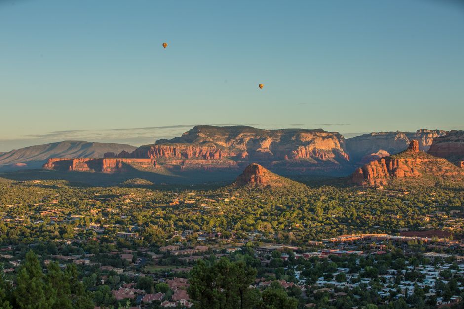
Sedona is a small town in central Arizona surrounded by some of the most beautiful scenery in the American Southwest: towering buttes, spires and mesas of glowing red sandstone, set against green juniper woodland and deep blue sky. Cathedral Rock, Bell Rock and Courthouse Butte rise right beside the roads, hiking trails start minutes from your hotel, and the cool, shady gorge of Oak Creek Canyon winds north toward Flagstaff. Sedona is also known for its art galleries, spas, jeep tours and the “vortex” energy sites that draw spiritual seekers. It is busy, especially on spring weekends, so plan your hikes early, use the free trailhead shuttle, and keep an eye on the weather: summer is hot, and monsoon storms can bring flash floods.
Right now in Sedona
- Tue11–26°C52–79°FClear
- Wed13–27°C55–81°FMostly clear
- Thu13–27°C56–81°FMostly clear
- Mon 12 Oct Columbus Day · regional holiday in Arizona
Top tours in Sedona
See all tours for Sedona →
From local operators, with prices and reviews; you check availability and book on Viator, our partner. We may earn a commission at no extra cost to you. How we earn money
Sedona at a glance
- Best months: March–May and late September–November, for warm days and cool nights. June to August is hot, with monsoon storms from July; winter is mild by day and chilly at night, with the occasional snow on the red rocks.
- Time needed: two days for the main viewpoints and a couple of hikes; three or four to add Oak Creek Canyon, Jerome and a day trip to the Grand Canyon.
- Getting there: about 2 hours by car from Phoenix Sky Harbor airport, 45 minutes from Flagstaff and about 2.5 hours from the Grand Canyon’s South Rim. There is no train or major airport in Sedona.
- Costs (as of October 2026): a Red Rock Pass for trailhead parking is $5 a day or $15 a week; the trailhead shuttle is free; hotel bills add about 13–14% in taxes.
- Before you go: entry rules, money, driving and general safety are on our United States travel guide.
Sedona areas and who each one suits
Uptown Sedona
The tourist center along State Route 89A, with souvenir and crystal shops, restaurants with views of Snoopy Rock and Steamboat Rock, jeep-tour offices and hotels. Walkable and lively, but traffic jams are common at weekends.
Gallery District and Tlaquepaque
Along State Route 179 just south of Uptown, Tlaquepaque Arts & Shopping Village is a pretty, Mexican-style complex of courtyards, fountains, galleries and restaurants beside Oak Creek. Nearby resorts and spas sit close to the creek.
West Sedona
Where most locals live and shop, with supermarkets, more affordable hotels and restaurants, and quick access to Airport Mesa, Soldier Pass and the Dry Creek area trailheads, including the road to Devil’s Bridge.
Village of Oak Creek
About 7 miles (11 km) south on State Route 179, below Bell Rock and Courthouse Butte, with resorts, golf, outlet shops and easy trail access. Quieter, often cheaper, and the first place you reach coming from Phoenix.
Oak Creek Canyon
North of Uptown, cabins, lodges and campgrounds line the creek beneath steep, forested walls. Cooler in summer and very scenic, but parts of the canyon were affected by the 2026 Pocket Fire and its flood risk (see below).
Top things to see in Sedona
Cathedral Rock
Sedona’s most photographed formation. The short but very steep Cathedral Rock Trail scrambles up slickrock to a saddle between its spires, with huge views; it is a climb with hands in places, not a stroll. For the classic reflection, walk to Red Rock Crossing at Crescent Moon Picnic Site on Oak Creek, a fee area run by a concessioner. On shuttle days, ride the free shuttle: the trailhead lot is closed to private cars while it runs.
Bell Rock and Courthouse Butte
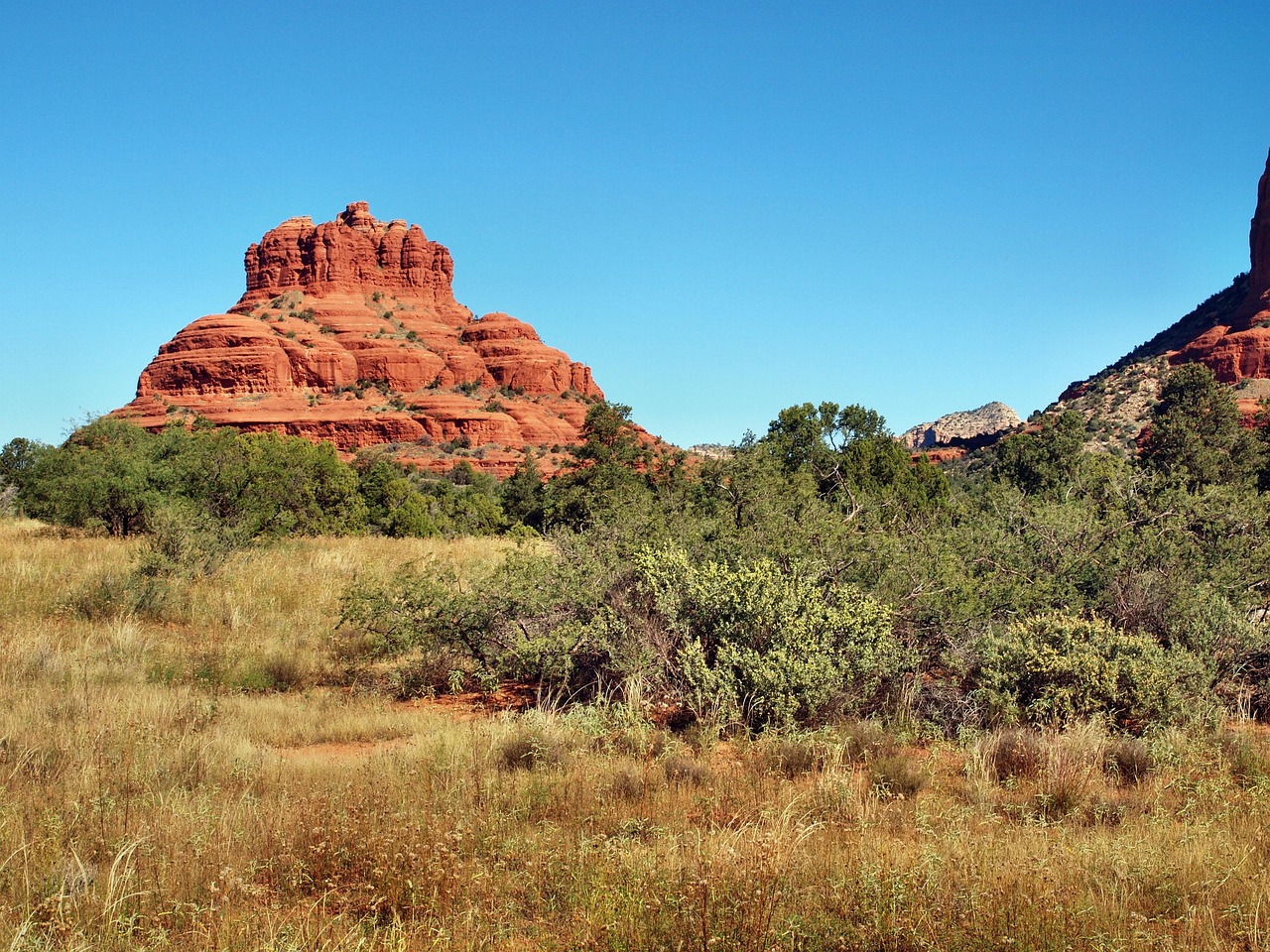
Bell-shaped and impossible to miss beside State Route 179, Bell Rock has easy paths around its base and steeper scrambles up its lower ledges. The Courthouse Butte Loop circles both formations on mostly level ground, about 4 miles (6.4 km).
Devil’s Bridge
The largest natural sandstone arch in the Sedona area, which you can walk across for a famous (and exposed) photo. From the Dry Creek Vista or Mescal trailheads, served by the free shuttle, it is a moderate hike of about 4 miles (6.4 km) round trip, with a steep final climb. Expect lines for photos on the arch; go at sunrise to avoid them.
Chapel of the Holy Cross
Built in 1956 into a red-rock ridge south of Uptown, this Catholic chapel with a giant cross in its glass wall is one of Arizona’s most striking buildings. Entry is free; parking at the top is very limited, so you may be asked to walk up from lower down the road.
Airport Mesa
A low mesa above West Sedona with 360-degree views across town to the buttes, a favorite sunset spot and one of the best-known vortex sites. The small parking lot fills early; a short but steep path climbs to the viewpoint.
Oak Creek Canyon and Slide Rock State Park
State Route 89A climbs 14 miles (23 km) through the canyon toward Flagstaff, ending in tight switchbacks to an overlook. Slide Rock State Park, a historic apple farm, has a natural water slide in the creek, popular in summer. It is open 8 a.m. to 6 p.m. until 20 November and 9 a.m. to 5 p.m. from 21 November to 30 January (entry and swimming end an hour before closing; closed Christmas Day). Entry is by car only, $20 per vehicle for up to 4 people from 22 August 2026 to April 2027 ($30 from May to late August) plus $5 per extra person; children under 6 are free, and there are no reservations. Pets are not allowed in the creek. There is no apple picking in fall 2026.
After the 2026 Pocket Fire: what’s open
The Pocket Fire started on 19 June 2026 about 7 miles (11 km) north of Sedona and burned more than 17,000 acres (6,900 hectares), much of it in the Red Rock-Secret Mountain Wilderness above Oak Creek Canyon. Oak Creek Canyon was evacuated, and the creek was then closed through the summer because burned slopes raise the risk of flash floods and debris flows. The Coconino National Forest lifted the creek closure on 17 September 2026, reopening the creek and nearly all its recreation sites, and the swim area at Slide Rock reopened. The West Fork of Oak Creek trail, Call of the Canyon and several wilderness trails north of West Sedona (Bear Sign, David Miller, Dry Creek, HS Canyon and Secret Canyon) were closed until 1 October 2026. Check the Forest Service’s alerts before you hike, and stay out of the creek and burned drainages whenever rain is forecast.
Hiking in Sedona: the Red Rock Pass and the free shuttle
Sedona has hundreds of miles of trails, from flat strolls to slickrock scrambles. Most trailheads are on Coconino National Forest land, where you need a Red Rock Pass to park: $5 a day, $15 a week or $20 a year, sold at trailhead machines, the Sedona Chamber of Commerce visitor center, the Red Rock Visitor Center and on Recreation.gov. An America the Beautiful pass is accepted instead. You don’t need one to stop for a quick photo of 15 minutes or so, or to ride the shuttle. A few sites run by concessioners (such as Crescent Moon) and state parks charge their own fees.
The free Sedona Shuttle runs to the busiest trailheads: Cathedral Rock and Little Horse from the park-and-ride lot on State Route 179 north of the Village of Oak Creek, and Soldier Pass, Dry Creek Vista and Mescal (for Devil’s Bridge) from Posse Grounds Park in West Sedona. It normally runs Thursday to Sunday, from about 7 a.m. to 5:30 p.m., and daily during spring break and some holidays; no reservation or Red Rock Pass is needed, and when it is running the trailhead lots it serves are closed to private cars. Check the current timetable on the shuttle’s website.
- Easy: Bell Rock Pathway, the Courthouse Butte Loop and the Airport Mesa loop sections.
- Moderate: Devil’s Bridge, Soldier Pass (past the Seven Sacred Pools and a cave) and Boynton Canyon.
- Steep and short: Cathedral Rock, which has no shade and some exposed scrambling.
See our hiking guide for general advice. Stay on marked trails, don’t stack rocks or build “vortex” circles, and pack out all trash.
Heat and flash-flood safety
Sedona sits at about 4,350 ft (1,330 m), cooler than Phoenix but still hot in summer: the average July high is 97 °F (36 °C), and the open red-rock trails reflect the heat. From May to September, hike at dawn, carry plenty of water (at least a quart or liter per hour of hiking), wear a hat and sunscreen, and turn back before you run low. Many rescues here involve dehydrated hikers. The monsoon, from about July to September, brings sudden afternoon thunderstorms with lightning and flash floods: never cross a flooded wash or road, keep out of narrow canyons and the creek when storms are around, and be especially careful below the 2026 burn scar, where even moderate rain can send debris flows down Oak Creek. Check the National Weather Service forecast and Forest Service alerts each day.
Other things to do in Sedona
- Jeep tours: licensed companies run rough-road tours to places like Broken Arrow and Schnebly Hill; you can also rent your own off-road vehicle.
- Vortexes and wellness: visitors come to feel the “energy” at Bell Rock, Airport Mesa, Cathedral Rock and Boynton Canyon; spas, yoga and healing centers abound.
- Art and food: galleries in Uptown and Tlaquepaque, Southwestern restaurants and wineries in the Verde Valley. See our wine tasting guide.
- Hot-air balloons and stargazing: sunrise balloon flights over the red rocks, and dark skies protected by local lighting rules.
- Mountain biking: famous slickrock and singletrack trails; bike shops rent and guide. See our cycling guide.
Day trips from Sedona
- The Grand Canyon: the South Rim is 119 miles (192 km) away, about 2.5 hours via Flagstaff; see our Grand Canyon guide for fees and what’s open.
- Jerome: a former copper-mining town clinging to Cleopatra Hill, now full of galleries, wine bars and ghost stories, about 45 minutes southwest.
- Verde Canyon Railroad: a scenic heritage train from Clarkdale through a canyon without roads, about 40 minutes from Sedona.
- Montezuma Castle and Tuzigoot: cliff dwellings and a hilltop pueblo built by the Sinagua people, both national monuments. One ticket for $10 per adult (16 and over) covers both for 7 days; America the Beautiful passes are valid.
- Flagstaff: a mountain college town on Route 66, 30 miles (48 km) north via Oak Creek Canyon, with Lowell Observatory.
Nearby destinations
- Grand Canyon National Park136 km
- Scottsdale153 km
- Phoenix159 km
- Monument Valley281 km
- Zion National Park282 km
Getting there and getting around
| From | Distance | Route and time |
|---|---|---|
| Phoenix (PHX airport) | about 116 miles (187 km) | Interstate 17 north, then State Route 179; about 2 hours |
| Flagstaff | about 30 miles (48 km) | State Route 89A through Oak Creek Canyon; about 45 minutes |
| Grand Canyon South Rim | 119 miles (192 km) | Via Flagstaff; about 2.5 hours |
| Las Vegas | about 275 miles (443 km) | US 93 and Interstate 40 via Kingman and Flagstaff; about 4.5 hours |
Most visitors fly into Phoenix Sky Harbor and rent a car; airport shuttle companies also run between Phoenix and Sedona. From Las Vegas (see our Las Vegas travel guide) you can combine Sedona with the Grand Canyon. In town, a car is easiest, but traffic on State Route 179 and in Uptown can crawl on weekends and holidays: start early, use the free trailhead shuttle, and walk around Uptown. Driving tips are in our United States travel guide.
When to go and how long to stay
Sedona is pleasant much of the year. Spring is the busiest season, with wildflowers and perfect hiking weather; summer is hot and stormy from July; fall is warm, clear and less crowded once school starts; winter days are often sunny and mild, with cold nights and occasional snow on the buttes, a magical sight.
| Season | Average high | Average low | What it’s like |
|---|---|---|---|
| Spring (Mar–May) | 68–84 °F (20–29 °C) | 40–53 °F (4–12 °C) | Busiest; ideal hiking; spring-break crowds. |
| Summer (Jun–Aug) | 94–97 °F (34–36 °C) | 61–68 °F (16–20 °C) | Hot; monsoon storms and flash floods from July; hike at dawn. |
| Fall (Sep–Nov) | 89–67 °F (32–19 °C) | 61–41 °F (16–5 °C) | Warm and clear; fall color in Oak Creek Canyon in late October. |
| Winter (Dec–Feb) | 58–61 °F (14–16 °C) | 33–36 °F (1–2 °C) | Mild, sunny days; cold nights; occasional snow. |
Figures are NOAA 1991–2020 normals for the Sedona weather station at 4,220 ft (1,286 m). It gets about 17.1 inches (435 mm) of rain a year, mostly in winter and in the July–September monsoon.
How long to stay: 2, 3 and 4 days
Two days: sunrise at Cathedral Rock or Devil’s Bridge, the Chapel of the Holy Cross and Tlaquepaque, then sunset on Airport Mesa; on day two, Bell Rock and Courthouse Butte, Uptown and a jeep tour. Three days: add Oak Creek Canyon and Slide Rock, or Jerome and the Verde Canyon Railroad. Four days: add a day trip to the Grand Canyon.
Where to stay in Sedona: lodging tax
Sedona has luxury resorts with red-rock views, boutique inns, creekside cabins and plenty of mid-range hotels, but prices are high in spring and fall weekends; the Village of Oak Creek, Cottonwood (25 minutes) and Flagstaff are cheaper. Book well ahead for March, April and October. Room rates are quoted before tax. Inside city limits, the bill adds Arizona and county sales tax plus the city’s 3.5% sales tax and 3.5% bed tax, about 13.3% in total on the Yavapai County side (most of West Sedona) and about 13.9% on the Coconino County side (Uptown and Oak Creek Canyon). Some resorts also add a resort fee.
Practical tips for Sedona
- Time zone: Arizona does not use daylight saving time, so Sedona is on Mountain Standard Time all year: the same as Las Vegas in summer and one hour ahead in winter, and one hour behind Utah and the Navajo Nation in summer.
- Start early: trailhead lots fill soon after sunrise in busy seasons, and Uptown traffic peaks late morning.
- Fire rules: campfires are banned in many areas around Sedona; check current restrictions.
- Wildlife: watch for rattlesnakes in warm months and give javelinas plenty of room.
- Tipping: 18–22% in sit-down restaurants; tip jeep and tour guides too. Emergencies: call 911.
What to pack for Sedona
Bring hiking shoes with sticky soles for slickrock, a large water bottle or hydration pack, a sun hat, sunglasses and high-factor sunscreen, and layers for cool mornings and evenings. In summer, add a light rain jacket for monsoon storms; in winter, a warm jacket for frosty nights. Water shoes help if you plan to swim at Slide Rock.
Sedona travel FAQ
Do I need a Red Rock Pass in Sedona?
Yes, to park at most national-forest trailheads: $5 a day, $15 a week or $20 a year. An America the Beautiful pass also works. You don’t need one for a short photo stop or to ride the free shuttle.
Is the Sedona Shuttle free?
Yes. It serves Cathedral Rock, Little Horse, Soldier Pass, Dry Creek Vista and Mescal trailheads, usually Thursday to Sunday from about 7 a.m. to 5:30 p.m., and daily in spring break.
Is Oak Creek open after the Pocket Fire?
Mostly. The creek and nearly all its recreation sites reopened on 17 September 2026, and Slide Rock’s swim area is open. West Fork and some wilderness trails were closed until 1 October; check Forest Service alerts.
How much is Slide Rock State Park?
$20 per vehicle for up to 4 people from late August 2026 to April 2027, rising to $30 from May to late August, plus $5 per extra person.
How far is Sedona from the Grand Canyon?
About 119 miles (192 km) to the South Rim, roughly 2.5 hours each way via Flagstaff, so a long but doable day trip.
What is the best time to visit Sedona?
March to May and late September to November. Summer is very hot, with monsoon storms and flash floods from July.
Does Sedona observe daylight saving time?
No. Like most of Arizona, Sedona stays on Mountain Standard Time all year. The Navajo Nation to the northeast does change its clocks.
What is the hotel tax in Sedona?
About 13.3% on the Yavapai County side of town and 13.9% on the Coconino County side, including the city’s 3.5% bed tax.
Plan your trip
Partner links: TravelerCenter may earn a commission if you book, at no extra cost to you.
Sources · last reviewed 4 October 2026
Researched and last reviewed on 4 October 2026. The Red Rock Pass: Coconino National Forest and Visit Sedona; the trailhead shuttle: the City of Sedona and Sedona Shuttle; Slide Rock fees and hours: Arizona State Parks; the Pocket Fire and the Oak Creek closures: Coconino National Forest and the City of Sedona; Montezuma Castle and Tuzigoot fees and the Grand Canyon distance: the National Park Service; climate: NOAA’s 1991–2020 normals for the Sedona station. Lodging-tax totals, shuttle details, drive times and some attraction details come from secondary references and are flagged for checking. Prices, closures and rules change, so check the official sites before you go. For entry rules, money and general safety, see our United States travel guide.
Data: Weather: MET Norway (CC BY 4.0) · Air quality: OpenAQ · Rates: ECB · Holidays: Nager.Date · Costs: World Bank ICP and price levels · Wikidata (CC0)