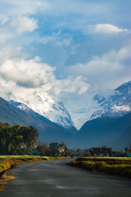
The Annapurna Conservation Area, north of Pokhara in central Nepal, is the country’s largest protected area and its most popular trekking region. It covers about 7,630 km² (2,950 sq miles), from subtropical rice terraces barely 800 m (2,600 ft) above sea level, through rhododendron forests and Gurung and Magar villages, to the glaciers of the Annapurna massif, whose main summit, Annapurna I, rises to 8,091 m (26,545 ft), and on to the high, arid valleys of Manang and Mustang on the Tibetan side of the range. Between Annapurna and Dhaulagiri, the Kali Gandaki river cuts one of the deepest gorges on Earth. Created in 1986 as Nepal’s first conservation area, it is managed by the National Trust for Nature Conservation (NTNC) under a model in which local communities share the work and the income. The classic treks are the short Ghorepani–Poon Hill circuit, the walk into the Annapurna Sanctuary to Annapurna Base Camp, the Mardi Himal ridge and the Annapurna Circuit over the 5,416 m (17,769 ft) Thorong La pass. Foreigners need an entry permit, a TIMS card and a licensed guide. The best months are October and November and March to May.
Right now in Annapurna Conservation Area (Jomsom)
- Wed -3–15°C 27–59°F Partly cloudy
- Thu 2–16°C 36–61°F Mostly clear
- Fri 2–11°C 35–52°F 2 mm Partly cloudy
Weather: MET Norway (CC BY 4.0)
Top tours in Annapurna Conservation Area
See all tours for Annapurna Conservation Area →
From local operators, with prices and reviews; you check availability and book on Viator, our partner. We may earn a commission at no extra cost to you. How we earn money
Annapurna at a glance
- Best for: teahouse trekking, close-up views of the Annapurnas, Dhaulagiri and Machhapuchhre, village life, and the high desert of Mustang.
- How long: 4 days for Poon Hill; 4–6 days for Mardi Himal; 7–10 days for Annapurna Base Camp; 12–18 days for the Annapurna Circuit.
- Best time: October and November, for clear skies; March to May, for rhododendrons and warmer days. Upper Mustang can be visited in the monsoon.
- Getting there: most treks start or end a short drive from Pokhara; the Annapurna Circuit starts at Besisahar, about 6 hours by road from Kathmandu.
- Fees: according to the Nepal Tourism Board, foreigners pay NPR 3,000 for the conservation area entry permit, plus NPR 2,000 for a TIMS card issued through a registered agency.
- Rules to know: trek with a licensed guide, carry your permits for the checkpoints, ascend slowly above 3,000 m (9,800 ft), and do not cross the Thorong La in bad weather.
- Before you go: the visa, money and general safety are in our Nepal travel guide.
Fees, permits and rules (as of October 2026)
The ACAP entry permit
All foreign visitors entering the conservation area need an Annapurna Conservation Area Project (ACAP) entry permit. According to the Nepal Tourism Board, foreigners pay NPR 3,000 (about US$19.50) per person per entry, SAARC citizens NPR 1,000 and Nepalis NPR 100; children under 10 enter free. Permits are issued at the Nepal Tourism Board offices in Kathmandu (Bhrikutimandap) and Pokhara, usually by your trekking agency; they are checked at posts such as Birethanti, Ghandruk, Chame, Manang and Jomsom.
TIMS and the guide rule
According to the Nepal Tourism Board, under the revised TIMS rules in force since March 31, 2023, foreign trekkers on the Annapurna Circuit, Nar Phu, the Tilicho and Mesokanto pass, Poon Hill and Annapurna Base Camp, Khopra, Mardi Himal and other routes in the region must be accompanied by a licensed trekking guide and carry a TIMS card issued through a Government-registered agency, costing NPR 2,000 for most foreigners and NPR 1,000 for SAARC citizens.
Restricted areas: Upper Mustang and Nar Phu
Parts of the region near the Tibetan border are restricted areas, open only to groups of at least two trekkers with a licensed guide and a special permit from the Department of Immigration, issued through an agency. According to the department, Upper Mustang costs US$50 per person per day, and the Nar and Phu valleys in Manang US$100 per week from September to November and US$75 per week from December to August. The ACAP permit is also required.
The area’s key rules
Walk on marked trails, use teahouse toilets, carry out your trash and avoid single-use plastic bottles (many villages sell filtered water). Choose solar- or gas-heated showers over firewood where you can, and do not disturb wildlife. Respect local customs at monasteries and shrines, and ask before photographing people.
The main treks
Ghorepani and Poon Hill
The most popular short trek climbs from Nayapul or Ulleri, a short drive from Pokhara, through rhododendron forest to Ghorepani (about 2,860 m / 9,380 ft), where trekkers rise before dawn to climb Poon Hill (about 3,210 m / 10,530 ft) for sunrise over Dhaulagiri, the Annapurnas and Machhapuchhre. The loop usually returns via the Gurung village of Ghandruk, in about four days. In April, the forests turn red and pink with flowering rhododendrons, Nepal’s national flower.
Annapurna Base Camp (the Annapurna Sanctuary)
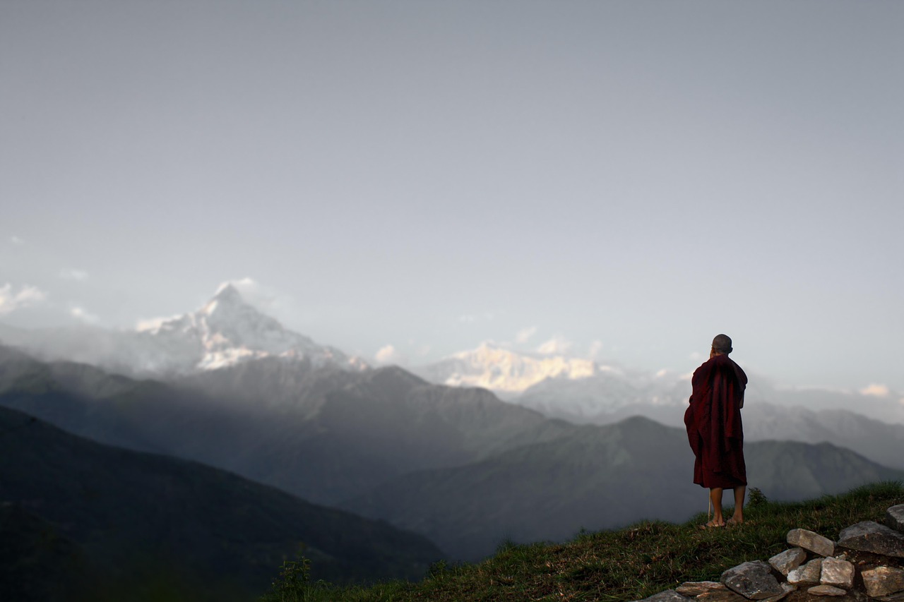
From Chhomrong, the trail enters the narrow Modi Khola gorge between Hiunchuli and Machhapuchhre and climbs to Machhapuchhre Base Camp (about 3,700 m / 12,140 ft) and Annapurna Base Camp (about 4,130 m / 13,550 ft), in a natural amphitheater ringed by Annapurna I, Annapurna South, Gangapurna and the fishtail peak of Machhapuchhre, which is sacred and has never been officially climbed. The trek takes about 7 to 10 days from Pokhara, or longer when combined with Poon Hill. The upper gorge, between Deurali and Machhapuchhre Base Camp, is exposed to avalanches after heavy snow.
Mardi Himal
A newer, quieter route follows a forested ridge east of the Sanctuary to Mardi Himal High Camp (about 3,580 m / 11,750 ft) and a viewpoint at around 4,500 m (14,800 ft) directly below Machhapuchhre, in about 4 to 6 days from Pokhara.
The Annapurna Circuit
The classic long trek circles the Annapurna massif counterclockwise, from Besisahar up the Marsyangdi valley through Chame and Pisang to Manang (about 3,540 m / 11,610 ft), where trekkers rest to acclimatize; then over the Thorong La (5,416 m / 17,769 ft), one of the highest trekking passes in the world, to the pilgrimage town of Muktinath and down the Kali Gandaki valley through Jomsom and the Thakali village of Marpha to the hot springs of Tatopani. Roads now reach much of the route, and many trekkers ride jeeps on some sections or follow the marked New Annapurna Trekking Trails (NATT), which keep to footpaths away from the roads. The full circuit takes about 12 to 18 days; side trips lead to Tilicho Lake (about 4,920 m / 16,140 ft), among the highest lakes in the world.
Upper Mustang
North of Kagbeni, the former kingdom of Lo is a high desert of eroded canyons, red cliffs, cave dwellings and Tibetan Buddhist monasteries, with the walled town of Lo Manthang at its heart. Treks take 10 to 14 days with the restricted-area permit; jeep tours are also possible. Because it lies in the rain shadow of the Himalaya, Upper Mustang can be visited during the monsoon, and the Tiji festival of masked dances is held in Lo Manthang in spring.
Khopra and Dhaulagiri views
The community-run lodges of the Khopra ridge, west of Poon Hill, offer a less crowded alternative with close views of Dhaulagiri and Annapurna South.
Villages, temples and culture
- Ghandruk: one of Nepal’s largest Gurung villages, with stone houses, a museum of Gurung culture and views of Annapurna South and Machhapuchhre.
- Muktinath: a temple complex at about 3,800 m (12,470 ft), sacred to both Hindus and Buddhists, with 108 water spouts and an eternal flame fed by natural gas.
- Marpha: a whitewashed Thakali village in the Kali Gandaki valley, famous for its apples, apple brandy and dried fruit.
- Kagbeni: a medieval-looking village of mud-brick houses and a red monastery at the gateway to Upper Mustang.
- Manang and Braga: villages of the upper Marsyangdi with old monasteries, glacier views and, in Manang, a Himalayan Rescue Association aid post with daily talks on altitude sickness in the trekking seasons.
Food and teahouse life
Teahouses line all the main routes, offering twin rooms, shared bathrooms and dining rooms around a stove. Dal bhat is the staple; the Thakali version, in the Kali Gandaki valley, is famous across Nepal. Try Gurung bread, buckwheat pancakes, apple pie in Marpha and Manang, yak cheese, and ginger-lemon-honey tea. Prices rise with altitude and distance from the road; hot showers, charging and Wi-Fi often cost extra.
Gateways and side trips
- Pokhara: the main base for the region, with permits, agencies, gear shops and flights to Jomsom. See our Pokhara guide.
- Jomsom: the airstrip and district headquarters of Mustang, with short morning flights to Pokhara and buses down the Kali Gandaki valley.
- Tatopani: natural hot springs at the end of the circuit’s descent.
- Bandipur: a preserved hill town between Pokhara and Kathmandu, a good stop on the way to Besisahar.
- Kathmandu: see our Kathmandu guide.
Nearby destinations
- Pokhara64 km
- Chitwan National Park147 km
- Kathmandu178 km
- Sagarmatha National Park (Everest Region)285 km
Getting there
By road
Treks on the southern side start from trailheads such as Nayapul, Ulleri, Kande, Phedi and Siwai, 1 to 3 hours by jeep or taxi from Pokhara. The Annapurna Circuit starts at Besisahar, about 6 hours by bus from Kathmandu or 4 to 5 hours from Pokhara, with shared jeeps continuing up the valley to Chame or Manang. Buses and jeeps run down the Kali Gandaki valley from Jomsom and Muktinath to Beni and Pokhara.
By air
Small planes fly between Pokhara and Jomsom in about 20 minutes, early in the morning before strong winds blow up the Kali Gandaki gorge; flights are often canceled in cloud or wind. A few flights also serve Manang (Humde) in season.
Getting around
On the trails, everything is on foot, with porters and mule trains on the circuit. Jeeps run on the dirt roads up the Marsyangdi and Kali Gandaki valleys, though landslides close them often in the monsoon. Porters can be hired through your agency.
When to go and how long to stay
The southern slopes of the Annapurnas, around Pokhara, Ghorepani and Chhomrong, take the full force of the monsoon and are among the wettest places in Nepal, while Manang and Mustang, in the rain shadow, receive little rain. October and November bring clear skies and the best views; nights are cold above 3,000 m (9,800 ft) and the Thorong La can see snow. March to May is warmer, with rhododendrons in flower, though clouds often build by midday. December to February is clear but cold, with snow closing the Thorong La and Tilicho at times, while lower treks such as Poon Hill stay open. The monsoon, from June to September, brings heavy rain, leeches, landslides and hidden views on the southern side, but is a good time for Upper Mustang. The table shows the 1991–2020 normals for Jomsom, at about 2,700 m (8,900 ft) in the Kali Gandaki valley, from Nepal’s Department of Hydrology and Meteorology (DHM), as published on the World Meteorological Organization’s (WMO) World Weather Information Service. For the southern side, see the much wetter Pokhara figures in our Pokhara guide.
| Month | Average high / low | Rain (rainy days) | What to expect |
|---|---|---|---|
| January | 10 °C (51 °F) / −2 °C (29 °F) | 14 mm (0.6 in), 2 days | Cold and clear; Thorong La often snowbound |
| February | 12 °C (53 °F) / −1 °C (31 °F) | 21 mm (0.8 in), 3 days | Cold; snow on the passes |
| March | 15 °C (59 °F) / 2 °C (36 °F) | 30 mm (1.2 in), 4 days | Spring season opens; rhododendrons lower down |
| April | 19 °C (65 °F) / 4 °C (40 °F) | 21 mm (0.8 in), 4 days | Busy; flowers in the forests; windy afternoons |
| May | 21 °C (69 °F) / 8 °C (46 °F) | 19 mm (0.7 in), 4 days | Warm days; Tiji festival in Lo Manthang |
| June | 23 °C (73 °F) / 12 °C (54 °F) | 32 mm (1.3 in), 6 days | Monsoon on the southern slopes; dry in Mustang |
| July | 23 °C (73 °F) / 14 °C (57 °F) | 47 mm (1.8 in), 10 days | Heavy rain south of the range; landslides |
| August | 23 °C (73 °F) / 14 °C (57 °F) | 44 mm (1.7 in), 9 days | Wet south of the range; Upper Mustang season |
| September | 21 °C (70 °F) / 12 °C (53 °F) | 36 mm (1.4 in), 6 days | Rains easing late in the month |
| October | 18 °C (65 °F) / 6 °C (42 °F) | 18 mm (0.7 in), 2 days | Clear and dry; peak season |
| November | 15 °C (59 °F) / 2 °C (35 °F) | 5 mm (0.2 in), 1 day | Crisp and clear; cold nights |
| December | 12 °C (54 °F) / −1 °C (30 °F) | 5 mm (0.2 in), under 1 day | Cold; quiet trails; snow on the passes |
Four days to Poon Hill
Day 1, drive from Pokhara to Ulleri or Tikhedhunga and walk to Ghorepani. Day 2, Poon Hill at sunrise, then on to Tadapani. Day 3, Ghandruk. Day 4, walk down and drive back to Pokhara.
Annapurna Base Camp in 8 days
Pokhara to Jhinu Danda or Chhomrong, then Bamboo, Deurali, Annapurna Base Camp via Machhapuchhre Base Camp, and back down via Bamboo and the hot springs at Jhinu.
Where to stay
- Teahouses on the trails: simple lodges in every village on the main routes, from basic rooms to lodges with private bathrooms in Ghandruk, Chhomrong, Manang and Jomsom.
- Community lodges: on the Khopra ridge and some newer routes, run by local communities.
- Pokhara: before and after treks. See our Pokhara guide.
Teahouses at Ghorepani, Machhapuchhre and Annapurna base camps and Thorong Phedi fill up in October and April; guides book ahead.
What a trek in the Annapurnas costs
Prices are approximate, for October 2026, converted at about 154 rupees (NPR) to the US dollar. Permit fees are those of the Nepal Tourism Board and the Department of Immigration.
| Item | Typical cost |
|---|---|
| ACAP entry permit, foreigners | NPR 3,000 (about US$19.50) |
| TIMS card through an agency, foreigners | NPR 2,000 (about US$13) |
| Upper Mustang restricted-area permit | US$50 per person per day |
| Licensed trekking guide, per day | NPR 4,000–6,000 (about US$26–39) |
| Porter, per day | NPR 3,000–4,000 (about US$19–26) |
| Teahouse room, per night | NPR 300–2,000 (about US$2–13) |
| Dal bhat, lower villages / near Thorong La or Annapurna Base Camp | NPR 500–800 / NPR 900–1,400 (about US$3.25–5 / US$6–9) |
| Flight Pokhara–Jomsom, foreigners, one way | about US$120–140 |
Practical tips for Annapurna treks
- Get permits before you start: your agency arranges the ACAP permit and TIMS card in Kathmandu or Pokhara.
- Cross the Thorong La early: leave Thorong Phedi or High Camp before dawn to cross before the afternoon wind, and turn back in bad weather.
- Use the NATT trails: on the circuit, follow the red-and-white or blue-and-white markers to avoid walking on jeep roads.
- Carry cash: ATMs exist in Besisahar, Jomsom and a few villages but are unreliable.
- Watch for avalanche warnings: after heavy snow, the upper Modi Khola gorge on the way to Annapurna Base Camp can be closed.
Safety
Altitude sickness is the main risk on the Annapurna Circuit, at Tilicho Lake, at Annapurna Base Camp and on Mardi Himal: above about 2,500 m (8,200 ft), the Nepal Tourism Board recommends sleeping no more than 300–500 m (1,000–1,600 ft) higher each night and taking a rest day for every 1,000 m (3,300 ft) gained, and descending if symptoms worsen; the Himalayan Rescue Association’s aid post in Manang gives daily talks in the trekking seasons. Weather on the Thorong La can change fast: in October 2014, a sudden blizzard in the region killed dozens of trekkers, guides and porters, so check forecasts and never cross in a storm. Avalanches affect the upper Annapurna Sanctuary trail after heavy snowfall. During the monsoon, from June to September, landslides and floods close roads and trails, and the Kali Gandaki and Marsyangdi roads are often blocked. Jeep rides on the dirt roads are rough and accidents occur. Mountain flights to Jomsom are often delayed. Trek with a licensed guide, as the rules require, and carry insurance that covers helicopter rescue. For emergencies, call 100 for police and 102 for an ambulance, or the Tourist Police on 1144.
What to pack for the Annapurnas
Broken-in trekking boots, layers from T-shirts to a down jacket (temperatures range from tropical at the trailheads to well below freezing on the Thorong La), a waterproof shell, warm hat and gloves, sunglasses and sunscreen, a sleeping bag for cold teahouses, a headlamp, trekking poles, water purification, and leech socks in the wet season. Nepal uses 230 V, with round two-pin (type C) and three-pin (types D and M) sockets. See our hiking shoes, rain jackets and travel adapters guides.
Annapurna Conservation Area travel FAQ
How much is the Annapurna (ACAP) permit?
According to the Nepal Tourism Board, NPR 3,000 (about US$19.50) for foreigners and NPR 1,000 for SAARC citizens; children under 10 are free.
Do I need a guide for the Annapurna Circuit or Poon Hill?
Yes. Since March 31, 2023, the Nepal Tourism Board’s rules require foreign trekkers on the Annapurna routes, including the circuit, Poon Hill, Annapurna Base Camp and Mardi Himal, to be accompanied by a licensed guide and carry a TIMS card from a registered agency.
What is the easiest Annapurna trek?
The Ghorepani–Poon Hill circuit, about four days from Pokhara, with a maximum altitude of about 3,210 m (10,530 ft).
How long is the Annapurna Circuit?
About 12 to 18 days, depending on where you start and finish and how much you use jeeps on the road sections.
How high is the Thorong La?
5,416 m (17,769 ft). Acclimatize in Manang and cross early in the morning.
When is the best time for the Annapurna Base Camp trek?
October and November, and March to May. Avoid the upper gorge after heavy snow because of avalanches.
Can I trek in the Annapurnas during the monsoon?
The southern treks are wet, cloudy and leech-filled from June to September, and landslides are common, but Upper Mustang and the upper Manang valley are much drier.
How much does Upper Mustang cost?
The restricted-area permit costs US$50 per person per day, according to Nepal’s Department of Immigration, plus the ACAP permit, a guide and a group of at least two.
Where do I get the ACAP permit?
At the Nepal Tourism Board offices in Kathmandu or Pokhara, usually through your trekking agency.
Is there a road on the Annapurna Circuit?
Yes. Jeep roads now run up much of the Marsyangdi and Kali Gandaki valleys, but the New Annapurna Trekking Trails keep trekkers on footpaths for most of the way.
Sources and last review
Researched and last reviewed on 4 October 2026. The ACAP entry fee, the guide and TIMS rules and the list of Annapurna routes covered, the HRA aid post in Manang and altitude guidance: the Nepal Tourism Board; restricted-area permit fees for Upper Mustang and Nar Phu (Manang): Nepal’s Department of Immigration; climate normals for Jomsom: Nepal’s Department of Hydrology and Meteorology, via the World Meteorological Organization’s World Weather Information Service (1991–2020); exchange rate: Nepal Rastra Bank; monsoon and road conditions: the UK government’s travel pages (factual content only). The area’s size and history, peak and pass heights, trek durations, the October 2014 blizzard, flight details, festival timing and all typical prices are general references or estimates, flagged for checking. Fees and rules change, so check the official sites before you go. For entry rules, money and general safety, see our Nepal travel guide.
Plan your trip
Partner links: TravelerCenter may earn a commission if you book, at no extra cost to you.
🇳🇵 Useful Nepali phrases for Annapurna Conservation Area
All 38 Nepali phrases: restaurant, hotel, emergencies, romance (printable) →