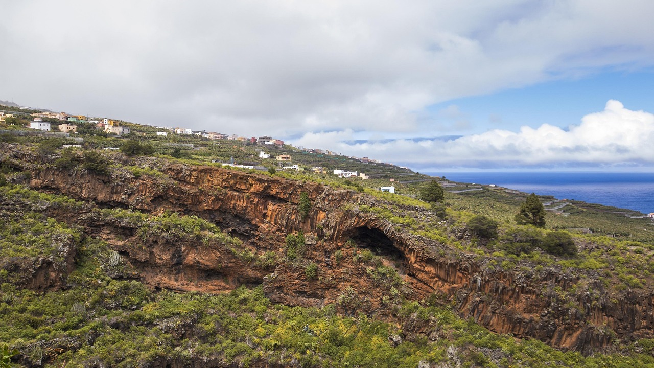
La Palma, “La Isla Bonita”, is the green, steep north-western island of the Canaries, about two and a half hours by ferry from Tenerife. It rises to 2,426 m at the Roque de los Muchachos, on the rim of the huge Caldera de Taburiente, and its skies are so clear and dark that the world’s astronomers built one of their great observatories there. The whole island is a UNESCO Biosphere Reserve and a Starlight Reserve. In the south, a ridge of young volcanoes runs to the sea; the newest, Tajogaite, erupted for 85 days in autumn 2021, burying homes and plantations and creating new land. Five years on, the island is open and welcoming. La Palma suits hikers, stargazers, nature lovers and anyone after a quiet, unspoilt island; it is pleasant all year, with the best walking from spring to autumn.
Right now in La Palma (Los Llanos de Aridane)
- Wed 19–22°C 65–71°F 8 mm Rain
- Thu 17–22°C 63–72°F 10 mm Showers
- Fri 18–22°C 65–72°F 5 mm Showers
- Mon 12 Oct National Day of Spain (Fiesta Nacional de España)
Weather: MET Norway (CC BY 4.0) · Sea temperature: NOAA CoastWatch · Rates: ECB · Holidays: Nager.Date
Top tours in La Palma
See all tours for La Palma →
From local operators, with prices and reviews; you check availability and book on Viator, our partner. We may earn a commission at no extra cost to you. How we earn money
La Palma at a glance
- Best for: mountain and forest hiking, volcano landscapes, stargazing, quiet black-sand beaches and slow travel.
- How long: 4–5 days for the Caldera, the Roque, the volcanoes and the north-east forests; a week or more for serious walking.
- Best time: April to October for high-mountain walks and clear skies; the coast is mild all year, while winter brings rain and sometimes snow on the summits.
- Getting there: flights to La Palma airport (SPC) from the other islands, Madrid, Barcelona and several European cities; ferries from Tenerife in about 2 hours 30 minutes.
- Getting around: TILP island buses link the main towns; a hire car is almost essential for the mountain viewpoints and trailheads.
- Before you go: entry rules, money, trains and general safety are on our Spain travel guide.
La Palma’s towns and who each one suits
The island is shaped like a heart, with a high mountain wall down the middle. The east side, with the capital and the airport, catches the trade-wind clouds and is greener; the west side, round Los Llanos, is sunnier and drier. A tunnel under the central ridge links the two in about half an hour by car.
Santa Cruz de La Palma
The capital, ferry port and one of the best-preserved colonial towns in the Canaries, rich from 16th-century trade with the Americas. Calle Real is lined with Renaissance and Canarian houses, and along the Avenida Marítima wooden balconies lean over the sea. Good for a car-free stay and for walking out to dinner.
Los Cancajos and Breña Baja
Just south of the capital and a few minutes from the airport, Los Cancajos is the east coast’s small resort, with apartments and hotels round a sheltered black-sand beach protected by breakwaters. Good for families; bus 500 links it with Santa Cruz and the airport.
Los Llanos de Aridane, El Paso and Tazacorte
The sunny west is the island’s busiest area. Los Llanos is a lively market town; El Paso, higher up, is the gateway to the Caldera and the volcano walks; Puerto de Tazacorte has a beach, fish restaurants and boat trips. Puerto Naos, the west’s main beach resort, was evacuated after the eruption because of volcanic gases; its beach has been open again since 2024, and homes, shops and its hotel have been reopening under the Cabildo’s gas-monitoring protocol.
The north and the south
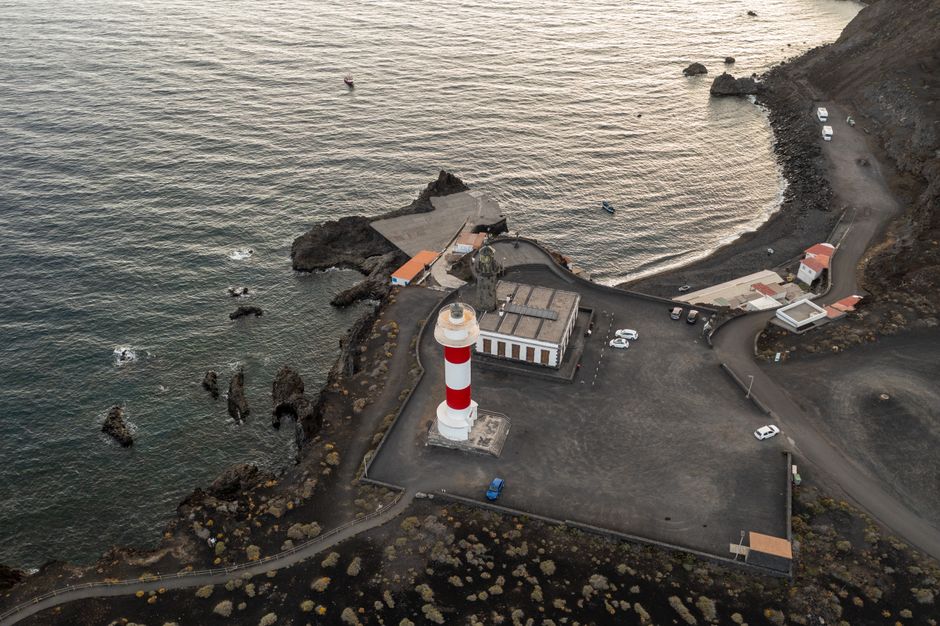
The wild north-west (Garafía, Puntagorda, Tijarafe) is a land of pine forest, almonds and dragon trees. The north-east (San Andrés y Sauces, Barlovento) has the laurel forest of Los Tilos and natural sea pools. In the far south, Fuencaliente has volcanoes, vineyards growing in black ash, salt pans and a lighthouse.
Top things to see on La Palma
Prices and hours below were checked on the official sites in October 2026, unless we say otherwise; check again before you go. National-park trails and viewpoints are free.
Caldera de Taburiente National Park
A vast crater about 9 km across, ringed by cliffs up to 2,000 m high and filled with Canary pine forest, streams and waterfalls, protected as a national park since 1954. The visitor centre is beside the LP-2 road at El Paso, on the bus route between Santa Cruz and Los Llanos. From there a 7 km road climbs to the Mirador de La Cumbrecita, the most visited viewpoint. As of October 2026, cars can go up between 8:30 and 16:00 only with a free parking booking on the national parks’ reservation site, reservasparquesnacionales.es; after 16:00 no booking is needed. Allow one hour for the view and the flat 1 km track to the Lomo de las Chozas viewpoint, two for the circular viewpoints walk.
The classic way into the crater is the long walk from Los Brecitos down to the Playa de Taburiente, the riverbed and camping area at its heart, and out along the Barranco de las Angustias: about 12.5 km and six hours, graded difficult. Park at the Barranco de las Angustias car park and take one of the taxis that run up the 13 km track to Los Brecitos in the morning (8:30–13:30 in summer, 9:00–12:00 in winter, according to the national parks’ ministry); cars may drive the track but cannot park at the top. As of October 2026 both sections of the route were open, but several others were closed, including Pico de la Nieve–Roque de los Muchachos and La Cumbrecita–camping area; check the park’s trail-status page first, and never enter the Angustias ravine after heavy rain. Camping is allowed only in the official camping area, with a permit from the same reservation site; no fires or camping gas, and no dogs anywhere in the park.
Roque de los Muchachos and the observatory
A road climbs from either coast to the island’s summit on the northern rim of the Caldera, with a dizzying view down into the crater and, on clear days, Teide floating above the clouds. Around it stand the domes of the Roque de los Muchachos Observatory, run by the Instituto de Astrofísica de Canarias (IAC), including the giant Gran Telescopio Canarias. There is no regular bus; go by car, taxi or tour. The visitor centre near the summit, run by the Cabildo with Garafía town council and the IAC, opens daily 10:00–16:30 in winter and 10:00–17:30 in summer; the Cabildo lists entry at €15, €7.50 reduced, free for children up to 12. Visits inside the telescope buildings are only with accredited “Starlight guides”, booked in advance through the Starlight Foundation; they run in small groups by day, last about 90 minutes, start at the visitor centre and depend on the weather and telescope work.
The Ruta de los Volcanes and Tajogaite
The Cumbre Vieja ridge in the south is a line of craters and cinder cones, and the Ruta de los Volcanes, part of the GR 131, follows its crest for about 24 km from the Refugio de El Pilar to Fuencaliente: a long, exposed, waterless day best started early. The Tajogaite volcano, born on 19 September 2021, lies on the western flank. As of October 2026 you cannot walk to it on your own: the island’s official tourism site says the 6 km circular trail (about two hours’ walking) near the cone must be done with an authorised guide, booked in advance through local companies. You can see the lava flows from the LP-2 road and its viewpoints, and from boat trips out of Puerto de Tazacorte along the new lava deltas. Do not collect ash or stones.
Los Tilos and the north-east forests
The Los Tilos laurel forest above San Andrés y Sauces is the heart of La Palma’s Biosphere Reserve: tall trees, ferns and springs in a deep, humid ravine. The information point opens daily 9:00–17:30, according to the town council. From here the famous Marcos y Cordero trail (PR-LP 06) follows water channels through a dozen tunnels to the springs; the Cabildo reopened it in stages after safety works in 2026, and local press reported the whole route open again from 18 September. It is demanding: the Cabildo asks walkers to wear a helmet and carry a headtorch, and to check the trail status first. In Puntallana, the Cubo de La Galga is an easier laurel-forest walk.
More to see
- San Antonio volcano, Fuencaliente: a visitor centre and a walk round the crater rim, with the 1971 Teneguía volcano below; as of October 2026 the municipality lists €8 (€6 for Canary residents), free under 12, open 9:00–17:00 from October to June.
- Fuencaliente lighthouse and salt pans: white salt pans against black lava at the island’s southern tip.
- Charco Azul and La Fajana: natural sea pools on the north-east coast.
- Mirador del Time: a high viewpoint over the Aridane valley and Puerto de Tazacorte.
Other things to do on La Palma
Stargazing
La Palma was one of the first places named a Starlight Reserve, and a law protects its night sky from light pollution, so on a clear, moonless night the Milky Way is bright even from the coast. The Cabildo has built astronomical viewpoints around the island, and local companies run evening sessions with telescopes. Dress warmly.
Hiking
La Palma has a large network of waymarked trails, including the GR 130 round the coast and the GR 131 along the central ridge. Beyond the walks above, try the pine forests of El Pilar or the coastal paths of the north-west. Check trail status, carry plenty of water, and remember that the mountains can be under snow in winter and very hot in summer. See our hiking guide.
Beaches, boat trips and diving
Beaches are black sand and few, but Los Cancajos, Puerto de Tazacorte, Puerto Naos and Charco Verde have calm, sheltered water in good weather. From Puerto de Tazacorte, boats sail along the west coast to see the sea caves and the new lava deltas, often with dolphins; Los Cancajos is the base for diving on the volcanic reefs. See our beaches, boat trips and diving guides.
Food and drink
Try the island’s smoked goat’s cheese, papas arrugadas with red and green mojo, fresh fish in Tazacorte, and Malvasía wines from the volcanic vineyards of Fuencaliente.
Day trips and onward travel
Tenerife
Tenerife is the natural partner for a La Palma trip, with ferries and frequent short flights between the two. See our Tenerife guide and Teide National Park.
Gran Canaria, La Gomera and El Hierro
Binter and Canaryfly fly between La Palma and Gran Canaria, and Fred. Olsen Express lists a La Palma–Gran Canaria sailing of about 3 hours 50 minutes. For La Gomera and El Hierro, the easiest connections are through Tenerife. See our Gran Canaria guide.
Nearby destinations
- La Gomera87 km
- Tenerife130 km
- Gran Canaria235 km
Getting there and getting around
Flights
La Palma airport (SPC), run by Aena, is on the east coast about 8 km south of Santa Cruz, between Los Cancajos and Mazo. As of October 2026 Aena lists Binter and Canaryfly flights to Tenerife North and Gran Canaria (Binter also to Tenerife South), Iberia to Madrid and Vueling to Barcelona, plus flights to Amsterdam, Düsseldorf, Frankfurt, Munich, Katowice, London Gatwick and Manchester, some of them seasonal. TILP bus line 500 links the airport with Los Cancajos and Santa Cruz, from 7:15 to 22:45 Monday to Saturday and 7:45 to 22:45 on Sundays and holidays.
Ferries
As of October 2026, Fred. Olsen Express sails from Los Cristianos, in the south of Tenerife, to Santa Cruz de La Palma in about 2 hours 30 minutes, and Armas Trasmediterránea also links Tenerife with La Palma. Both carry cars. Fares shown on the operators’ home pages are often resident fares; check the full fare when you book.
Buses, cars and taxis
Transportes Insular La Palma (TILP) runs the island’s buses. Line 300 links Santa Cruz and Los Llanos through the tunnel, stopping near the Caldera visitor centre at El Paso; line 100 runs up the north-east coast to Los Sauces and Barlovento; lines 200, 201 and 210 go south to Fuencaliente; line 110 links Los Llanos with Puntagorda. As of October 2026 TILP lists fares of €1.50 for trips up to 10 km, €2.40 up to 20 km and €2.60 beyond with its rechargeable “monedero” card, which you can ask for on the bus. Buses do not reach the Roque de los Muchachos, La Cumbrecita or most trailheads, so hire a car or use taxis for the mountains; mountain roads are narrow and winding, with fog and, in winter, ice.
When to go and how long to stay
La Palma has a mild subtropical climate on the coast and a mountain climate on the heights. The table uses AEMET’s 1991–2020 climate normals for the La Palma airport weather station, on the east coast at 33 m: average daily highs and lows, and days with at least 1 mm of rain. The west around Los Llanos is usually sunnier and a little warmer. There is no climate-normals station on the summits; at the comparable height of Izaña on Tenerife (2,371 m), January averages 8 °C by day and 2 °C at night, and July 23 °C and 14 °C.
| Season | Average high / low | Rainy days per month | What it’s like | Good for |
|---|---|---|---|---|
| Winter (Dec–Feb) | 21–22 °C / 15–17 °C | 4–8 | Mild on the coast; the wettest months, with snow possible on the summits | Coastal walks, Los Tilos, towns |
| Spring (Mar–May) | 21–23 °C / 16–18 °C | 1–3 | Green, flowering and fresh; summit roads clear of snow | Hiking, the Caldera, Ruta de los Volcanes |
| Summer (Jun–Aug) | 25–27 °C / 19–21 °C | 0–1 | Warm and dry, cloud banks on the east side; clearest skies | Stargazing, high-mountain walks, beaches |
| Autumn (Sep–Nov) | 27 °C falling to 24 °C / 21 °C falling to 18 °C | 2 in September, 7 in November | Warmest sea in September; the rains return from October | Swimming, hiking, observatory visits |
The airport records about 320 mm of rain a year, much of it from October to February; the north-east forests get far more. These are long-term averages; recent summers have often been hotter.
Events worth planning around
- Carnival Monday (February or March): Los Indianos in Santa Cruz, a huge white-clad street party with clouds of talcum powder, recalling the emigrants who returned from Cuba.
- 3 May: the Fiesta de la Cruz, with crosses decorated with flowers and jewels in Santa Cruz and Breña Alta.
- Early September: the Danza del Diablo in Tazacorte, a fiery devil dance at the fiesta of San Miguel.
- Every five years: the Bajada de la Virgen de las Nieves, the island’s great festival, last held in 2025.
How long to stay: 3, 5 and 7 days
3 days: Day 1, Santa Cruz’s old town and the Cubo de La Galga or Los Tilos. Day 2, the Caldera visitor centre, La Cumbrecita (book the car park) and Los Llanos. Day 3, sunrise or sunset at the Roque de los Muchachos, then the south: San Antonio volcano and the Fuencaliente salt pans.
5 days: add the full Caldera walk from Los Brecitos and a guided Tajogaite walk, with an evening of stargazing. 7 days: slow down: add the Ruta de los Volcanes, Marcos y Cordero, a boat trip from Tazacorte, a day in the wild north-west and a beach afternoon.
Where to stay on La Palma and the tourist tax
- Santa Cruz de La Palma: historic town houses and small hotels, the ferry and buses on the doorstep.
- Los Cancajos: apartments by a calm beach, ten minutes from the airport.
- Los Llanos, El Paso and Tazacorte: the sunny west, close to the Caldera and the volcano walks.
- Puerto Naos: the west’s beach resort, reopening step by step since the eruption; check what is open when you book.
- Casas rurales: restored farmhouses in the north-west and around Fuencaliente, for peace and dark skies; you will need a car.
As of October 2026 we found no tourist tax in force on La Palma or anywhere in the Canary Islands at regional level; check when you book. Prices include the Canary sales tax, IGIC, not mainland VAT. Book early for Easter, the Indianos carnival and the summer.
Practical tips for La Palma
- Book La Cumbrecita: reserve your car-park slot on reservasparquesnacionales.es, or go up after 16:00.
- Check trail status: the Caldera park and the Cabildo close paths after storms and rockfalls; read the notices and the AEMET forecast first.
- Stay off the volcano on your own: the Tajogaite area is guided-only; respect the signs and wardens.
- Respect the dark sky: do not use car headlights or bright torches at the astronomical viewpoints at night.
- Respect the sea: swim only on calm days and at sheltered beaches; the Atlantic is strong here.
- Emergencies: call 112.
What to pack for La Palma
Bring sturdy hiking boots with good grip for loose volcanic gravel and steep ravines, walking poles for the long descents, and a daypack with a large water bottle, as many trails have no water at all. For the Marcos y Cordero trail add a helmet, a headtorch and a waterproof jacket for the tunnels. Pack warm layers, a hat and gloves for the summits and stargazing. On the coast you need shorts, a swimsuit, water shoes for the black-sand and rocky beaches, a sun hat, sunglasses and high-factor sunscreen.
La Palma travel FAQ
Can I visit the Tajogaite volcano?
Yes, but as of October 2026 only on the authorised trail with a licensed guide, booked in advance with a local company: about 6 km, roughly two hours’ walking. You can also see the lava flows from the road and from boat trips out of Puerto de Tazacorte.
Is Puerto Naos open again?
Yes. The beach has been open since 2024, and the Cabildo has been authorising homes, businesses and the hotel to reopen under a gas-monitoring protocol; by September 2026 well over a thousand homes and premises had been cleared for use. Check what is open when you book.
Do I need a permit for the Caldera de Taburiente?
Not to walk the trails or visit the park, which are free. You need a free booking to park at La Cumbrecita between 8:30 and 16:00, and a permit to use the camping area inside the crater, both on reservasparquesnacionales.es.
How do I walk from Los Brecitos to the Playa de Taburiente?
Park at the Barranco de las Angustias, take a taxi up the track to Los Brecitos in the morning, walk down to the Playa de Taburiente and follow the ravine back to your car: about 12.5 km and six hours. Avoid it after heavy rain.
Can I visit the telescopes at the Roque de los Muchachos?
Yes, on daytime guided visits with accredited Starlight guides, booked in advance through the Starlight Foundation; they last about 90 minutes and depend on the weather and the telescopes’ work. The visitor centre near the summit opens daily.
How do I get from Tenerife to La Palma?
By ferry from Los Cristianos to Santa Cruz de La Palma, about 2 hours 30 minutes with Fred. Olsen Express (Armas Trasmediterránea also sails from Tenerife), or by a short Binter flight from Tenerife North or South.
Do I need a car on La Palma?
For the mountains, yes: buses link the towns but not the Roque de los Muchachos, La Cumbrecita or most trailheads.
Is there a tourist tax on La Palma?
As of October 2026 we found no tourist tax in force on La Palma or across the Canary Islands at regional level. Check when you book.
When is the best time to visit La Palma?
April to October for high-mountain walks, the Caldera and clear night skies; the coast is mild all year. Winter is wetter, and snow can close the summit road.
Sources and last review
Researched and last reviewed on 4 October 2026. Caldera de Taburiente access, La Cumbrecita bookings, camping and trail status: the national parks’ ministry (MITECO) and reservation centre; Tajogaite and the Caldera route: the Cabildo’s official tourism site, visitlapalma.es; Marcos y Cordero: the Cabildo de La Palma; observatory visits: the IAC; Roque de los Muchachos visitor centre: the Cabildo’s interpretation-centres site; San Antonio volcano: Fuencaliente’s municipal tourism site; flights and airport bus: Aena; island buses and fares: TILP; ferries: Fred. Olsen Express and Armas Trasmediterránea; climate: AEMET 1991–2020 normals for La Palma airport and Izaña, as published by the WMO. Puerto Naos’s reopening and the full reopening of Marcos y Cordero come partly from local news reports, and event dates from general knowledge; they are flagged for checking. Prices, timetables and rules change, so check the official links before you travel. For entry rules, money and general safety, see our Spain travel guide.
Plan your trip
Partner links: TravelerCenter may earn a commission if you book, at no extra cost to you.
🇪🇸 Useful Spanish phrases for La Palma
All 38 Spanish phrases: restaurant, hotel, emergencies, romance (printable) →