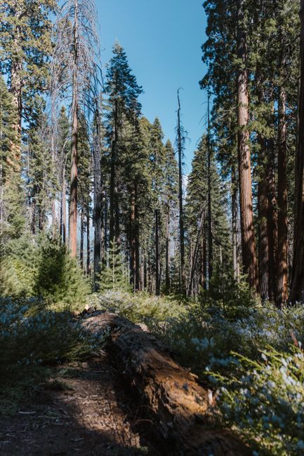
Sequoia National Park, in California’s southern Sierra Nevada, is the home of the giant sequoias, the largest trees on Earth, among them the General Sherman Tree, the biggest single tree by volume anywhere. The park climbs from hot oak foothills at about 1,700 ft (520 m) through forests of giants at 6,000–7,000 ft to Mount Whitney on its eastern edge, and it is run together with neighboring Kings Canyon National Park, home of the General Grant Tree and one of the deepest canyons in the country. Sequoia is quieter than Yosemite, about four hours from Los Angeles and San Francisco, and needs no reservation to enter, but non-US visitors pay a $100 non-resident fee, and the roads are steep and winding. Autumn 2026 brings the seasonal closing of Mineral King, Crystal Cave and Cedar Grove.
Right now in Sequoia National Park (Lodgepole)
- Wed9–22°C48–71°FClear
- Thu9–22°C49–71°FClear
- Fri8–19°C46–66°FClear
- Mon 12 Oct Columbus Day
- Mon 12 Oct Indigenous Peoples' Day · regional holiday in California
Top tours in Sequoia National Park
See all tours for Sequoia National Park →
From local operators, with prices and reviews; you check availability and book on Viator, our partner. We may earn a commission at no extra cost to you. How we earn money
Sequoia at a glance
- Best months: June to early October, when all roads are open and the sequoia groves are snow-free; late spring for foothill wildflowers. Winter brings deep snow and chains.
- Time needed: one full day for the Giant Forest and General Sherman; two or three days to add Kings Canyon, Grant Grove and Cedar Grove.
- Getting there: about 225 miles (362 km), 4 hours, from Los Angeles to the Ash Mountain entrance via Visalia; about 250 miles (402 km), 4.5 hours, from San Francisco to the Big Stump entrance via Fresno.
- Fees (as of October 2026): $35 per car for 7 days, covering both parks, plus $100 per person for non-US residents aged 16 and over without an annual or America the Beautiful pass. No reservation needed.
- Before you go: entry rules for international visitors, driving and tipping are in our United States travel guide.
What’s open in fall 2026
The parks are open 24 hours a day, every day. In early October 2026 the Generals Highway, the main road between the two parks, was open, with delays of up to 30 minutes on weekdays from 8 a.m. to 5 p.m. north of Wuksachi Lodge for hazard-tree removal. The seasonal changes to plan around:
- Mineral King Road closes for winter on October 28, 2026. Until then, road construction closes it completely from 10 a.m. to 4 p.m. Monday to Thursday, with delays before and after, and on Friday to Sunday allows only convoys at 10 a.m., 1 p.m. and 4 p.m.
- Crystal Cave tours have ended for 2026 and are expected to start again in late spring 2027.
- Cedar Grove in Kings Canyon: the lodge, market, grill, showers and Sheep Creek Campground stay open through October 25, 2026, and the visitor center opens only Friday to Sunday in October. The Kings Canyon Scenic Byway (Highway 180) beyond Hume Lake Road usually closes for winter in early to mid-November and reopens in late April or May.
- Campgrounds: Buckeye Flat and Dorst Creek are closed for 2026, and South Fork indefinitely, after storm damage.
- Fire: no fire closures were listed in early October 2026; a small lightning fire in August burned in the remote Kings Canyon wilderness. Stage 1 fire restrictions ban wood and charcoal fires in the low foothill campgrounds and picnic areas.
From the Friday after January 1 to the third Friday in March, the Generals Highway between Lodgepole and Grant Grove is not plowed and often closes, and chains can be required at any time from late fall to spring; vehicles without them may be turned away. Check the park’s road conditions page or call 559-565-3341 before you go.
Entrance fees and passes (as of October 2026)
One pass covers Sequoia and Kings Canyon National Parks and the neighboring Hume Lake area of Sequoia National Forest. No reservation or timed entry is needed, and the park has never used one; as of October 2026 nothing has been announced for 2027. Entrance stations are cashless, so pay by card or buy a digital pass on Recreation.gov.
| Pass | Price | What it covers |
|---|---|---|
| Private vehicle | $35 | One car and its passengers, 1–7 days |
| Motorcycle | $30 | 7 days |
| Per person (foot or bike) | $20 | Each person 16 or over; 15 and under free |
| Non-resident fee | +$100 per person | Non-US residents 16 and over, unless entering with an annual or America the Beautiful pass |
| Sequoia and Kings Canyon annual pass | $70 | Both parks, 12 months |
| America the Beautiful pass | $80 residents / $250 non-residents | All national parks and federal lands for 12 months |
For international visitors: Sequoia and Kings Canyon is one of 11 parks where non-residents pay the extra $100 per person in 2026, along with Yosemite and the Grand Canyon. Two adults from abroad would pay $35 plus $200 here, so the $250 non-resident America the Beautiful pass is cheaper as soon as there are two of you, and it covers Yosemite, Death Valley and Joshua Tree too. US residents enter free on the remaining 2026 fee-free days, October 27 and November 11. On Fridays, Saturdays and holidays in summer, lines at the entrances can exceed an hour; arrive early.
Top things to see in Sequoia and Kings Canyon
The General Sherman Tree and the Congress Trail
The General Sherman Tree is the largest tree on Earth by volume: about 52,500 cubic feet (1,487 m³) of wood, 275 ft (84 m) tall and almost 103 ft (31 m) around at the base. From the main parking area on Wolverton Road, a half-mile (0.7 km) trail with some stairs descends to it; at about 7,000 ft (2,100 m), take the climb back slowly. Visitors with a disability placard can park on the Generals Highway near an accessible trail. From the tree, the paved Congress Trail, a 2-mile (3.2 km) loop, winds among dozens more giants; parts were being rebuilt in 2026.
The Giant Forest, Moro Rock and Tunnel Log
Start at the Giant Forest Museum and walk the paved, accessible Big Trees Trail, 0.75 mile (1.2 km) around Round Meadow. Then drive or take the summer shuttle along Crescent Meadow Road to Moro Rock, a granite dome whose staircase of about 350 steps climbs 300 ft (91 m) in a quarter mile (0.4 km) to a summit with views over the foothills and the Great Western Divide; the stairway closes in snow or ice. Further along the road, cars drive through Tunnel Log, a sequoia that fell across the road in 1937 (taller vehicles use a bypass), and Crescent Meadow, which naturalist John Muir called the “gem of the Sierra.”
Tokopah Falls and Lodgepole
From Lodgepole Campground, a 1.7-mile (2.7 km) trail follows the Marble Fork of the Kaweah River to Tokopah Falls, which tumbles 1,200 ft (366 m) down a granite cliff; it is at its best in early summer. Lodgepole has a visitor center, market, showers and laundry.
Grant Grove and the General Grant Tree
In Kings Canyon National Park, near the Big Stump entrance, the General Grant Tree is the world’s second-largest tree and the nation’s official Christmas tree. A short paved loop circles it through the grove. Nearby are the Kings Canyon Visitor Center, John Muir Lodge and Panoramic Point, with a view over Kings Canyon to the High Sierra (no RVs or trailers).
Cedar Grove and the Kings Canyon Scenic Byway
An hour’s drive from Grant Grove, Highway 180 drops into the deep glacial canyon of the South Fork Kings River, with sheer granite walls rising thousands of feet. Stop at Roaring River Falls and walk the flat loop around Zumwalt Meadow, then continue to Roads End, a trailhead for the wilderness. The road is open only from late spring to fall.
Crystal Cave and Mineral King
Crystal Cave, a marble cavern kept at 50 °F (10 °C), is visited only on 50-minute guided tours run by the Sequoia Parks Conservancy, sold online at least 36 hours ahead (no tickets at the cave); the 2027 season is expected to start in late spring. Mineral King, a high subalpine valley at 7,500 ft (2,286 m), is reached by a narrow, winding road that starts near Three Rivers; the valley is 9.4 miles (15 km), about 45 minutes, above the road’s junction with Highway 198. It is usually open from late May to late October.
Nature
- Giant Forest
- Tokopah Falls
Other sights
- General Grant
- General Sherman
- Tunnel Log
Viewpoints
- Moro Rock
Caves
- Crystal Cave
Hiking, wildlife and staying safe
Beyond the short walks above, the park has hundreds of miles of trails, from the Crescent Meadow loop to the High Sierra Trail and the climb to Mount Whitney (from the east side, outside the park’s road network). A wilderness permit is needed for overnight trips. See our hiking guide.
- Rivers: according to the park, drowning is the main cause of death here. The rivers look calm but are cold and fast, especially in spring and early summer; stay off slippery rocks.
- Bears are active day and night. Store all food and scented items in the metal food-storage boxes, never in your car.
- Altitude: the Giant Forest is at about 6,400–7,000 ft (1,950–2,130 m); take it easy on the first day.
- Heat and air: the foothills are hot in summer, with highs around 97 °F (36 °C) at Ash Mountain, and ozone often exceeds federal standards in summer; check the air-quality reading near the Foothills Visitor Center.
Fire and the sequoias: giant sequoias need fire to reproduce, but the extreme wildfires of 2020 and 2021, including the Castle Fire and the KNP Complex Fire, killed an estimated 13–19% of the world’s large sequoias, according to the National Park Service. The General Sherman Tree survived, wrapped in protective foil in 2021. Some trails in Redwood Canyon remain limited because of fire-damaged trees. Rangers now use prescribed burns to protect the groves; you may see smoke from them in spring and fall.
Getting there and getting around
There are two main entrances, both from the west: Ash Mountain on Highway 198 from Visalia and Three Rivers, for the Sequoia side, and Big Stump on Highway 180 from Fresno, for Grant Grove and Kings Canyon. No roads cross the Sierra from the east. There are no gas stations or electric-car chargers inside the parks; the nearest fuel is at Hume Lake (all year) and Stony Creek (summer only) in the national forest, so fill up in Three Rivers or Fresno.
| From | Entrance | Distance and time |
|---|---|---|
| Los Angeles | Ash Mountain (Hwy 198) | 225 miles (362 km), about 4 hours via Interstate 5, Highway 99 and Visalia |
| San Francisco | Big Stump (Hwy 180) | 250 miles (402 km), about 4.5 hours |
| Las Vegas | Ash Mountain | 400 miles (644 km), about 6.5 hours |
| Yosemite (South Entrance) | Big Stump | 130 miles (209 km), about 2.5 hours |
| Fresno / Visalia | Big Stump / Ash Mountain | 60 miles (97 km), 1 h 15 min / 36 miles (58 km), 45 min |
Big vehicles: the Generals Highway above Ash Mountain has many hairpin turns; vehicles longer than 24 ft (7.3 m) are not advised between the Foothills Visitor Center and Potwisha Campground, and longer than 22 ft (6.7 m) between Potwisha and the Giant Forest Museum. Use Highway 180 instead. From the foothills it takes about 45 minutes of winding road to reach the Giant Forest.
Shuttles and public transportation: free park shuttles run in the Giant Forest area in summer (in 2026 from May 22 to September 7) and on some winter holiday weekends; there are none in Kings Canyon. In summer, the Sequoia Shuttle from Visalia needs a reservation and fee. The nearest airports are Fresno (FAT) and Visalia; Amtrak trains stop at Hanford and Fresno. See our Los Angeles and San Francisco travel guides.
Around Sequoia
- Three Rivers: the small gateway town just outside Ash Mountain, with motels, cafés and river swimming spots.
- Giant Sequoia National Monument and Hume Lake: national forest land between the two parks, with more groves and a summer lake.
- Yosemite National Park: about 2.5 hours north of Big Stump; many visitors combine the two on a Sierra road trip. See our Yosemite National Park guide.
- Death Valley National Park is about 5.5 hours away by road, around the southern end of the Sierra.
Nearby destinations
- Yosemite National Park148 km
- Death Valley National Park172 km
- Santa Barbara253 km
- Big Sur261 km
- Monterey279 km
- Los Angeles283 km
When to go and how long to stay
Because the park rises from 1,700 ft to over 14,000 ft, the weather depends on where you are. The sequoia groves have mild summers and snowy winters; the foothills are hot in summer and green with wildflowers from January to spring. The table uses NOAA’s 1991–2020 normals for Lodgepole, at 6,735 ft (2,053 m), close to the Giant Forest.
| Season | Average high / low at Lodgepole | What it’s like |
|---|---|---|
| Winter (Dec–Feb) | 37–41 °F (3–5 °C) / 17–18 °F (−8 °C) | Deep snow (about 220 inches, or 5.6 m, falls in an average year), chains, snowshoeing among the giants. |
| Spring (Mar–May) | 45–58 °F (7–15 °C) / 22–33 °F (−6 to 1 °C) | Snow lingers in the groves; foothill wildflowers and full rivers. |
| Summer (Jun–Aug) | 68–76 °F (20–24 °C) / 40–46 °F (4–8 °C) | Warm days, cool nights; all roads open; busiest season. |
| Fall (Sep–Nov) | 70 °F falling to 47 °F (21–8 °C) / 39 °F falling to 23 °F (4 to −5 °C) | Crisp and quiet; light snow possible from late October. |
Lodgepole gets about 43 inches (1,097 mm) of rain and melted snow a year, almost all from November to April. Down at Ash Mountain, in the foothills, July highs average about 97 °F (36 °C).
Weather month by month
Sequoia in one day
Enter early at Ash Mountain, drive up to the Giant Forest Museum and walk the Big Trees Trail, climb Moro Rock and drive through Tunnel Log, then visit the General Sherman Tree and walk part of the Congress Trail in the afternoon light.
Two or three days
Add Tokopah Falls, then drive the Generals Highway north to Grant Grove and the General Grant Tree, and spend a day in Cedar Grove when the road is open. In summer, an extra day lets you visit Crystal Cave or Mineral King.
Where to stay in and near Sequoia
- Wuksachi Lodge: 102 rooms and a restaurant at 7,050 ft (2,149 m), 2 miles (3 km) from Lodgepole; open all year.
- John Muir Lodge and Grant Grove Cabins: in Grant Grove, Kings Canyon.
- Cedar Grove Lodge: 21 rooms by the river in Kings Canyon, open through October 25, 2026.
- Three Rivers, Visalia and Fresno: more choice and lower prices outside the park.
- Camping: 14 campgrounds, nearly all reserved on Recreation.gov, from $32 a night for a standard site; Lodgepole and Potwisha are open in October 2026. There is no free roadside camping in the parks.
Park lodges are run by the concessioner Delaware North; book months ahead for summer. Room rates are quoted before tax; according to Tulare County, lodging in its unincorporated area, which includes Three Rivers and the Sequoia side of the park, carries a 10% transient occupancy tax.
Practical tips for Sequoia
- Fill your tank before you enter; there is no gas in the parks.
- Navigation: follow park signs, not apps that avoid entrance stations; turn off “avoid tolls” in your map app. Cell service is limited.
- Parking at the Sherman Tree and Giant Forest Museum is usually full by mid-morning in summer; use the Wolverton lot or the shuttle.
- Sales tax: according to the state tax agency (CDTFA), the rate in unincorporated Tulare County is 7.75% as of October 2026.
- Emergencies: call 911.
What to pack for Sequoia
Pack layers for big temperature changes between the foothills and the groves, a warm jacket for evenings, sturdy shoes, a sun hat and sunscreen, a refillable water bottle and a headlamp. From October to May carry tire chains (check your rental agreement) and winter clothing; in summer, bring swimwear for the river towns but stay out of fast water.
Sequoia travel FAQ
Do I need a reservation to visit Sequoia National Park?
No. Sequoia and Kings Canyon have no entry reservation or timed entry. Lodging, campgrounds and Crystal Cave tours must be booked ahead.
How much does it cost to enter Sequoia in 2026?
$35 per car for 7 days, valid in both parks. Non-US residents aged 16 and over also pay $100 each unless they have an annual or America the Beautiful pass.
Are Sequoia and Kings Canyon the same park?
They are two national parks side by side, managed together, with one entrance fee and the Generals Highway linking them.
How long is the walk to the General Sherman Tree?
Half a mile (0.7 km) each way from the main parking area, downhill with some stairs on the way there and uphill on the way back. An accessible trail starts from placard parking on the Generals Highway.
Is Crystal Cave open?
Not in fall 2026: tours ended for the season and are expected to resume in late spring 2027.
When does Mineral King Road close?
On October 28, 2026, for the winter. Until then, construction closes it from 10 a.m. to 4 p.m. Monday to Thursday.
When does the road to Cedar Grove close?
Usually in early to mid-November, reopening in late April or May. Cedar Grove’s lodge and services close after October 25, 2026.
Do I need snow chains for Sequoia?
From late fall to spring, chains can be required at any time, and vehicles without them may be turned away. Check road conditions before you go.
Is there gas in Sequoia National Park?
No. Fill up in Three Rivers, Visalia or Fresno; the nearest fuel nearby is at Hume Lake in the national forest.
Plan your trip
Partner links: TravelerCenter may earn a commission if you book, at no extra cost to you.
Sources · last reviewed 4 October 2026
Researched and last reviewed on 4 October 2026. Fees, the non-resident fee, fee-free days, reservations, road conditions and seasonal closures, Mineral King construction, Crystal Cave, fire restrictions and fires, safety, the General Sherman Tree, trails, shuttles, vehicle limits, driving distances, lodging and campgrounds come from Sequoia and Kings Canyon National Parks (National Park Service); sales tax from the California Department of Tax and Fee Administration; climate from NOAA’s 1991–2020 normals for Lodgepole and Ash Mountain. Sequoia mortality figures, Tunnel Log details and Tulare County’s hotel tax come from summaries of official pages and are flagged for checking. Check the park’s road conditions before you travel. For entry rules, driving and tipping, see our United States travel guide.
Also: NOAA NCEI normals 1991–2020, Lodgepole (climate)
Data: Weather: MET Norway (CC BY 4.0) · Rates: ECB · Holidays: Nager.Date · Costs: World Bank ICP and price levels · © OpenStreetMap contributors (ODBL) · Wikidata (CC0)