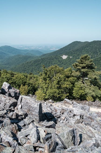
Shenandoah National Park stretches for 105 miles (169 km) along the crest of the Blue Ridge Mountains in northern Virginia, a long, narrow ribbon of forest, rocky summits and waterfalls only about two hours west of Washington, D.C. Its spine is Skyline Drive, a slow, curving scenic road with more than 75 overlooks that look west over the farms of the Shenandoah Valley and east across the Virginia Piedmont. From the Drive, short trails climb to viewpoints like Stony Man and Hawksbill, the park’s highest peak, or drop into hollows to waterfalls, while 101 miles (163 km) of the Appalachian Trail run the length of the park. Black bears, white-tailed deer and wild turkeys are common sights, and in October the whole ridge turns red, orange and gold. Two historic lodges, campgrounds and the meadow at Big Meadows sit near the middle of the park; the gateway towns of Front Royal and Luray are just outside. The park is open all year, but most services run only from spring to late November.
Right now in Shenandoah National Park (Big Meadows)
- Wed6–18°C42–64°FClear
- Thu11–19°C51–66°FClear
- Fri9–17°C48–62°FClear
- Mon 12 Oct Columbus Day · regional holiday in Virginia
- Mon 12 Oct Indigenous Peoples' Day · regional holiday in Virginia
Top tours in Shenandoah National Park
See all tours for Shenandoah National Park →
From local operators, with prices and reviews; you check availability and book on Viator, our partner. We may earn a commission at no extra cost to you. How we earn money
Shenandoah at a glance
- Best months: May–June for wildflowers, azaleas and mountain laurel, and October for fall color, which usually peaks in the second or third week of the month. Summer is green and cooler than the valley; winter is quiet, with most services closed and the Drive shut during snow and ice.
- Time needed: one full day to drive part of Skyline Drive and take two short hikes; two or three days to see the whole Drive, hike to a waterfall and Hawksbill, and climb Old Rag.
- Getting there: the north entrance at Front Royal is about 70 miles (113 km) west of Reagan National Airport and 56 miles (90 km) from Dulles; the south entrance at Rockfish Gap is 31 miles (50 km) from Charlottesville airport. You need a car: there is no shuttle.
- Fees (as of October 2026): $30 per car for 7 days, $25 per motorcycle, $15 per person on foot or bike. There is no $100 non-resident fee at Shenandoah and no entry reservation; the park is cashless. Old Rag needs a separate $2 day-use ticket from March to November.
- Before you go: entry rules for international visitors (ESTA or visa), driving and tipping are in our United States travel guide.
Entrance fees and passes (as of October 2026)
Everyone needs an entrance pass, whether you drive Skyline Drive or hike in from a trailhead on the park boundary such as Old Rag or lower Whiteoak Canyon. Since July 2025 Shenandoah has been fully cashless: entrance stations take only credit and debit cards or mobile payments, and you can buy a digital pass in advance on Recreation.gov. If you can pay only in cash, the park lists a few outside sellers, including the Front Royal/Warren County Visitors Center and Appalachian Trail Outfitters in Luray. Lodges, waysides, restaurants and park stores still accept cash.
| Pass | Price | What it covers |
|---|---|---|
| Private vehicle | $30 | One non-commercial vehicle and everyone in it, 7 consecutive days from purchase |
| Motorcycle | $25 | Up to 2 motorcycles with up to 4 riders, 7 days |
| Per person (foot or bike) | $15 | Each person 16 or over; under-16s free; a family pays no more than the vehicle fee |
| Shenandoah annual pass | $55 | This park only, 12 months; pass holder and up to 4 adults in one vehicle; US citizens and residents |
| America the Beautiful pass | $80 residents / $250 non-residents | All national parks and federal recreation lands for 12 months; one vehicle or four people paying per person |
For international visitors: the $100 per-person fee that non-US residents pay at 11 busy national parks, including Acadia, Zion and the Grand Canyon, does not apply at Shenandoah: you pay the same $30 per car as everyone else. The $250 non-resident America the Beautiful pass only pays off if you are also visiting parks that charge the extra fee. US seniors 62 and over can buy a $20 annual or $80 lifetime pass; US military, US 4th graders and US residents with a permanent disability get free passes. US citizens and residents enter free on the remaining 2026 fee-free days, 27 October and 11 November; camping and Old Rag ticket fees still apply.
New this fall: starting in fall 2026, the park is installing automated entry stations at all four entrances so that you can buy a standard 7-day pass by card, or scan a pass you already have, when the booths are unstaffed. If you arrive before the booth opens or after it closes, you can still enter and pay later or on your way out.
Driving Skyline Drive
Skyline Drive is the only public road through the park. It runs 105 miles (169 km) from Front Royal in the north to Rockfish Gap near Waynesboro in the south, where it meets the Blue Ridge Parkway. Concrete mileposts on the west side of the road count from 0 at Front Royal to 105 at the south end, and every park map, trailhead and service uses them, so note the mile of anything you want to see. The speed limit is 35 mph (56 km/h) or less, and with stops at overlooks the park says you need at least 3–4 hours to drive the whole length. Watch for deer and bears crossing, and pull fully off the road before stopping.
| Entrance | Skyline Drive mile | Nearest town and road |
|---|---|---|
| Front Royal (North Entrance) | 0 | Front Royal, on US 340 near Interstate 66 |
| Thornton Gap | 31.5 | Between Luray and Sperryville, on US 211 |
| Swift Run Gap | 65.5 | East of Elkton, on US 33 |
| Rockfish Gap (South Entrance) | 104.6 | Near Waynesboro, at Interstate 64 and US 250 |
- Closures: the Drive is generally open 24 hours a day, but sections close whenever snow, ice, fog-related crashes, fallen trees or other hazards make it unsafe, and it can take crews several days to reopen it after a winter storm. Visitor centers close when the Drive is closed. The park no longer updates a phone line: text SHENALERTS to 888777 for closure alerts, or check the Alerts page on nps.gov. You can still walk in at the entrance stations when the road is shut. As of early October 2026 the entire Drive was open, with no construction closures listed.
- Fuel and charging: the only gas station in the park is at Big Meadows Wayside (mile 51), and the pumps can be unreliable, especially in winter; fill up before you enter. Electric vehicle chargers (Level 2) are at Skyland.
- RVs and trailers are welcome but must clear the Marys Rock Tunnel at mile 32.2, which is 12 ft 8 in (3.86 m) high. You can avoid the tunnel by visiting only the northern or southern part of the park.
- Don’t trust GPS to find the park: it can route you to gated service roads. Navigate to one of the four entrance stations instead, and download offline maps, as phone signal is poor along most of the Drive.
- Fall weekends in October bring long lines at the Front Royal and Thornton Gap entrances and full overlooks; start early, enter from the south, or come midweek.
Old Rag day-use tickets
Old Rag Mountain, an outlier on the park’s eastern edge, is Shenandoah’s most famous hike: a 9.4-mile (15 km) loop on the Ridge, Ridge Access and Saddle trails with a long, strenuous granite rock scramble and 360-degree views at the top. It is not reached from Skyline Drive but from the park boundary near Nethers, about 12 miles (19 km) south of Sperryville on Routes 522, 231 and 601; don’t rely on GPS alone.
- Who needs a ticket: everyone hiking the Saddle, Ridge or Ridge Access trails from 1 March to 30 November needs an Old Rag day-use ticket ($2 per person) bought in advance on Recreation.gov, in addition to a park entrance pass. Tickets are not sold at the entrance station. No ticket is needed from December to February.
- When they are released: 800 tickets a day, in two waves at 10 a.m. Eastern Time: 400 become available 30 days ahead and 400 five days ahead. Any left over can be bought on the day, but there is no phone signal or internet at the trailhead, so buy before you set out.
- Changes and refunds: you can cancel or change the date until noon the day before; the $1 cancellation fee is not refunded. Print or save the confirmation, and the buyer must show photo ID to the ranger.
- Parking in 2026: the main Old Rag trailhead lot has been closed for construction since May 2026, with work expected to finish by November 2026; use the overflow lots. Park only in marked areas: cars parked along local roads may be towed.
- Is it for you? The scramble involves squeezing through cracks and pulling yourself up boulders, and most people take 7–8 hours. Start early, carry plenty of water and a headlamp, and turn back in rain or ice. Dogs are not allowed on the Old Rag summit trails.
Top things to see in Shenandoah
The overlooks of Skyline Drive
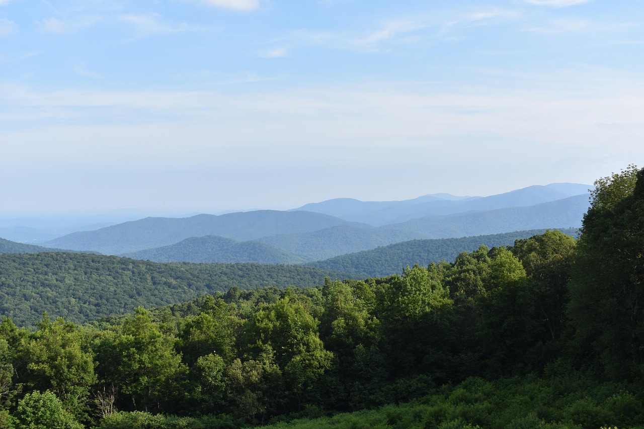
Each of the Drive’s 75-plus overlooks has a slightly different view. In the north, overlooks near Dickey Ridge (mile 4.6) look down on Front Royal and the Shenandoah River’s bends. Between Thornton Gap and Skyland, the Drive reaches its highest point, 3,680 ft (1,122 m), at mile 41.7, with long views of the Massanutten ridge across the valley. Sunset is best from west-facing overlooks; for sunrise, pick one facing east toward the Piedmont.
Big Meadows (mile 51)
The heart of the park is a broad, open meadow at about 3,500 ft (1,070 m), where deer graze at dawn and dusk and wildflowers and blueberries bloom in summer. Around it are the Byrd Visitor Center, with exhibits on the people who lived here before the park, Big Meadows Lodge, a wayside with groceries and the park’s only fuel, a campground and a picnic ground. Short walks start right here, including the Story of the Forest Trail through the woods next to the meadow and, just up the road, the trail to Dark Hollow Falls.
Dark Hollow Falls and other waterfalls
None of the park’s waterfalls can be seen from the Drive, so you have to hike. The most popular is Dark Hollow Falls, a 1.4-mile (2.3 km) round trip from mile 50.7 that drops 440 ft (134 m) to a 70-ft (21 m) cascade; the climb back up is the hard part. Pets are not allowed on this trail; the nearby Rose River Loop is an alternative with dogs. Longer and more spectacular, Whiteoak Canyon has a series of falls, one of them 86 ft (26 m) high, reached from Skyline Drive at mile 42.6 or from the lower trailhead on the park boundary. Never climb on or around waterfalls: the rocks are extremely slippery.
Stony Man and Hawksbill
Two of the best short summit hikes are near Skyland. Stony Man is a 1.6-mile (2.6 km) round trip from mile 41.7 with only 340 ft (104 m) of climbing, partly on the Appalachian Trail, to cliffs with one of the park’s best views (dogs are not allowed on the final summit spur). Hawksbill, at 4,050 ft (1,234 m) the highest point in the park, is a steeper 1.7-mile (2.7 km) round trip with 690 ft (210 m) of gain from the Hawksbill Gap parking area at mile 45.5, ending at a stone observation platform and the Byrds Nest shelter.
Limberlost and Rapidan Camp
The Limberlost Trail at mile 43 is the park’s only fully accessible trail: a gentle 1.3-mile (2 km) loop on a crushed greenstone walkway through a forest of hemlocks and mountain laurel, gorgeous in June. Rapidan Camp, President Herbert Hoover’s 1929–1932 summer retreat and now a National Historic Landmark, is a 4-mile (6.4 km) round-trip hike from Milam Gap (mile 52.8); its restored Brown House shows how the president fished and worked here.
Wildlife and wildflowers
Several hundred black bears live in the park, and you may see one almost anywhere, from a trail to a lodge parking lot. Deer are everywhere, especially at Big Meadows and Skyland. More than 800 species of wildflowers grow here: spring blooms come first along the low streams, pink azaleas line the Drive in late May and early June, and mountain laurel peaks in June. Birders come for warblers in May and hawk migration in September.
Peaks and mountains
- Hawksbill Mountain
- Old Rag Mountain
- Stony Man Mountain
Other sights
- Rapidan Camp
Monuments
- Skyline Drive
Other things to do in Shenandoah
- Hiking: more than 500 miles (800 km) of trails, from easy loops to long backcountry routes, including 101 miles of the Appalachian Trail. Shenandoah is one of the few national parks that allow leashed dogs on most trails (a few, listed by the park, are off-limits). See our hiking guide for general advice.
- Cycling: bikes are allowed on Skyline Drive and paved areas but not on trails or fire roads. The Drive is hilly and has narrow shoulders against rock walls; use lights in fog. See our cycling guide.
- Horseback riding: guided trail rides leave from the Skyland stables, which close for the season on 25 October 2026; reserve by phone. Riders with their own horses can use more than 180 miles (290 km) of horse trails.
- Ranger programs: guided walks, talks and evening campfire programs run from spring to fall at Big Meadows, Skyland and the campgrounds.
- Fishing and paddling: park streams are open to catch-and-release fly fishing with a Virginia license. There are no lakes for boating, but outfitters near Front Royal and Luray rent canoes, kayaks and tubes for the Shenandoah River.
- Stargazing: on clear nights, Big Meadows is one of the darkest easy-to-reach places in the eastern US.
Around Shenandoah: Front Royal, Luray and the valley
- Front Royal: the town at the north entrance, on the South Fork of the Shenandoah River, with motels, restaurants, river outfitters and the start of the Drive at mile 0. It is the closest gateway to Washington, D.C.
- Luray: a small town in the valley 9 miles (14 km) west of Thornton Gap, best known for Luray Caverns, a large privately run show cave with stalactite-lined chambers (tickets from the caverns; check prices and times on their website). It is the most central base for the park.
- Sperryville and Washington, Virginia: villages on the east side near Thornton Gap and Old Rag, with galleries, farm shops and inns.
- Charlottesville: about 30 minutes east of the south entrance, home to Thomas Jefferson’s Monticello and the University of Virginia, with wineries all around.
- Blue Ridge Parkway: continues south from Rockfish Gap for 469 miles (755 km) toward the Great Smoky Mountains, a natural extension of a road trip.
Nearby destinations
- Washington, D.C.121 km
- Virginia Beach280 km
Getting there
You need your own car: there are no authorized shuttles in the park and no public transport along Skyline Drive. Most visitors fly into the Washington, D.C. airports and rent a car; driving tips are in our United States travel guide.
| From | Distance | Route and time |
|---|---|---|
| Washington Dulles (IAD) | 56 miles (90 km) to the Front Royal entrance | Via Interstate 66 west; about 1–1.5 hours |
| Reagan National (DCA) and central Washington, D.C. | 70 miles (113 km) to the Front Royal entrance | Interstate 66 west to Front Royal, then US 340 south; about 1.5–2 hours, longer in rush-hour traffic |
| Charlottesville-Albemarle (CHO) | 31 miles (50 km) to the Rockfish Gap entrance | Interstate 64 west to exit 99; about 40 minutes |
| Shenandoah Valley Regional (SHD) | 27 miles (43 km) to the Swift Run Gap entrance | Via US 33 east through Elkton; about 40 minutes |
| Richmond, VA | about 95 miles (153 km) to Rockfish Gap | Interstate 64 west; about 1.5 hours |
Shenandoah makes an easy add-on to a trip to the capital: see our Washington, D.C. travel guide for the airports and city sights. From Philadelphia or New York City, allow about 4 and 6 hours by car to Front Royal. Long-distance travelers often continue south on the Blue Ridge Parkway.
When to go and how long to stay
Skyline Drive runs mostly between 2,000 and 3,700 ft (610–1,130 m), and the park says the ridge is usually about 10 °F (5–6 °C) cooler than the valley below. Spring arrives late on the crest, summer is mild with afternoon thunderstorms and haze, and fall color moves down the mountain from the high peaks through October, sometimes lingering into November. Winter weather can strike any time from October to March: rain in the valley can be snow and ice on the ridge, and the Drive closes during storms. Fog can roll in on any day of the year.
| Season | Average high | Average low | What it’s like |
|---|---|---|---|
| Spring (Mar–May) | 44–64 °F (6–18 °C) | 27–46 °F (−3 to 8 °C) | Late, changeable spring; wildflowers along low streams, azaleas from late May; facilities open from late March. |
| Summer (Jun–Aug) | 70–75 °F (21–24 °C) | 54–59 °F (12–15 °C) | Pleasant on the ridge while the valley is hot and humid; thunderstorms and haze. |
| Fall (Sep–Nov) | 69 °F falling to 48 °F (21–9 °C) | 52 °F falling to 32 °F (11–0 °C) | Crisp, clear days; peak color usually mid-October; busiest weekends of the year. |
| Winter (Dec–Feb) | 36–40 °F (2–4 °C) | 19–24 °F (−7 to −5 °C) | Cold, often icy; most services closed; the Drive closes during snow and ice. |
Temperatures are NOAA 1991–2020 normals for the Big Meadows weather station at mile 51, at about 3,540 ft (1,079 m). For rain, the nearest station with full records is Luray 5 E in the valley, which averages about 44 inches (1,121 mm) a year spread fairly evenly through the months, with 5–8 wet days a month and the wettest month in September. Expect more snow and fog on the ridge than in Luray.
Weather month by month
Shenandoah in one day
Enter at Thornton Gap (mile 31.5), the closest entrance to the park’s highlights, and drive south. Hike Stony Man at mile 41.7 for the view, stop for lunch at Skyland or Big Meadows, then walk down to Dark Hollow Falls (mile 50.7). In the late afternoon, look for deer in Big Meadows and catch the sunset from a west-facing overlook before driving back out.
Two or three days
Stay at Skyland, Big Meadows or in Luray. Drive the whole Drive over two days, adding Hawksbill, Limberlost and Whiteoak Canyon, and a hike to Rapidan Camp. Give a third day to Old Rag (with a ticket), Luray Caverns or a paddle on the Shenandoah River.
Where to stay in and near Shenandoah
All park lodging and food is run by the concessioner Delaware North. These are the 2026 season dates published by the park; they change each year.
| Place | Skyline Drive mile | 2026 season | What it is |
|---|---|---|---|
| Skyland | 41.7 and 42.5 | 30 March – 8 November | The park’s largest lodge: rooms, suites and small cabins in 28 buildings along the ridge, dining room and tap room |
| Big Meadows Lodge | 51.2 | 4 May – 29 November | 1930s stone lodge with rooms and small cabins, dining room, tap room and valley views |
| Lewis Mountain Cabins | 57.5 | 10 April – 8 November (check: listed as closed for the season in fall 2026) | Rustic cabins with private baths near a campstore |
| Big Meadows Campground | 51.2 | 25 March – 29 November | Reservation only, on Recreation.gov |
| Mathews Arm and Loft Mountain campgrounds | 22.2 and 79.5 | 29 April – 1 November | Reservable and first-come, first-served sites |
| Lewis Mountain Campground | 57.5 | 26 March – 22 November | Small, first-come, first-served only |
Reservable campsites are released in stages on Recreation.gov: half six months ahead, a quarter two weeks ahead and the rest four days ahead. In fall the campgrounds fill on Thursdays or early Fridays for the weekend. Car camping or sleeping in an RV at overlooks, trailheads or picnic grounds is not allowed, and when the campgrounds close for the winter you must camp outside the park. Backcountry camping needs a permit from Recreation.gov. Outside the park, Front Royal, Luray, Elkton, Waynesboro and Charlottesville have motels, inns and cabin rentals.
Room taxes: Virginia room rates are quoted before tax. Hotel bills in the counties around the park add Virginia’s 5.3% sales tax plus a local transient occupancy (lodging) tax set by each county or town; Page County, home to Luray, raised its rate to 10% in July 2024. Check the total when you book.
Practical tips for Shenandoah
- Bring a card: entrance stations and campgrounds take no cash.
- Check alerts on the day: sign up for text alerts (SHENALERTS to 888777) or check the park’s Alerts page; Skyline Drive can close at short notice.
- Phone signal and Wi-Fi: mobile coverage is unreliable, though it usually works at Dickey Ridge and some west-facing overlooks. Free Wi-Fi is available at the Byrd Visitor Center, Big Meadows Lodge and the Skyland dining room.
- Off-season services: most facilities open in March or April and close by late November. In winter, only a few restrooms and frost-proof water taps stay open; bring food and water.
- Safety: store food in your car or bear boxes and never feed bears or deer; if you meet a bear, give it plenty of room and never approach it. Check for ticks after hikes in grass or woods, watch for timber rattlesnakes and copperheads on rocky trails, and stay well back from waterfall edges. In winter, carry traction devices for icy trails. Call 911 or the park’s emergency line, 1-800-732-0911.
- Leave no trace: pack out all trash, stay on trails, keep dogs on a 6-ft (1.8 m) leash and bag their waste. Drones are not allowed in national parks.
- Time zone: Virginia uses Eastern Time with daylight saving time.
What to pack for Shenandoah
Pack layers: even in summer the ridge can be cool and windy in the morning and evening, and a warm fleece and a rain jacket are essential in spring and fall. Bring sturdy hiking shoes with good grip for rocky trails, a daypack with water and snacks, a headlamp, insect repellent and a hat. For Old Rag, add gloves for the granite, more water and a printed copy of your ticket. In winter, bring warm clothes, a blanket in the car and microspikes for icy trails, and fill the tank before you enter.
Shenandoah travel FAQ
How much does it cost to enter Shenandoah National Park in 2026?
$30 per private vehicle, $25 per motorcycle or $15 per person on foot or bike, valid 7 days, as of October 2026. A Shenandoah annual pass costs $55. Payment is by card or mobile only.
Do international visitors pay the $100 non-resident fee at Shenandoah?
No. The extra $100 per-person fee applies only at 11 national parks, and Shenandoah is not one of them. Visitors from abroad pay the same entrance fee as US residents.
Do I need a reservation to visit Shenandoah?
No timed-entry reservation is needed for Skyline Drive. You need an advance day-use ticket only for Old Rag from March through November, and reservations for lodges and most campsites.
How do I get an Old Rag ticket?
Buy it on Recreation.gov for $2 per person: 400 tickets a day are released 30 days ahead and 400 five days ahead, at 10 a.m. Eastern Time. You also need a park entrance pass.
Is Skyline Drive open now?
It is generally open all day, all year, but sections close during snow, ice and other hazards. Check the park’s Alerts page or text SHENALERTS to 888777 for updates before you go.
How long does it take to drive Skyline Drive?
The 105-mile Drive has a 35 mph speed limit, so plan at least 3–4 hours end to end without long stops, and a full day or two with hikes.
When is the best time to see fall colors in Shenandoah?
Usually the second or third week of October, starting on the highest peaks and moving downhill; some color often lasts into November. Weekends are very busy, so go early or midweek.
Are dogs allowed in Shenandoah National Park?
Yes, on a 6-ft leash, on most trails, in campgrounds and in pet-friendly lodge rooms. A few trails are off-limits, including Dark Hollow Falls, the Old Rag summit trails, Limberlost and the Stony Man summit spur.
How far is Shenandoah from Washington, D.C.?
The Front Royal entrance is about 70 miles (113 km) west of Reagan National Airport, roughly 1.5–2 hours by car on Interstate 66, and 56 miles from Dulles.
Where can I see bears in Shenandoah?
Almost anywhere: several hundred black bears live in the park and are often seen near Big Meadows and along the Drive at dawn and dusk. Keep your distance, never approach or feed them, and store food in your car.
Plan your trip
Partner links: TravelerCenter may earn a commission if you book, at no extra cost to you.
Sources · last reviewed 4 October 2026
Researched and last reviewed on 4 October 2026. Fees, passes, fee-free days, the cashless system and automated entry stations, Skyline Drive entrances, mileposts, closures, fuel and the tunnel limit, Old Rag tickets and the trailhead parking work, current alerts, 2026 opening and closing dates of lodges, campgrounds and visitor centers, campsite release rules, trail facts, pets, winter conditions, fall color timing and distances to airports come from Shenandoah National Park (National Park Service) and Recreation.gov; sales tax from Virginia Tax; climate from NOAA’s 1991–2020 normals for Big Meadows and Luray. The Page County lodging tax, some drive times, the Whiteoak Canyon and Rapidan Camp distances and the Old Rag hiking time are flagged for checking. Conditions change, so check the park’s alerts before you travel. For entry rules, driving and tipping, see our United States travel guide.
Also: NOAA NCEI normals 1991–2020, Big Meadows (temperature) and Luray 5 E (precipitation) (climate)
Data: Weather: MET Norway (CC BY 4.0) · Air quality: OpenAQ · Rates: ECB · Holidays: Nager.Date · Costs: World Bank ICP and price levels · © OpenStreetMap contributors (ODBL) · Wikidata (CC0)