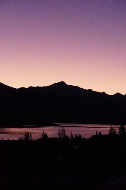
Wānaka is a lakeside resort town in Otago, in the south of New Zealand’s South Island, about an hour’s drive north of Queenstown over the Crown Range. It sits at the southern end of Lake Wānaka, a long glacial lake framed by mountains, with the snowy peaks of Mount Aspiring National Park on the horizon and the even quieter Lake Hāwea next door. Wānaka has grown fast, to around 11,500 people, but it has kept a relaxed, outdoorsy feel that many visitors prefer to Queenstown’s bustle: fewer bars and bungy jumps, more lake swims, bike rides, coffee and hikes. Its most famous views are free. The steep climb up Roys Peak gives one of the most photographed panoramas in the country, and the lone willow tree growing out of the lake, known as “That Wānaka Tree,” draws photographers at sunrise. In summer, the lakefront fills with swimmers, paddleboarders and families; in winter, Cardrona and Treble Cone ski areas are a short drive away. Wānaka is also the gateway to the Rob Roy Glacier Track and the Matukituki Valley in Mount Aspiring National Park, and a stop on the scenic route between Queenstown and the West Coast glaciers via the Haast Pass.
Right now in Wanaka
- Thu11–15°C51–59°F1 mm rain
- Fri7–16°C45–61°FPartly cloudy
- Sat11–17°C52–62°F1 mm rain
Top tours in Wanaka
See all tours for Wanaka →
From local operators, with prices and reviews; you check availability and book on Viator, our partner. We may earn a commission at no extra cost to you. How we earn money
Wānaka at a glance
- Best months: December to March for warm days, lake swims and hiking; late June to September for skiing; April for golden autumn poplars. Note that Roys Peak Track is closed from 1 October to 10 November each year.
- Time needed: two to three days; a week if you plan to ski or hike in Mount Aspiring National Park.
- Getting there: about 1 hour (67 km, 42 miles) from Queenstown Airport via the Crown Range, or 1 hour 20 minutes via Cromwell; about 3.5 hours from Franz Josef over the Haast Pass. There is no airport with scheduled flights.
- Costs (as of October 2026): prices in New Zealand dollars; the main hikes and lakefront are free. Ski lift passes cost roughly NZ$170–200 a day.
- Before you go: entry rules, the NZeTA and visitor levy, biosecurity and driving rules are in our New Zealand travel guide.
Wānaka’s areas and who each one suits
Town center and the lakefront
Ardmore Street, along the lakefront, and the streets behind it have most of the restaurants, cafés, shops and the visitor center, plus motels and apartments within a few minutes’ walk of the water. The best base without a car.
Far Horizon, Beacon Point and the lake edge
West and north of the center, quieter residential areas have holiday homes, lodges and B&Bs with lake views, near the lakeside track to Beacon Point and Glendhu Bay. Good for families and longer stays.
Albert Town and Lake Hāwea
Albert Town, 10 minutes northeast where the Clutha River leaves the lake, and the village of Lake Hāwea, 15 minutes further, are calmer, cheaper bases with river and lake access. You will need a car.
Cardrona Valley
On the road over the Crown Range toward Queenstown, the Cardrona Valley has the historic Cardrona Hotel, a few lodges and the access roads to Cardrona ski area and the Snow Farm. Ideal for skiers who want to be close to the slopes.
Top things to see in Wānaka
Roys Peak Track
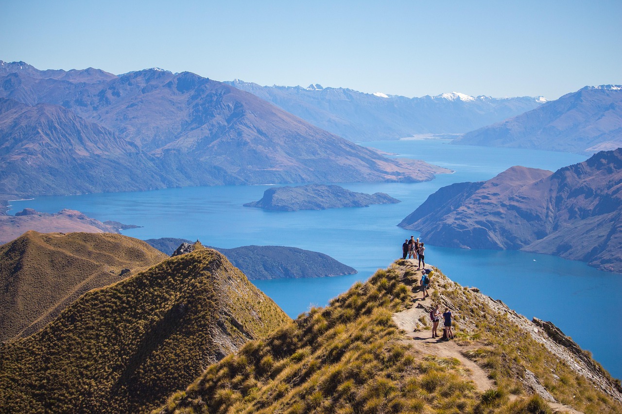
New Zealand’s most famous day hike for a view climbs relentlessly from the lake to the summit of Roys Peak, at 1,578 m (5,177 feet), with a panorama over Lake Wānaka’s islands and arms to Mount Aspiring/Tititea. The Department of Conservation (DOC) describes it as a 16 km (10-mile) return walk of 5 to 6 hours with more than 1,200 m (3,900 feet) of elevation gain, on a zigzag farm track through private land with grazing sheep. There is no shade and no water on the way, so carry plenty. Two toilets are on the track: at the car park and near the famous photo viewpoint about 30 minutes below the summit, where lines form for the classic ridge photo.
- Closed for lambing every year from 1 October to 10 November; it reopens on 11 November. During the closure, DOC suggests Isthmus Peak Track, near Lake Hāwea, which has a similar length and difficulty, fewer people and views of both lakes.
- Parking at the large car park, about 6 km (4 miles) from town on Wānaka–Mount Aspiring Road, is free for cars and campervans, but it fills up; don’t park on the roadside. You can cycle or walk to the start on the lakeside track.
- Winter: snow and ice make the upper track much harder from about June to September; carry microspikes and check the avalanche forecast for terrain above 1,000 m.
- Start early (many people go for sunrise with head torches) or late in the afternoon to avoid the heat and the crowds.
That Wānaka Tree
A crack willow growing in the shallows near the lake edge at Roys Bay, a short walk west of the town center, has become one of the most photographed trees in the world. Go at sunrise or on a still evening for reflections. Please don’t climb it or wade out to touch it; it has been damaged by visitors before.
Rob Roy Glacier Track, Mount Aspiring National Park
At the end of the Matukituki Valley, a 10 km (6-mile) return track of 3 to 4 hours climbs through beech forest beside a roaring creek to a lookout facing the hanging Rob Roy Glacier, waterfalls and cliffs. It is one of the best day walks in the country and suitable for fit older children. The trailhead, at the Raspberry Creek car park, is 54 km (34 miles) west of Wānaka, about 1 hour 20 minutes’ drive, with the last 30 km on gravel and several fords that rise in heavy rain and can become impassable; after a day of little or no rain, they are usually passable for 2WD cars and campervans. Avalanches can cross the upper section from May to November; DOC strongly recommends not going past the lower lookout in that period.
The lakefront and Mount Iron
The lakeside paths from town to Eely Point, Beacon Point and Glendhu Bay are flat and lovely for walking, running and cycling. Mount Iron, a rocky hill on the edge of town, has a 1.5-hour loop track with views over the lakes, valleys and town, a good alternative to Roys Peak.
Puzzling World
A favorite with families, Puzzling World, on the road into town, has a large outdoor maze, tilted rooms, a hall of faces that follows you, and optical illusions.
Lake Hāwea
Fifteen minutes north, Lake Hāwea is a quieter, deep-blue lake with a village beach, the Isthmus Peak and Breast Hill tracks, and the scenic drive along “The Neck” between Hāwea and Wānaka on the way to the Haast Pass.
Other things to do in Wānaka
- Skiing and snowboarding: Cardrona (about 35 minutes) is family-friendly with good beginner terrain and parks; Treble Cone (about 30 minutes) has steeper, advanced runs and lake views. The Snow Farm offers cross-country skiing. The season usually runs from about mid-June to early October.
- On the water: paddleboards, kayaks, jet-boat trips on the Clutha River, boat trips to Mou Waho Island (a predator-free island with a lake on it), and swimming at Roys Bay or Glendhu Bay in summer.
- Cycling: the Upper Clutha trails along the lake and river, and mountain biking at Sticky Forest and Cardrona’s summer bike park.
- Canyoning and climbing: guided canyoning in the Matukituki Valley and climbing at local crags and via ferrata routes on the waterfalls above town.
- Scenic flights: small planes and helicopters to Mount Aspiring, the glaciers and Milford Sound.
- Warbirds over Wānaka: a big air show held every two years at Easter.
Food and drink
Wānaka has a cheerful café culture, good bakeries and a handful of excellent restaurants and craft breweries for its size, along with Rippon, one of the region’s best-known vineyards on the lake shore, and Central Otago Pinot Noir on most wine lists. In summer, buy cherries and apricots from the orchard stalls on the road to Cromwell.
Day trips from Wānaka
Queenstown and Arrowtown
The Crown Range Road over to Arrowtown and Queenstown is New Zealand’s highest main road, at 1,076 m (3,530 feet), with switchbacks and big views; carry chains in winter, when it can close in snow. The gold-rush village of Arrowtown is about 50 minutes away.
Haast Pass and the Blue Pools
North along Lakes Hāwea and Wānaka, State Highway 6 crosses the Haast Pass (Tioripatea) to the West Coast. About an hour from Wānaka, a short forest walk leads to the Blue Pools, clear glacial pools under a swing bridge. Further on are Fantail and Thunder Creek falls. Continuing to Westland Tai Poutini National Park and the glaciers takes about 3.5 hours.
Cromwell and Bannockburn
Forty-five minutes southeast, Cromwell has a restored heritage precinct beside Lake Dunstan and a cycle trail along the lake, with wineries in nearby Bannockburn.
Aoraki/Mount Cook
About 2.5 hours northeast via the Lindis Pass, Aoraki/Mount Cook National Park makes a long day trip, or a good next stop.
Nearby destinations
Getting there and getting around
By air and road
The nearest airport with scheduled flights is Queenstown (ZQN), about an hour away via the Crown Range or 1 hour 20 minutes via Cromwell (the route to use in snow). Shuttles and InterCity coaches connect Wānaka with Queenstown, Christchurch and the West Coast. From Christchurch, the drive takes about 5 hours via Lake Tekapo and the Lindis Pass.
Getting around
There is no public bus service in Wānaka; the Otago Regional Council is considering trial services for the Upper Clutha that could start in early 2028 if funded. The town center and lakefront are walkable, and bikes and e-bikes are easy to rent. For Roys Peak, Rob Roy and the ski areas, you need a car, a shuttle or a tour. Ski shuttles run from town to Cardrona and Treble Cone in winter.
Driving tips
The Wānaka–Mount Aspiring Road turns to gravel with fords beyond Treble Cone; check conditions after rain. The Crown Range and Haast Pass can be icy in winter, and the Haast Pass is occasionally closed by slips after heavy rain. Drive on the left and give way at the one-lane bridges.
When to go and how long to stay
Wānaka has a dry, sunny, continental climate with warm summers and cold, frosty winters. Summer (December to February) brings warm days, often in the mid-20s °C (mid-70s °F), long evenings and the busiest season. Autumn (March to May) has calm days and spectacular golden poplars and willows in April. Winter (June to August) brings sharp frosts, clear days and snow on the mountains; the town itself rarely gets heavy snow. Spring (September to November) is changeable, with late snowfalls; remember Roys Peak’s lambing closure from 1 October to 10 November.
| Month | Average high | Average low | Rain | Rain days (≥1 mm) |
|---|---|---|---|---|
| Jan | 22 °C (72 °F) | 10 °C (50 °F) | 72 mm (2.8 in) | 8 |
| Feb | 22 °C (71 °F) | 10 °C (49 °F) | 51 mm (2.0 in) | 7 |
| Mar | 19 °C (66 °F) | 7 °C (45 °F) | 49 mm (1.9 in) | 7 |
| Apr | 15 °C (59 °F) | 4 °C (40 °F) | 58 mm (2.3 in) | 7 |
| May | 12 °C (53 °F) | 2 °C (36 °F) | 75 mm (3.0 in) | 10 |
| Jun | 9 °C (47 °F) | 0 °C (31 °F) | 62 mm (2.4 in) | 9 |
| Jul | 8 °C (47 °F) | −1 °C (29 °F) | 56 mm (2.2 in) | 8 |
| Aug | 10 °C (50 °F) | 0 °C (32 °F) | 53 mm (2.1 in) | 8 |
| Sep | 13 °C (55 °F) | 2 °C (36 °F) | 62 mm (2.5 in) | 8 |
| Oct | 15 °C (60 °F) | 4 °C (40 °F) | 62 mm (2.5 in) | 8 |
| Nov | 18 °C (64 °F) | 6 °C (43 °F) | 61 mm (2.4 in) | 8 |
| Dec | 20 °C (68 °F) | 8 °C (47 °F) | 60 mm (2.4 in) | 9 |
| Year | 15 °C (60 °F) | 4 °C (40 °F) | 721 mm (28.4 in) | 96 |
NIWA’s published 1991–2020 normals don’t include a Wānaka station, so this table shows Queenstown, about 50 km (31 miles) to the south at a similar altitude by a similar lake. Wānaka is slightly drier and sunnier, with similar temperatures.
Events worth planning around
- Warbirds over Wānaka (held at Easter in alternate years; check the next date).
- Ski season from about mid-June to early October, busiest in the July school holidays.
- Challenge Wānaka triathlon and other summer endurance events.
- Christmas to January, the busiest weeks of the summer; book well ahead.
Dates change every year; check the organizers’ sites before you book.
How long to stay: 2, 3 and 5 days
- Two days: Roys Peak (outside the lambing closure) or Mount Iron, the lakefront and That Wānaka Tree at sunrise.
- Three days: add the Rob Roy Glacier Track and an afternoon on the lake.
- Five days: add Lake Hāwea and Isthmus Peak, the Blue Pools, a ski day or a scenic flight.
Where to stay in Wānaka
- Town center: motels, apartments, hostels and boutique hotels near the lake.
- Lake-view homes: holiday rentals and lodges on the hills around Roys Bay and Beacon Point.
- Albert Town and Lake Hāwea: quieter, good-value motels and holiday parks.
- Cardrona Valley: lodges and the historic hotel for skiers.
- Glendhu Bay: a popular lakeside holiday park for campervans and tents.
Prices include 15% GST and rise sharply in the Christmas to January holidays, at Easter and in the July ski holidays.
Typical costs in Wānaka
| Item (as of October 2026) | New Zealand dollars | About US dollars |
|---|---|---|
| Roys Peak, Rob Roy and Mount Iron tracks | Free | Free |
| Roys Peak car park | Free | Free |
| Ski lift pass, adult, one day | about NZ$170–200 | about US$95–110 |
| Paddleboard or kayak hire, per hour | about NZ$30–40 | about US$17–22 |
| Puzzling World, adult | about NZ$25–30 | about US$14–17 |
| Casual restaurant main | about NZ$28–40 | about US$16–22 |
| Motel room, per night | about NZ$170–300 | about US$95–170 |
Track and parking information is from DOC. Ski, rental, attraction, meal and motel prices are typical ranges, not official prices. Conversions use about US$0.56 to NZ$1.
Safety in Wānaka
- Alpine weather: conditions can change quickly on Roys Peak and in Mount Aspiring National Park; snow can fall in any month above the bushline. Carry warm, waterproof layers and plenty of water.
- River crossings: fords on the Wānaka–Mount Aspiring Road and streams in the Matukituki Valley rise fast in heavy rain. Never drive or walk through floodwater.
- Avalanches: from May to November, avalanches can cross the upper Rob Roy Track; check the New Zealand avalanche forecast.
- Sun and heat: Roys Peak has no shade; start early and use sunscreen.
- Cold water: the lakes stay cold, around 16 °C (61 °F) at best in late summer.
- Winter roads: ice on the Crown Range and ski roads; carry chains, and use the Cromwell route in snow.
- Driving on the left and one-lane bridges: take care on rural roads.
- Sandflies: common in the Matukituki Valley; bring repellent.
- Emergencies: call 111.
Practical tips for Wānaka
- Time zone: New Zealand Daylight Time (UTC+13) from 27 September 2026 to 4 April 2027.
- Check the Roys Peak dates: closed for lambing from 1 October to 10 November.
- Free things: Roys Peak, Mount Iron, That Wānaka Tree, the lakefront tracks and swimming beaches.
- Visitor center: the DOC Tititea/Mt Aspiring National Park Visitor Centre in town has track and weather information.
- Tipping: not expected.
What to pack for Wānaka
Bring hiking boots, a daypack, at least 2 liters of water per person for Roys Peak, a warm and waterproof jacket, a hat and high-SPF sunscreen, a swimsuit for summer lake swims and insect repellent for the valleys. In winter, add thermal layers, gloves and boots with grip, and get chains from your rental company.
Wānaka travel FAQ
When is Roys Peak Track closed?
Every year from 1 October to 10 November for lambing; it reopens on 11 November. Isthmus Peak Track, near Lake Hāwea, is a good alternative during the closure.
How long does Roys Peak take?
DOC says 5 to 6 hours return for the 16 km track, with more than 1,200 m of climbing. Allow extra time for photo lines at the viewpoint.
Is Roys Peak hard?
Yes. It’s a steep, relentless climb with no shade or water, though the track itself is well formed. You need good fitness, sun protection and plenty of water.
Where is That Wānaka Tree?
In the shallows of Roys Bay, a short walk west of the town center along the lakefront. Please don’t climb it.
How do I get to the Rob Roy Glacier Track?
Drive 54 km west to the Raspberry Creek car park (about 1 hour 20 minutes, with 30 km of gravel and several fords). The 10 km return track takes 3 to 4 hours.
Is there public transport in Wānaka?
No public bus service operates in Wānaka as of October 2026; use a car, bike, shuttle or tour. Coaches link the town with Queenstown and Christchurch.
How far is Wānaka from Queenstown?
About an hour via the Crown Range Road, or 1 hour 20 minutes via Cromwell.
Which ski areas are near Wānaka?
Cardrona, about 35 minutes away, and Treble Cone, about 30 minutes; the Snow Farm has cross-country skiing. The season is usually mid-June to early October.
Wānaka or Queenstown: which is better?
Queenstown has more activities, nightlife and flights; Wānaka is quieter, with outstanding free hikes and lake life. Many travelers stay in both.
When is the best time to visit Wānaka?
December to March for summer activities, April for autumn colors, and July to September for skiing.
Plan your trip
Partner links: TravelerCenter may earn a commission if you book, at no extra cost to you.
Sources · last reviewed 5 October 2026
Researched and last reviewed on 5 October 2026. Roys Peak Track distance, time, elevation gain, lambing closure dates, parking and toilets, and Rob Roy Track distance, access, fords and avalanche season come from the Department of Conservation; Upper Clutha public transport status from the Otago Regional Council; climate from NIWA’s 1991–2020 normals for Queenstown (used as the nearest published station); holiday and daylight saving dates from Employment New Zealand and Govt.nz; exchange rates from the European Central Bank; population from Wikidata. Summit and pass heights, drive times, the ski season, event dates, lake temperatures, and ski, rental, attraction, meal and motel prices are general references and flagged for checking. Prices and schedules change, so check the official sites before you go. For entry rules, biosecurity and driving, see our New Zealand travel guide.
Data: Weather: MET Norway (CC BY 4.0) · Rates: ECB · Costs: World Bank ICP and price levels · Wikidata (CC0)