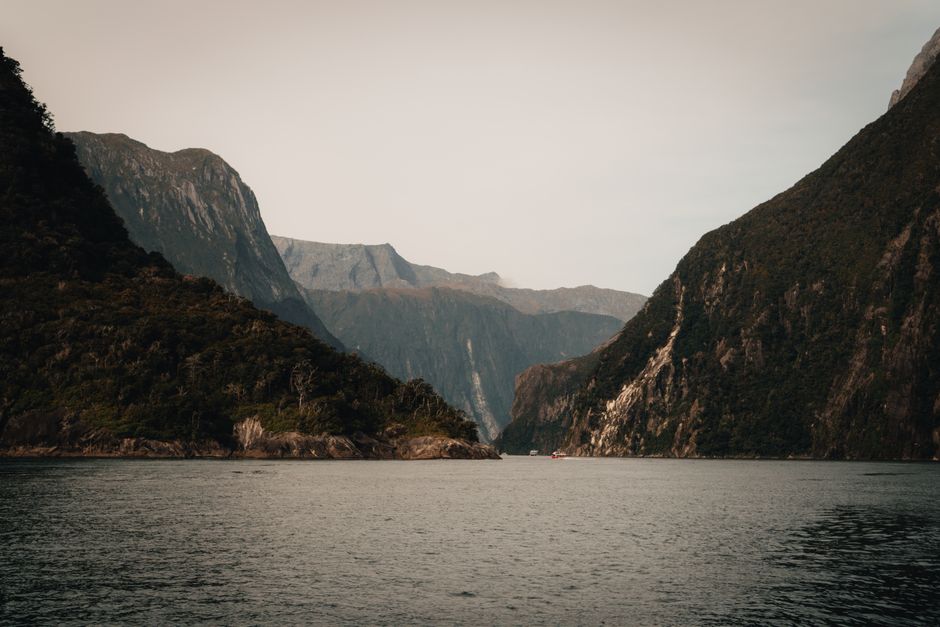
Fiordland National Park covers the remote southwest corner of New Zealand’s South Island: about 12,000 km² (4,600 sq miles) of granite mountains, glacier-carved fjords, rainforest, waterfalls and lakes, making it the largest national park in the country. Together with Aoraki/Mount Cook, Westland and Mount Aspiring national parks, it forms Te Wāhipounamu – South West New Zealand, a UNESCO World Heritage Area. Its most famous sight is Milford Sound/Piopiotahi, where Mitre Peak rises almost straight out of the sea and waterfalls pour off sheer cliffs; the Department of Conservation (DOC) counts around 1.1 million visitors a year, most of them international. Reaching it is part of the experience, along the Milford Road through the Eglinton Valley and the Homer Tunnel, or on foot along the Milford Track, one of three Great Walks in or near the park with the Routeburn and Kepler tracks. Quieter Doubtful Sound/Patea, reached by boat and bus from Lake Manapouri, is the park’s second great fjord. The base for almost everything is Te Anau, a lakeside town on the park’s eastern edge. Fiordland is one of the wettest places on Earth, so expect rain, which brings out hundreds of temporary waterfalls, and the sandflies that come with it.
Right now in Fiordland National Park (Milford Sound) (Milford Sound)
- Thu6–15°C42–59°F2 mm rain
- Fri4–13°C40–56°F1 mm rain
- Sat5–11°C42–52°F5 mm rain
Top tours in Fiordland National Park (Milford Sound)
See all tours for Fiordland National Park (Milford Sound) →
From local operators, with prices and reviews; you check availability and book on Viator, our partner. We may earn a commission at no extra cost to you. How we earn money
Fiordland at a glance
- Best months: November to April for the Great Walks season, longer days and the best chance of calm weather; Milford Sound cruises run all year, and winter (June to August) brings clear, cold days and snow on the peaks, with avalanche risk on the Milford Road.
- Time needed: one long day for Milford Sound; two or three days based in Te Anau to add Doubtful Sound, the glowworm caves or a day hike; four days for a Great Walk.
- Getting there: Te Anau is about 2 hours by road from Queenstown and 2.5 hours from Invercargill. Milford Sound is another 120 km (75 miles), about 2 to 2.5 hours, from Te Anau on State Highway 94.
- Costs (as of October 2026): there is no fee to enter the national park. Milford Track huts cost NZ$152 a night for international adults in season (about US$85); Milford Sound cruises cost roughly NZ$90–150.
- Before you go: entry rules, the NZeTA and visitor levy, biosecurity and driving rules are in our New Zealand travel guide.
Park access, Great Walk bookings and fees (as of October 2026)
Entry to Fiordland National Park and its day walks is free. You pay for boat cruises and transport, and for huts and campsites on the multi-day tracks. On the three Great Walks, huts and campsites must be booked on the DOC website during the Great Walks season, and the most popular dates sell out soon after bookings open. In the season, international visitors pay higher fees than New Zealanders.
| Great Walk, 2026/27 season | Season | Hut, per night: international adult / NZ adult | Campsite, international adult |
|---|---|---|---|
| Milford Track (53.5 km, 4 days, one-way, huts only) | 1 November 2026–30 April 2027 (last departure 28 April) | NZ$152 / NZ$106 | No camping allowed |
| Routeburn Track (33 km, 2–4 days) | 1 November 2026–30 April 2027 | NZ$132 / NZ$88 | NZ$42 |
| Kepler Track (60 km loop, 3–4 days) | 27 October 2026–30 April 2027 | NZ$132 / NZ$88 | NZ$42 |
International children (0–17) pay half the adult rate; New Zealand children under 18 pay half, and under-5s are free. Proof of eligibility is required for the New Zealand rate. If you turn up without a booking in season, you may be charged a penalty or turned away from a full hut. Outside the season, hut fees fall to NZ$30–35 a night and bunks are first come, first served, but the tracks become alpine routes with avalanche risk, some bridges removed and no wardens; DOC says only fit, experienced and well-equipped people with alpine and river-crossing skills attempt them, and that the Milford Track is not recommended for children under 10.
Proposed access charge for Milford Sound
In May 2026, the government introduced the Conservation Amendment Bill, which would allow DOC to charge international visitors to enter some popular conservation sites. Milford Sound/Piopiotahi is one of four sites being investigated, with local consultation held from June to August 2026. As of October 2026, the bill had not become law and no access charge applied. Check DOC before visiting in 2027.
The Milford Road (State Highway 94) and the Homer Tunnel
The 120 km road from Te Anau to Milford Sound is one of the most scenic in the world, and one of the most demanding in New Zealand. It follows Lake Te Anau, crosses the open Eglinton Valley, passes the Mirror Lakes and climbs through beech forest to the Homer Tunnel, a single-lane, 1.2 km (0.75-mile) tunnel through the mountains, controlled by traffic lights, before zigzagging steeply down the Cleddau Valley to Milford Sound.
- No fuel after Te Anau: fill up before you leave; there is no fuel at Milford Sound or on the way.
- No mobile coverage along most of the road.
- Avalanche season usually runs from about June to October. The avalanche zone covers about 17 km, from Falls Creek above the Hollyford Road turnoff to The Chasm on the Milford side of the tunnel. NZ Transport Agency (NZTA) controls the risk by keeping traffic moving through the zone and by closing the road for avalanche control work, sometimes at short notice.
- Chains: between June and November you may need to carry snow chains; driving past signs requiring chains can bring a fine of NZ$750.
- No stopping: because of rockfall and avalanche risk, stopping is not allowed in the zone on the east side of the Homer Tunnel (from the winter traffic signals to the tunnel entrance) or for about 850 m west of the tunnel. The Chasm car park is the only formal stopping place on this section.
- Timing: allow at least 2 to 2.5 hours one way without stops, more in summer traffic. Leave early or late in the day to avoid the midday coach rush, and check NZTA’s road status before setting out.
If you’d rather not drive, coaches run from Te Anau and Queenstown, and scenic flights land at Milford Sound’s small airstrip from Queenstown, Te Anau and Wānaka.
Safety: weather, rivers, avalanches and sandflies
- Rain and flooding: Fiordland gets up to 9,000 mm (350 inches) of rain a year in places. Heavy rain can close tracks and roads within hours; rivers and side streams rise fast. Never cross a flooded river; wait or turn back.
- Alpine weather: cold, snow, strong winds and heavy rain can happen in any season on the passes of the Milford, Routeburn and Kepler tracks. Check the NIWA mountain forecasts and MetService warnings, and carry warm, waterproof gear.
- Avalanches: from May to November, avalanches can cross the Milford Road and the alpine tracks. Outside the Great Walks season, carry avalanche gear only if you know how to use it, and check the New Zealand avalanche forecast.
- No cell service: carry a personal locator beacon on tracks (they can be hired in Te Anau), and leave your plans with someone.
- Sandflies: they are everywhere at Milford Sound and on the tracks. Use repellent and cover up; they don’t carry disease, but bites itch for days.
- Driving: drive on the left and slowly; watch for one-lane bridges, kea on the road near the tunnel (don’t feed them), and tired drivers on the long return trip.
- Freshwater pests: clean, check and dry boots, kayaks and fishing gear between waterways to avoid spreading didymo and other pests.
- Emergencies: call 111 where there is coverage, or activate your beacon.
Top things to see in Fiordland
Milford Sound/Piopiotahi
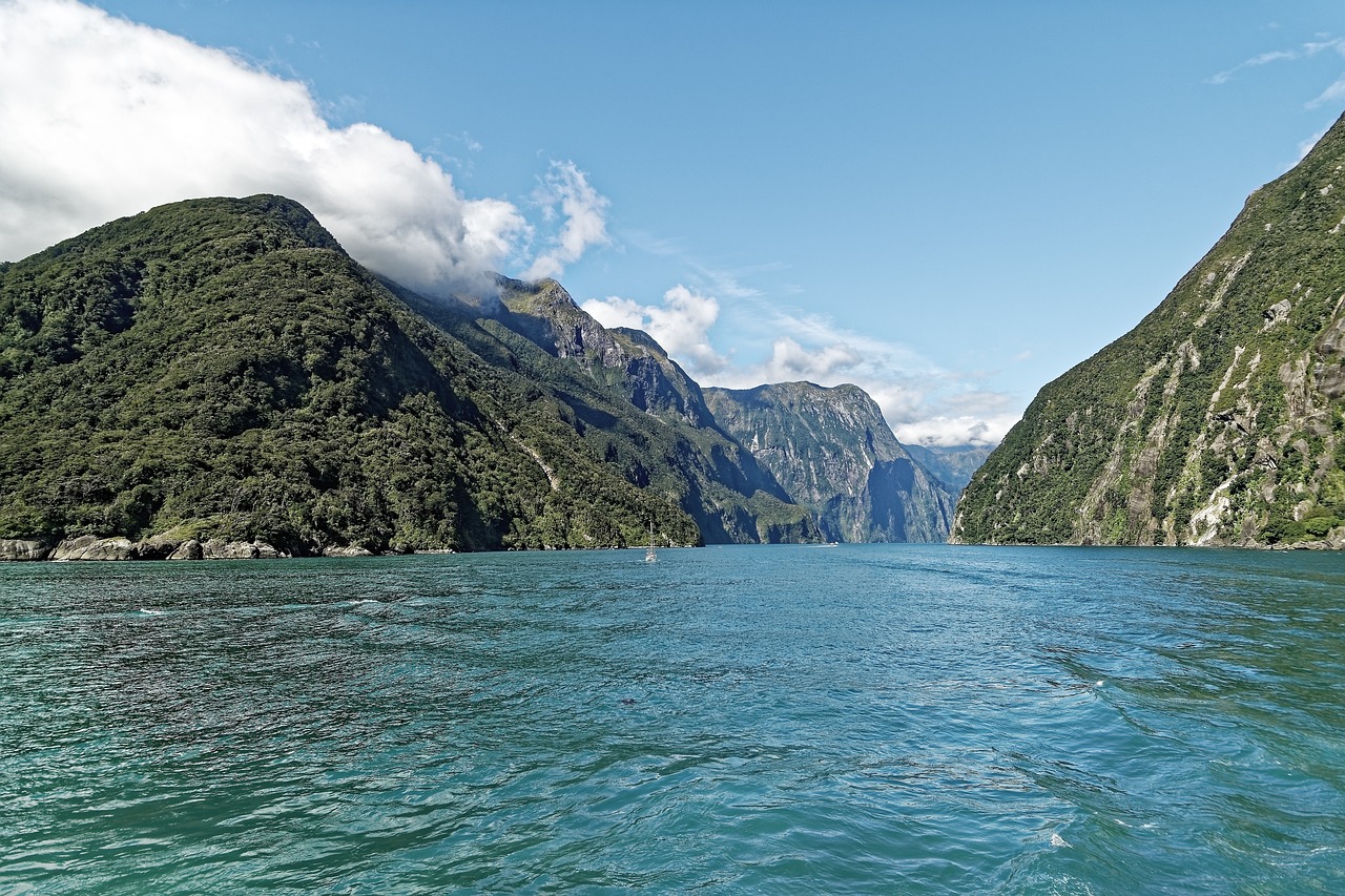
Strictly a fjord, carved by glaciers, Milford Sound runs 15 km (9 miles) from the head of the sound to the Tasman Sea. Mitre Peak (Rahotu) rises 1,692 m (5,551 feet) from the water; Stirling Falls and Lady Bowen Falls pour from hanging valleys; and fur seals, bottlenose dolphins and, occasionally, Fiordland crested penguins live here. A cruise of about two hours goes out to the open sea and back, nosing under the waterfalls. Kayak trips explore the shoreline, and an underwater observatory at Harrison Cove shows black coral at shallow depths. Rain is the norm and transforms the cliffs into curtains of waterfalls, while on clear days the reflections are extraordinary. There is a short foreshore walk from the visitor terminal for the classic Mitre Peak photo.
The Milford Track
Often called the finest walk in the world, the 53.5 km (33-mile) track runs over four days and three nights from the head of Lake Te Anau, up the Clinton Valley, over Mackinnon Pass (Omanui) and down the Arthur Valley past Sutherland Falls, one of the highest waterfalls in New Zealand, to Sandfly Point on Milford Sound. In the season it must be walked in one direction, staying at the Clinton, Mintaro and Dumpling huts, with boat transport at both ends (book transport in advance; there is no road access to either end). Bookings for the next season open months ahead and sell out quickly. Guided walks with private lodges are another option.
The Routeburn Track and Key Summit
The 33 km (21-mile) Routeburn links Fiordland and Mount Aspiring national parks over the Harris Saddle, with alpine gardens, tarns and big views of the Darran and Humboldt mountains. From the Fiordland end at The Divide on the Milford Road, a popular day hike climbs to Key Summit in about three hours return, with views of the Hollyford Valley and Lake Marian.
The Kepler Track
A 60 km (37-mile) loop from the Te Anau control gates, the Kepler climbs to Luxmore Hut and follows an exposed alpine ridgeline with views over Lake Te Anau and the Murchison Mountains before descending through beech forest to Iris Burn and Lake Manapouri. You can walk the first section to Brod Bay or Luxmore Hut as a day hike.
Doubtful Sound/Patea
Three times longer than Milford and far quieter, Doubtful Sound is reached by a cruise across Lake Manapouri from Pearl Harbour, a bus over the Wilmot Pass and a boat into the fjord. Day cruises take about seven to eight hours from Manapouri, and overnight cruises are available. Look for bottlenose dolphins and fur seals, and enjoy the “sound of silence” when the engines are turned off.
Te Anau and the glowworm caves
The town on the shore of Lake Te Anau, the South Island’s largest lake, has the DOC Fiordland National Park Visitor Centre, a bird sanctuary with rare takahē, and lakefront walks. Boat trips cross the lake to the Te Anau Glowworm Caves, a young, active cave system where you walk and take a small boat past underground waterfalls to a grotto lit by glowworms.
Other things to do in Fiordland
- Short walks on the Milford Road: Mirror Lakes (5 minutes), Lake Gunn Nature Walk (45 minutes), The Chasm (20 minutes, on the Milford side of the tunnel) and Lake Marian (3 hours return, steep).
- Kayaking: guided trips on Milford Sound and Doubtful Sound.
- Scenic flights: small planes and helicopters from Te Anau, Queenstown and Milford, some landing on glaciers or alpine lakes.
- Diving: Milford’s dark freshwater surface layer lets black coral grow at shallow depths, a rarity divers come for.
- Fishing and boating: Lake Te Anau and Lake Manapouri have trout fishing; a license is required.
- Hollyford Track: a lower-level, all-season track down the Hollyford Valley to the coast, with guided options.
Getting there
- From Queenstown: about 2 hours by road to Te Anau, then 2 to 2.5 hours to Milford Sound. Coach and cruise day tours from Queenstown take about 12 to 13 hours in total.
- From Invercargill or Dunedin: about 2.5 and 4 hours to Te Anau respectively.
- By air: Queenstown is the nearest airport with scheduled flights. Scenic fly-cruise-fly trips land at Milford Sound airstrip, weather permitting.
- For the Great Walks: track transport operators run between Te Anau, Te Anau Downs, Milford Sound and the trailheads, and must be booked in advance in the season.
Around Fiordland
Te Anau has supermarkets, fuel, gear hire and the visitor center; Manapouri, 20 minutes south, is the departure point for Doubtful Sound. At Milford Sound, there is a visitor terminal, a café, a lodge and a small amount of parking with paid areas; there are no shops or fuel. Most cruise operators coordinate departures with coach arrivals, so build in time.
When to go and how long to stay
Fiordland’s weather is wet, mild and changeable. Summer (December to February) has the longest days and the most stable conditions for walking, with highs around 19–20 °C (66–68 °F) at Milford Sound, but also the most visitors and sandflies. Autumn (March to May) can bring calm, settled spells. Winter (June to August) is cold but often clear, with snow on the peaks, fewer visitors and avalanche management on the road. Spring (September to November) is the wettest and windiest. Whenever you go, rain is likely: Milford Sound records rain on about half the days of every month.
| Month | Average high | Average low | Rain | Rain days (≥1 mm) |
|---|---|---|---|---|
| Jan | 20 °C (67 °F) | 11 °C (51 °F) | 667 mm (26.3 in) | 16 |
| Feb | 20 °C (68 °F) | 11 °C (51 °F) | 467 mm (18.4 in) | 13 |
| Mar | 18 °C (65 °F) | 9 °C (49 °F) | 571 mm (22.5 in) | 14 |
| Apr | 16 °C (61 °F) | 7 °C (45 °F) | 528 mm (20.8 in) | 13 |
| May | 12 °C (54 °F) | 5 °C (41 °F) | 645 mm (25.4 in) | 16 |
| Jun | 9 °C (49 °F) | 2 °C (36 °F) | 440 mm (17.3 in) | 15 |
| Jul | 9 °C (49 °F) | 2 °C (35 °F) | 468 mm (18.4 in) | 14 |
| Aug | 11 °C (52 °F) | 3 °C (37 °F) | 457 mm (18.0 in) | 16 |
| Sep | 13 °C (56 °F) | 4 °C (39 °F) | 541 mm (21.3 in) | 18 |
| Oct | 15 °C (59 °F) | 6 °C (42 °F) | 617 mm (24.3 in) | 18 |
| Nov | 16 °C (62 °F) | 8 °C (46 °F) | 558 mm (22.0 in) | 15 |
| Dec | 18 °C (65 °F) | 10 °C (49 °F) | 585 mm (23.0 in) | 17 |
| Year | 15 °C (59 °F) | 6 °C (44 °F) | 6,545 mm (257.7 in) | 185 |
Figures are NIWA’s 1991–2020 climate normals for the Milford Sound station at the head of the fjord, one of the wettest inhabited places in New Zealand. Te Anau and Manapouri, on the drier eastern side of the mountains, get roughly a sixth as much rain.
Fiordland in one day
From Te Anau, leave early for the Milford Road, stopping at the Mirror Lakes, Lake Gunn and The Chasm, take a late-morning or early-afternoon cruise on Milford Sound, and drive back with a stop for the Key Summit view if you have the energy.
Three days or more
Day one Milford Sound; day two Doubtful Sound from Manapouri; day three the Kepler Track to Luxmore Hut or the glowworm caves. Or set aside four days for the Milford, Routeburn or Kepler track.
Where to stay
- Te Anau: motels, lodges, hostels, holiday parks and lakeside hotels; the best base by far.
- Manapouri: a few lodges and a holiday park, handy for Doubtful Sound.
- Milford Sound: a single lodge with rooms and campervan sites; book well ahead.
- Along the Milford Road: basic DOC campsites in the Eglinton Valley, first come, first served.
- Overnight cruises: on Milford and Doubtful sounds, with cabins.
Prices include 15% GST. There is no separate park or bed tax.
Typical costs in Fiordland
| Item (as of October 2026) | New Zealand dollars | About US dollars |
|---|---|---|
| National park entry | Free | Free |
| Milford Track hut, international adult, per night in season | NZ$152 | US$85 |
| Routeburn or Kepler hut, international adult, per night in season | NZ$132 | US$74 |
| Routeburn or Kepler campsite, international adult | NZ$42 | US$24 |
| Milford Sound day cruise, adult | about NZ$90–150 | about US$50–85 |
| Doubtful Sound day cruise from Manapouri | about NZ$250–300 | about US$140–170 |
| Coach and cruise day tour from Queenstown | about NZ$200–300 | about US$110–170 |
| Motel room in Te Anau, per night | about NZ$160–260 | about US$90–145 |
Hut and campsite fees are official DOC figures. Cruise, tour and motel prices are typical ranges, not official prices. Conversions use about US$0.56 to NZ$1.
Practical tips for Fiordland
- Book the Great Walks early: popular dates go quickly; check DOC for each season’s opening date.
- Fill up in Te Anau: fuel, food and cash; there’s nothing beyond.
- Go early or late: the busiest time at Milford Sound is the middle of the day, when coaches from Queenstown arrive.
- Rain is a bonus: the waterfalls are at their best during and after heavy rain.
- Respect the kea: these alpine parrots are endangered; don’t feed them, and watch your car’s rubber seals.
- Compare Patagonia: for similar wild fjords and trekking at the other end of the world, see Torres del Paine National Park in Chile.
What to pack for Fiordland
A good rain jacket and rain pants, warm layers (fleece or merino), a hat and gloves even in summer, sturdy waterproof boots for the tracks, insect repellent for sandflies, sunscreen, a dry bag for camera gear on boats, and snacks and water for the Milford Road. For a Great Walk, bring a 3- to 4-season sleeping bag, cooking gear (except on guided walks), a pack liner, first-aid kit and a personal locator beacon.
Fiordland National Park travel FAQ
Do I need to pay to enter Fiordland National Park?
No. There is no entry fee. You pay for cruises, transport and Great Walk huts. A government bill could allow an access charge for international visitors at Milford Sound in future, but none applied in October 2026.
How much does the Milford Track cost?
In the 2026/27 season (1 November 2026 to 30 April 2027), huts cost NZ$152 per night for international adults and NZ$106 for New Zealand adults, for three nights, plus boat and bus transport.
Can I drive to Milford Sound myself?
Yes, on State Highway 94 from Te Anau (about 2 to 2.5 hours). There is no fuel after Te Anau, no mobile coverage, a single-lane tunnel with traffic lights, and avalanche no-stopping zones; carry chains from June to November.
Is the Milford Road open in winter?
Usually yes, but it can close for avalanche control or snow, sometimes at short notice. Check NZTA’s road status before you leave Te Anau.
Milford Sound or Doubtful Sound: which is better?
Milford is easier to reach and more dramatic, with Mitre Peak and big waterfalls, but busier. Doubtful is bigger, more remote and quieter, and takes a full day from Manapouri.
When is the best time to visit Milford Sound?
November to April for longer days and walking, but cruises run year-round. Rainy days bring the most waterfalls; clear winter days give the best reflections.
Can I do Milford Sound as a day trip from Queenstown?
Yes, by coach (12 to 13 hours) or on a fly-cruise-fly trip. Driving yourself, it is better to stay a night in Te Anau.
How bad are the sandflies in Fiordland?
They can be fierce, especially at Milford Sound and on lakeshores. Bring a strong repellent, wear long sleeves and pants, and keep moving.
What is the Homer Tunnel?
A 1.2 km single-lane road tunnel through the mountains on the Milford Road, with traffic lights at each end. Waits can be up to 15 minutes in busy periods.
Do I need a guide for the Milford Track?
No. In the season you can walk independently with DOC hut bookings, or join a guided walk that uses private lodges. Outside the season, the track is only for experienced, self-sufficient trampers.
Plan your trip
Partner links: TravelerCenter may earn a commission if you book, at no extra cost to you.
Sources · last reviewed 5 October 2026
Researched and last reviewed on 5 October 2026. Great Walk seasons, hut and campsite fees, booking rules, rainfall and winter conditions come from the Department of Conservation’s Milford, Routeburn and Kepler track pages; the proposed access charge from DOC’s 2026 consultation page; Milford Road avalanche season, chain rules, fines and no-stopping zones from NZ Transport Agency Waka Kotahi (read via official page summaries, as its site blocked direct access); climate from NIWA’s 1991–2020 normals for Milford Sound; exchange rates from the European Central Bank. The park’s area, Mitre Peak’s height, the tunnel’s length and wait times, visitor numbers, drive times, short-walk times, Doubtful Sound logistics, and cruise, tour and motel prices are general references and flagged for checking. Prices, schedules and road conditions change, so check the official sites before you go. For entry rules, biosecurity and driving, see our New Zealand travel guide.
Data: Weather: MET Norway (CC BY 4.0) · Sea temperature: NOAA CoastWatch · Rates: ECB · Costs: World Bank ICP and price levels · Wikidata (CC0)