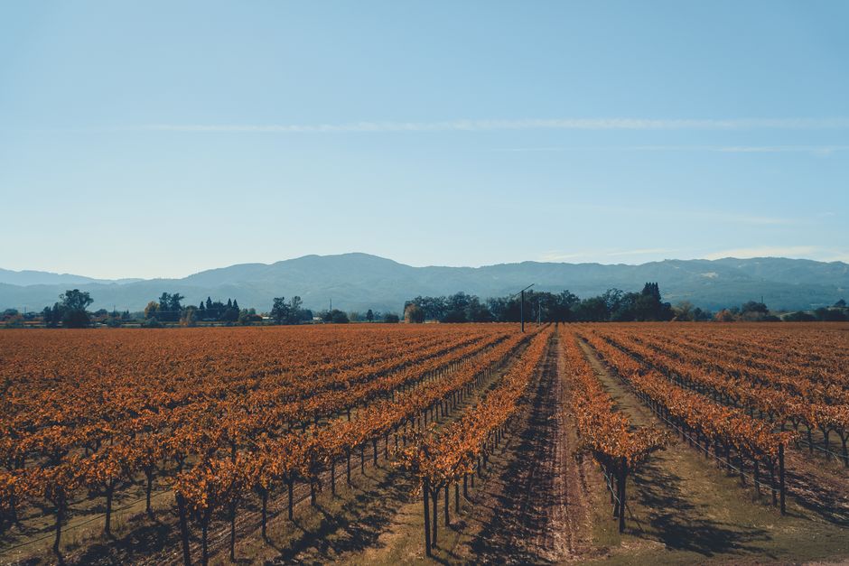
Napa Valley is America’s most famous wine country: a narrow, sunny valley about 30 miles (48 km) long, an hour or so north of San Francisco, lined with vineyards, stone wineries and five small towns, from the city of Napa in the south through Yountville and St. Helena to the hot-spring town of Calistoga at the top. Visitors come to taste Cabernet Sauvignon where it grows, to eat in some of the best restaurants in the country, to soak in mud baths and to drift over the vines in a hot-air balloon. Harvest, from late summer into October, is the most beautiful and busiest season; winter is green, quiet and cheaper. Plan ahead: most wineries now work by reservation, and nobody should drive after a day of tasting.
Right now in Napa Valley (St. Helena)
- Wed20–36°C67–97°FClear
- Thu20–37°C68–98°FClear
- Fri15–29°C60–83°FClear
- Mon 12 Oct Columbus Day
- Mon 12 Oct Indigenous Peoples' Day · regional holiday in California
Top tours in Napa Valley
See all tours for Napa Valley →
From local operators, with prices and reviews; you check availability and book on Viator, our partner. We may earn a commission at no extra cost to you. How we earn money
Napa Valley at a glance
- Best for: wine tasting, food, spas and mud baths, hot-air balloons, cycling between vineyards and a romantic weekend.
- How long: 2 days for a first taste; 3–4 days to cover the valley from Napa to Calistoga at an easy pace.
- Best time: September and October for harvest, with warm days around 78–87 °F (26–31 °C); April and May for green vines and fewer crowds. Winter is rainy but peaceful.
- Getting there: about 50 miles (80 km) from San Francisco by car, roughly 1–1.5 hours without traffic; the nearest big airports are SFO, Oakland and Sacramento.
- Getting around: a car, a driver or a tour; the Vine’s Route 10 bus runs up the valley daily for $2 a ride as of October 2026.
- Before you go: entry rules, money, tipping and driving are in our United States travel guide.
Napa Valley’s towns: where things are
Two roads run the length of the valley: busy Highway 29 on the west side, past many of the big-name wineries, and the quieter Silverado Trail on the east. Cross-valley roads link them every few miles, so it is easy to make a loop. According to Visit Napa Valley, the county’s tourism board, the valley has more than 400 wineries open for tastings and about 90 tasting rooms in its towns.
Napa
The largest town and the gateway from the south has a lively downtown on the Napa River, with tasting rooms, wine bars and restaurants within walking distance of each other. Oxbow Public Market, a food hall of local producers, opens daily from 7:30 a.m. to 9 p.m., and the Napa Valley Wine Train leaves from the station next door. It is the best base without a car and usually the best value.
Yountville
About 9 miles (14 km) north of Napa, this small, walkable village is the food capital of the valley, home to The French Laundry and a cluster of famous chefs’ restaurants, bakeries and boutique hotels, with outdoor art along its main street. The free Yountville Bee Line, part of the Vine bus network, gets you around town.
Oakville and Rutherford
These are less towns than famous stretches of Highway 29, where the valley floor is lined with historic Cabernet estates. Many of the names you know from wine lists are here, so this is where reservations fill up first.
St. Helena
A handsome old Main Street of stone buildings, shops and restaurants in the heart of the valley, surrounded by some of its oldest wineries. It is quieter and more upscale than Napa, with a farmers’ market and the Culinary Institute of America’s Napa Valley campus at Greystone just north of town.
Calistoga
At the top of the valley, Calistoga is the most relaxed town, built on hot springs: its spas are known for volcanic-ash mud baths and mineral pools. It is a good base for hiking in the hills and for wineries on the quieter north end, and it has a laid-back, small-town feel.
Wine tasting in Napa Valley: how it works
Gone are the days of simply walking up to the bar at most big wineries. Visit Napa Valley explains why: popular wineries fill their reservations weeks ahead, small ones need notice so someone is there to greet you, many have county permits that limit the number of guests each day, and seated tastings start and end at set times. So book two or three tastings a day, not more, with a long lunch in between.
- Book ahead: especially on weekends and from August to October. Downtown tasting rooms in Napa, Yountville, St. Helena and Calistoga are the easiest walk-in option.
- Prices: tasting fees vary widely, from modest at small family wineries to well over $100 per person for seated experiences at famous estates; many wineries waive the fee if you buy wine. The tourism board publishes lists of tastings for $50 and under. Check each winery’s site.
- Tipping: not expected everywhere, but Visit Napa Valley suggests about $10–$15 per couple at a stand-up bar, $15–$20 for a seated tasting and $20 or more at a boutique winery when the host has looked after you well.
- Age: you must be 21 or over to taste, with photo ID. Some wineries welcome children; many do not.
- Pace yourself: use the spit bucket, drink water and eat. See our wine tasting guide.
Do not drink and drive. California’s legal limit is a blood alcohol level of 0.08% for drivers 21 and over, and Highway 29 is patrolled. Hire a driver, join a tour, take the Wine Train or the Vine bus, or choose a designated driver who does not taste.
Top things to see and do in Napa Valley
The Napa Valley Wine Train
Restored vintage rail cars run from McKinstry Street Station in downtown Napa, near Oxbow Public Market, up the valley through Yountville, Oakville and Rutherford to St. Helena and back. Journeys last about 2.5 to 6 hours and combine a multi-course meal with views of the vineyards, and some include winery stops. Prices vary by experience, season and demand, so check the operator’s booking calendar; smart-casual dress is usual, and booking ahead is strongly recommended in peak season.
Downtown Napa and the Oxbow Public Market
Walk the Napa Riverfront, browse the market’s cheese, charcuterie and oyster counters, and hop between tasting rooms without driving. It is the easiest place to start or end a wine day, and an easy evening out.
Hot-air balloons over the vineyards
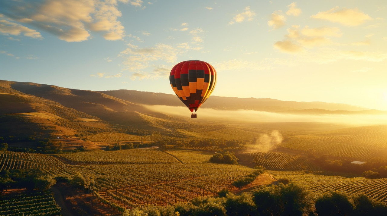
Balloons lift off at dawn, when the air is calm, and float over the valley for about an hour, usually followed by breakfast or sparkling wine. Flights run from Napa and Yountville most of the year, weather permitting; book with a licensed operator and expect very early starts.
Calistoga’s spas and the Old Faithful Geyser of California
Book a volcanic-ash mud bath and a mineral soak at one of Calistoga’s spas, a local tradition since the 1800s. Just north of town on Tubbs Lane, the privately owned Old Faithful Geyser of California, open daily all year, erupts about every 15–30 minutes, with picnic areas and free parking.
Historic wineries and caves
Many estates are worth seeing for their buildings as much as their wine: century-old stone wineries and barrel caves dug into the hillsides, mission-style courtyards, modern architecture and even a castle near Calistoga. Tours of caves and cellars usually need a reservation. Mix one famous name with a small family winery on the Silverado Trail or up in the hills for a more personal visit.
Other sights
- Beringer Vineyards
- Inglenook
- Old Faithful Geyser of California
Fun and family
- Napa Valley Wine Train
Castles and forts
- Castello di Amorosa
Cycling, hiking and eating
Cycling: the flat valley floor is lovely by bike, and rental shops in Napa, Yountville, St. Helena and Calistoga offer e-bikes and guided winery rides. Highway 29 is busy with fast traffic; the Silverado Trail and the Napa Valley Vine Trail, a walking and cycling path built in sections along the valley, are more pleasant. See our cycling guide.
Hiking: the hills on both sides have state and regional parks with oak woodland, redwoods in the canyons and views over the vineyards; Robert Louis Stevenson State Park, north of Calistoga, climbs Mount St. Helena. Start early in summer, when afternoons are hot. See our hiking guide.
Food: the valley has an extraordinary number of acclaimed restaurants for its size, from Michelin-starred tasting menus in Yountville and St. Helena to taco trucks and picnic delis. Top restaurants open reservations weeks or months ahead. A picnic at a winery that allows it is a lovely, cheaper lunch.
Activities and best months
- Wine tastingMore than 400 wineries open for tastings; the popular ones fill weeks ahead and most need a reservation for seated tastings.
Napa or Sonoma? And trips around the valley
- Sonoma Valley: just west over the Mayacamas Mountains, more relaxed and generally less expensive, with smaller family wineries and the historic town square of Sonoma.
- San Francisco: most visitors combine the two; see our San Francisco travel guide.
- Lake Berryessa: a large reservoir in the hills east of the valley, for boating and swimming in summer.
- Further afield: Lake Tahoe and the Sierra Nevada are about three hours east, and Yosemite National Park about four hours southeast.
Nearby destinations
- San Francisco68 km
- Monterey203 km
- Lake Tahoe215 km
- Yosemite National Park256 km
- Big Sur261 km
Getting there and getting around
By car
From San Francisco, cross the Golden Gate Bridge and drive through Marin and Sonoma counties, or take the Bay Bridge and Interstate 80 to Vallejo; either way it is about 50 miles (80 km) to the town of Napa, roughly 1–1.5 hours, much longer at rush hour or on Friday afternoons. From Sacramento it is about 60 miles (97 km). Napa to Calistoga is about 26 miles (42 km) on Highway 29. The Golden Gate Bridge charges a toll southbound, into San Francisco, collected electronically; details are on our San Francisco travel guide.
Without a car
The Napa Valley Transportation Authority runs the Vine buses. Route 10, the Up Valley Connector, runs every day between Napa, Yountville, St. Helena and Calistoga; Route 11 links Napa with Vallejo, where San Francisco Bay Ferry boats cross to San Francisco’s Ferry Building, and Route 29 runs on weekdays and Saturdays to El Cerrito del Norte BART station. As of October 2026, an adult fare is $2 ($1.25 for ages 6–18 and $1 for seniors), a day pass $7, and the Route 29 express to BART $6. In town, the Yountville Bee Line is free and the Calistoga Shuttle costs $1. Bus plus walking works for downtown tasting rooms, but for vineyard estates a tour or a driver is easier.
Airports
San Francisco International (SFO) and Oakland (OAK) are about 1–1.5 hours away by car, Sacramento (SMF) about the same, and the small Charles M. Schulz–Sonoma County Airport (STS) near Santa Rosa about 45 minutes from Calistoga. Rent a car at the airport or book a shuttle.
When to go and how long to stay
The valley has a Mediterranean climate: hot, dry summers, mild, rainy winters and fog that rolls in from San Pablo Bay in the south on summer mornings. The table uses NOAA’s 1991–2020 normals for the St. Helena weather station, in the middle of the valley.
| Season | Average high / low | Rain per month | What it’s like |
|---|---|---|---|
| Winter (Dec–Feb) | 58–63 °F (14–17 °C) / 40–42 °F (4–6 °C) | 6.5–7.2 in (164–182 mm) | Green hills, rain, quiet wineries and lower hotel rates; mustard flowers between the vines from late winter. |
| Spring (Mar–May) | 67–78 °F (19–26 °C) / 44–51 °F (7–11 °C) | 1.3–5 in (33–126 mm) | Bud break and fresh green vines; pleasant for cycling. |
| Summer (Jun–Aug) | 85–89 °F (29–32 °C) / 54–56 °F (12–13 °C) | Almost none | Hot, dry afternoons and cool nights; busy weekends. |
| Fall (Sep–Nov) | 87 °F falling to 66 °F (31–19 °C) / 54 °F falling to 44 °F (12–7 °C) | 0.1–3.2 in (2–82 mm) | Harvest and crush, the most popular season; fall colors in the vineyards by late October. |
St. Helena gets about 34 inches (863 mm) of rain a year, almost all from November to April. Late summer and fall are also the main wildfire season in Northern California; the 2017 and 2020 fires burned parts of the county’s hills. If a fire is burning, follow Napa County and CAL FIRE alerts, and check the air quality on the federal AirNow site: smoke can drift into the valley from fires far away. Power companies sometimes switch off electricity in windy, dry weather to reduce the fire risk.
Weather month by month
Events worth planning around
- August to October: harvest and crush; the busiest and most expensive weeks, especially weekends.
- Late May: the BottleRock Napa Valley music festival fills downtown Napa; the 2027 edition is set for May 28–30, 2027. Book hotels early or avoid those dates.
- Winter: the quietest season, with off-season offers at hotels and wineries.
How long to stay: 2, 3 and 4 days
2 days: day one, downtown Napa, the Oxbow Public Market and two tastings on the Silverado Trail; day two, Yountville, an Oakville or Rutherford estate and dinner in St. Helena. 3 days: add Calistoga for a mud bath, the geyser and a hillside winery. 4 days: add a sunrise balloon flight, the Wine Train or a morning hike, and an afternoon in Sonoma.
Where to stay in Napa Valley and the hotel taxes
- Napa (downtown): the widest choice, the best prices and walkable restaurants and tasting rooms.
- Yountville: boutique hotels steps from famous restaurants; expensive.
- St. Helena and Rutherford: luxury resorts and inns among the vines.
- Calistoga: spa resorts, hot-spring motels and a more relaxed feel.
- American Canyon, Vallejo or Fairfield: chain hotels at lower rates, 20–30 minutes south of Napa.
Rates are quoted before tax and rise sharply on weekends and during harvest; many places have two-night minimums. As of October 2026, the City of Napa charges a 12% transient occupancy tax plus a 1% special tax for affordable housing and a 2% Tourism Improvement District assessment, so about 15% in total, according to the city’s finance department. In unincorporated Napa County the tax is 13%, plus a 2% tourism assessment; Yountville, St. Helena and Calistoga set their own rates. Some resorts add daily resort fees, so compare total prices.
Practical tips for Napa Valley
- Sales tax: prices in shops and restaurants exclude sales tax; according to the state tax agency (CDTFA), the rate from October 1, 2026, is 8.75% in the city of Napa, 8.25% in St. Helena and 7.75% in Yountville, Calistoga and the rest of the county.
- Shipping wine: many wineries ship within the United States; rules for other countries vary, and airlines limit alcohol in luggage.
- Weekdays are better: fewer crowds, easier reservations and lighter traffic on Highway 29.
- Tipping: 18–22% at sit-down restaurants; more in our United States travel guide.
- Emergencies: call 911.
What to pack for Napa Valley
Pack smart-casual clothes for tastings and dinners, layers for cool mornings and evenings (temperatures can swing by 30 °F, or about 17 °C, in a day), comfortable flat shoes for vineyard and cave tours, sunglasses, a hat and sunscreen in summer, and a rain jacket from November to April. A cooler bag in the car keeps bottles from cooking in the summer heat.
What to pack
- City walking shoesQuinta visits and harvest days mean steep terraces, gravel and cellar floors.
- Wine bottle travel protectorsPort and Douro wines bought at the quintas travel home safely in checked luggage with padded bottle protectors.
Napa Valley travel FAQ
Do I need reservations for Napa wineries?
For most wineries, yes. Many have permits that limit daily guests and offer seated tastings at set times. Book ahead, especially for weekends and harvest; downtown tasting rooms are easier for walk-ins.
How much does wine tasting cost in Napa?
It varies widely, from modest fees at small wineries to well over $100 per person for seated experiences at famous estates. Fees are often waived if you buy wine.
Can you visit Napa Valley without a car?
Yes. Stay in downtown Napa or Yountville, walk to tasting rooms, and use the Vine’s Route 10 bus ($2 as of October 2026), the Wine Train, a tour or a private driver for vineyard estates.
How far is Napa from San Francisco?
About 50 miles (80 km), roughly 1–1.5 hours by car without traffic. You can also take the ferry to Vallejo and the Vine’s Route 11 bus to Napa.
When is the best time to visit Napa Valley?
September and October for harvest, or April and May for green vines and fewer crowds. Winter is quiet and cheaper; summer is hot and busy.
Is Napa or Sonoma better for a first visit?
Napa has the famous names, the restaurants and the Wine Train; Sonoma is more relaxed and usually cheaper. With three or more days, see both.
How old do you have to be to taste wine in Napa?
21, with photo ID. Some wineries allow children to accompany adults; check before you book.
What taxes are added to Napa hotel bills?
In the City of Napa about 15% in total (12% hotel tax, 1% housing tax and a 2% tourism assessment); in unincorporated Napa County 13% plus a 2% assessment, as of October 2026.
Is wildfire smoke a problem in Napa Valley?
It can be in late summer and fall. Most days are clear, but check CAL FIRE and Napa County alerts and the AirNow air-quality map before and during your trip.
Plan your trip
Partner links: TravelerCenter may earn a commission if you book, at no extra cost to you.
Sources · last reviewed 4 October 2026
Researched and last reviewed on 4 October 2026. Winery numbers, reservations and tasting tips: Visit Napa Valley (the county’s tourism board); Wine Train: the Napa Valley Wine Train; buses and fares: the Vine (Napa Valley Transportation Authority); geyser: Old Faithful Geyser of California; market hours: Oxbow Public Market; BottleRock dates: the festival’s site; hotel taxes: the City of Napa Finance Department and the Napa County Treasurer-Tax Collector; sales tax: the California Department of Tax and Fee Administration; drink-driving limit: the California DMV; air quality: AirNow; climate: NOAA’s 1991–2020 normals for St. Helena. Distances and drive times are approximate and flagged for checking. Check the official sites before you go. For entry rules, tipping and driving, see our United States travel guide.
Also: visitnapavalley.com · NOAA NCEI normals 1991–2020, St. Helena (climate)
Data: Weather: MET Norway (CC BY 4.0) · Rates: ECB · Holidays: Nager.Date · Costs: World Bank ICP and price levels · © OpenStreetMap contributors (ODBL) · Wikidata (CC0)