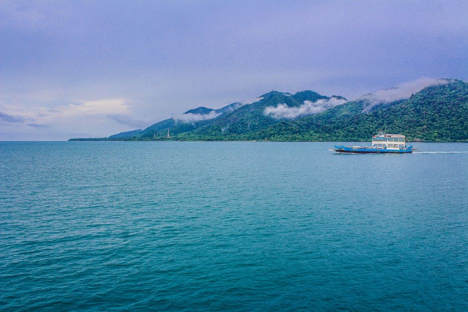
Ko Chang, “Elephant Island,” is Thailand’s third-largest island, in the far east of the Gulf of Thailand near the Cambodian border, about 300 km (190 miles) from Bangkok in Trat province. Most of it is a mountainous national park of rainforest, waterfalls and mangroves, with a ring of beaches along the west coast and fishing villages on stilts in the south and east. It is a favorite with Bangkok residents and families for long weekends, and the starting point for island-hopping south to Ko Wai, Ko Mak and Ko Kut, and for snorkeling trips to the coral of Ko Rang. Come for White Sand Beach and the quieter bays of the west coast, jungle waterfalls, kayaking in the mangroves, the pier village of Bang Bao, seafood, and boat trips in the Mu Ko Chang Marine National Park. The best time is from November to April; from May to October the southwest monsoon makes Ko Chang one of the wettest places in Thailand, with rough seas on the west coast.
Right now in Ko Chang (White Sand Beach)
- Wed23–27°C73–80°F5 mm rain
- Thu23–28°C73–82°F6 mm rain
- Fri24–27°C75–81°F2 mm rain
Top tours in Ko Chang
See all tours for Ko Chang →
From local operators, with prices and reviews; you check availability and book on Viator, our partner. We may earn a commission at no extra cost to you. How we earn money
Ko Chang at a glance
- Best for: beach holidays from Bangkok, families, jungle waterfalls and hiking, snorkeling and diving trips, and island-hopping to Ko Mak and Ko Kut.
- How long: 3–4 days for the beaches, a waterfall and a boat trip; a week or more to add the southern islands.
- Best time: November to April, with highs of about 32–33 °C (89–92 °F) and little rain from December to February.
- Getting there: about 5–6 hours by road from Bangkok to the ferry piers near Trat, or a 1-hour flight to Trat Airport, then a 30–45-minute car ferry.
- Getting around: shared songthaews on the coast road, rental scooters and cars, and boats to the outer islands.
- Fees to know: Mu Ko Chang National Park charges an entry fee at its waterfalls and on marine trips; some small islands in the park are closed indefinitely.
- Before you go: entry rules, the Thailand Digital Arrival Card, money and general safety are in our Thailand travel guide.
Ko Chang’s areas: where things are
Ko Chang is about 30 km (19 miles) long and 14 km (9 miles) wide. One road runs most of the way around the island, along the west coast from the ferry piers in the northeast to Bang Bao in the south, and down the east coast to Salak Phet; there is no road across the mountainous interior or around the southwest tip.
White Sand Beach (Hat Sai Khao)
The island’s longest and busiest beach, on the northwest coast, with the widest choice of hotels, restaurants, bars and shops. The sand is fine and the swimming good in the dry season; the northern end is quieter.
Khlong Prao and Kai Bae
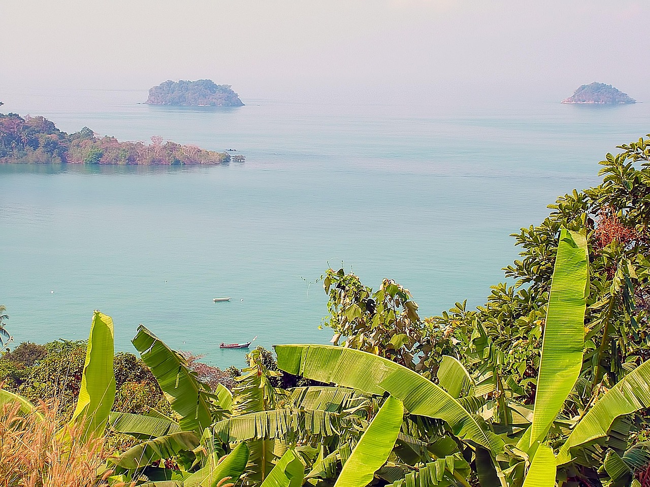
South of White Sand Beach, Khlong Prao is a long, wide beach with mid-range and upscale resorts, a river estuary and the turnoff to Khlong Plu waterfall. Kai Bae, farther south, has a smaller beach and views of offshore islands, with a good choice of mid-range places.
Lonely Beach (Hat Tha Nam)
The island’s backpacker and nightlife area, with budget bungalows, bars and beach parties. The beach can have strong currents.
Bang Bao and the south
Bang Bao is a fishing village built on a long pier over the sea, now lined with seafood restaurants, souvenir shops and dive centers; boats for snorkeling trips and the southern islands leave from here. Nearby, Khlong Kloi is a quiet beach in a sheltered bay.
Salak Phet and the east coast
The east coast is quieter and greener, with fishing villages, mangroves and few beaches. Salak Phet, at the southeast corner, has a large bay of stilt houses, and Long Beach (Hat Yao), at the end of the road, is one of the island’s most secluded.
Top things to see on Ko Chang
Khlong Plu Waterfall
The island’s most popular waterfall, a 20 m (66 ft) cascade into a deep pool in the forest, reached by a walk of about 600 m (0.4 mile) from the park office near Khlong Prao. Swimming in the pool is a refreshing break from the beach. A national park entry fee is charged.
Than Mayom Waterfall
On the east coast, a series of falls in the forest, with rocks inscribed by King Chulalongkorn (Rama V) and later kings, who visited in the late 19th and early 20th centuries. The upper tiers are reached by steep paths; the falls are best in the rainy and early dry season.
Khlong Nonsi and Khlong Nueng waterfalls
Khlong Nonsi, on the east coast, is an easy forest waterfall for a swim. Khlong Nueng, near Salak Khok, is the island’s tallest but is reached only by a long, demanding jungle hike with a guide.
Salak Khok mangroves
A community-run kayaking trip through the mangrove forest of Salak Khok Bay on the southeast coast, with a wooden walkway and a floating restaurant; the community has won awards for its ecotourism.
Bang Bao pier village
Stroll the long pier of shops and restaurants, choose your seafood from the tanks for dinner, and see the lighthouse at the end of the pier.
More classic sights
- Kai Bae viewpoint: a roadside lookout over Kai Bae and the islands to the south.
- Ko Chang Viewpoint (Khao Ta Lot): on the road between the ferry and White Sand Beach, with views over the north coast.
- Wat Salak Phet: a temple at the southeast of the island with views over the bay.
- Jungle trails: guided treks of half a day or more into the national park, past streams, giant trees and wildlife such as hornbills and monkeys.
- Lonely Beach (Hat Tha Nam)
Islands, snorkeling and diving
Mu Ko Chang Marine National Park
Ko Chang and around 50 smaller islands make up Mu Ko Chang National Park, covering about 650 km² (250 sq miles) of land and sea. In 2025 the park was named among the Green Destinations Top 100 Stories, as announced by the Tourism Authority of Thailand. According to the national parks department, the small islands of Ko Thong Lang, Ko Kra and Ko Thian are closed indefinitely, and a coral-restoration area at Ko Yak Yai is temporarily closed to scuba diving.
Ko Rang and the snorkeling islands
Day trips by speedboat or larger boat from Bang Bao and Kai Bae visit the reefs around Ko Rang, a group of protected islets southwest of Ko Chang with the area’s best coral and fish, as well as Ko Wai, Ko Mak and Ko Kham. Trips run mainly from about November to May, when the sea is calm and clear. See our guides to snorkeling and boat trips.
Diving
Dive centers in Bang Bao and White Sand Beach run trips to Ko Rang, Hin Luk Bat and the wreck of the HTMS Chang, a former navy ship sunk off Ko Rang as an artificial reef. See our guide to diving.
Beaches
The west-coast beaches are long and sandy, with the calmest water from November to April. White Sand Beach and Khlong Prao are best for swimming; Lonely Beach and the far south can have strong currents. See our guide to beaches.
Activities and best months
- SnorkelingIn Mu Ko Chang National Park, Ko Thong Lang, Ko Kra and Ko Thian are closed indefinitely, and the Ko Yak Yai coral-restoration dive area is temporarily closed.
Other things to do on Ko Chang
Food and drink
Seafood is the star: grilled fish, crab, prawns and squid at the Bang Bao pier restaurants and on the beaches at night, and eastern Thai dishes with local herbs and fruits. Trat province is known for its golden pineapples and Ko Chang’s own durians, which have a protected geographical indication. White Sand Beach has a night market, and cafés with sea views line the west-coast road.
Kayaking and hiking
Rent a kayak to paddle to the small islands off Khlong Prao and Kai Bae, explore the mangroves at Salak Khok, or hire a local guide for a jungle trek. See our guide to hiking.
Festivals
Songkran in mid-April brings water fights to White Sand Beach and the coast road, and on Loy Krathong (November 24 in 2026) people float krathongs at the beaches and piers. On January 17, ceremonies at Laem Ngop on the mainland remember the 1941 naval battle of Ko Chang.
Day trips from Ko Chang
- Ko Rang snorkeling trip: a full day by boat from Bang Bao or Kai Bae, from about November to May.
- Ko Wai and Ko Mak: small islands with white beaches and calm water, by speedboat; Ko Mak is better with a night.
- Ko Kut: an island of waterfalls and clear water farther south, best with two or three nights.
- Trat town: a quiet provincial capital with an old riverside quarter and markets, close to the mainland piers.
- Chanthaburi: the gem-trading town and its riverside community, about 1.5 hours from the piers.
Nearby destinations
- Ko Samet110 km
- Pattaya184 km
- Sihanoukville206 km
- Siem Reap (Angkor)215 km
- Kampot259 km
- Hua Hin265 km
- Khao Yai National Park269 km
- Bangkok270 km
Getting there and getting around
By road and ferry
From Bangkok, buses leave from the Eastern Bus Terminal (Ekkamai) and from Suvarnabhumi Airport for Trat and the ferry piers at Laem Ngop, taking about 5–6 hours; some include the ferry ticket. Car ferries run from the Ao Thammachat and Centrepoint piers near Laem Ngop to the Ao Sapparot and Dan Kao piers on Ko Chang roughly every 30–60 minutes in the daytime, taking about 30–45 minutes. If you drive, it is about 300 km (190 miles) from Bangkok to the piers.
By air
Bangkok Airways flies from Bangkok’s Suvarnabhumi Airport to Trat Airport (TDX) in about 1 hour; airport transfers combine a minivan with the car ferry to the island.
To Cambodia and the other islands
The Hat Lek border crossing south of Trat was closed as of December 2025, according to the Tourism Authority of Thailand; check its status before planning an overland trip to Cambodia. In the dry season, speedboats link Ko Chang with Ko Wai, Ko Mak and Ko Kut; services are reduced or stop from about May to October.
Around the island
Shared songthaews meet the ferries and run along the west coast, charging per person by destination; agree the fare before you get in, and expect few services at night. Scooters and cars can be rented, but the roads between the piers and White Sand Beach and between Kai Bae and Lonely Beach are very steep with sharp bends; you need the right license, an International Driving Permit and a helmet.
When to go and how long to stay
Ko Chang faces the southwest monsoon head on: it is one of the wettest parts of Thailand from May to October, with downpours, strong winds and big waves, and dry and sunny from about November to April. There is no long-term weather station on the island, so the table uses the 1991–2020 normals of the Thai Meteorological Department (TMD) for its Trat station on the mainland, about 30 km (19 miles) to the east, as submitted to the World Meteorological Organization (WMO): average daily highs and lows, total rain, and days with at least 1 mm of rain.
| Month | Average high / low | Rain (days with 1 mm or more) | What to expect |
|---|---|---|---|
| January | 32 °C (89 °F) / 22 °C (72 °F) | 51 mm (2.0 in), 4 days | Dry, sunny and calm; peak season |
| February | 32 °C (90 °F) / 23 °C (73 °F) | 82 mm (3.2 in), 6 days | Mostly dry; good for boat trips |
| March | 33 °C (91 °F) / 24 °C (76 °F) | 140 mm (5.5 in), 10 days | Hot, with some storms; clear water |
| April | 33 °C (92 °F) / 25 °C (76 °F) | 196 mm (7.7 in), 12 days | Hot; afternoon storms; Songkran |
| May | 33 °C (91 °F) / 25 °C (77 °F) | 420 mm (16.5 in), 19 days | Monsoon begins; seas getting rougher |
| June | 32 °C (89 °F) / 24 °C (76 °F) | 777 mm (30.6 in), 23 days | Very wet; many boat trips stop |
| July | 31 °C (87 °F) / 24 °C (75 °F) | 1,024 mm (40.3 in), 25 days | The wettest month; big waves on the west coast |
| August | 31 °C (87 °F) / 24 °C (75 °F) | 970 mm (38.2 in), 25 days | Very wet; waterfalls at their fullest |
| September | 31 °C (88 °F) / 24 °C (75 °F) | 816 mm (32.1 in), 22 days | Still very wet; low prices |
| October | 32 °C (89 °F) / 24 °C (74 °F) | 338 mm (13.3 in), 17 days | Rains easing; seas calming late in the month |
| November | 33 °C (91 °F) / 24 °C (74 °F) | 85 mm (3.4 in), 7 days | Dry season starts; boats resume |
| December | 32 °C (90 °F) / 23 °C (73 °F) | 28 mm (1.1 in), 2 days | Dry and sunny; busy at New Year |
The Trat station records about 4,930 mm (194 in) of rain a year, almost three-quarters of it from June to September. In the rainy season, ferries usually keep running, but snorkeling trips and island-hopping boats are often canceled.
Weather month by month
3 days on Ko Chang
Day one, settle in on White Sand Beach or Khlong Prao and watch the sunset. Day two, a snorkeling trip to Ko Rang and Ko Wai. Day three, Khlong Plu waterfall in the morning, Bang Bao for lunch, and kayaking in the Salak Khok mangroves.
A week or more
Add the east coast and Than Mayom, a jungle trek, and two or three nights on Ko Mak or Ko Kut.
Where to stay on Ko Chang
- White Sand Beach: the most choice, restaurants and nightlife; convenient for the ferries.
- Khlong Prao: long beach, resorts and a calmer feel; good for families.
- Kai Bae: mid-range hotels, island views and easy boat trips.
- Lonely Beach: budget bungalows and parties.
- Bang Bao and Khlong Kloi: quiet, close to the boats, with pier-side rooms.
- Salak Phet and Long Beach: for seclusion and nature, far from everything.
Rates are highest from November to April and at Thai holidays, and drop sharply from May to October.
What a trip to Ko Chang costs
Prices are approximate, for October 2026, converted at about 33 baht to the US dollar.
| Item | Typical cost |
|---|---|
| Street food or market dish | 50–120 baht (about US$1.50–3.60) |
| Seafood dinner for two at Bang Bao | 800–2,000 baht (about US$24–60) |
| Bus from Bangkok to the piers | 250–400 baht (about US$7.50–12) |
| Car ferry, foot passenger | 80–100 baht (about US$2.40–3) |
| Shared songthaew from the pier to White Sand Beach | 50–100 baht per person (about US$1.50–3) |
| Ko Rang snorkeling day trip, including park fee | 1,000–1,800 baht (about US$30–55) |
| Scooter rental, per day | 200–300 baht (about US$6–9) |
| Mid-range beach resort double | 1,500–4,500 baht (about US$45–135) |
Practical tips for Ko Chang
- Avoid Thai long weekends if you want quiet beaches and easy ferries, or book ahead.
- Cash: ATMs are in White Sand Beach, Khlong Prao, Kai Bae and Bang Bao, but carry cash for park fees and songthaews.
- Rainy season: from May to October, check which boat trips and resorts are running, and plan indoor and waterfall days.
- Temples: cover shoulders and knees.
- Cannabis and vaping: cannabis flower needs a Thai prescription, and e-cigarettes are illegal in Thailand.
- Help: the Tourist Police (1155) speak English, and the TAT Contact Center (1672) answers tourist questions.
Safety
Ko Chang is relaxed and safe; most problems come from the roads and the sea.
- Sea conditions: from about May to October, the southwest monsoon brings big waves and strong rip currents to the west-coast beaches, especially Lonely Beach and White Sand Beach; swim only when flags allow it and never when red flags fly, and stay out of the sea in stormy weather.
- Jellyfish: the Tourism Authority of Thailand lists the nearby islands of Ko Mak and Ko Kut among the places where box jellyfish are occasionally reported; swim where notices and vinegar stations are posted, pour vinegar on a sting for at least 30 seconds and call 1669.
- Road safety: the coast road has some of the steepest hills on any Thai island, and scooter crashes are common; ride slowly, wear a helmet, and never ride after drinking or in heavy rain.
- Waterfalls and jungle: rocks are slippery and water levels rise quickly after rain; trek with a guide and watch for snakes and leeches.
- Boats: check that speedboats carry life jackets for everyone, and don’t travel when trips are canceled for the weather.
- Emergencies: call 1155 for the Tourist Police (English spoken), 191 for the police and 1669 for an ambulance.
What to pack for Ko Chang
Swimwear and a rash guard, reef-safe sunscreen, a hat, sandals and water shoes for waterfalls and rocky beaches, sturdy shoes for trekking, insect repellent, a dry bag for boat trips, a good rain jacket from May to October, and something to cover shoulders and knees for temples. Thailand uses 220 V; sockets take both flat two-pin and round two-pin plugs.
What to pack
- Reef-friendly sunscreenSnorkelers burn their backs fast; mineral sunscreen and a rash vest are kinder to marine life.
- Snorkel masks and finsYour own mask fits better than a rental and makes clear-water coves and lava pools more fun.
- Water shoesEntries are often over rock, so water shoes protect feet getting in and out.
- WetsuitsEven in summer, 30+ minutes in 19–23 °C water gets cold; a 2–3 mm suit extends sessions.
Ko Chang travel FAQ
When is the best time to visit Ko Chang?
From November to April, when it is dry and the sea is calm. May to October is the rainy season, with July and August the wettest months.
How do I get to Ko Chang from Bangkok?
By bus or car to the ferry piers near Trat (about 5–6 hours) or by plane to Trat Airport (about 1 hour), then a 30–45-minute car ferry.
Which beach is best on Ko Chang?
White Sand Beach for choice and atmosphere, Khlong Prao for families, Kai Bae for value and views, and Long Beach for seclusion.
Is Ko Chang good for snorkeling?
Yes, on boat trips to Ko Rang, Ko Wai and Ko Mak from about November to May; the reefs right off the main beaches are limited.
Is there an entry fee on Ko Chang?
There is no fee to visit the island, but Mu Ko Chang National Park charges an entry fee at its waterfalls and on marine trips.
Can I visit Ko Mak and Ko Kut from Ko Chang?
Yes, by speedboat in the dry season; both are better with a night or two.
Is Ko Chang good for families?
Yes. It is close to Bangkok, with calm, sandy beaches in the dry season, waterfalls and mangrove kayaking.
Do I need a scooter on Ko Chang?
Not necessarily: songthaews run along the west coast. If you ride, take care on the island’s very steep hills.
How many days should I spend on Ko Chang?
Three or four days for the beaches, a waterfall and a boat trip; a week or more to add Ko Mak or Ko Kut.
Can I cross to Cambodia from Ko Chang?
The nearest crossing, Hat Lek, was closed as of December 2025, according to the Tourism Authority of Thailand; check the current status before you plan.
Plan your trip
Partner links: TravelerCenter may earn a commission if you book, at no extra cost to you.
🇹🇭 Useful Thai phrases for Ko Chang
All 38 Thai phrases: restaurant, hotel, emergencies, romance (printable) →
Sources · last reviewed 4 October 2026
Researched and last reviewed on 4 October 2026. National park closures: the Department of National Parks, Wildlife and Plant Conservation; the Green Destinations listing, Trat flights, the Hat Lek border crossing, Ko Chang durians, jellyfish areas, cannabis and e-cigarette rules and the Tourist Police: the Tourism Authority of Thailand (TAT); climate normals: the Thai Meteorological Department via the World Meteorological Organization’s 1991–2020 normals; Loy Krathong date: the 12th-month full moon from the US Naval Observatory; exchange rate: the US Federal Reserve. Park fees, ferry times and fares, distances, sight details and typical prices are general references or estimates, flagged for checking. Prices and schedules change, so check the official sites before you go. For entry rules, money and general safety, see our Thailand travel guide.
Also: docs.google.com · TMD normals 1991–2020, Trat (climate)
Data: Weather: MET Norway (CC BY 4.0) · Sea temperature: NOAA CoastWatch · Rates: ECB · Costs: World Bank ICP and price levels · © OpenStreetMap contributors (ODBL) · Wikidata (CC0)