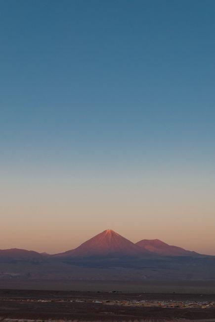
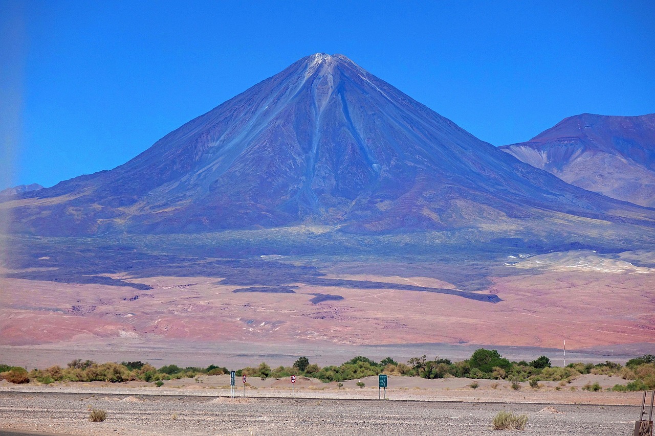
San Pedro de Atacama is a small oasis town of adobe houses and dusty streets at about 2,400 m (7,900 ft) in Chile’s far north, surrounded by one of the driest deserts on Earth and a horizon of snow-capped volcanoes. It is the base for some of South America’s most otherworldly landscapes: the wind-carved ridges and dunes of the Valle de la Luna, flamingos on the Salar de Atacama, turquoise lagoons at over 4,000 m (13,100 ft), the steaming El Tatio geysers at dawn, salt lagoons you can float in, hot springs in a canyon, and some of the clearest night skies in the world. The town belongs to the Lickanantay (Atacameño) people, whose communities co-manage many of the sites. Days are sunny and warm almost all year, nights are cold, and the altitude needs respect.
Right now in San Pedro de Atacama
- Tue 10–27°C 50–80°F Partly cloudy
- Wed 7–26°C 45–78°F Clear
- Thu 7–25°C 44–77°F Partly cloudy
- Mon 12 Oct Columbus Day (Día del Descubrimiento de Dos Mundos)
Weather: MET Norway (CC BY 4.0) · Holidays: Nager.Date
Top tours in San Pedro de Atacama
See all tours for San Pedro de Atacama →
From local operators, with prices and reviews; you check availability and book on Viator, our partner. We may earn a commission at no extra cost to you. How we earn money
San Pedro de Atacama at a glance
- Best for: desert and volcano landscapes, salt flats and high lagoons, geysers, stargazing, sandboarding and cycling, and the start or end of a trip to Bolivia’s salt flats.
- How long: 3–4 nights for the main sights; 5–6 to add the altiplano at an easier pace and some downtime.
- Best time: all year; spring (September to November) and fall (March to May) have the most comfortable temperatures. Summer storms over the Andes can close high roads in January and February, and winter nights drop below freezing.
- Getting there: fly from Santiago to Calama (about 2 hours), then a shuttle of about 100 km (62 miles) to San Pedro; buses from Calama, Antofagasta and Salta in Argentina.
- Altitude: the town is at about 2,400 m (7,900 ft), and many tours go above 4,000 m (13,100 ft); rest on arrival and see the Safety section below.
- Before you go: entry rules, money and general safety are in our Chile travel guide.
The town: where things are
San Pedro is compact and walkable. The leafy main square, with its whitewashed adobe church dating from the colonial era and ceiling beams of cactus wood, is the heart of town. Caracoles, the pedestrian main street, and the lanes around it are lined with tour agencies, restaurants, cafés and craft shops. Hostels and mid-range hotels are scattered through the center; the more spacious lodges and all-inclusive hotels sit in the ayllus, the farming hamlets and orchards on the edge of town, a short walk or bike ride away. Streets are unpaved and there is very little lighting at night, which is part of what makes the stargazing so good.
Top things to see around San Pedro
Most sights are reached on half-day or full-day tours from town, or by rental car or bike for the closer ones. Many sites in the Los Flamencos National Reserve are co-administered by CONAF and local Lickanantay communities, which sell their own entry tickets; prices change often, so check before you go and carry your passport.
Valle de la Luna (Valley of the Moon)
About 13 km (8 miles) west of town, the Valle de la Luna is a sector of the Los Flamencos National Reserve: salt-crusted ridges, sand dunes, caves and rock towers such as the Tres Marías, sculpted by wind and water in the Cordillera de la Sal. The classic visit ends at sunset, when the valley turns orange and pink beneath the volcanoes. According to CONAF’s official pass site, tickets for the Valle de la Luna must be bought online at least one day in advance from the community that runs it, and the sector was closed on the Tuesdays of October 2026 (6, 13, 20 and 27) from 9 a.m. to 7 p.m. You can visit by tour, car or bike; cycling there takes about an hour each way on a hot, dusty road.
Valle de Marte and the dunes
Next to the Valle de la Luna, the Valle de Marte (often called Valle de la Muerte) is a canyon of red rock and steep sand dunes, popular for sandboarding and for sunset views from the Piedra del Coyote lookout.
Salar de Atacama and Laguna Chaxa
Chile’s largest salt flat stretches south of town. At Laguna Chaxa, in the Soncor sector of the Los Flamencos reserve, about an hour away near the village of Toconao, Andean, Chilean and James’s flamingos feed in shallow pools. The site is run by the Toconao community; according to its official ticket page, it opens from 8 a.m. to 8 p.m., with the barrier closing at 7 p.m. Go at sunrise or sunset for the best light.
Lagunas Miscanti and Miñiques
Two deep-blue lagoons at over 4,000 m (13,100 ft) beneath the Miscanti and Miñiques volcanoes, about 2 hours south of town via Socaire. According to the CONAF pass site, entry is booked through the Socaire community’s site, SocaireChile.cl, with check-in in Socaire village. Tours often combine them with the Piedras Rojas (red rocks) by the Salar de Talar, and with Laguna Chaxa and Toconao on the way back.
El Tatio geysers
About 90 km (56 miles) north of town at roughly 4,300 m (14,100 ft), El Tatio is one of the largest geyser fields in the Southern Hemisphere, with dozens of fumaroles and geysers that are most active in the freezing hour around sunrise. Tours leave at about 4 or 5 a.m., and temperatures at the field are often well below freezing; some include a dip in a thermal pool and a stop at the village of Machuca on the way back. The site is managed by local indigenous communities, which charge an entry fee. Stay on the marked paths: the ground crust is thin and the water is boiling.
Laguna Cejar and the Ojos del Salar
Salt lagoons south of town where the water is so salty that you float effortlessly, with the volcanoes as a backdrop; the nearby Ojos del Salar are two freshwater pools in the desert floor. Bring water to rinse off the salt.
Stargazing
The Atacama’s altitude, dry air and lack of light pollution make it one of the best places on Earth to see the stars; the major international observatories, including ALMA on the Chajnantor plateau, are nearby. Astronomy tours with telescopes run most nights from town, except around the full moon, when faint objects fade; book a night near the new moon if you can.
More to see
- Pukará de Quitor: a 12th-century hilltop fortress of the Atacameño people, about 3 km (2 miles) north of town, with views over the oasis.
- Aldea de Tulor: the remains of a village of round mud houses about 2,500 years old, south-west of town; according to CONAF’s pass site, tickets are sold only on site.
- Termas de Puritama: natural hot pools in a canyon on the road to El Tatio, a good stop after the geysers.
- Toconao and the Valle de Jere: a village of volcanic stone with a separate bell tower, and a green gorge of fruit orchards.
Other things to do in San Pedro
Cycling, hiking and sandboarding
Bikes are rented all over town for the Valle de la Luna, the Pukará de Quitor and the Catarpe gorge; ride early to avoid the heat and the afternoon wind. Sandboarding on the dunes of the Valle de Marte is offered by several agencies. Experienced, acclimatized hikers can climb volcanoes such as Lascar or Cerro Toco with specialist guides. See our guides to cycling and hiking.
Food and drink
San Pedro’s restaurants mix Chilean and Andean cooking: quinoa, llama meat, goat cheese, sopaipillas and empanadas, with chañar and rica-rica (a desert herb) flavoring drinks, ice cream and pisco sours. Many restaurants offer a good-value set lunch, and evenings often bring a fire pit and live Andean music. Prices are higher than in the rest of the north, because most supplies come from Calama. Alcohol and altitude don’t mix well on your first nights.
Day trips and onward journeys
- Salar de Uyuni (Bolivia): three-day 4×4 tours cross the border at Hito Cajón, about 45 minutes east of town, to the lagoons and geysers of the Eduardo Avaroa reserve and the world’s largest salt flat. Bolivia has its own entry rules. See our Salar de Uyuni travel guide.
- Salta and Jujuy (Argentina): buses cross the Andes by the Jama pass, at about 4,200 m (13,800 ft), to Purmamarca and Salta, a long day’s ride. See our Salta travel guide.
- Calama and Chuquicamata: the mining city has the airport, and the vast open-pit copper mine of Chuquicamata nearby has been offered as a tour.
- Antofagasta and the coast: about 300 km (186 miles) south-west, the port city has the giant sea arch of La Portada and beaches.
Getting there and getting around
By air via Calama
The nearest airport is Calama’s El Loa airport (CJC), about 100 km (62 miles) and 1 hour 15 minutes to 1 hour 30 minutes from San Pedro by road. LATAM, Sky and JetSMART fly from Santiago in about 2 hours, and shared shuttles meet most flights and drop you at your hotel; book one ahead or at the desks in arrivals.
By bus
Buses run between Calama’s terminals and San Pedro many times a day, and there are direct buses from Antofagasta, Arica, Iquique, La Serena and Santiago, though the last is more than 20 hours. International buses connect San Pedro with Salta and Jujuy in Argentina over the Jama pass, usually a few times a week; the crossing can close in winter snow.
Getting around
Town is walkable, and most visitors use tours for the outlying sights. A rental car (from Calama) gives freedom for the Valle de la Luna, the lagoons and Toconao, but roads to El Tatio and some lagoons are rough gravel at very high altitude, there’s only one fuel station in town, and driving in the dark on desert roads is risky. Never leave valuables in a parked car at a viewpoint.
When to go and how long to stay
The Atacama is sunny almost every day of the year, with huge swings between hot days and cold nights. No official long-term normals are published for San Pedro itself, so the tables use the nearest station with official 1991–2020 normals, Calama airport, about 100 km (62 miles) away at a similar altitude, from Chile’s Meteorological Directorate via the World Meteorological Organization. On the high plateau, where the geysers and lagoons are, it is much colder.
| Season | Average high / low (Calama) | What it’s like |
|---|---|---|
| Summer (Dec–Feb) | 25 °C (77 °F) / 5–7 °C (41–45 °F) | Hot sun, the busiest season; the “altiplanic winter” brings afternoon storms to the mountains, which can close the geysers and lagoons for a day or two |
| Fall (Mar–May) | 24 °C falling to 22 °C (76 to 72 °F) / 6 °C falling to 2 °C (43 to 35 °F) | Settled and clear, pleasant days, cooling nights |
| Winter (Jun–Aug) | 21–22 °C (70–72 °F) / about 0 °C (31–33 °F) | Warm sun, freezing nights, very cold at the geysers; snow sometimes closes high roads |
| Spring (Sep–Nov) | 23 °C rising to 25 °C (74 to 77 °F) / 1 °C rising to 3 °C (34 to 38 °F) | Clear, dry and windy; excellent stargazing |
Calama receives only about 7 mm (0.3 in) of rain a year. The sun is intense at this altitude, and humidity can drop below 10%.
San Pedro de Atacama month by month
Average daily highs and lows and rainfall at Calama airport (DMC 1991–2020 normals, via the WMO).
| Month | High / low | Rain | What to expect |
|---|---|---|---|
| January | 25 °C (77 °F) / 7 °C (44 °F) | almost none | Hot days; summer holidays; altiplanic storms possible in the mountains |
| February | 25 °C (76 °F) / 7 °C (45 °F) | 1 mm (0.1 in) | Busy; storms in the high Andes may close roads to the geysers and lagoons |
| March | 24 °C (76 °F) / 6 °C (43 °F) | almost none | Settled weather returns; fewer crowds |
| April | 24 °C (74 °F) / 4 °C (39 °F) | almost none | Clear and calm; excellent month |
| May | 22 °C (72 °F) / 2 °C (35 °F) | 1 mm (0.1 in) | Cool nights; quiet season |
| June | 21 °C (71 °F) / 0 °C (33 °F) | almost none | Freezing nights; very cold at El Tatio |
| July | 21 °C (70 °F) / 0 °C (31 °F) | 1 mm (0.0 in) | Coldest nights; winter school holidays bring Chilean families |
| August | 22 °C (72 °F) / 0 °C (33 °F) | almost none | Cold mornings, warm sun; possible snow on high passes |
| September | 23 °C (74 °F) / 1 °C (34 °F) | almost none | Spring winds; wildflowers if there was rain |
| October | 24 °C (76 °F) / 2 °C (36 °F) | almost none | Clear skies; ideal for stargazing |
| November | 25 °C (77 °F) / 3 °C (38 °F) | almost none | Warm days, very dry |
| December | 25 °C (77 °F) / 5 °C (41 °F) | almost none | Summer begins; Christmas and New Year are busy |
Crowds and prices: busiest in January and February, July (winter holidays), Easter, Fiestas Patrias (mid-September) and the Christmas and New Year period; book hotels and tours ahead then. May, June and November are quiet. San Pedro uses mainland Chile time, UTC−4 in winter and UTC−3 in summer.
3 nights in San Pedro
Day one, settle in, walk around town and bike or tour to the Valle de la Luna for sunset. Day two, Laguna Chaxa, Toconao and the altiplanic lagoons of Miscanti and Miñiques with the Piedras Rojas; stargazing at night. Day three, the El Tatio geysers at dawn, Puritama hot springs on the way back, and Laguna Cejar in the late afternoon.
5 nights
Add a day with the Pukará de Quitor, the Aldea de Tulor and sandboarding, and keep a spare day for weather or rest at altitude, or continue on a three-day tour to Uyuni in Bolivia.
Where to stay
- Town center: hostels, guesthouses and small hotels around Caracoles and the square, close to restaurants and tour pickups.
- The ayllus: quieter adobe lodges, boutique hotels and all-inclusive resorts with pools, gardens and their own guided excursions, a short ride from town.
- Camping: a few campsites in and around town; nights are very cold.
Foreign tourists who pay for a hotel registered with Chile’s tax service in US dollars or with a card issued abroad don’t pay the 19% VAT (IVA) on the room; show your passport and entry record.
What a trip to San Pedro costs
These are our estimates for October 2026 at about CLP 985 per US dollar. Site entry fees, charged by the communities, are paid on top of most tours.
| Item | Typical price |
|---|---|
| Shuttle Calama airport–San Pedro, one way | CLP 15,000–25,000 (US$15–25) |
| Valle de la Luna sunset tour | CLP 20,000–35,000 (US$20–35) |
| Altiplanic lagoons and Piedras Rojas tour, full day | CLP 45,000–75,000 (US$45–75) |
| El Tatio geysers tour, early morning | CLP 40,000–65,000 (US$40–65) |
| Stargazing tour | CLP 30,000–50,000 (US$30–50) |
| Bike rental, per day | CLP 10,000–15,000 (US$10–15) |
| Hostel bed | CLP 15,000–30,000 (US$15–30) |
| Mid-range double room | CLP 90,000–180,000 (US$90–180) |
| Set lunch in town | CLP 10,000–15,000 (US$10–15) |
Safety and practical tips for San Pedro
Altitude
San Pedro sits at about 2,400 m (7,900 ft), and the geysers, lagoons and border passes are between about 4,000 and 4,500 m (13,100–14,800 ft). At these heights many people feel headaches, breathlessness, nausea or poor sleep. Spend a day or two in town before going high, drink plenty of water, go easy on alcohol, and take the geysers and lagoons later in your stay. Anyone with heart or lung conditions, pregnant travelers and families with small children should ask a doctor before booking high-altitude tours. Symptoms that worsen, such as confusion or severe breathlessness, mean going down at once and seeking medical help; the town has a small health center, and the nearest hospital is in Calama.
Sun, cold and dryness
The UV is extreme: wear high-factor sunscreen, a hat and sunglasses every day. Dawn at El Tatio can be −10 °C (14 °F) or colder, so bring a warm jacket, gloves and a hat even in summer. The air is very dry, so carry water and lip balm.
Other tips
- Cash: San Pedro has few ATMs, which sometimes run out at busy times; bring some pesos from Calama, though most agencies and restaurants take cards.
- Choose tours carefully: pick agencies registered with Sernatur, with oxygen and first-aid kits for high-altitude trips and vehicles in good condition.
- Respect the sites: stay on marked paths at the geysers and lagoons, don’t walk on the salt crust at flamingo areas, and take your trash with you.
- Theft: petty theft from hostels and unattended bags happens; use lockers.
- Emergencies: 133 for the police, 131 for an ambulance.
What to pack for San Pedro de Atacama
Pack for heat and frost on the same day: light clothes, a wide-brimmed hat, sunglasses and high-factor sunscreen for the day; a down jacket, fleece, warm hat and gloves for the geysers and the stargazing tours. Add sturdy shoes for dusty trails (see our guide to hiking shoes), swimwear for Laguna Cejar and the hot springs, a refillable water bottle, lip balm and moisturizer, a headlamp for the dark streets, and any altitude medication your doctor recommends. Chile uses 220 V with type C and L sockets.
San Pedro de Atacama travel FAQ
How high is San Pedro de Atacama?
About 2,400 m (7,900 ft). The El Tatio geysers are at about 4,300 m (14,100 ft) and the altiplanic lagoons above 4,000 m (13,100 ft), so plan a day or two to acclimatize before going higher.
How many days do I need in San Pedro de Atacama?
Three or four nights for the Valle de la Luna, the lagoons, the geysers and a stargazing tour; five or six for a more relaxed pace.
How do I get to San Pedro de Atacama?
Fly from Santiago to Calama, about 2 hours, then take a shuttle about 100 km (62 miles) to San Pedro, roughly 1 hour 15 minutes to 1 hour 30 minutes.
Do I need to book the Valle de la Luna in advance?
Yes. According to CONAF’s official pass site, tickets must be bought online at least one day ahead from the community that runs the sector. It closed on the Tuesdays of October 2026.
How cold is it at the El Tatio geysers?
Very cold. Tours arrive around sunrise, when temperatures at about 4,300 m (14,100 ft) are often well below freezing, even in summer.
When is the best time to visit San Pedro de Atacama?
Any time of year. Spring and fall have the most comfortable temperatures; January and February can bring storms in the mountains, and winter nights are freezing.
Can I go from San Pedro to Uyuni in Bolivia?
Yes. Three-day 4×4 tours cross the border at Hito Cajón and end in Uyuni, passing high lagoons and geysers. Check Bolivia’s entry rules first.
Is San Pedro de Atacama good for stargazing?
It’s one of the best places in the world, thanks to the altitude, dry air and dark skies. Book a telescope tour on a night near the new moon.
Can I swim in Laguna Cejar?
Yes, in the designated area, where the salty water lets you float easily. Bring water to rinse off and sunscreen.
Do I need cash in San Pedro de Atacama?
Bring some, as ATMs are few and can run out, but most agencies, hotels and restaurants accept cards.
Sources and last review
Researched and last reviewed on 4 October 2026. Valle de la Luna advance online tickets and October 2026 closures, ticket sales by the communities, Miscanti and Miñiques booking via SocaireChile.cl, and Tulor’s on-site sales: CONAF’s official pass site, Pases Parques; Laguna Chaxa hours: the Toconao community’s ticket site; Chile’s emergency numbers: chile.travel; exchange rate: the Central Bank of Chile; hotel VAT exemption: Decree-Law 825; climate: the Meteorological Directorate’s 1991–2020 normals for Calama airport, as published by the World Meteorological Organization. Altitudes, distances, flight and transfer times, the geysers’ management and early tour times, observatories, history of the sites, border crossings, restaurant notes, altitude advice and typical costs come from general references and are flagged for checking; costs are our estimates. Community entry fees change often, so check before you go. For entry rules and money, see our Chile travel guide.
Plan your trip
Partner links: TravelerCenter may earn a commission if you book, at no extra cost to you.
🇪🇸 Useful Spanish phrases for San Pedro de Atacama
All 38 Spanish phrases: restaurant, hotel, emergencies, romance (printable) →