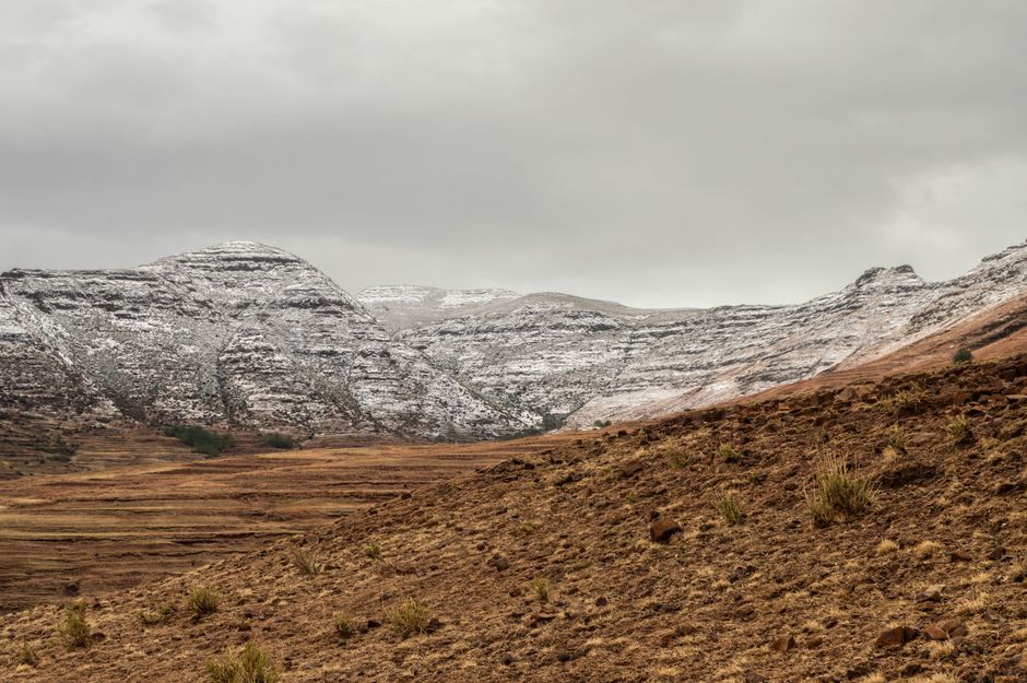
Lesotho is the “Kingdom in the Sky,” a small, high mountain country completely surrounded by South Africa. Almost all of it lies above 1,000 m, and its peaks climb to 3,482 m (11,424 ft) at Thabana Ntlenyana, the highest point in southern Africa. This is a land of sandstone cliffs and table mountains in the west and the wild, treeless Maloti range in the east, where villages of round stone huts cling to the slopes, shepherds wrap themselves in colorful woolen blankets and the conical Basotho hat, the national symbol, is still worn every day. Most visitors arrive overland from South Africa, through the capital, Maseru, on the Caledon River, or up the dramatic Sani Pass from KwaZulu-Natal. From there, the highlights are the mountain fortress of Thaba Bosiu, where King Moshoeshoe I founded the nation, the 190-meter Maletsunyane Falls at Semonkong, pony trekking from Malealea, the vast Katse Dam, dinosaur footprints, San rock art, and, in winter, skiing at Afriski. Visitors from the UK and the US can stay without a visa, according to their governments, and the loti is fixed one to one to the South African rand, which is accepted everywhere. Spring and autumn are the best seasons; summer is green and stormy, and winter is dry, sunny and freezing at night. Give it five days to a week.
Right now in Lesotho
- Sat13–26°C56–79°F11 mm rain
- Sun14–27°C58–81°FPartly cloudy
- Mon16–23°C61–74°F4 mm rain
Weather, sun and air quality here are for one point near the centre of Lesotho, not the whole country; conditions elsewhere can differ. Readings refresh through the day.
Lesotho: quick answers
- Best time to visit Lesotho
- Lesotho has a high-altitude, summer-rainfall climate. Summer (November to March) is warm and green, with most of the year’s rain falling in afternoon thunderstorms, often with lightning and hail. More
- Things to do in Lesotho
- Mountains, culture and adventure. More
- Entry rules for Lesotho
- Lesotho is entirely surrounded by South Africa, so every visitor also enters South Africa, by air or by road, and needs to meet South Africa’s entry rules as well, according to the UK government. More
Lesotho at a glance
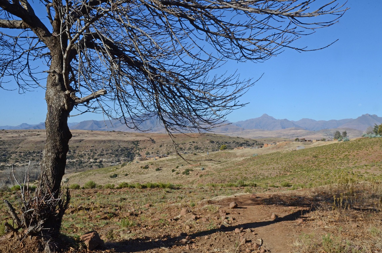
Lesotho covers 30,355 km² (11,720 sq miles), a little larger than Maryland or Belgium, and is one of only three countries in the world entirely surrounded by another. Its lowest point, where the Orange River leaves the country, is still about 1,400 m (4,600 ft) above sea level, the highest low point of any country. The western lowlands along the Caledon River hold the capital and most of the towns; the foothills rise into sandstone plateaus with caves and rock shelters; and the eastern highlands of the Maloti mountains, part of the same great basalt escarpment as South Africa’s Drakensberg, reach 3,000 m and more. The Orange River (Senqu) and many of southern Africa’s rivers rise here, and the Lesotho Highlands Water Project stores their water in large reservoirs such as Katse and Mohale. About two million people live in Lesotho; the people are the Basotho (one person is a Mosotho), and the language is Sesotho.
Sesotho and English are the official languages, according to the Government of Lesotho, and English is widely used in hotels, offices and shops. The country was united by King Moshoeshoe I in the 1820s, became the British protectorate of Basutoland in the 19th century, and gained independence on October 4, 1966. Lesotho is a constitutional monarchy, and most people are Christian. The time zone is South African Standard Time (UTC+2) all year, with no daylight saving time. Driving is on the left.
Lesotho’s regions
- Maseru and the western lowlands: the capital, the Maseru Bridge border crossing, Thaba Bosiu, the mission town of Morija with its museum, and the villages of Ha Kome with their cave houses.
- The south: Malealea and its pony trekking, the gorges of the Makhaleng River, Semonkong and the Maletsunyane Falls, Mohale’s Hoek and Quthing, with its dinosaur footprints and San rock art.
- The north and northeast: the border towns of Leribe and Butha-Buthe, Ts’ehlanyane National Park and the Liphofung cave, the high road over Moteng and Mahlasela passes to the Afriski ski resort and Mokhotlong.
- The central highlands: Katse Dam and the Bokong Nature Reserve, Thaba-Tseka, and the Mohale Dam, reached by spectacular mountain roads.
- The east: Sani Top at the head of the Sani Pass, Thabana Ntlenyana, and, far in the southeast near Qacha’s Nek, Sehlabathebe National Park.
Videos of Lesotho
Hand-picked travel videos from YouTube creators to help you picture the trip. They play from YouTube; the facts in this guide come from our own research.
Where to go: the capital, the mountains and the passes
Most first trips start in Maseru, then loop through the lowlands and foothills to Malealea and Semonkong, or cross the highlands from Maseru or the north to Katse and Sani Pass. Our Maseru guide has the details:
- Maseru: the capital and main gateway, with the Basotho Hat craft shop, markets and the day trip to Thaba Bosiu, the mountain fortress where the nation was born.
Maseru Travel Guide
Plan a visit to Maseru: the Basotho Hat craft shop, Kingsway and the cathedral, the 24-hour Maseru Bridge border crossing and Moshoeshoe I airport,…
Beyond Maseru
Thaba Bosiu and Morija
Just east of Maseru, Thaba Bosiu (“mountain at night”) is a flat-topped sandstone mountain that King Moshoeshoe I made his stronghold in the 1820s and that was never taken by attackers. A cultural village at its foot tells the story, and guides lead visitors up to the summit, with the ruins of the king’s settlement and the graves of the royal family. Southwest of the capital, the mission town of Morija has the country’s best museum and archives, with fossils, crafts and early photographs, and hosts the Morija Arts and Cultural Festival, which the Government of Lesotho names as the country’s showcase of Basotho culture.
Malealea and Semonkong
Malealea, a village at the end of a winding road about two hours south of Maseru, is famous for its lodge and its community-run pony trekking, from a few hours to several days across the mountains to villages, waterfalls and rock art. Further east, the small horseback town of Semonkong (“place of smoke”) sits above the Maletsunyane Falls, which drop about 190 m (620 ft) into a deep gorge, one of the highest single-drop waterfalls in southern Africa. In winter the spray can freeze into ice around the falls.
Katse Dam and the central highlands
The Katse Dam, one of the highest large dams in Africa, holds back a long, winding reservoir in the heart of the Maloti mountains. Its curved concrete wall and the mountain roads that lead to it, over passes well above 3,000 m, are a sight in themselves. Nearby, the Bokong Nature Reserve protects high alpine grassland and wetlands, with a short walk to the Lepaqoa waterfall, which freezes in winter.
Sani Pass and Sani Top
The Sani Pass climbs from the South African foothills near Underberg in a series of steep hairpins to the Lesotho border post at Sani Top, about 2,870 m (9,420 ft) up. The upper section on the South African side is a rough mountain road; the Government of Canada notes that you need a four-wheel-drive vehicle to enter or leave Lesotho by the Sani Pass, and most visitors go on a 4×4 tour from Underberg or Himeville. At the top, there’s a lodge with a famous high-altitude pub, Basotho villages and a long day’s hike toward Thabana Ntlenyana. See our Drakensberg guide for the South African side.
The north: Ts’ehlanyane, Liphofung and Afriski
In the northern foothills, Ts’ehlanyane National Park protects one of the country’s few patches of indigenous woodland, with rivers, hiking trails and a lodge. Liphofung is a large sandstone cave with San rock art and a small cultural center. The road continues over the high passes to Afriski, a ski resort at about 3,000 m that makes snow in winter and offers mountain biking and hiking in summer.
Sehlabathebe National Park
In the remote southeast, Sehlabathebe National Park is a high plateau of rock arches, pools and grassland, with hundreds of San rock painting sites. Since 2013, it has formed part of the Maloti-Drakensberg Park World Heritage site together with South Africa’s uKhahlamba-Drakensberg Park. The access roads are rough, so allow plenty of time.
Quthing and the dinosaur footprints
The sandstones of southern Lesotho preserve dinosaur footprints from about 200 million years ago, and several sites near Quthing and elsewhere let you see them by the roadside or with a local guide, along with San rock paintings in nearby shelters.
Best time to visit Lesotho
Lesotho has a high-altitude, summer-rainfall climate. Summer (November to March) is warm and green, with most of the year’s rain falling in afternoon thunderstorms, often with lightning and hail. Winter (June to August) is dry and sunny, with mild days in the lowlands and hard frosts every night; snow falls in the mountains and can close the high passes for a day or more. Spring (September and October) and autumn (April and May) are usually the best times for hiking and pony trekking, with clear skies and comfortable days. The table shows the official 1981–2010 averages from the Lesotho Meteorological Services, as published by the World Meteorological Organization.
| Area (weather station) | January high / low | July high / low | October high / low | Rain a year |
|---|---|---|---|---|
| Maseru and the lowlands (Mejametalana, Maseru) | 29 °C (84 °F) / 15 °C (59 °F) | 17 °C (62 °F) / −1 °C (31 °F) | 25 °C (77 °F) / 10 °C (50 °F) | about 640 mm (25 in), mostly October to March |
| Semonkong (about 2,200 m) | 23 °C (73 °F) / 9 °C (48 °F) | 12 °C (54 °F) / −5 °C (23 °F) | 19 °C (67 °F) / 4 °C (40 °F) | about 650 mm (26 in) |
| Mokhotlong and the east | 25 °C (77 °F) / 11 °C (52 °F) | 14 °C (58 °F) / −1 °C (30 °F) | 22 °C (71 °F) / 7 °C (45 °F) | about 595 mm (23 in) |
| Northern highlands (Oxbow, near Afriski) | 19 °C (65 °F) / 7 °C (45 °F) | 9 °C (49 °F) / −6 °C (20 °F) | 15 °C (60 °F) / 3 °C (38 °F) | about 1,130 mm (44 in) |
July is the driest month everywhere, with only one or two rainy days in Maseru; January has 12 or more. In the highlands, nights are below freezing for much of the year, and the weather can turn cold, wet and misty even in summer, so always carry warm layers.
Lesotho month by month
| Month | Weather | Highlights |
|---|---|---|
| January | Warm; frequent afternoon storms | Green hills; full rivers and waterfalls |
| February | Warm; rainy | Wildflowers in the highlands |
| March | Warm days; cooler nights | End of the rains; harvest begins |
| April | Clear and mild | Excellent hiking and pony trekking |
| May | Dry; cold nights | Golden grasslands; quiet roads |
| June | Dry, sunny, freezing nights | Ski season opens at Afriski |
| July | Coldest month; snow on the peaks | Skiing; frozen waterfalls at Semonkong and Bokong |
| August | Dry; windy | Ski season continues; clear mountain views |
| September | Warming; dry | Spring hiking; blossom in the lowlands |
| October | Warm; first storms | Independence Day (October 4); trekking season |
| November | Warm; rainy | Green landscapes return |
| December | Warm; stormy | Holiday season; busy border crossings |
Festivals worth planning around
The Morija Arts and Cultural Festival, held in Morija, is the best-known celebration of Basotho music, dance, crafts and food; check dates locally, as they vary. Independence Day on October 4 brings celebrations in Maseru. South African school holidays, especially in December and July, make the border crossings and Sani Pass busier.
How long to stay: sample itineraries
- 2–3 days: Maseru and Thaba Bosiu, with a day at Morija or Ha Kome; or a day trip up the Sani Pass from the Drakensberg.
- 5 days: Maseru and Thaba Bosiu (1 night), Malealea for pony trekking (2 nights), and Semonkong for the Maletsunyane Falls (2 nights).
- 7–10 days: Maseru, Malealea and Semonkong, then the mountain roads to Katse Dam and Bokong, and on through Thaba-Tseka or the north to Mokhotlong and down the Sani Pass into KwaZulu-Natal.
- Combining countries: Lesotho fits easily into a road trip through South Africa, between Johannesburg, the Drakensberg and Durban; see our South Africa, Johannesburg and Durban guides. Eswatini, on the other side of KwaZulu-Natal, makes a natural second small kingdom; see our Eswatini guide.
Entry, money and costs
Entry and visas (last reviewed November 2026)
Lesotho is entirely surrounded by South Africa, so every visitor also enters South Africa, by air or by road, and needs to meet South Africa’s entry rules as well, according to the UK government. Lesotho’s Ministry of Home Affairs says citizens of countries with visa abolition agreements with Lesotho, and of some Commonwealth countries, do not need a visa; everyone else must apply for one in advance.
- United Kingdom: visa-free for up to 90 days, according to GOV.UK; a 90-day extension is possible at the Visa Application Centre in the Manthabiseng Convention Centre in Maseru.
- United States: visa-free for holiday or business visits of up to 90 days, according to the US Department of Commerce’s guide to Lesotho.
- Canada: no tourist visa needed for short stays, according to the Government of Canada, which advises applying early to the Lesotho immigration authorities if you want to stay longer.
- Ireland: no visa needed for up to 44 days; Denmark, Finland, Iceland, Norway and Sweden: no visa for up to 14 days, according to Lesotho’s embassy in Ireland.
- Other nationalities: check with a Lesotho embassy or high commission before you travel. Lesotho’s online visa service was not available on the Ministry of Home Affairs website when we checked in November 2026.
Passports: the UK government says your passport must be valid for at least 90 days after you arrive and have at least four blank pages, because both Lesotho and South Africa stamp it each time you cross; the Government of Canada asks for six months beyond your departure date, which is the safer rule. Make sure your passport is stamped at every crossing. Travelers who come from a country with yellow fever may be asked for a vaccination certificate.
Customs
Lesotho is part of the Southern African Customs Union with South Africa, Botswana, Namibia and Eswatini. Declare cash of 25,000 maloti or more, in any currency, when you enter or leave, according to the UK government. Rental cars from South Africa can be brought into Lesotho with a letter of authorization from the rental company, so ask for one when you book.
Money and cards
The currency is the loti (plural maloti, LSL, written M), divided into 100 lisente. It is fixed one to one to the South African rand, and rand notes and coins are accepted throughout Lesotho, according to the UK government; maloti are hard to use or change outside the country, so spend them before you leave. Using the European Central Bank’s reference rates for November 10, 2026, US$1 was worth about 16.40 rand (or maloti), the rate used on this page. Cards are widely accepted in Maseru, and ATMs are found in the main towns, but take enough cash for anything outside the capital, from fuel and village guesthouses to pony treks and guides.
Tipping
Tipping is customary but modest. In restaurants, leave about 10% if service isn’t included. On pony treks and guided hikes, tip your guide and horse handlers at the end of the trip, and give fuel-station attendants a few maloti.
What a trip costs
These are typical ranges, as of November 2026, at about R16.40 to the US dollar; they are our estimates, not official prices.
| Item | Typical cost |
|---|---|
| Coffee in a Maseru café | M30–45 (about US$2–3) |
| Main course in a mid-range restaurant | M100–220 (about US$6–13) |
| Half-day pony trek from Malealea or Semonkong | M300–600 (about US$18–37) |
| Sani Pass 4×4 day tour from Underberg | R1,200–1,800 (about US$73–110) |
| Rental car from South Africa, per day | R500–900 (about US$30–55) |
| Mountain lodge or guesthouse, double, per night | M800–2,000 (about US$50–120) |
A budget trip with lodges, local food and self-driving costs about US$60–100 per person per day; a mid-range trip with good lodges, guides and activities about US$120–200.
Getting there and getting around
By road
Almost all visitors arrive by road from South Africa. The busiest crossing is Maseru Bridge, on the edge of the capital, about 140 km (90 miles) from Bloemfontein; South Africa’s Department of Home Affairs lists it, with Ficksburg in the north, as open 24 hours. Other crossings keep shorter hours: Caledonspoort (for Butha-Buthe and the north) and Van Rooyen’s Gate (for Mafeteng and the south) were listed at 06:00–22:00, Sani Pass at 06:00–18:00 and Peka Bridge at 08:00–16:00, in the department’s most recent published list (December 2022). Check current hours before you set off, especially for remote mountain crossings, and plan to reach them in daylight. Johannesburg is about five hours’ drive from Maseru; Durban is about the same to the foot of Sani Pass.
By air
Moshoeshoe I International Airport (MSU), south of Maseru, is the country’s only international airport, with short flights to Johannesburg, according to the US Department of Commerce. Services have been interrupted in the past, so check the current timetable with the airline before you book. Many visitors fly into Johannesburg (OR Tambo) or Bloemfontein instead and drive.
Driving in Lesotho
Driving is the best way to see Lesotho. The main roads between the lowland towns are paved, and good paved roads now cross the mountains to Katse, Thaba-Tseka, Mokhotlong and Sani Top, but they are steep, winding and high, with passes above 3,000 m. Many smaller roads are gravel or dirt, and some need a high-clearance or four-wheel-drive vehicle. Livestock and pedestrians are common on all roads, there are few fuel stations in the mountains, and snow and ice can close passes in winter, so fill up in every town, carry warm clothes and water, and drive in daylight. UK visitors can use their photocard driving license for up to three months, according to GOV.UK.
Public transport and tours
Shared minibus taxis link the towns and are how most Basotho travel, but they are crowded and don’t run to many sights. Tour operators in Maseru and South Africa, and the lodges at Malealea, Semonkong and Sani Top, arrange guided trips, transfers and treks.
Hiking, pony trekking and the outdoors
Lesotho is one of southern Africa’s great hiking countries, with almost no fences and footpaths linking villages across the mountains. The classic way to explore is on a sure-footed Basotho pony, with a local guide, on treks of a few hours to several days from Malealea, Semonkong or Ts’ehlanyane, staying in village huts. Popular hikes include the trail to the bottom of the Maletsunyane gorge, the walks around Sani Top and up Thabana Ntlenyana, the forest trails of Ts’ehlanyane and the rock-art routes of Sehlabathebe. In winter, Afriski offers skiing and snowboarding on a short run of slopes with snowmaking, and in summer, mountain biking and trail running. Fly-fishing for trout in the highland rivers and dams is another quiet pleasure. Hike with a local guide on remote routes, as paths are not marked and the weather changes quickly. See our hiking guide and cycling guide.
Culture, food and everyday etiquette
Basotho culture
The Basotho blanket, worn wrapped around the shoulders in bright patterns, and the woven grass mokorotlo hat, whose shape is said to echo the mountain Qiloane near Thaba Bosiu, are the symbols of the nation, and you’ll see both everywhere. A good place to buy a hat, baskets and weavings is the Basotho Hat building in Maseru, which the Government of Lesotho recommends for souvenirs. In the mountains, many villagers still travel on horseback, and herd boys spend months at cattle posts high on the slopes.
Food
The staple is papa, a stiff maize porridge, eaten with meat, beans or moroho (cooked greens), while the Government of Lesotho notes that villagers offer visitors the traditional sorghum porridge, motoho. Bread baked in three-legged pots, grilled mutton and local trout from the highland dams are also worth trying. Maloti Brewery’s beers are found everywhere, and in villages you may be offered home-brewed joala. Lodges and Maseru’s restaurants serve familiar international food.
Etiquette
- Greetings: greet people before asking for anything; “Lumela” (hello, to one person) or “Lumelang” (to several), and “Kea leboha” (thank you), are much appreciated.
- Photos: ask before photographing people, and expect herd boys to ask for sweets or a few coins; never photograph government buildings, the palace or police.
- Villages: on treks, ask your guide how to greet the chief and where to camp; dress modestly.
- Respect sacred sites: Thaba Bosiu and the royal graves are a place of national pride; follow your guide’s lead.
Health, safety and connectivity
- Altitude and cold: much of Lesotho is above 2,000 m, and the UK government lists altitude sickness as a risk in parts of the country. Go slowly for the first day in the mountains, drink plenty of water, and carry warm, waterproof layers in every season.
- Storms and snow: summer thunderstorms bring lightning and hail to the high ground; get off exposed ridges by early afternoon. Winter snow can close mountain roads at short notice.
- Roads: mountain roads are steep and winding, with animals on the road, so drive slowly and in daylight.
- Health care: facilities are basic, and the main hospitals are in Maseru; many visitors use private hospitals in Bloemfontein, about 90 minutes’ drive away. Take travel insurance that covers medical evacuation. Lesotho is free of malaria, according to its embassy in Ireland.
- Water: drink bottled, boiled or filtered water, especially in rural areas.
- Emergencies: call 112 for police, fire and ambulance.
Connectivity: Vodacom Lesotho and Econet Telecom Lesotho sell prepaid SIM cards in towns (bring your passport to register), and both run 4G and, in parts of the country, 5G networks, according to the US Department of Commerce. Coverage is good in the lowlands and along main roads but patchy in deep valleys and remote highlands. Sockets are the large South African three-round-pin type M, at 220 V; see our travel adapters guide.
Things to do: mountains, culture and adventure
- Pony trekking: from a half day to a week, with Basotho guides from Malealea, Semonkong and other villages.
- Hiking: Maletsunyane gorge, Sani Top, Thabana Ntlenyana, Ts’ehlanyane and Sehlabathebe. See our hiking guide.
- History and culture: Thaba Bosiu, the Morija Museum, the cave houses of Ha Kome, and San rock art at Liphofung and Sehlabathebe. See our city sightseeing guide.
- Scenic drives: the Sani Pass, the road to Katse Dam over Mafika Lisiu and Bokong passes, and the northern highlands road to Mokhotlong.
- Waterfalls: Maletsunyane Falls at Semonkong, Lepaqoa in Bokong and the Ketane Falls.
- Winter sports: skiing and snowboarding at Afriski, usually from about June to August.
- Mountain biking: trails at Afriski and long gravel routes through the foothills. See our cycling guide.
What to pack for Lesotho
Pack for four seasons in a day. Bring a warm fleece or down jacket, a hat and gloves for evenings and winter, a waterproof rain jacket for summer storms, sturdy hiking shoes, long trousers for pony trekking, sunglasses, a sun hat and high-factor sunscreen for the strong mountain sun, a headlamp, a water bottle with a filter, cash in rand or maloti, and an adapter for type M sockets. Keep your passport handy for every border crossing.
Lesotho travel FAQ
Do I need a visa for Lesotho?
Not if you hold a UK or US passport, for stays of up to 90 days, according to those governments. Canadians, Irish citizens and Nordic citizens also don’t need one for short stays. Other nationalities should check with a Lesotho embassy before travel.
How do I get to Lesotho?
Overland through South Africa, most often via the Maseru Bridge crossing, open 24 hours, or the Sani Pass from KwaZulu-Natal. There are short flights from Johannesburg to Maseru’s Moshoeshoe I airport; check the current timetable.
What currency is used in Lesotho?
The loti (maloti), fixed at par with the South African rand. Rand are accepted everywhere, about R16.40 to the US dollar in November 2026.
Do I need a 4×4 to visit Lesotho?
Not for the main paved roads to Maseru, Semonkong, Katse or Sani Top from the Lesotho side. You do need one for the South African side of the Sani Pass and for many gravel roads in the mountains.
What is the best time to visit Lesotho?
April–May and September–October for hiking and trekking. June to August is best for skiing but freezing at night; November to March is green but stormy.
Does it snow in Lesotho?
Yes. Snow falls in the highlands most winters, from about June to August, and occasionally at other times of year, closing high passes for short periods.
Is there malaria in Lesotho?
No. Lesotho is a malaria-free destination, according to its embassy in Ireland, though you may pass through malaria areas elsewhere in southern Africa.
How many days do I need in Lesotho?
Two or three days for Maseru, Thaba Bosiu and a taste of the mountains; five to seven days to add Malealea, Semonkong, Katse and Sani Pass.
What language is spoken in Lesotho?
Sesotho and English are both official. English is spoken in hotels and towns; a few words of Sesotho, such as “Lumela” (hello) and “Kea leboha” (thank you), go a long way.
What plugs are used in Lesotho?
The South African type M, with three large round pins, at 220 V.
What is the emergency number in Lesotho?
112, for police, fire and ambulance.
Can I combine Lesotho with South Africa and Eswatini?
Yes, easily by road: Lesotho sits between Johannesburg, the Drakensberg and Durban, and Eswatini is about a day’s drive away via KwaZulu-Natal or Mpumalanga.
What is the time difference in Lesotho?
Lesotho is on UTC+2 all year, the same as South Africa, with no daylight saving time.
Plugs and power in Lesotho
Lesotho uses 220 V, 50 Hz and these plugs (left) and wall sockets (right):
South African three-round-pin sockets; newer buildings may also have type N.
All plug types and voltages by country → · Check what you need to pack →
Plan your trip
Partner links: TravelerCenter may earn a commission if you book, at no extra cost to you.
Before you go: guidebooks and travel gear
Affiliate links: we may earn a commission at no extra cost to you. As an Amazon Associate we earn from qualifying purchases. We pick items for the place, not for the commission. How we earn money
Sources
Researched and last reviewed on November 10, 2026. Area, highest point, independence date, official languages, the Morija festival and the Basotho Hat building: Government of Lesotho (gov.ls); visa rules: Lesotho’s Ministry of Home Affairs, GOV.UK entry requirements (UK), the US Department of Commerce’s country guide (US), the Government of Canada (Canada) and Lesotho’s embassy in Ireland (Ireland and Nordic countries); currency peg, cash declaration, cards, emergency number, altitude risk, driving licenses and health care: GOV.UK; exchange rate: European Central Bank; climate: Lesotho Meteorological Services, via the World Meteorological Organization; border hours: South Africa’s Department of Home Affairs (December 2022 list); the 4×4 rule on Sani Pass and rental-car letters: Government of Canada; airport, mobile networks: US Department of Commerce; time zone: IANA time zone database. Geography, history, sight descriptions, heights, the World Heritage listing, food, tipping, plugs, travel times, prices and daily budgets are general references or our estimates, flagged for checking. Border hours, flights and rules change, so check the official sites before you go.
Data: Weather: MET Norway (CC BY 4.0) · Rates: ECB · Wikidata (CC0)