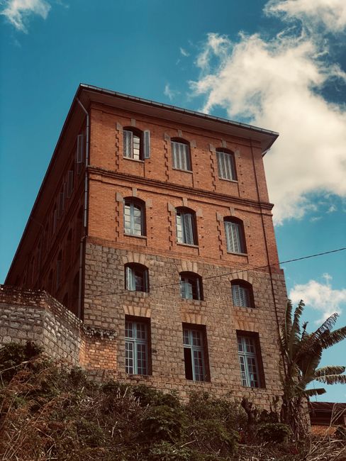
Madagascar is the fourth-largest island on Earth, a mini-continent about 1,600 km (1,000 miles) long, lying some 400 km (250 miles) off the southeast coast of Africa across the Mozambique Channel. Separated from other landmasses for around 88 million years, it evolved its own world of plants and animals: more than 100 kinds of lemurs, half the world’s chameleons, six of the eight species of baobab tree, and thousands of plants found nowhere else. Its landscapes are just as varied: misty rainforests on the eastern escarpment, rice terraces and red-earth villages on the central highlands, the knife-edged limestone pinnacles of the Tsingy, sandstone canyons at Isalo, spiny forest in the arid south, and the famous Avenue of the Baobabs at Morondava on the west coast. Around the coast, islands such as Nosy Be and Île Sainte-Marie offer beaches, diving and whale watching. Malagasy culture, a blend of Austronesian and African roots with French influence, is warm and rich in tradition. Travel here takes time and patience: distances are long, roads are often poor, and flights can change at short notice. Visitors need a tourist visa, available online through the official eVisa portal or on arrival. The dry season from April to November is the best time for most of the country.
Right now in Madagascar
- Wed 15–26°C 59–79°F 12 mm Heavy showers
- Thu 15–28°C 58–82°F 2 mm Light showers
- Fri 16–28°C 60–83°F Mostly clear
Weather: MET Norway (CC BY 4.0)
Multi-day tours of Madagascar
Multi-day tours from local operators. You check dates and book on Viator, our partner; we may earn a commission at no extra cost to you. How we earn money
Madagascar at a glance
Madagascar covers about 587,000 km² (227,000 sq miles), a little larger than France, and has about 32 million inhabitants. The capital, Antananarivo (“Tana”), spreads over hills at about 1,300 m (4,300 ft) on the central highlands. The island was settled by seafarers from Borneo more than a thousand years ago, later joined by people from East Africa and Arabia, and the Merina kingdom unified much of it in the 19th century before France colonized it in 1896. Madagascar became independent in 1960.
The official languages are Malagasy, spoken by everyone, and French, widely used in business, hotels and signs; English is spoken in tourism but less widely. Madagascar Time is UTC+3, with no daylight saving time. The currency is the ariary (MGA). Electricity is 220 V with European two-pin sockets (types C and E), and traffic drives on the right.
Regions of Madagascar
- The central highlands: Antananarivo, the royal hill of Ambohimanga, the thermal town of Antsirabe, Ambositra’s woodcarvers and Fianarantsoa, with rice terraces, vineyards and red-brick villages.
- The east: rainforest parks such as Andasibe-Mantadia, home of the indri, and Ranomafana, the port of Toamasina, the Pangalanes canal and Île Sainte-Marie.
- The north: Antsiranana (Diego Suarez) and its bay, Montagne d’Ambre, the Tsingy of Ankarana, and the beach island of Nosy Be with its archipelago.
- The west: Morondava and the Avenue of the Baobabs, Kirindy Forest, the Tsiribihina River and the Tsingy de Bemaraha World Heritage Site.
- The south: the sandstone massif of Isalo, the spiny forest and beaches around Toliara (Tuléar), Ifaty and Anakao, and Taolagnaro (Fort Dauphin) in the southeast.
Where to go: lemurs, baobabs and beaches
Most trips concentrate on one or two regions, because getting around takes time. See our guides:
- Nosy Be: Madagascar’s main beach island in the northwest, with Lokobe National Park, ylang-ylang plantations, diving and boat trips to Nosy Komba, Nosy Tanikely and Nosy Iranja, plus whale sharks in season.
- Morondava: the west-coast town that is the gateway to the Avenue of the Baobabs, Kirindy Forest and the Tsingy de Bemaraha.
Other highlights include Andasibe-Mantadia National Park, a few hours east of Antananarivo, where the eerie wail of the indri, the largest lemur, carries through the rainforest; the Route Nationale 7 (RN7) south from Tana through Antsirabe, Ranomafana, Isalo and the spiny forest to the beaches of Ifaty; the Tsingy de Bemaraha, a UNESCO World Heritage Site of razor-sharp limestone pinnacles with rope bridges and ladders; Île Sainte-Marie off the east coast, for humpback whale watching from about July to September; and Ankarana and Montagne d’Ambre in the north.
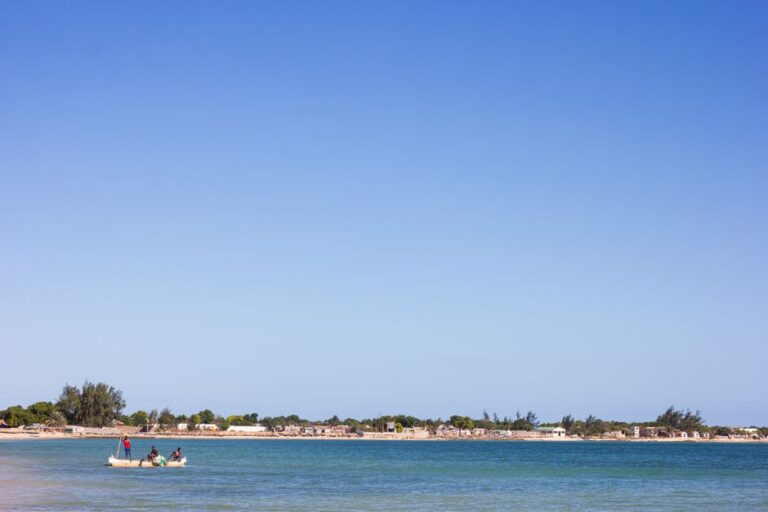
Morondava Travel Guide
Plan a trip to Morondava, Madagascar: the Avenue of the Baobabs at sunset and sunrise, the Baobabs Amoureux, Kirindy Forest and the fossa, the…
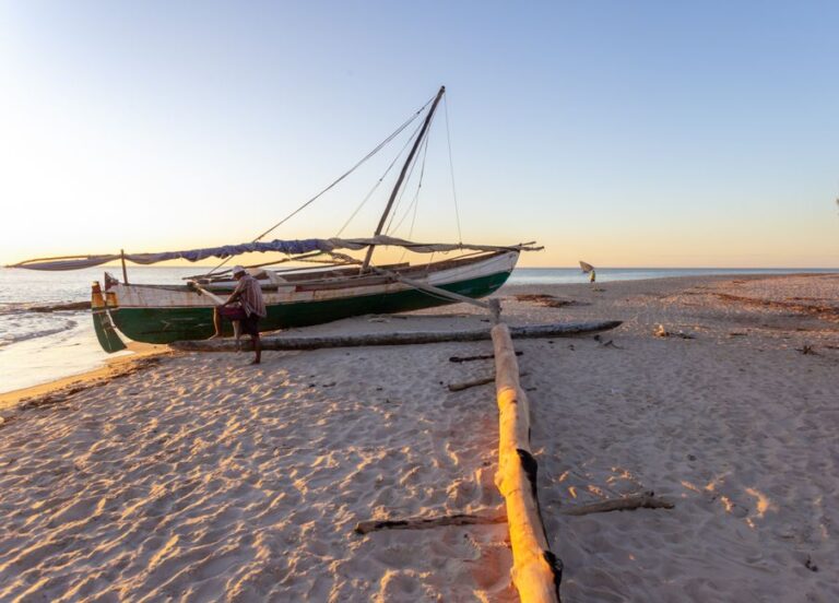
Nosy Be Travel Guide
Plan a trip to Nosy Be, Madagascar: Lokobe National Park, Nosy Komba, Nosy Tanikely and Nosy Iranja, Andilana and Ambatoloaka beaches, whale sharks and…
Antananarivo
Most trips begin and end in the capital, a city of steep hills, stairways and red-brick houses around rice paddies and Lake Anosy, where jacarandas bloom purple in October. The Rova, the former royal palace complex on the highest hill, has been restored after a fire in 1995 and looks out over the whole city. The Andohalo and Haute-Ville districts have colonial houses and churches; the Lemurs’ Park, about 45 minutes west, shelters rescued lemurs; and the craft market at La Digue (not to be confused with the Seychelles island), on the road to the airport, is the best place to buy embroidery, raffia, woodcarvings and semiprecious stones. About 20 km (12 miles) north, the Royal Hill of Ambohimanga, a UNESCO World Heritage Site, was the sacred seat of the Merina kings. Traffic is heavy, so plan time for transfers.
The RN7: highlands to the southwest coast
Madagascar’s classic road trip follows the Route Nationale 7 south from Antananarivo for about 950 km (590 miles) to Toliara. It passes Antsirabe, a spa town of colorful pousse-pousse rickshaws; Ambositra, the center of Zafimaniry woodcarving; the rainforest of Ranomafana National Park; Fianarantsoa, with its old upper town and nearby vineyards and tea plantations; the community reserve of Anja, with ring-tailed lemurs among granite boulders; the grassy plains of the Horombe plateau; and Isalo National Park, where canyons, natural swimming pools and sandstone ridges make excellent hiking. The road ends at Toliara, near the beach villages of Ifaty and Anakao and the spiny forest. Allow at least 10 days to travel it without rushing, and fly back to the capital.
Île Sainte-Marie and the east coast
Île Sainte-Marie (Nosy Boraha), a long, narrow island off the east coast, is the best place in Madagascar to watch humpback whales, which come to its sheltered channel to breed and give birth from about July to September. It also has palm-fringed beaches, a pirate cemetery and a relaxed island pace. It is reached by flight from Antananarivo or by boat from the mainland coast north of Toamasina. Nearby, the Pangalanes Canal links lagoons and rivers along the coast, and the parks of Masoala and Nosy Mangabe protect some of the island’s wildest rainforest.
The far north
Antsiranana (Diego Suarez) lies on one of the world’s largest natural bays, with the Emerald Sea lagoon, the Three Bays coast walk and colonial architecture. Nearby, Montagne d’Ambre National Park has cloud forest, waterfalls and tiny chameleons, and the Ankarana Special Reserve has gray tsingy, caves, canyons and crowned lemurs; the Red Tsingy are eroded laterite pinnacles. The north combines well with Nosy Be.
Where to stay
Accommodation ranges from simple bungalows and family-run hotels to comfortable lodges near national parks and a handful of luxury beach resorts and private islands, mainly around Nosy Be. In Antananarivo, good hotels are found in the city center and near Ivato Airport, convenient for early flights. Lodges near popular parks, such as Andasibe, Ranomafana and Isalo, are often booked well ahead in the high season from July to November. In remote areas, expect basic rooms, cold water, irregular electricity from generators and limited Wi-Fi. Many travelers book a package with a local tour operator that includes a car, a driver-guide and accommodation along the route.
Best time to visit Madagascar
Madagascar’s climate varies widely from region to region, but most of the country has a dry season from about April to November and a wet season from about December to March, when heavy rain, heat and humidity make many unpaved roads impassable and tropical cyclones can strike, especially in the east and north. The east coast is wet all year. The highlands are mild, with cool, dry winters from June to August, when nights in Antananarivo drop to about 10 °C (50 °F) and can be colder in the mountains. The west and south are hot and dry, with little rain outside the summer months.
The table shows the 1991–2020 climate normals for Antananarivo, published by the national weather service, Météo Madagascar, through the World Meteorological Organization (WMO).
| Month | Average high | Average low | Rain | Rain days (≥1 mm) |
|---|---|---|---|---|
| Jan | 26 °C (80 °F) | 17 °C (63 °F) | 312 mm (12.3 in) | 16.8 |
| Feb | 26 °C (79 °F) | 18 °C (64 °F) | 237 mm (9.3 in) | 14.3 |
| Mar | 26 °C (79 °F) | 17 °C (63 °F) | 156 mm (6.1 in) | 11 |
| Apr | 26 °C (78 °F) | 16 °C (61 °F) | 45 mm (1.8 in) | 4.4 |
| May | 24 °C (74 °F) | 14 °C (57 °F) | 15 mm (0.6 in) | 2 |
| Jun | 21 °C (70 °F) | 12 °C (53 °F) | 6 mm (0.2 in) | 1.4 |
| Jul | 20 °C (69 °F) | 11 °C (51 °F) | 6 mm (0.2 in) | 0.9 |
| Aug | 22 °C (71 °F) | 11 °C (52 °F) | 5 mm (0.2 in) | 1.1 |
| Sep | 24 °C (75 °F) | 12 °C (54 °F) | 8 mm (0.3 in) | 1 |
| Oct | 26 °C (79 °F) | 14 °C (58 °F) | 39 mm (1.5 in) | 4.3 |
| Nov | 27 °C (81 °F) | 16 °C (61 °F) | 117 mm (4.6 in) | 9 |
| Dec | 27 °C (81 °F) | 17 °C (63 °F) | 226 mm (8.9 in) | 13.6 |
| Year | 25 °C (76 °F) | 15 °C (58 °F) | 1,171 mm (46.1 in) | 80 |
Regional climate at a glance
| Region (station) | Hottest months, high / low | Coolest months, high / low | Rain a year | Wettest months |
|---|---|---|---|---|
| Highlands: Antananarivo | 27 °C (81 °F) / 17 °C (63 °F) in Nov–Feb | 20 °C (68 °F) / 11 °C (52 °F) in Jul | about 1,170 mm (46 in) | December to February |
| Northwest: Nosy Be | 32 °C (90 °F) / 24 °C (75 °F) in Mar–Apr | 30 °C (86 °F) / 20 °C (67 °F) in Jul | about 1,730 mm (68 in) | December to March |
| North: Antsiranana | 32 °C (90 °F) / 23 °C (74 °F) in Nov–Dec | 29 °C (84 °F) / 20 °C (67 °F) in Jul | about 940 mm (37 in) | December to March |
| East coast: Toamasina | 31 °C (88 °F) / 23 °C (74 °F) in Jan–Feb | 25 °C (77 °F) / 17 °C (63 °F) in Jul–Aug | about 3,200 mm (126 in) | January to March, wet all year |
| West: Morondava | 32 °C (90 °F) / 24 °C (75 °F) in Dec–Mar | 29 °C (84 °F) / 16 °C (61 °F) in Jul | about 710 mm (28 in) | December to February |
| Southwest: Toliara | 33 °C (91 °F) / 24 °C (75 °F) in Jan–Feb | 28 °C (82 °F) / 15 °C (59 °F) in Jul | about 360 mm (14 in) | January to February |
Figures are Météo Madagascar’s 1991–2020 normals via the WMO, rounded.
Madagascar month by month
| Month | Weather | Highlights | Travel conditions |
|---|---|---|---|
| January | Wet season; heavy rain; cyclone risk | Lush landscapes; frogs and reptiles active | Many unpaved roads impassable; some lodges close |
| February | Wettest and stormiest month in many regions | Lemur babies in some species | Difficult travel; western routes closed |
| March | Rain easing in the south and west | Green scenery | Some roads still closed |
| April | Start of the dry season | Rice harvest on the highlands | Good value; roads reopening |
| May | Dry and pleasant | Fewer visitors; good wildlife | Good |
| June | Dry; cool on the highlands | Independence Day (June 26) | Good; busy around the holiday |
| July | Cool, dry winter | Humpback whales off Sainte-Marie; famadihana ceremonies on the highlands | High season begins |
| August | Dry, sunny | Whales; lemurs active; European holidays | Peak season; book early |
| September | Dry and warming | Excellent wildlife; jacaranda blossom in Tana late in the month | High season |
| October | Warm and dry | Lemur babies; baobabs in leaf; whale sharks off Nosy Be | Excellent; one of the best months |
| November | Hot; first rains late in the month | Whale sharks off Nosy Be; flowering forests | Good, but rains may start |
| December | Rainy season begins; hot | Christmas | Roads deteriorate; Nosy Be still popular |
Holidays and festivals
Independence Day (June 26) is the biggest national celebration, with parades and fireworks. On the highlands, families hold famadihana, the “turning of the bones” ceremony, in which the remains of ancestors are rewrapped in new shrouds amid music and feasting, mainly from about July to September; visitors may be invited, but only attend with an invitation and a local guide. The Donia music festival on Nosy Be and the Santabary rice harvest festivals are other events. Christian holidays are widely observed.
How long to stay: sample itineraries
- 10 days: Antananarivo, Andasibe-Mantadia for the indri, then a flight to Morondava for the Avenue of the Baobabs and Kirindy Forest, ending with a few days on Nosy Be.
- 2 weeks: drive the RN7 from Antananarivo through Antsirabe, Ranomafana and Isalo to the beaches of Ifaty, then fly back to the capital.
- 3 weeks: combine the RN7 with the west (Morondava, Kirindy and the Tsingy de Bemaraha, in the dry season only), or with the north (Antsiranana, Ankarana and Nosy Be).
- Beach and wildlife: a week on Nosy Be with day trips to Lokobe and the islands, plus Ankarana or Montagne d’Ambre.
Entry, money and costs
Visas and the eVisa (last reviewed October 2026)
All visitors to Madagascar need a tourist visa. According to the official eVisa Madagascar portal (evisamada.gov.mg, which redirects to the government’s eService of Tourism, Immigration and Emigration), all nationalities are eligible for the eVisa, which can be applied for online in three steps (create an account, pay by card, download an electronic travel authorization) and is issued no later than 72 hours after your registration is validated. Print it or keep it on your phone for the border police. The portal lists these fees:
| Length of stay | Fee in US dollars | Fee in euros |
|---|---|---|
| 1 to 15 days | US$35 | €30 |
| 16 to 30 days | US$41 | €35 |
| 31 to 60 days | US$47 | €40 |
| 61 to 90 days | US$59 | €50 |
According to the portal, the online visa costs the same as a visa bought on arrival, which is also available at eVisa counters at the airport, and you can apply between one week and six months before departure. The tourist eVisa is single entry. The portal warns that evisamada.gov.mg is the only official site; other sites charge extra. Your passport should be valid for at least six months after arrival, with at least two blank pages, and you should be ready to show an onward or return ticket. A yellow fever vaccination certificate is required if you arrive from, or have transited for more than 12 hours through, a country with a risk of yellow fever transmission.
Money and cards
The ariary (MGA, Ar) traded at roughly Ar 4,500 to the US dollar and Ar 5,200 to the euro in early October 2026 (approximate rates; check with your bank). Madagascar is largely a cash economy: bring euros or US dollars in clean, recent notes to exchange at banks and exchange offices, or withdraw ariary from ATMs, which are found in Antananarivo, regional towns and Nosy Be but not in rural areas. Visa is more widely accepted than Mastercard at ATMs. Credit cards are accepted in better hotels and some restaurants, often with a surcharge. National park fees are paid in ariary. Carry small notes, as change is often short.
Tipping
Tipping is customary for guides, drivers and porters: national park guides and driver-guides on multi-day tours expect a tip at the end, and a small tip in restaurants is appreciated.
What a trip costs
Madagascar can be cheap for local food and transport but expensive for organized travel, because of the cost of vehicles, drivers, fuel and domestic flights. Prices are approximate for October 2026, converted at about Ar 4,500 per US dollar.
| Item | Ariary | About US dollars |
|---|---|---|
| eVisa, up to 30 days | — | US$41 (€35) |
| Basic hotel double | Ar 70,000–150,000 | US$15–35 |
| Mid-range hotel or lodge double | Ar 180,000–450,000 | US$40–100 |
| Comfortable beach resort on Nosy Be, double | Ar 450,000–1,350,000 | US$100–300 |
| Car with driver-guide, per day (plus fuel) | Ar 270,000–450,000 | US$60–100 |
| National park entry permit, one day | Ar 45,000–100,000 | US$10–22 |
| Local park guide, half day | Ar 50,000–150,000 | US$11–33 |
| Domestic flight, one way | Ar 900,000–1,800,000 | US$200–400 |
| Meal in a local hotely (rice and zebu) | Ar 8,000–20,000 | US$2–4 |
| Main course in a tourist restaurant | Ar 30,000–60,000 | US$7–13 |
| THB beer (65 cl) | Ar 5,000–8,000 | about US$1–2 |
A couple on a mid-range tour with a driver-guide typically spends US$200–350 a day including lodging, meals, park fees and transport, plus domestic flights.
Getting there and getting around
Flights
Most international flights land at Ivato International Airport (TNR), about 15 km (9 miles) north of central Antananarivo; traffic into the city can be very slow. Airlines link Antananarivo with Paris, Réunion, Mauritius, Johannesburg, Nairobi, Addis Ababa, Istanbul and the Comoros. Fascene Airport (NOS) on Nosy Be also has international flights, including from Addis Ababa, Réunion and seasonal charters from Europe. There are no direct flights from North America.
Domestic flights
The national carrier, Madagascar Airlines, flies from Antananarivo to regional airports such as Nosy Be, Antsiranana, Morondava, Toliara, Taolagnaro, Mahajanga and Île Sainte-Marie. Schedules change often, and flights are sometimes delayed, rescheduled or canceled at short notice, so reconfirm, leave a spare day before international departures, and avoid tight connections.
Roads and driving
Distances are long and many roads are in poor condition, so journeys take much longer than the distance suggests: the RN7 from Antananarivo to Toliara, about 950 km (590 miles), takes three to four days with stops. Most visitors hire a car with a driver-guide through a local agency, which is safer and less stressful than self-driving. Many secondary roads are unpaved and become impassable in the rainy season, especially in the west. Avoid traveling by road after dark: roads are unlit, and vehicles, cattle and pedestrians are hard to see. Taxi-brousses (bush taxis), minibuses that connect towns, are cheap but crowded, slow and involved in many accidents; private transport is a safer choice.
Boats and island hopping
Boats link Nosy Be with its surrounding islands and with Ankify on the mainland, and ferries cross to Île Sainte-Marie from the east coast. Boats can be overcrowded and poorly equipped, and squalls arise quickly: choose reputable operators, check the weather, wear a life jacket, and avoid crossings in rough seas.
National parks and wildlife
Madagascar’s protected areas, most of them run by Madagascar National Parks, protect lemurs, chameleons, birds and plants found nowhere else. Visitors buy an entry permit at the park office and must be accompanied by a licensed local guide, whose fee is separate. Highlights include:
- Andasibe-Mantadia: rainforest with the indri, sifakas and night walks for chameleons and frogs.
- Ranomafana: misty rainforest on the RN7, with the golden bamboo lemur.
- Isalo: sandstone canyons, natural pools and ring-tailed lemurs.
- Tsingy de Bemaraha: a UNESCO World Heritage Site of limestone pinnacles, reached from Morondava in the dry season only.
- Kirindy Forest: dry forest north of Morondava with the fossa and the giant jumping rat.
- Lokobe: a small rainforest park on Nosy Be, reached by boat.
- Ankarana and Montagne d’Ambre: tsingy, caves and cloud forest in the north.
Never feed or touch lemurs, keep your distance from wildlife, and do not buy products made from protected species, including tortoises, which are illegal to export.
See our hiking, beaches, diving, snorkeling and boat trips guides.
The Avenue of the Baobabs
About 15–20 km (10–12 miles) north of Morondava, the dirt road to Belo-sur-Tsiribihina passes between two rows of giant Grandidier’s baobabs, some about 30 m (100 ft) tall and many hundreds of years old. The site is a protected natural monument, managed with the local communities, and its sunsets and sunrises draw visitors from all over the world; according to the national tourism office, it recorded 47,686 visitors between January and October 2024. Small fees are collected locally for access and parking. See our Morondava guide.
Beaches, diving and whale watching
Madagascar has around 5,000 km (3,100 miles) of coastline, much of it remote. The best-known beach areas are Nosy Be and its islands in the northwest, with calm water, coral reefs and dive sites such as Nosy Tanikely Marine Park; Ifaty and Anakao in the southwest, on one of the largest coral reef systems in the Indian Ocean; the bays around Antsiranana; and Île Sainte-Marie in the east. Humpback whales migrate along the coasts from about July to October, with the best sightings off Sainte-Marie and in the north; whale sharks are often seen off Nosy Be from about October to December. Choose operators that keep their distance from whales and whale sharks and limit the number of swimmers in the water. Sharks are present off parts of the east coast, so swim only where locals do and in protected lagoons.
Accessibility
Travel in Madagascar is difficult for people with limited mobility: sidewalks are uneven or absent, few buildings have ramps or elevators, national park trails are steep and muddy, and boat transfers often involve wading ashore. A private car with a driver and lodges chosen for step-free rooms make a trip more manageable; discuss your needs with a specialist tour operator.
Responsible travel
Deforestation and poverty are the greatest threats to Madagascar’s wildlife. Choose local guides and community-run lodges, pay park fees, which support conservation and local villages, and avoid charcoal-fueled businesses where possible. Respect fady, local taboos that vary from place to place, such as not pointing at tombs or not bringing pork to certain sites; your guide will explain them. Ask before photographing people.
Food and drink
Malagasy meals are built around rice (vary), eaten three times a day, with a side dish (laoka). Try romazava, a beef and leafy green stew; ravitoto, pounded cassava leaves with pork; zebu steaks and skewers; akoho sy voanio, chicken in coconut milk, on the coast; mofo gasy, small rice-flour cakes eaten at breakfast; and koba, a sweet of peanuts, rice and banana wrapped in leaves. Seafood is excellent on the coasts, especially on Nosy Be. Drink THB (Three Horses Beer), rhum arrangé (rum infused with fruit and spices) and local vanilla-scented coffee. Simple local restaurants are called hotely. Do not drink tap water; use bottled or treated water, and eat freshly cooked food.
Culture and etiquette
Malagasy people are courteous and gentle. Greet people with a “salama” or “manao ahoana,” dress modestly away from the beach, and take your time; directness and raised voices are considered rude. Ancestors play a central role in life, and tombs are sacred. Fady (taboos) differ between regions and villages, so follow your guide’s lead. Bargaining is normal in markets, but keep it friendly.
Safety, health and connectivity
These are the main practical points:
- Malaria: according to the US Centers for Disease Control and Prevention (CDC), malaria occurs in all areas except the city of Antananarivo, where transmission is rare; CDC recommends prescription antimalarial medicine for travel outside the capital, plus insect bite precautions everywhere. Talk to a doctor before you go.
- Other health risks: plague occurs in some areas, mainly the highlands; avoid contact with rodents and fleas. Drink only bottled or treated water, and avoid swimming in fresh water, which may carry schistosomiasis or leptospirosis. Medical facilities outside Antananarivo are limited; have insurance that covers evacuation.
- Road safety: road accidents are a major risk. Use a reputable driver, avoid road travel at night and wear seat belts where fitted.
- Cyclones (November to April): most likely from January to March, especially in the north and east; storms can cut roads and contaminate water supplies. Follow Météo Madagascar.
- Crime: pickpocketing and bag snatching occur in Antananarivo and other towns, and robberies have occurred on isolated beaches and roads; use hotel transport after dark, keep valuables out of sight, and ask your guide or hotel about local conditions before visiting remote beaches.
- Demonstrations: protests take place at times, mainly in Antananarivo, and can lead to road closures and, at times, temporary curfews; avoid gatherings and check local news before and during your trip.
- Emergencies: call 117 for police and 118 for fire; for medical emergencies, contact your hotel or tour operator and your insurer.
Mobile networks (Telma, Orange and Airtel) cover towns and main roads, with patchy coverage in rural areas; buy a local SIM card in Antananarivo or at the airport. Wi-Fi is common in hotels in towns but slow or absent in remote lodges.
Madagascar travel FAQ
Do I need a visa for Madagascar?
Yes. All visitors need a tourist visa, available online through the official eVisa portal (evisamada.gov.mg) or on arrival at the airport’s eVisa counters, at the same price.
How much does a Madagascar visa cost?
According to the official eVisa portal, US$35 (€30) for up to 15 days, US$41 (€35) for 16–30 days, US$47 (€40) for 31–60 days and US$59 (€50) for 61–90 days.
What is the best time to visit Madagascar?
The dry season from April to November; September to November is excellent for wildlife. December to March is the rainy and cyclone season.
Do I need malaria tablets for Madagascar?
The CDC recommends antimalarial medicine for all areas except the city of Antananarivo. Ask a doctor before you travel.
How do I get to the Avenue of the Baobabs?
Fly or drive to Morondava on the west coast; the avenue is about 15–20 km (10–12 miles) north, along the road to Belo-sur-Tsiribihina, about 30–45 minutes by car.
Can I drive myself in Madagascar?
It is possible but not recommended. Roads are often poor, distances long and night driving dangerous; most visitors hire a car with a driver-guide.
Where can I see lemurs in Madagascar?
In national parks such as Andasibe-Mantadia, Ranomafana, Isalo, Kirindy and Lokobe on Nosy Be, always with a licensed local guide.
Is Nosy Be worth visiting?
Yes, for beaches, diving, boat trips to nearby islands and an easy introduction to Madagascar’s wildlife at Lokobe.
What currency is used in Madagascar?
The ariary. Bring euros or US dollars to exchange, or use ATMs in towns; cards are only accepted in better hotels.
How many days do you need in Madagascar?
At least two weeks to see two regions without rushing; distances are long and domestic flights can change at short notice.
Is the tap water safe in Madagascar?
No. Drink bottled or treated water and avoid ice in local restaurants.
Can I visit the Tsingy de Bemaraha all year?
No. Access by road from Morondava is usually only possible in the dry season, roughly April or May to November; the park’s tracks close in the rainy season.
What language is spoken in Madagascar?
Malagasy and French are the official languages. English is spoken by many guides and in tourist hotels.
Sources and last review
Researched and last reviewed on 5 October 2026. eVisa eligibility, steps, fees by length of stay, visa on arrival at the same price and the official portal: eVisa Madagascar (evisamada.gov.mg); malaria areas, recommended medicine and yellow fever entry rules: the US Centers for Disease Control and Prevention; climate: Météo Madagascar’s 1991–2020 normals for Antananarivo, Nosy Be, Antsiranana, Toamasina, Morondava and Toliara, via the World Meteorological Organization (archived by NOAA’s National Centers for Environmental Information); the Tsingy de Bemaraha and Lokobe: Madagascar National Parks; Avenue of the Baobabs visitor numbers: the Madagascar National Tourism Office; passport validity, cyclone season, road, boat, beach and demonstration conditions: the UK government’s travel pages (factual content only); area and population: Wikidata. The exchange rate, park fees, domestic flight routes, festivals, emergency numbers and all typical prices are general references or estimates, flagged for checking. Rules change, so check the official sites before you go.
Plugs and power in Madagascar
Madagascar uses 220 V, 50 Hz and these plugs (left) and wall sockets (right):
All plug types and voltages by country → · Check what you need to pack →
Plan your trip
Partner links: TravelerCenter may earn a commission if you book, at no extra cost to you.
🇫🇷 Useful French phrases for Madagascar
All 38 French phrases: restaurant, hotel, emergencies, romance (printable) →