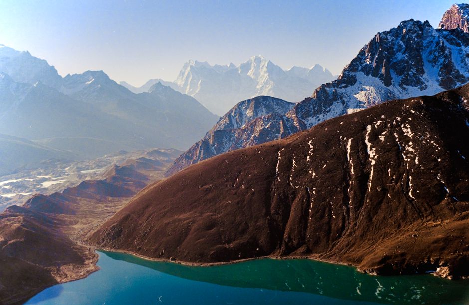
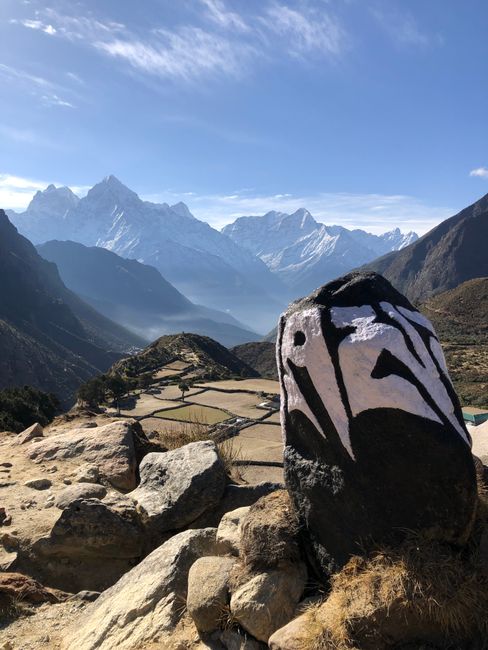
Sagarmatha National Park protects the upper Khumbu region of northeastern Nepal, the homeland of the Sherpa people and the setting of Mount Everest, which Nepalis call Sagarmatha. The park covers about 1,150 km² (440 sq miles) of glaciers, moraines, high valleys and rhododendron forest, rising from about 2,800 m (9,200 ft) to the summit of Everest at 8,849 m (29,032 ft); Lhotse, Cho Oyu and the elegant spire of Ama Dablam stand within or on its edge. Established in 1976 and inscribed as a UNESCO World Heritage Site in 1979, it is one of the most famous trekking areas on Earth: every year tens of thousands of trekkers walk the stone trails from Lukla through Namche Bazaar and Tengboche Monastery to Everest Base Camp, the Gokyo Lakes and the high passes, sleeping in family-run teahouses. Foreigners need a park entry permit, the local municipality’s permit and, under the Nepal Tourism Board’s rules, a licensed guide. The best months are October to November and March to May; winters are bitterly cold up high, and the monsoon, from June to September, brings cloud, rain and canceled flights.
Right now in Sagarmatha National Park (Everest Region) (Namche Bazaar)
- Wed-3–10°C27–49°F1 mm rain
- Thu-2–9°C29–47°F5 mm rain
- Fri-5–8°C24–46°F5 mm rain
Top tours in Sagarmatha National Park (Everest Region)
See all tours for Sagarmatha National Park (Everest Region) →
From local operators, with prices and reviews; you check availability and book on Viator, our partner. We may earn a commission at no extra cost to you. How we earn money
Sagarmatha at a glance
- Best for: high-altitude trekking, Everest and Himalayan views, Sherpa culture and Buddhist monasteries.
- How long: about 12 days from Lukla for Everest Base Camp; 15–20 days for the Gokyo Lakes or the Three Passes; 5–7 days for a shorter trek to Namche and Tengboche.
- Best time: October and November, for clear skies; March to May, warmer, with rhododendrons in bloom and the climbing season under way.
- Getting there: a 30-minute flight to Lukla from Kathmandu or, in busy seasons, from Manthali Airport in Ramechhap; or several days’ walk from the road at Salleri or Jiri.
- Fees: NPR 3,000 park entry and NPR 3,000 Khumbu Pasang Lhamu Rural Municipality fee for most foreigners, plus a TIMS card arranged by a registered agency.
- Rules to know: trek with a licensed guide, ascend slowly to avoid altitude sickness, and carry your permits for the checkpoints at Lukla and Monjo.
- Before you go: the visa, money and general safety are in our Nepal travel guide.
Fees, permits and rules (as of October 2026)
Park entry permit
According to the Nepal Tourism Board, foreigners pay NPR 3,000 (about US$19.50) per person per entry to Sagarmatha National Park, SAARC citizens NPR 1,500 and Nepalis NPR 100; children under 10 enter free. The permit is sold at the Tourist Service Center in Bhrikutimandap, Kathmandu, and at the park entrance at Monjo, a day’s walk north of Lukla.
Khumbu Pasang Lhamu Rural Municipality fee
The local government of the Khumbu collects its own tourism fee from visitors entering the area. Under the municipality’s Financial Act for the fiscal year 2083/84 (mid-July 2026 to mid-July 2027), foreigners pay NPR 3,000 per person, citizens of SAARC countries and China NPR 2,000, and diplomats and children under 10 nothing. It is collected at the checkpoint in Lukla or, for trekkers walking in from the south, on the trail.
TIMS and the guide rule
The Nepal Tourism Board lists the Everest Base Camp, Gokyo, Cho La, Renjo La, Three Passes and Everest View treks among the routes on which, since March 31, 2023, foreign trekkers must be accompanied by a licensed guide and carry a TIMS card issued through a registered trekking agency (NPR 2,000 for most foreigners). Rules have been applied differently in the Khumbu, where the municipality collects its own fee, so ask your agency what is being checked when you travel. Climbing Everest or the trekking peaks, such as Island Peak and Lobuche East, requires separate climbing permits.
The park’s key rules
Stay on the trails, carry out your trash (including batteries and plastic bottles), and respect the region’s Buddhist monuments: walk clockwise around chortens and to the left of mani walls carved with prayers. Do not disturb wildlife, buy wildlife products or remove plants, and ask permission before flying a drone, which requires approval from the authorities.
The main trekking routes
Lukla to Namche Bazaar
From Lukla, at about 2,860 m (9,380 ft), the trail descends to the Dudh Koshi river and follows it north through villages and pine forest, crossing high suspension bridges to Phakding and Monjo, where you enter the park. A steep climb leads to Namche Bazaar (about 3,440 m / 11,290 ft), the Khumbu’s trading town, with lodges, bakeries, gear shops and a Saturday market. Most trekkers spend two nights here to acclimatize, with a walk up to the park visitor center or the Everest View Hotel at Syangboche for a first view of Everest.
Everest Base Camp
The classic trek continues to Tengboche (about 3,870 m / 12,700 ft) and its monastery, then through Dingboche (4,410 m / 14,470 ft), where a second acclimatization day is normal, to Lobuche and Gorak Shep (about 5,160 m / 16,930 ft) beside the Khumbu Glacier. Everest Base Camp, at about 5,364 m (17,598 ft), is a rocky moraine where expedition tents stand in spring; the best view of Everest itself comes from Kala Patthar (about 5,644 m / 18,517 ft) above Gorak Shep at sunrise. The round trip from Lukla takes about 12 days.
Gokyo Lakes
A quieter valley west of the main route leads past the Ngozumpa Glacier, the longest in Nepal, to a chain of turquoise glacial lakes at Gokyo (about 4,790 m / 15,720 ft). The climb to Gokyo Ri (about 5,357 m / 17,575 ft) gives a panorama of four 8,000 m peaks: Everest, Lhotse, Makalu and Cho Oyu. The lakes are a Ramsar wetland of international importance.
The Three Passes
Strong, experienced trekkers link the valleys over the Kongma La, Cho La and Renjo La, each about 5,350–5,540 m (17,550–18,180 ft), in a loop of 15 to 20 days; the passes can be icy and need careful timing and a guide familiar with the route.
Shorter treks
Five to seven days from Lukla to Namche Bazaar, Khumjung and Tengboche gives a taste of the Khumbu, with views of Everest and Ama Dablam, without going much above 3,900 m (12,800 ft).
Sherpa villages and monasteries
Tengboche Monastery
The Khumbu’s largest monastery stands on a ridge with Ama Dablam and Everest behind it. Visitors can attend the monks’ afternoon prayers; in autumn, usually in October or November, the monastery holds Mani Rimdu, a festival of masked dances.
Khumjung and Khunde
Twin villages above Namche, with stone houses, potato fields, the school founded by Sir Edmund Hillary in 1961, and a monastery that keeps what is said to be a yeti scalp.
Thame and Pangboche
Thame, on the old trade route to Tibet, is the home village of many famous climbers and has a cliffside monastery. Pangboche has one of the oldest monasteries in the Khumbu.
The Sagarmatha National Park visitor center
At Mendalphu above Namche, the park’s visitor center has displays on the Khumbu’s wildlife, glaciers and Sherpa culture, and a viewpoint over the peaks.
Wildlife and nature
The forests of pine, fir, birch and rhododendron below about 4,000 m (13,100 ft) shelter Himalayan tahr (a wild goat), musk deer and the colorful Danphe (Himalayan monal), Nepal’s national bird; snow leopards and red pandas live in the park but are rarely seen. Above the tree line, juniper scrub gives way to alpine meadows, moraines and glaciers.
Food and teahouse life
Teahouses along the main routes offer simple rooms with twin beds and shared toilets, and dining rooms heated by a stove in the evening. Menus are surprisingly long, but dal bhat, with free refills, is the best value and the most filling; try Sherpa stew, potato rildok, thukpa and fried momos, and milk tea or ginger-lemon-honey tea. Prices rise with altitude, since everything is carried up by porters, yaks and helicopters, and hot showers, battery charging and Wi-Fi cost extra. Avoid alcohol while acclimatizing.
Beyond the Khumbu
- Salleri and Phaplu: the district headquarters in Solu, reachable by road from Kathmandu, from which trekkers walk north to Lukla and Namche in about four days, avoiding the Lukla flight.
- Jiri: the start of the old walking route to Everest used by the first expeditions, about a week to Namche.
- Island Peak (Imja Tse): a popular trekking peak of about 6,160 m (20,210 ft) from Chhukung, for climbers with a permit and guide.
- Kathmandu: for days before and after the trek. See our Kathmandu guide.
Nearby destinations
- Kathmandu137 km
- Darjeeling182 km
- Chitwan National Park236 km
- Pokhara268 km
- Paro273 km
- Annapurna Conservation Area285 km
- Thimphu293 km
Getting there
By air to Lukla
Tenzing-Hillary Airport at Lukla, a short, steep runway on a mountainside, is served by small planes run by several Nepali airlines. The flight from Kathmandu takes about 30 minutes, with views of the Himalaya. In the busiest seasons, operators have in recent years flown to Lukla from Manthali Airport in Ramechhap, about 4 to 5 hours’ drive east of Kathmandu, leaving in the early hours to catch the morning flights. Flights only operate in good visibility, usually in the morning, and delays of a day or more are common in cloud, wind or monsoon weather, so build spare days into your plans. Helicopter charters are a costly alternative when flights are grounded.
On foot
Roads now reach Salleri and beyond in the Solu region, and jeeps continue to points a few days’ walk south of Lukla, depending on road conditions. Walking in avoids the flights and helps acclimatization.
Getting around
Everything in the park is on foot, on stone trails shared with porters, yaks and mule trains: step to the mountain side of the trail when animals pass. Porters can be hired through your agency to carry bags of up to about 20–25 kg (44–55 lb). Helicopters fly rescue and supply missions.
When to go and how long to stay
The trekking seasons are October to November, when the air is clear and dry after the monsoon, days are mild and nights below freezing at high altitude; and March to May, warmer, with spring flowers and the Everest climbing season, but more afternoon cloud. December to February is cold, with temperatures far below freezing above 4,000 m (13,100 ft), some lodges closed and passes snowbound, but the skies are often clear and the trails quiet. The monsoon, from June to September, brings rain in the lower valleys, cloud, leeches and frequent flight cancellations. There is no long-term high-altitude station in the World Meteorological Organization’s (WMO) public lists, so the table uses the 1991–2020 normals for Okhaldhunga, at 1,731 m (5,679 ft), about 70 km (45 miles) south of Lukla, from Nepal’s Department of Hydrology and Meteorology (DHM), to show the seasonal pattern. Temperatures fall by roughly 6 °C (11 °F) for every 1,000 m (3,300 ft) of height, so at Namche Bazaar, about 1,700 m (5,600 ft) higher, expect temperatures roughly 10 °C (18 °F) lower, and at Base Camp, more than 3,600 m (11,800 ft) higher, far below freezing at night for most of the year.
| Month | Okhaldhunga high / low | Rain (rainy days) | What to expect in the Khumbu |
|---|---|---|---|
| January | 16 °C (60 °F) / 5 °C (42 °F) | 12 mm (0.5 in), 2 days | Very cold up high; clear; some lodges closed |
| February | 18 °C (65 °F) / 7 °C (45 °F) | 15 mm (0.6 in), 2 days | Cold; snow possible; Losar in Sherpa villages |
| March | 22 °C (71 °F) / 10 °C (51 °F) | 26 mm (1.0 in), 4 days | Spring season opens; cold nights |
| April | 25 °C (76 °F) / 14 °C (56 °F) | 66 mm (2.6 in), 8 days | Busy; rhododendrons; climbers at Base Camp |
| May | 25 °C (77 °F) / 15 °C (60 °F) | 154 mm (6.0 in), 14 days | Warmer; afternoon clouds; Everest summit window |
| June | 25 °C (78 °F) / 17 °C (63 °F) | 293 mm (11.5 in), 18 days | Monsoon; flights unreliable |
| July | 25 °C (77 °F) / 18 °C (64 °F) | 418 mm (16.5 in), 22 days | Wettest month; clouds hide the peaks |
| August | 25 °C (77 °F) / 18 °C (64 °F) | 416 mm (16.4 in), 21 days | Very wet; few trekkers |
| September | 25 °C (76 °F) / 17 °C (62 °F) | 265 mm (10.4 in), 16 days | Rain easing late in the month |
| October | 24 °C (74 °F) / 14 °C (57 °F) | 61 mm (2.4 in), 5 days | Clear and dry; peak season; Mani Rimdu in some years |
| November | 21 °C (69 °F) / 10 °C (50 °F) | 8 mm (0.3 in), 1 day | Crisp and clear; very cold nights up high |
| December | 17 °C (63 °F) / 7 °C (44 °F) | 8 mm (0.3 in), 1 day | Cold, clear and quiet |
Everest Base Camp in 12 days
Day 1, fly to Lukla and walk to Phakding. Day 2, Namche Bazaar. Day 3, acclimatize in Namche. Day 4, Tengboche. Day 5, Dingboche. Day 6, acclimatize in Dingboche. Day 7, Lobuche. Day 8, Gorak Shep and Base Camp. Day 9, Kala Patthar at dawn and down to Pheriche. Day 10, Namche. Day 11, Lukla. Day 12, fly to Kathmandu, weather permitting.
A shorter Everest view trek
Five to seven days: Lukla, Phakding, two nights in Namche with a hike to Syangboche and Khumjung, Tengboche, and back.
Where to stay
- Namche Bazaar: the largest choice, from simple teahouses to comfortable lodges with private bathrooms, bakeries and Wi-Fi.
- Lukla and Phakding: lodges for the first and last nights; Lukla has the most options.
- Tengboche and Dingboche: teahouses with mountain views; Dingboche has more choice.
- Lobuche and Gorak Shep: basic lodges, cold and crowded in peak season; your guide will book ahead.
- Gokyo: lodges on the lakeshore.
What a trek in the Everest region costs
Prices are approximate, for October 2026, converted at about 154 rupees (NPR) to the US dollar. Permit fees are those of the Nepal Tourism Board and the Khumbu Pasang Lhamu Rural Municipality.
| Item | Typical cost |
|---|---|
| Sagarmatha National Park entry, foreigners | NPR 3,000 (about US$19.50) |
| Khumbu Pasang Lhamu Rural Municipality fee, foreigners | NPR 3,000 (about US$19.50) |
| TIMS card through an agency, foreigners | NPR 2,000 (about US$13) |
| Flight Kathmandu or Ramechhap to Lukla, one way | about US$180–220 |
| Licensed trekking guide, per day | NPR 4,000–6,000 (about US$26–39) |
| Porter, per day | NPR 3,000–4,000 (about US$19–26) |
| Dal bhat, Namche / Gorak Shep | NPR 700–1,000 / NPR 1,200–1,800 (about US$4.50–6.50 / US$8–12) |
| Teahouse room, per night | NPR 500–3,000 (about US$3–19) |
A guided teahouse trek to Base Camp typically costs about US$1,300–2,500 per person for 12 days from Kathmandu, including flights, permits, a guide, lodging and meals, depending on group size and comfort.
Practical tips for the Everest region
- Plan spare days: two at the end of the trek for delayed Lukla flights.
- Acclimatize: take rest days at Namche and Dingboche, and sleep no more than 300–500 m (1,000–1,600 ft) higher each night above 3,000 m (9,800 ft).
- Carry cash: there are ATMs in Lukla and Namche, but they are unreliable; bring enough rupees for the trek.
- Treat your water: use a filter or purification tablets instead of buying bottles, which add to the waste problem.
- Buy the right insurance: make sure it covers trekking up to at least 5,500 m (18,000 ft) and helicopter evacuation.
Safety
The main danger is altitude sickness. Acute mountain sickness can strike anyone above about 2,500 m (8,200 ft), and its severe forms, high-altitude cerebral and pulmonary edema, can kill within hours. The Nepal Tourism Board advises ascending slowly, taking rest days and descending if headache, nausea, dizziness or breathlessness get worse; the Himalayan Rescue Association runs an aid post with volunteer doctors at Pheriche (4,250 m / 13,940 ft) in the trekking seasons, with daily talks on altitude, and a clinic at Everest Base Camp in the climbing season. Mountain flights to and from Lukla depend on visibility and are frequently delayed or canceled. In the monsoon, landslides and floods affect lower trails, and glacial lakes and rivers can flood suddenly. Snow, ice and avalanches threaten the high passes, especially in winter and spring. On the trails, step to the mountain side when yaks pass. Trek with a licensed guide, as the Nepal Tourism Board requires, and carry insurance that covers helicopter rescue. For emergencies, call 100 for police and 102 for an ambulance, or contact the Tourist Police on 1144; your agency and guide coordinate rescues.
What to pack for the Everest region
Broken-in trekking boots, a warm down jacket and a sleeping bag rated well below freezing, thermal layers, a fleece, a waterproof shell, warm hat and gloves, sunglasses with high UV protection and sunscreen for the strong high-altitude sun, a headlamp, water purification, and a basic first-aid kit. Nepal uses 230 V, with round two-pin (type C) and three-pin (types D and M) sockets, and charging is paid in the teahouses. See our hiking shoes, rain jackets and travel adapters guides.
Sagarmatha National Park travel FAQ
How much are the permits for the Everest region?
For most foreigners, NPR 3,000 for Sagarmatha National Park, NPR 3,000 for the Khumbu Pasang Lhamu Rural Municipality and NPR 2,000 for a TIMS card arranged by a registered agency: NPR 8,000 (about US$52) in all.
Do I need a guide to trek to Everest Base Camp?
Under the Nepal Tourism Board’s rules in force since March 31, 2023, foreigners on the Everest Base Camp route must trek with a licensed guide arranged through a registered agency.
How long does the Everest Base Camp trek take?
About 12 days round trip from Lukla, including two acclimatization days, plus travel days to and from Kathmandu.
How high is Everest Base Camp?
About 5,364 m (17,598 ft). Kala Patthar, the usual viewpoint for Everest, is about 5,644 m (18,517 ft).
Can I see Everest from Base Camp?
Not well: the summit is hidden by Nuptse and the icefall. The classic views are from Kala Patthar, Gokyo Ri, Tengboche and above Namche Bazaar.
Why are Lukla flights delayed?
Flights operate only in good visibility on a short mountain runway, and clouds, wind and monsoon weather often ground them; in busy seasons, flights may also leave from Ramechhap instead of Kathmandu.
When is the best time to trek to Everest Base Camp?
October and November for clear views, and March to May for warmer weather and the climbing season atmosphere.
Can I trek to Everest Base Camp in winter?
Yes, with good gear: December to February is very cold at night and some lodges close, but skies are often clear and trails quiet. High passes may be snowbound.
How do I avoid altitude sickness on the Everest trek?
Ascend slowly, take rest days at Namche and Dingboche, drink plenty of water, avoid alcohol, and descend if symptoms get worse.
Is there internet in the Everest region?
Yes. Mobile data works in many villages, and teahouses sell Wi-Fi, often through prepaid cards, though connections slow down higher up.
Plan your trip
Partner links: TravelerCenter may earn a commission if you book, at no extra cost to you.
🇳🇵 Useful Nepali phrases for Sagarmatha National Park (Everest Region)
All 38 Nepali phrases: restaurant, hotel, emergencies, romance (printable) →
Sources · last reviewed 4 October 2026
Researched and last reviewed on 4 October 2026. Park entry fees, the guide and TIMS rules and the list of Everest routes covered, altitude guidance and the Himalayan Rescue Association aid post at Pheriche: the Nepal Tourism Board; the municipality fee: the Khumbu Pasang Lhamu Rural Municipality’s Financial Act 2083/84; climate normals for Okhaldhunga: Nepal’s Department of Hydrology and Meteorology, via the World Meteorological Organization (1991–2020 normals archived by NOAA’s National Centers for Environmental Information); exchange rate: Nepal Rastra Bank; flight disruption and monsoon hazards: the UK government’s travel pages (factual content only). The park’s history, area, altitudes, Everest’s height, trek durations, the seasonal Ramechhap flights, Mani Rimdu dates, wildlife, the Khumbu’s application of the guide rule and all typical prices are general references or estimates, flagged for checking. Fees and rules change, so check the official sites before you go. For entry rules, money and general safety, see our Nepal travel guide.
Data: Weather: MET Norway (CC BY 4.0) · Rates: ECB · Costs: World Bank ICP and price levels · Wikidata (CC0)