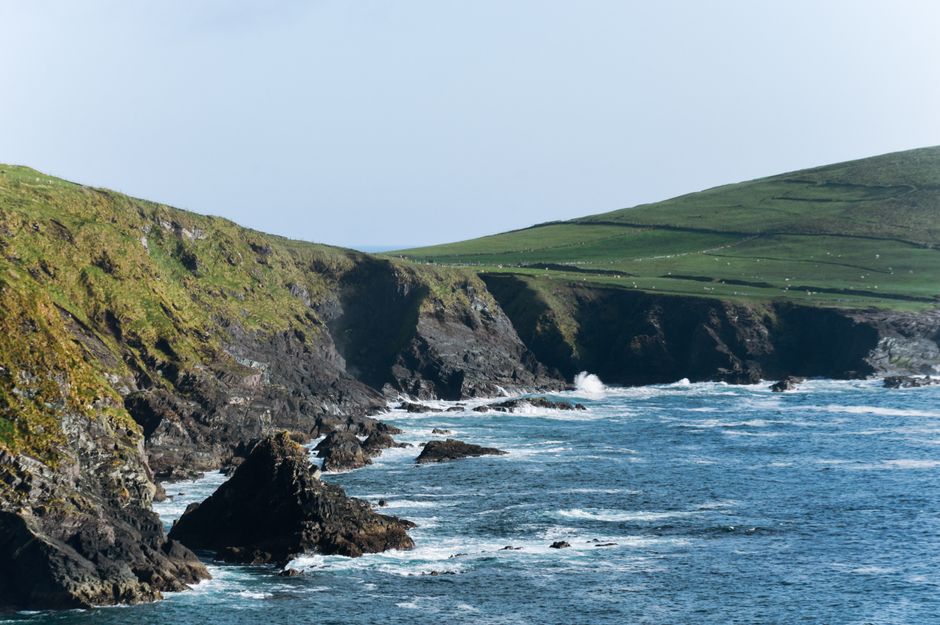
The Dingle Peninsula is the northernmost of Kerry’s long fingers of land, running about 50 km west into the Atlantic from Tralee to Slea Head, the end of Europe as it looked to the people who lived here. It has Ireland’s densest concentration of early Christian and prehistoric sites, beehive huts and stone forts on green hillsides above white beaches, a mountain spine crowned by Mount Brandon, and the Blasket Islands lying offshore. West of Dingle town it is part of the Gaeltacht, where Irish is still the language of daily life. You come to drive or cycle the Slea Head loop, cross to the Great Blasket, climb the Conor Pass, walk the beaches, and spend the evenings in Dingle’s pubs and seafood restaurants. Give it one full day at least, and two or three to slow down.
Right now in Dingle Peninsula (Dingle)
- Wed 11–13°C 51–56°F 3 mm Light showers
- Thu 11–15°C 52–60°F 8 mm Rain
- Fri 13–15°C 55–59°F 14 mm Light rain
Weather: MET Norway (CC BY 4.0) · Sea temperature: NOAA CoastWatch · Rates: ECB
Top tours in Dingle Peninsula
See all tours for Dingle Peninsula →
From local operators, with prices and reviews; you check availability and book on Viator, our partner. We may earn a commission at no extra cost to you. How we earn money
The Dingle Peninsula at a glance
- Best for: coastal scenery, ancient sites, beaches, hill walking, the Irish language and traditional music.
- How long: 1 day for the Slea Head Drive; 2–3 days to add the Blaskets (in season), the Conor Pass, Inch Beach and a walk.
- Best time: May to September, when the Blasket ferries run and the days are long; the Blasket Centre is open from March to early November.
- Getting in: by bus or car from Tralee (about 50 km, roughly an hour); Kerry Airport and Killarney are about an hour away by car.
- Getting around: a car or bike, or a day tour from Dingle town; public transport west of Dingle is very limited.
- Before you go: Ireland uses the euro and type G plugs, and it is not in the Schengen area; see our travel adapters guide.
The peninsula, place by place
Two roads lead west from Tralee: the main N86 along the south side through Annascaul to Dingle, and the R560 along the north coast past Castlegregory and over the Conor Pass. West of Dingle town, the R559 loops around Slea Head.
- Dingle town (An Daingean): the only town of any size, a fishing port of brightly painted streets climbing from the harbour, with about 50 pubs for some 2,000 residents, seafood restaurants, craft shops and the base for most visitors.
- Ventry and Slea Head: a wide sandy bay, then cliff roads past stone forts and beehive huts to the westernmost headland.
- Dunquin and Ballyferriter: the heart of the Gaeltacht, facing the Blasket Islands, with the Blasket Centre, the pier for the ferries and village pubs.
- Ballydavid and Brandon Creek: the north-west coast below Mount Brandon, with Gallarus Oratory and the creek from which St Brendan the Navigator is said to have sailed.
- Inch and Annascaul: on the south side towards Tralee, a long sandy spit and the village of the Antarctic explorer Tom Crean, whose South Pole Inn is still a pub.
- Castlegregory and the Maharees: on the north side, a sandy isthmus with surf and windsurfing beaches between Brandon Bay and Tralee Bay.
The Slea Head Drive
The Slea Head Drive (Slí Cheann Sléibhe) is a loop of roughly 45–50 km that starts and ends in Dingle, and one of the most spectacular coastal roads in Ireland. Drive it clockwise, heading west from Dingle to Ventry first, as the local tourist board and the road signs ask: the road is narrow, with sheer drops on the seaward side, and coaches and most traffic follow the same direction, which makes passing easier. Allow at least half a day, and a full day if you want to visit the sights and walk on the beaches. In order, the main stops are:
- Ventry: a long blue-flag beach on a sheltered bay, good for a swim in summer.
- Dunbeg Fort and the Fahan beehive huts: an Iron Age promontory fort on the cliff edge and, above the road, clusters of clocháns, corbelled stone huts. Local landowners charge a small fee to visit.
- Slea Head: a white crucifixion scene by the roadside, and the first view of the Blasket Islands; on a clear day you can see the Skelligs to the south.
- Coumeenoole: a small, beautiful cove below the road, seen in the 1970 film Ryan’s Daughter; swimming here is dangerous because of strong currents.
- Dunquin: the zigzag path to the ferry pier, and the Blasket Centre.
- Ballyferriter and Gallarus: the local museum, the Riasc monastic site and Gallarus Oratory, before the road returns to Dingle.
Follow the road signs rather than your phone’s navigation, which may send you anticlockwise or down lanes too narrow for cars. The loop is also a classic bike ride, with a couple of steep climbs; bikes can be hired in Dingle. See our guide to cycling.
Top things to see on the Dingle Peninsula
Prices and hours below were checked on the official sites in October 2026. They change, so check before you go.
The Blasket Islands and the Blasket Centre
Until 1953, when the last islanders were moved to the mainland, a small Irish-speaking community lived on the Great Blasket, fishing and farming on the edge of the Atlantic. Several of them wrote books about their lives that became classics of Irish literature, among them Tomás Ó Criomhthain’s An tOileánach (The Islandman) and the autobiography of the storyteller Peig Sayers. The Blasket Centre (Ionad an Bhlascaoid) in Dunquin, run by the OPW and fully renewed in 2022, tells their story, with a viewing area looking straight across the sound to the island. Its 2026 season runs from 6 March to 8 November 2026, daily 10:00–18:00 (last admission 17:15). As of October 2026, admission costs €5 for adults, €4 for seniors, €3 for students and €13 for a family; children under 12 go free.
Ferries to the Great Blasket leave from the steep pier at Dunquin in a short summer season, weather permitting; the crossing takes about 20 minutes, and you land on the island’s slipway by a smaller boat. Blasket Island Ferries’ season has ended for 2026; for 2027 it has announced sailings from 6 May to 8 September 2027, with departures at 9:45, 10:45, 11:45 and 12:45, returns in the afternoon, and fares of €60 for adults and €40 for children, which allows about four hours on the island. Book ahead by email or phone. The trip suits fit visitors aged 7 and over, not people with limited mobility. On the island you can walk among the ruined houses, follow the paths along the ridge and watch the grey seals on the White Strand from at least 50 m away. Other boats sail around the islands from Dingle and Ventry without landing.
Gallarus Oratory
This small stone church, shaped like an upturned boat, is built of carefully fitted sandstone blocks, without a curve in its walls, and is still watertight after many centuries. It is the best-preserved building of its kind in Ireland. Its age is uncertain: it was long thought to be early Christian, but many archaeologists now date it to the 11th or 12th century. The oratory is on the Slea Head loop near Ballydavid. A privately run visitor centre and car park next to it charges a small fee and shows a short film; you can also reach the oratory on foot by the public lane.
The Conor Pass
At 456 m, the Conor Pass (An Chonair) on the R560 is one of the highest mountain roads in Ireland, linking Dingle with Brandon Bay and Castlegregory on the north coast. The road climbs past corrie lakes and cliff faces to a car park at the summit with views over Dingle Bay on one side and Brandon Bay on the other; below it on the north side, a short scramble leads to a lake and waterfall at Pedlar’s Lake. Near the top, the road is single-track along a cliff, with passing places: vehicles over 2 tonnes, including coaches and large campervans, are banned, so take the N86 instead if you are driving one. Avoid it in fog or strong wind.
Inch Beach
On the south coast, about 20 minutes east of Dingle, a sand spit of about 5 km reaches out into Dingle Bay, backed by dunes. It is one of the best beaches in Kerry for walking and for learning to surf, with surf schools in summer, and cars are allowed to park on the firm sand near the entrance. Lifeguards are on duty in summer only. See our guides to beaches and surfing.
Dingle town, Fungie and the distillery
Dingle is a lively small town, crowded in summer, with Green Street, Main Street and the Mall lined with pubs, galleries and shops; some old pubs still double as hardware or shoe shops by day. For almost four decades, its most famous resident was Fungie, a wild bottlenose dolphin who arrived in the harbour in 1983 and swam alongside the tour boats. He was last seen on 13 October 2020 and has not returned; boat trips from the harbour now sail along the coast to look for wild dolphins, seabirds and seals, with no guarantee of sightings. A bronze statue of Fungie stands on the quay.
The Dingle Distillery, on the edge of town, was one of the first new independent whiskey distilleries in Ireland when it opened in 2012, and also makes gin and vodka. As of October 2026, its 75-minute guided tour with a tasting costs €25 (€22 for students and seniors), and the whiskey-only Distillers’ Selection tour costs €50. Tours are for over-18s only, with ID, and often sell out, so book online; opening times vary through the year.
Peaks and mountains
- Baurtregaum
- Caherconree
- Mount Brandon
Monuments
- Dunbeg Fort
- Gallarus Oratory
- Kilmalkedar
Viewpoints
- Slea Head
Walking: the Dingle Way and Mount Brandon
The Dingle Way is a 162 km waymarked trail that loops around the peninsula from Tralee, usually walked in about eight days, on bog roads, beaches, cliff paths and old green roads. It is managed by a local committee and Kerry County Council, and its highest point, at about 640 m on the shoulder of Mount Brandon, is the highest of any National Waymarked Trail in Ireland. You can walk single stages, such as Dunquin to Ballyferriter or Ventry to Dunquin, and return by taxi.
Mount Brandon (Cnoc Bréanainn, 952 m) is Ireland’s highest peak outside the McGillycuddy’s Reeks and a place of pilgrimage dedicated to St Brendan. The pilgrim path, Cosán na Naomh (the Saints’ Road), runs about 18 km from Ventry to the mountain, and the usual climbs are from the west, from the Ballybrack car park (about 8 km, 3–4 hours), or from Faha on the east side (about 9 km, 4–5 hours), which passes a chain of corrie lakes under steep cliffs. Cloud often covers the summit; go only in good weather, with a map and compass and proper boots, and turn back if the mist comes down. See our guide to hiking.
Activities and best months
- Beaches and swimmingThe peninsula's beaches include the sweep of Brandon Bay (sometimes called Ireland's longest beach), Inch, the sheltered Blue Flag beach at Ventry, safe for children, and Coumeenole under the cliffs facing the Blaskets (strong currents, unsafe for swimming).
- Boat tripsPassenger ferries sail to the Great Blasket Island in spring, summer and autumn, weather permitting: 20 minutes from Dún Chaoin pier, about 40 minutes from Dingle marina, or from Ventry; passengers transfer to a smaller boat to land.
- CyclingThe Slea Head Drive, a signed loop from Dingle on the Wild Atlantic Way past Ventry, Dunbeg Fort, the beehive huts and Slea Head, is popular with cyclists; bicycles can be hired in Dingle. Ride it clockwise, as the cliff road is narrow and single lane in parts.
- HikingThe Dingle Way, a 176 km waymarked trail, circles the peninsula in 7 to 8 days or in day sections; communities have marked loop and linear day walks, from ridge walking to cliff and beach walks, and local guides lead walks.
- SurfingThe Brandon Bay beaches face the North Atlantic and often receive long rolling swells; the tourism alliance lists surfing among the things to do on the peninsula's beaches.
The Gaeltacht and the Irish language
Most of the peninsula west of Dingle, Corca Dhuibhne, is an official Gaeltacht, where Irish is the community language. Road signs are in Irish only, so Dunquin appears as Dún Chaoin, Ballyferriter as Baile an Fheirtéaraigh and Ventry as Ceann Trá; it helps to have a map that shows both. Everyone also speaks English, but a “Dia dhuit” (hello) or “go raibh maith agat” (thank you) is always welcome. In summer, Irish-language colleges bring teenagers from all over Ireland to learn the language, and the pubs of Ballyferriter, Dunquin and Ballydavid host sessions of traditional music and song.
Getting there and getting around
By car
Dingle is about 50 km from Tralee on the N86 (about 50 minutes), and about 1 hour 15 minutes from Killarney via Castlemaine and Inch. Driving gives you the freedom to stop on the Slea Head loop, but roads are narrow, often lined with stone walls, and busy with cyclists and walkers in summer. Drive on the left, and park outside the centre of Dingle in July and August.
By bus and train
Tralee, the county town, has a railway station with trains from Dublin (usually changing at Mallow), Cork and Killarney. From Tralee bus station, beside the railway station, Bus Éireann route 275 runs to Dingle via Camp and Annascaul several times a day, in about 50 to 55 minutes. West of Dingle, buses are rare, so without a car the best options are a bike, a taxi or a day tour of Slea Head from Dingle.
By air
Kerry Airport at Farranfore, with flights from Dublin, London and some European cities, is about an hour from Dingle by car; there is no direct bus, so take a train or bus to Tralee and change. Shannon and Cork airports are about 3 hours away by car.
When to go and how long to stay
Weather for your datesSunrise and sunset
The peninsula takes the full force of the Atlantic: it is mild all year, wet and often windy, and the weather can change several times a day. Met Éireann does not publish 1991–2020 averages for Dingle, so the table uses its normals for Valentia Observatory, across Dingle Bay on the Iveragh Peninsula, which has a very similar exposed coastal climate.
| Season | Average temperature | Rain per month | Sunshine per month | What it’s like |
|---|---|---|---|---|
| Winter (Dec–Feb) | 7.4–8.1 °C | 137–187 mm | 37–64 hours | Mild, stormy and very quiet; Blasket Centre and ferries closed |
| Spring (Mar–May) | 8.2 °C rising to 11.7 °C | 94–116 mm | 105–177 hours | Brighter and drier; May is the sunniest month and the ferries start |
| Summer (Jun–Aug) | 13.8–15.4 °C | 101–117 mm | 136–168 hours | Highs around 17–18 °C; long days, the busiest roads and boats |
| Autumn (Sep–Nov) | 14.3 °C falling to 9.5 °C | 130 rising to 189 mm | 120 falling to 54 hours | September is often good; ferries stop in early September; wetter from October |
Valentia averages about 1,650 mm of rain a year, with at least 1 mm on about 203 days, and an annual mean temperature of 11.1 °C. Frost and snow are rare at sea level, but the Conor Pass and Mount Brandon are much colder, windier and cloudier than the coast.
The Dingle Peninsula in 1 day
Morning in Dingle town, then the Slea Head Drive clockwise: Ventry, Dunbeg Fort and the beehive huts, Slea Head, Coumeenoole, the Blasket Centre, Gallarus Oratory, and back to Dingle for dinner and music.
The Dingle Peninsula in 3 days
Day 2: the Great Blasket by ferry from Dunquin (May to early September), or a coastal boat trip from Dingle. Day 3: over the Conor Pass to the Maharees, or climb Mount Brandon in good weather, and finish on Inch Beach on the way out.
Weather month by month
Where to stay on the Dingle Peninsula
- Dingle town: hotels, guesthouses and B&Bs within walking distance of the pubs and restaurants; the best base without a car.
- Ventry, Dunquin and Ballyferriter: B&Bs, a hostel and holiday cottages in the Gaeltacht, with sea views and quiet nights.
- Castlegregory and the Maharees: campsites, cottages and B&Bs near the north-side beaches, popular with surfers.
Rooms are limited, so book well ahead for July and August and for festivals such as the Dingle Food Festival in early autumn; many places close from November to March.
Practical tips for the Dingle Peninsula
- Go clockwise on Slea Head: follow the signs, not the satnav.
- Check the sea: Blasket ferries are cancelled in rough weather, often at short notice; have a backup day.
- Fill up in Dingle: there are few fuel stations and cash machines further west.
- Respect the sites: many forts and huts are on working farms; close gates and pay the small entry fees.
- Swim with care: choose lifeguarded beaches such as Ventry and Inch in summer, and keep out of the water at Coumeenoole.
What to pack for the Dingle Peninsula
Packing list for Dingle Peninsula
A windproof and waterproof jacket, waterproof trousers for walks and boat trips, boots or shoes with good grip for wet cliff paths and the Blasket landing, warm layers even in summer, and a hat and sunscreen for the bright spells. If you plan to surf at Inch or the Maharees, a full wetsuit is needed all year; surf schools rent them. See our guides to rain jackets, hiking shoes and wetsuits.
What to pack
- Day packs and anti-theft bagsCarries water, towel and sunscreen down the long stairways to Algarve coves.
- Dry bags and phone pouchesProtects phones and cameras from sand and spray on beaches reached by ferry or steep paths.
- Fleeces and warm layersIt is cooler at sea than on land, especially on morning whale-watching trips.
- HeadlampsLevada routes such as PR1 and PR9 pass through long, dark, wet tunnels.
- Hiking shoes and bootsMadeira's levadas and the Azores' crater rims are wet, rocky and slippery, so grippy shoes matter more than anywhere else in Portugal.
- Quick-dry beach towelsA sand-shedding quick-dry towel packs small for beach days and lido visits.
- Rain jacketsA windproof, waterproof shell keeps you warm on open boats, where wind and spray cool you quickly.
- Reef-friendly sunscreenSummer UV is strong on Portuguese beaches and there is little shade below the cliffs.
- Surf accessories (boots, leashes, wax)Neoprene boots keep feet warm in winter and protect them on rock and reef breaks.
- Trekking polesLong stone staircases and steep descents on Madeira's peaks and the Azores' crater rims are easier on the knees with poles.
- Water bottles and hydration packsRiding in the Algarve and Alentejo heat needs more water than you expect.
- Water shoesRocky coves, lava pools and weever fish in shallow sand make water shoes useful.
- WetsuitsOn the west and north coasts the sea stays around 16–18 °C even in summer, so a thin suit helps for long swims.
Dingle Peninsula travel FAQ
Which way should I drive the Slea Head Drive?
Clockwise, leaving Dingle towards Ventry, as the local tourist board and the road signs recommend. Allow at least half a day for the loop of about 45–50 km.
When do the Blasket Island ferries run?
Only in summer and in good weather. The 2026 season has ended; Blasket Island Ferries has announced 6 May to 8 September 2027, from Dunquin pier, with fares of €60 for adults and €40 for children.
Is the Blasket Centre open?
In 2026 it is open from 6 March to 8 November, daily 10:00–18:00. As of October 2026, admission costs €5 for adults, and children under 12 go free.
Is Fungie the dolphin still in Dingle?
No. Fungie arrived in Dingle harbour in 1983 and was last seen on 13 October 2020. Boat trips now look for wild dolphins and other wildlife along the coast, without guaranteed sightings.
Can you drive over the Conor Pass in a campervan?
Not if it weighs more than 2 tonnes; vehicles over that limit, including coaches, are banned because the road is too narrow near the top. Use the N86 via Annascaul instead.
How do I get to Dingle without a car?
Take a train or bus to Tralee, then Bus Éireann route 275 to Dingle, about 50 to 55 minutes. West of Dingle, use a bike, a taxi or a day tour.
How much is the Dingle Distillery tour?
As of October 2026, €25 (€22 for students and seniors) for the 75-minute tour and tasting. Only over-18s are allowed, and booking ahead is recommended.
How long is the Dingle Way?
About 162 km, starting and ending in Tralee, usually walked in eight days. Its highest point is about 640 m on the shoulder of Mount Brandon.
Do people speak Irish on the Dingle Peninsula?
Yes. West of Dingle town is a Gaeltacht, where Irish is the everyday language and road signs are in Irish only. Everyone also speaks English.
How many days do you need on the Dingle Peninsula?
One full day for the Slea Head Drive; two or three to add the Blaskets, the Conor Pass, Inch Beach or a hill walk.
Can you see the Dingle Peninsula as a day trip from Killarney?
Yes, by car or on a day tour: Dingle is about 1 hour 15 minutes from Killarney, leaving time for Inch Beach and the Slea Head Drive. It is a long day; an overnight in Dingle is more relaxed.
Plan your trip
Partner links: TravelerCenter may earn a commission if you book, at no extra cost to you.
Sources · last reviewed 4 October 2026
Researched and last reviewed on 4 October 2026. The Blasket Centre: Heritage Ireland (OPW); Blasket ferries: Blasket Island Ferries; the Slea Head Drive direction and stops: the Dingle Peninsula tourism site (dingle-peninsula.ie); the Dingle Distillery: dingledistillery.ie; trains: Irish Rail timetables; buses: Bus Éireann; climate: Met Éireann 1991–2020 averages for Valentia Observatory. The Conor Pass weight limit, the Dingle Way and Mount Brandon figures, Fungie’s dates, Gallarus visitor centre details and the Tralee bus times come from secondary sources and are flagged for checking. Prices, timetables and rules change, so check the official links before you go. For another island-studded Atlantic coast, see our Scottish Highlands guide.
Also: dingle-peninsula.ie · Met Éireann normals 1991–2020, Valentia Observatory (climate)
Place data: © OpenStreetMap contributors (ODBL) · Wikidata (CC0)