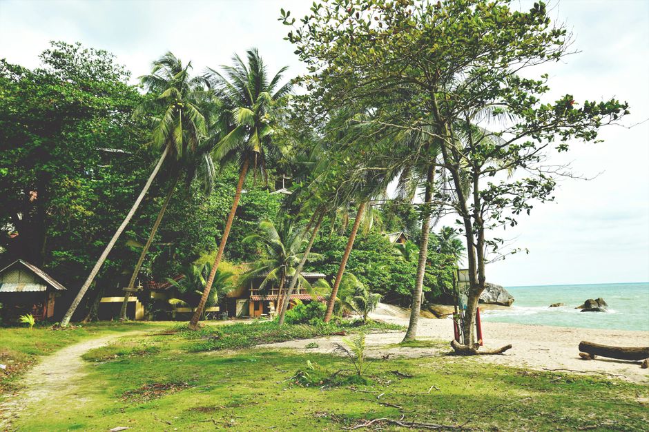
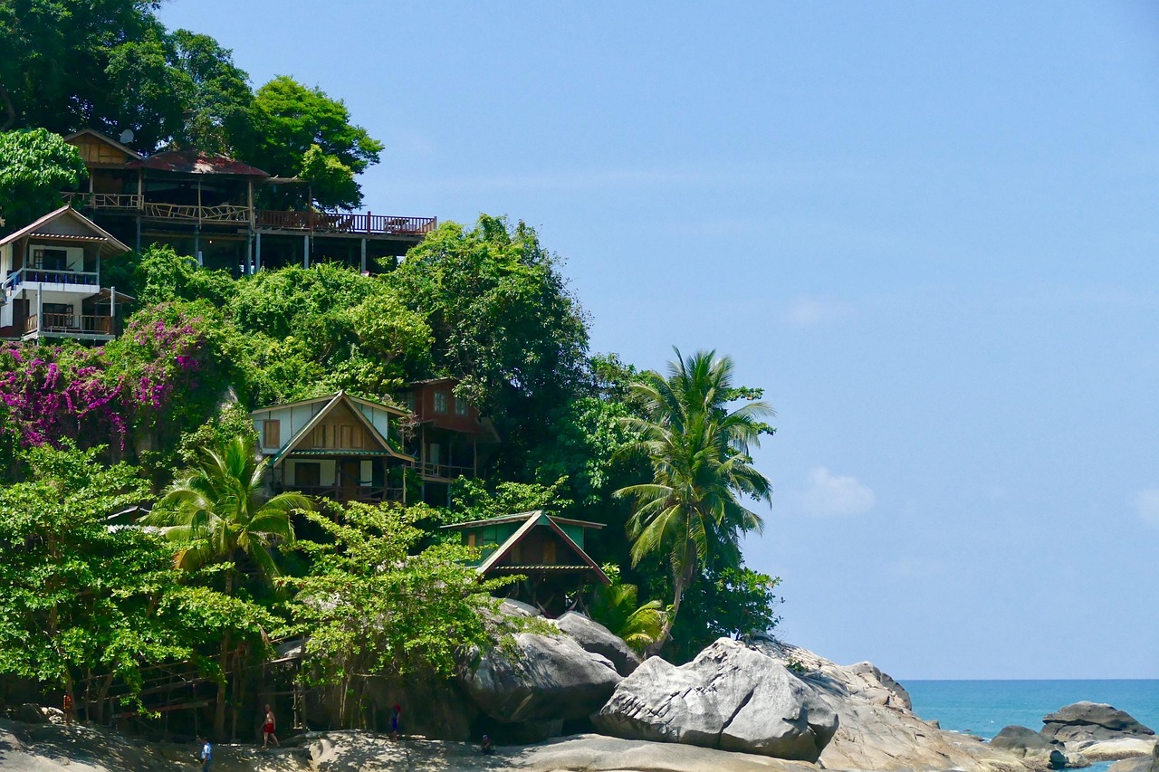
Ko Pha Ngan is the hilly, jungle-covered island between Ko Samui and Ko Tao in the Gulf of Thailand, about 20 km (12 miles) north of Samui. It is world famous for the Full Moon Party on Haad Rin’s Sunrise Beach, but most of the island has a very different mood: quiet coves on the north and east coasts reached by winding roads or long-tail boat, sunset beaches and yoga retreats in the west, waterfalls in the forested interior and a laid-back main town, Thong Sala, with a busy Saturday walking street. Come for the beaches, snorkeling around Ko Ma, waterfalls, wellness retreats, the parties if you want them, and boat trips to Ang Thong and Sail Rock. Like Samui, Ko Pha Ngan is driest from about January to August and wettest from October to December, when the northeast monsoon brings heavy rain and rough seas.
Right now in Ko Pha Ngan (Thong Sala)
- Wed25–28°C78–83°F24 mm rain
- Thu26–28°C78–83°F6 mm rain
- Fri27–29°C81–85°F13 mm rain
Top tours in Ko Pha Ngan
See all tours for Ko Pha Ngan →
From local operators, with prices and reviews; you check availability and book on Viator, our partner. We may earn a commission at no extra cost to you. How we earn money
Ko Pha Ngan at a glance
- Best for: beaches and coves, yoga and wellness retreats, snorkeling and diving trips, nightlife and the Full Moon Party, and slow island time.
- How long: 4–5 days for the beaches and one boat trip; a week or more to slow down, or to add Ko Tao.
- Best time: January to August, with highs of about 29–33 °C (84–91 °F); February to April are the driest and calmest months.
- Getting there: ferry or speedboat from Ko Samui in about 30 minutes, from Ko Tao in 1–1.5 hours, or a combined bus and ferry ticket from Bangkok, Surat Thani or Chumphon. There is no airport.
- Getting around: shared songthaews and taxis, ride-hailing in the busier areas, rental scooters and four-wheel-drive pickups, and long-tail boats to the remote beaches.
- Fees to know: Ang Thong Marine National Park’s fee is usually included in tour prices, and the park closes every year from November 1 to December 15.
- Before you go: entry rules, the Thailand Digital Arrival Card, money and general safety are in our Thailand travel guide.
Ko Pha Ngan’s areas: where things are
A paved road runs from Thong Sala, the port on the southwest coast, around the south and west of the island and up to Chaloklum in the north; steep side roads climb over the hills to the east-coast bays. The interior is mostly forest, part of Than Sadet–Ko Pha Ngan National Park.
Thong Sala
The island’s main town and ferry port: banks, supermarkets, a hospital, dive and travel agents, and the food market by the pier. On Saturday evenings the Thong Sala Walking Street fills with food stalls and handicrafts. Hotels here are convenient rather than beachy.
Haad Rin
The peninsula at the southeastern tip, with two beaches back to back: Sunrise Beach (Haad Rin Nok), the scene of the Full Moon Party, and the calmer Sunset Beach (Haad Rin Nai). Between them is a dense little town of guesthouses, bars and late-night food.
Ban Tai and Ban Khai
The flat south coast between Thong Sala and Haad Rin, with long, shallow beaches better for sunsets and paddleboarding than swimming at low tide.
Sri Thanu, Haad Yao and Haad Salad
The west coast is the island’s wellness and sunset side. Sri Thanu is the center of yoga, meditation and healthy cafés, with a lagoon and small beaches; Haad Yao is a long, gently curving beach with clear water; Haad Salad, just north, is a sheltered cove with good snorkeling.
Chaloklum, Mae Haad and Ko Ma
On the north coast, Chaloklum is a working fishing village around a wide bay, and Mae Haad is joined at low tide to the little island of Ko Ma by a sandbar, with some of the island’s best snorkeling just offshore. Haad Khom, a small cove nearby, also has good coral.
Thong Nai Pan and the east coast
Thong Nai Pan Noi and Thong Nai Pan Yai, two horseshoe bays in the northeast, are among Thailand’s prettiest beaches, with soft sand and a mix of upscale resorts and bungalows. Farther south, Haad Thian, Haad Yuan and Haad Sadet are reached mainly by long-tail boat or steep tracks, and Bottle Beach (Haad Khuad) in the north is a secluded bay usually reached by boat from Chaloklum.
Top things to see on Ko Pha Ngan
Than Sadet Waterfall and Haad Sadet
A series of cascades and pools that run down to the east-coast beach of Haad Sadet. King Chulalongkorn (Rama V) visited many times in the late 19th and early 20th centuries, and his initials, carved into a rock along with those of later kings, give the stream its royal name. The falls are best from about August to January, when there is water.
Phaeng Waterfall and the Domsila viewpoint
In the center of the island, the Phaeng Waterfall is the easiest of the falls to reach from the main road, with a short forest trail. A steeper path continues uphill to the Domsila viewpoint, which looks out over the west coast towards Ang Thong. Wear proper shoes; the rocks are slippery after rain.
Ko Ma and Mae Haad
Walk across the sandbar to Ko Ma at low tide (check the tide and take care when it rises), and snorkel the reef on the island’s sheltered side. The area is protected, so don’t stand on coral or feed the fish.
Bottle Beach
A long, quiet bay framed by jungle-covered hills in the north. A long-tail boat from Chaloklum is the usual way in; a steep, unpaved track also reaches it.
Temples and viewpoints
- Wat Phu Khao Noi: said to be the oldest temple on the island, on a hill near Thong Sala, with a white chedi and a quiet garden.
- Wat Khao Tham: a hilltop forest temple and meditation center above Ban Tai, with views of the south coast.
- The Chinese temple (Guanyin shrine): a colorful shrine on a hill near Chaloklum road, with a large statue and a view over the island.
- Khao Ra: at about 625 m (2,050 ft), the island’s highest peak; the forest trail is steep and best done with a local guide.
Churches and cathedrals
- Wat Phu Khao Noi
Beaches
- Bottle Beach (Hat Khuat)
- Haad Salad
Islands, snorkeling and diving
Ang Thong Marine National Park
The 42 islands of Mu Ko Ang Thong National Park lie west of Ko Pha Ngan: limestone islands with jungle, hidden lagoons, white beaches and the viewpoint on Ko Wua Talap. Day trips from Thong Sala include snorkeling, kayaking and the walk to the Emerald Lake on Ko Mae Ko. According to the national parks department, the whole park closes every year from November 1 to December 15, and boats can be canceled at other times in rough weather. See our guide to boat trips.
Sail Rock and Ko Tao
Sail Rock (Hin Bai), a pinnacle rising from the sea between Ko Pha Ngan and Ko Tao, is one of the best dive sites in the Gulf, with a vertical “chimney” swim-through and, in season, whale sharks. Island dive shops run trips there and courses for beginners. Ko Tao, an hour or so to the north, is a major place to learn to dive. See our guides to diving and snorkeling.
Beaches and water sports
The calmest swimming is usually on the west and north coasts and in the Thong Nai Pan bays; the south coast is shallow and reefy at low tide. See our guide to beaches.
Other things to do on Ko Pha Ngan
Food and drink
The island eats well for its size. Try southern Thai curries such as gaeng som and gaeng tai pla, grilled squid and fish at Chaloklum’s seafood restaurants, khao man gai and noodle soups at the Thong Sala food market, and fresh coconuts and fruit shakes everywhere. Sri Thanu is known for vegetarian, vegan and raw-food cafés; the Saturday Walking Street in Thong Sala is the best place to graze.
Yoga and wellness
Ko Pha Ngan is one of Thailand’s best-known places for yoga teacher trainings, meditation and detox retreats, especially around Sri Thanu and the west coast. Drop-in classes are easy to find.
The Full Moon Party and nightlife
Held on Haad Rin Sunrise Beach around each full moon, the Full Moon Party draws thousands of people to a night of music from beach bars, fire shows and dancing until after sunrise. Upcoming full moons fall on about October 26, November 24 and December 24, 2026; the exact party nights are set locally and can move, for example around Buddhist holidays, so check before you book. Other areas have smaller bars and live music.
Festivals
Songkran in mid-April is celebrated with water fights in Thong Sala and Haad Rin, and on Loy Krathong (November 24 in 2026) people float krathongs at beaches and piers.
Day trips from Ko Pha Ngan
- Ang Thong Marine National Park: a full day by boat, from December 16 to October 31.
- Ko Tao and Ko Nang Yuan: snorkeling and the famous three-island sandbar, by speedboat or high-speed catamaran.
- Ko Samui: the Big Buddha, Fisherman’s Village and shopping, 30 minutes by ferry; see our Ko Samui guide.
- Sail Rock: a full-day dive trip for certified divers.
Nearby destinations
- Ko Samui27 km
- Ko Tao44 km
- Ao Nang (Krabi)231 km
- Khao Lak232 km
- Ko Lanta260 km
- Ko Phi Phi263 km
- Phuket268 km
Getting there and getting around
By ferry from Ko Samui, Ko Tao and the mainland
There is no airport on Ko Pha Ngan, so everyone arrives by boat, mostly at Thong Sala pier. Lomprayah’s high-speed catamarans run from Bang Rak on Ko Samui about ten times a day (from 08:00 to 17:30 in its October 2026 timetable), from Maenam’s Pralarn pier, and from Ko Tao about six times a day; Seatran Discovery sails from Bang Rak and Nathon on Samui and from Don Sak on the mainland. The Haad Rin Queen links Big Buddha (Bang Rak) on Samui directly to Haad Rin. Car ferries run from Don Sak, near Surat Thani, in about 2.5 hours.
From Bangkok, Surat Thani and Chumphon
The easiest way from Bangkok is a flight to Ko Samui (USM) followed by a short ferry, or a flight to Surat Thani (URT) or Chumphon (CJM) with a combined bus-and-boat ticket. Lomprayah sells joint tickets from Bangkok (Khao San Road and Pinklao) with buses leaving at about 06:00 and from 21:00 to 22:00, and the State Railway of Thailand’s overnight trains run to Surat Thani (Phun Phin) and Chumphon, where buses connect with the boats. Sailings can be canceled in rough weather, especially from October to December.
Around the island
Shared songthaews (pickup taxis) wait at Thong Sala pier and charge per person by destination; private taxis and ride-hailing cars are available in the busier areas. Many visitors rent scooters, but the hill roads to Thong Nai Pan, Haad Rin and Haad Salad are very steep, and you need a motorcycle license, an International Driving Permit and a helmet. Long-tail boats from Haad Rin, Thong Nai Pan and Chaloklum reach the beaches with no road.
When to go and how long to stay
Ko Pha Ngan shares Samui’s Gulf climate: sheltered from the southwest monsoon that soaks Phuket from May to October, it gets its heaviest rain later, with the northeast monsoon. There is no long-term weather station on the island, so the table uses the 1991–2020 normals of the Thai Meteorological Department (TMD) for its Ko Samui station, about 25 km (16 miles) south, as submitted to the World Meteorological Organization (WMO): average daily highs and lows, total rain, and days with at least 1 mm of rain.
| Month | Average high / low | Rain (days with 1 mm or more) | What to expect |
|---|---|---|---|
| January | 29 °C (84 °F) / 24 °C (76 °F) | 127 mm (5.0 in), 8 days | Showers early in the month, then drying out; breezy |
| February | 29 °C (85 °F) / 25 °C (77 °F) | 64 mm (2.5 in), 4 days | Sunny and calm; one of the best months |
| March | 30 °C (87 °F) / 25 °C (78 °F) | 116 mm (4.6 in), 5 days | Mostly dry and sunny; clear water |
| April | 32 °C (89 °F) / 26 °C (79 °F) | 83 mm (3.3 in), 6 days | Hot and calm; Songkran water festival |
| May | 33 °C (91 °F) / 26 °C (78 °F) | 132 mm (5.2 in), 11 days | The hottest month; afternoon showers |
| June | 33 °C (91 °F) / 25 °C (78 °F) | 134 mm (5.3 in), 10 days | Mostly fine; good diving visibility |
| July | 32 °C (90 °F) / 25 °C (77 °F) | 117 mm (4.6 in), 11 days | Busy summer holidays; mostly fine |
| August | 32 °C (90 °F) / 25 °C (77 °F) | 102 mm (4.0 in), 10 days | Mostly fine; the waterfalls start to fill |
| September | 32 °C (89 °F) / 25 °C (77 °F) | 118 mm (4.6 in), 11 days | Showers increase; quieter and cheaper |
| October | 31 °C (87 °F) / 24 °C (76 °F) | 295 mm (11.6 in), 16 days | Northeast monsoon rains begin |
| November | 30 °C (85 °F) / 24 °C (75 °F) | 445 mm (17.5 in), 16 days | The wettest month; rough seas; Ang Thong closed from November 1 |
| December | 29 °C (85 °F) / 24 °C (75 °F) | 263 mm (10.4 in), 12 days | Still wet and windy early on; Ang Thong reopens December 16; busy at New Year |
The Samui station records about 1,990 mm (79 in) of rain a year, more than half of it from October to December, when downpours, strong winds and big waves on the east coast can cancel boats and make dirt roads impassable. From January to September it is mostly sunny with short showers.
Weather month by month
4 days on Ko Pha Ngan
Day one, sunset at Haad Yao or Sri Thanu. Day two, a boat trip to Ang Thong Marine National Park. Day three, the north: Chaloklum, snorkeling at Ko Ma and a long-tail to Bottle Beach. Day four, the waterfalls and viewpoints of the interior, and the Thong Sala market in the evening (on Saturday, the Walking Street).
A week or more
Add a few nights at Thong Nai Pan, a dive trip to Sail Rock or two or three nights on Ko Tao, and a yoga class or retreat.
Where to stay on Ko Pha Ngan
- Haad Rin: for nightlife and party nights; noisy, busy and expensive around the full moon.
- Thong Sala and Ban Tai: convenient for the pier, markets and budget stays.
- Sri Thanu and Haad Yao: sunsets, yoga and calm water on the west coast.
- Haad Salad and Mae Haad: small, pretty coves with good snorkeling.
- Thong Nai Pan: two beautiful bays and the island’s best resorts, but far from the pier.
- Bottle Beach, Haad Thian and Haad Yuan: for getting away from it all, mainly by boat.
Rates are highest from late December to April, in July and August, and in Haad Rin around the Full Moon Party. Many resorts add 10% service charge and 7% VAT (“++”).
What a trip to Ko Pha Ngan costs
Prices are approximate, for October 2026, converted at about 33 baht to the US dollar.
| Item | Typical cost |
|---|---|
| Street food or market dish | 50–120 baht (about US$1.50–3.60) |
| Seafood dinner for two in Chaloklum | 800–2,000 baht (about US$24–60) |
| Ferry or catamaran from Ko Samui | 250–450 baht (about US$7.50–14) |
| Shared songthaew from Thong Sala to Haad Rin | 100–200 baht per person (about US$3–6) |
| Scooter rental, per day | 200–350 baht (about US$6–11) |
| Ang Thong day trip, including park fee | 1,800–3,000 baht (about US$55–90) |
| Beach bungalow double | 800–2,000 baht (about US$24–60) |
| Mid-range or upscale resort double | 3,000–12,000 baht (about US$90–360) |
Practical tips for Ko Pha Ngan
- Book ahead around the full moon: boats, Haad Rin hotels and transfers fill up; some places sell multi-night packages only.
- Cash: ATMs are common in Thong Sala and Haad Rin but scarce on the remote beaches; carry cash for boats and small bungalows.
- Boats and weather: from October to December, leave a buffer day before an international flight.
- Temples: cover shoulders and knees at Wat Phu Khao Noi and the hilltop shrines.
- Cannabis and vaping: cannabis flower needs a Thai prescription, and e-cigarettes are illegal in Thailand.
- Help: the Tourist Police (1155) speak English, and the TAT Contact Center (1672) answers tourist questions.
Safety
Ko Pha Ngan is relaxed and friendly, but most problems come from the roads, the sea and party nights.
- Full Moon Party safety: go with friends and agree on a meeting point; buy sealed drinks and never leave a drink unattended, as spiked drinks are reported; the shared “buckets” are very strong. Keep away from fire-rope games, wear shoes against broken glass, leave passports and valuables in the hotel safe, and never swim after drinking. Illegal drugs carry heavy penalties, police checks are common, and cannabis is not legal for recreational use.
- Sea conditions: from about October to January the northeast monsoon brings big waves and rip currents to the east-coast beaches, including Haad Rin Sunrise Beach and Thong Nai Pan; swim only when flags allow it and keep to sheltered coves in rough weather.
- Jellyfish: the Tourism Authority of Thailand lists Ko Pha Ngan among the places where box jellyfish are occasionally reported, mainly in the rainy season; swim where notices and vinegar stations are posted, pour vinegar on a sting for at least 30 seconds and call 1669.
- Diving: dive with a licensed shop, check your certification level matches the site (Sail Rock is deep), and don’t fly within 18–24 hours of diving.
- Road safety: the hill roads are steep, sandy on the bends and slippery in rain; scooter crashes are the most common cause of injury. Wear a helmet, don’t ride at night if you are new to it, and never ride after drinking.
- Waterfalls and hikes: rocks are slippery and flash floods can follow heavy rain; don’t climb the falls.
- Emergencies: call 1155 for the Tourist Police (English spoken), 191 for the police and 1669 for an ambulance.
What to pack for Ko Pha Ngan
Swimwear and a rash guard, reef-safe sunscreen, a hat, sandals and water shoes for the reefs and waterfalls, a dry bag for long-tail boats, a headlamp for dark beach paths, a light rain jacket from October to December, and a sarong or long trousers for temples. Thailand uses 220 V; sockets take both flat two-pin and round two-pin plugs.
Ko Pha Ngan travel FAQ
When is the best time to visit Ko Pha Ngan?
From January to August, and especially February to April. The heaviest rain falls from October to December.
When is the next Full Moon Party?
It is held around each full moon; upcoming full moons are on about October 26, November 24 and December 24, 2026. Party nights are set locally and sometimes move, so check before you travel.
Is Ko Pha Ngan only a party island?
No. The Full Moon Party takes place on one beach in Haad Rin; the rest of the island is known for quiet coves, yoga retreats, waterfalls and snorkeling.
How do I get to Ko Pha Ngan?
By ferry or catamaran from Ko Samui (about 30 minutes) or Ko Tao (1–1.5 hours), or by combined bus and boat ticket from Surat Thani, Chumphon or Bangkok. There is no airport.
Which beach is best on Ko Pha Ngan?
Thong Nai Pan for beauty, Haad Yao and Haad Salad for swimming and sunsets, Bottle Beach for seclusion, and Haad Rin for nightlife.
Is Ko Pha Ngan good for snorkeling?
Yes, especially around Ko Ma and Mae Haad, Haad Salad and Haad Khom; Ang Thong and Ko Tao are good boat trips.
When is Ang Thong Marine National Park closed?
Every year from November 1 to December 15, according to the national parks department; boats may also be canceled in rough weather.
Do I need a scooter on Ko Pha Ngan?
Not necessarily. Songthaews and taxis cover the main routes, and long-tail boats reach the remote beaches. If you ride, you need a motorcycle license and a helmet, and the hill roads are steep.
How many days should I spend on Ko Pha Ngan?
Four or five days for the beaches and one boat trip; a week or more for slow travel, yoga or diving.
Is Ko Pha Ngan expensive?
It is cheaper than Ko Samui on the whole, with plenty of beach bungalows and market food, but Haad Rin prices rise sharply around party nights.
Plan your trip
Partner links: TravelerCenter may earn a commission if you book, at no extra cost to you.
🇹🇭 Useful Thai phrases for Ko Pha Ngan
All 38 Thai phrases: restaurant, hotel, emergencies, romance (printable) →
Sources · last reviewed 4 October 2026
Researched and last reviewed on 4 October 2026. Ang Thong closure dates: the Department of National Parks, Wildlife and Plant Conservation; ferry routes and October 2026 timetables: Lomprayah and Seatran Discovery; full moon dates: the US Naval Observatory; jellyfish areas, cannabis and e-cigarette rules, Loy Krathong and the Tourist Police: the Tourism Authority of Thailand (TAT); climate normals: the Thai Meteorological Department via the World Meteorological Organization’s 1991–2020 normals; exchange rate: the US Federal Reserve. Journey times, fares, sight details and typical prices are general references or estimates, flagged for checking. Prices and schedules change, so check the official sites before you go. For entry rules, money and general safety, see our Thailand travel guide.
Also: TMD normals 1991–2020, Ko Samui (climate)
Data: Weather: MET Norway (CC BY 4.0) · Sea temperature: NOAA CoastWatch · Rates: ECB · Costs: World Bank ICP and price levels · © OpenStreetMap contributors (ODBL) · Wikidata (CC0)