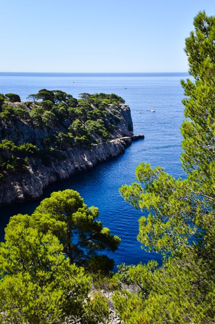
The Calanques National Park is a wild stretch of white limestone cliffs, pine-scented hills and turquoise coves (calanques) that begins inside Marseille and runs east past Cassis to La Ciotat, together with the islands and the sea around them. Created in 2012 as France’s tenth national park, it has no gates and no entry fee: you hike in on marked trails, see the cliffs from a boat, or paddle along them by kayak. It suits walkers, swimmers, climbers and anyone who loves rugged coastline, but it asks for preparation. From 1 June to 30 September a daily fire-risk map decides whether you may walk in at all, and on summer days the Sugiton cove needs a free booking. Give it one full day for a hike and a boat trip, or two or three days based in Marseille or Cassis.
Right now in Calanques National Park (Cassis)
- Wed19–21°C66–70°F60 mm rain
- Thu16–20°C60–68°F3 mm rain
- Fri13–19°C55–65°FClear
Top tours in Calanques National Park
See all tours for Calanques National Park →
From local operators, with prices and reviews; you check availability and book on Viator, our partner. We may earn a commission at no extra cost to you. How we earn money
Calanques National Park at a glance
- Best for: coastal hiking, swimming in clear coves, boat trips under the cliffs, kayaking, snorkelling, diving and climbing.
- How long: 1 day for one cove hike and a boat trip; 2–3 days to see the Marseille side, the Cassis side and La Ciotat.
- Best time: April to early June and late September to October, when the trails are open every day, the sea is still warm in autumn and the crowds are smaller.
- Getting in: fly to Marseille Provence airport or take the TGV to Marseille Saint-Charles, then city buses to the trailheads, or the regional train to Cassis in about 20 minutes.
- Getting around: on foot from bus stops and harbours; by boat from Marseille’s Vieux-Port, Cassis and La Ciotat. Driving is hard work in summer, when several access roads close.
- Before you go: entry rules, money and general safety are on our France travel guide; the city is in our Marseille travel guide, and the short visitor version of this page is our Calanques National Park attraction guide.
The park’s four sides and who each one suits
A calanque is a steep, narrow inlet cut into the limestone, with clear water at its foot. About 20 km of them line the coast between the southern edge of Marseille and Cassis, and the park continues east to the red cliffs of La Ciotat. The park describes itself as sitting at the meeting point of city and nature, in the heart of the Aix-Marseille-Provence metropolis, and it protects land and sea alike: the hills, the cliffs, the islands and a large marine area of seagrass meadows. It welcomes about three million visitors a year.
The Marseille side: Les Goudes to Sugiton
Most of the calanques belong to the city of Marseille, and almost all of them can be reached with a bus ticket and a walk. From west to east you pass Mont Rose and L’Escalette, the fishing village of Les Goudes, Cap Croisette, Callelongue at the end of the coast road, then Marseilleveyre, Sormiou, Morgiou, Sugiton and the Devenson cliffs. Best for travellers without a car who want to combine city sights and hikes.
The Cassis side: Port-Miou, Port-Pin and En-Vau
Only one calanque, Port-Miou, actually lies in the commune of Cassis, but this pretty fishing port is the gateway to the three most famous coves: Port-Miou, Port-Pin and En-Vau. It also has the shortest boat trips, white wine from the vineyards behind the town and the soaring Cap Canaille to the east. Best for a relaxed base with restaurants and a harbour.
The La Ciotat side: Cap Canaille, Figuerolles and the Île Verte
East of Cap Canaille the scenery changes: ochre and red conglomerate cliffs, the Bec de l’Aigle headland, the small calanques of Figuerolles and the Mugel, and the wooded Île Verte offshore. It is quieter, and the coves are only 15–30 minutes’ walk from the town centre. Best for families and short, easy outings.
The islands: Frioul and Riou
Facing Marseille, the Frioul archipelago (Pomègues, Ratonneau, If and Tiboulen) has a harbour village, walking paths and coves, reached by a year-round boat from the Vieux-Port. Further south, the Riou archipelago is uninhabited and protected for seabirds: landing is limited to a short stretch of its north-west coast between sunrise and sunset, and dogs are banned. Far offshore, the Planier lighthouse marks the park’s western edge.
Top things to see in the Calanques
Entry to the park is free, and it is open 24 hours a day, every day, except on days closed for fire risk. The coves below are the best known; walking times come from the national park and are one way from the nearest bus stop or car park.
Sugiton and the Pierres Tombées
The classic Marseille-side cove: a narrow inlet of blue water below a pine-covered slope, with flat rocks for swimming and the fallen boulders of the Pierres Tombées next door, plus a viewpoint (belvédère) high above. Before bookings began, the park counted peaks of 2,500 visitors a day, which washed the soil down the slope. How to visit: take bus B1 from Castellane to the Luminy campus stop (Luminy – PN des Calanques), then walk about 45 minutes down, and longer back up. On busy summer days a free online booking is compulsory (details below).
En-Vau and Port-Pin
En-Vau is the most famous calanque of all: a deep, narrow fjord between towering walls, ending in a small pebble beach. Port-Pin, next door, has a tiny sandy cove shaded by leaning Aleppo pines. How to visit: the park entrance on the Cassis peninsula at Port-Miou is about 30 minutes’ walk from the centre of Cassis; allow about 15 minutes more to Port-Pin and about an hour to En-Vau, where the final descent is steep and tiring in summer. Until June 2027, works on a new water reservoir disrupt the Port-Miou area: hikers coming from the Col de la Gardiole or the Auberge de la Fontasse must detour via Port-Pin (allow an extra hour), and the cycle track between the Fontasse and Port-Miou is closed.
Sormiou and Morgiou
Two larger calanques with fishermen’s huts (cabanons), small harbours and beaches. Sormiou’s beach is one of only two lifeguarded beaches in the park in summer, with Saint-Estève on the Frioul. How to visit: bus 23 to La Cayolle or bus 22 to Les Baumettes, then about 45 minutes on foot to Sormiou, or about an hour to Morgiou. The narrow roads down are closed to unauthorised cars from 7:00 to 19:00 in the busy season.
Les Goudes, Callelongue and Marseilleveyre
The coast road south of Marseille ends at Les Goudes and Callelongue, two tiny harbours with seafood restaurants and the start of trails into the Marseilleveyre massif; the calanque of Marseilleveyre is about 45 minutes’ walk from the Callelongue bus terminus. From 1 September 2026 to 31 March 2027, work to make old lead-smelting waste safe between the calanque of Saména and Callelongue brings traffic lights on the road, and car access to Callelongue is reserved for residents at weekends and in school holidays. Take bus 19 then bus 20 (every 20–30 minutes, 6:30–20:00 daily), or cycle.
Cap Canaille and the Route des Crêtes
Between Cassis and La Ciotat, the cliffs of Cap Canaille rise straight from the sea and are among the highest sea cliffs in Europe. The Route des Crêtes (D141) runs along their top with roadside viewpoints over Cassis bay and the calanques, and is one of the few places with a view that needs no hike. It closes on red fire-risk days between 1 June and 30 September and in very strong winds.
Figuerolles, the Mugel and the Île Verte
La Ciotat’s calanques are short walks from town (15–30 minutes) or bus line 30. Figuerolles is a small cove between strange eroded rocks; the Mugel lies below the Bec de l’Aigle, and since April 2025 its coves are a children’s marine reserve where fishing from the shore and spearfishing are banned. How to visit the Île Verte: a shuttle boat leaves La Ciotat’s Vieux-Port roughly hourly from April to September (call ahead for October), for €14 return for adults and €9 for children under 10, cash or cheque only, according to the operator.
Access rules: fire risk, bookings and road closures
Rules from the Calanques National Park, the Bouches-du-Rhône prefecture and the Ville de Marseille, as of October 2026. They change each summer, so check before every visit.
The summer fire-risk map
From 1 June to 30 September, the prefecture decides each day whether the wild hills (massifs) are open, including the Calanques, Cap Canaille and Grand Caunet massifs. The map for the next day is published around 18:00 on risque-prevention-incendie.fr/bouches-du-rhone, on the park’s Mes Calanques app and on 0811 20 13 13. Green means access is allowed; red means you may not enter on foot, by bike or by car, and the Route des Crêtes closes. On red days you can still see the Calanques from a boat, but landing is strictly forbidden; the Frioul islands stay open. In 2026, for example, Thursday 2 July was classed red. Outside that period there is no daily map, but stay off the trails on very windy, dry days.
Sugiton booking in 2026 and 2027
To stop erosion, the park requires a free online booking for the Sugiton and Pierres Tombées coves on the busiest days. In 2026 it applied on 20–21 June, every day from 27 June to 30 August, and on 5–6 and 12–13 September. Bookings open three days before at 9:00 and close the day before at 18:00; each one covers a whole day for up to five people (children under 3 are not counted), and one person can book up to eight times in the season. Show the confirmation email when asked. If the hills close for fire risk, all bookings for that day are cancelled and cannot be moved. The park has renewed the scheme until 2027; look for the 2027 dates on its website in late spring.
Road closures
The roads down to Sormiou, Morgiou and Callelongue are closed to unauthorised vehicles from 7:00 to 19:00 in the busy season. In 2026 that meant 5–7 June and every day from 12 June to 30 August, plus weekends in September for Sormiou and Morgiou. The Gardiole track and the road to Cap Croisette are closed to motor traffic for good. Buses 20, 22 and 23 reach the trailheads instead.
Rules all year
- No fire and no smoking: fires and barbecues are banned all year (the park cites fines of €135).
- No camping: camping and bivouacking are banned, including along the roads (€68 per person, according to the park).
- Leave no trace: there are no bins in the park, so take all rubbish home; no loudspeakers, no picking plants and no feeding animals.
- Stay on the paths: keep to marked trails and out of the fenced plant-regeneration areas.
- Dogs: allowed on a lead, but banned on the Riou archipelago.
- Drones: any motorised flight below 1,000 m above the ground, including leisure drones, is banned without a permit.
- Bikes: allowed only on a mapped network of tracks; e-bikes must be pedal-assisted, under 250 W.
Seeing the Calanques from the sea
Boat trips
A cruise along the cliffs is the easiest way to see the Calanques with children, in the heat or on a red fire-risk day. Boats leave Marseille’s Vieux-Port and Cassis harbour and usually last one to three hours. Only a limited number of companies are allowed to carry passengers in the park: look for the orange flag and sticker; a blue Esprit Parc national flag marks boats with a quality and environmental label. From Cassis, tours run all year, weather permitting, and cover 3, 5, 8 or 9 calanques. As of October 2026 one Cassis operator lists adult fares from €21 for 3 calanques (about 1 hour) to €33 for 9 calanques (about 2 h 20). Tickets for Cassis boats are sold at kiosks on the harbour. See our boat trips guide for more.
Kayak and paddleboard
Paddling lets you reach the coves quietly. Since May 2023 only renters approved by the park may hire out kayaks and paddleboards, and around En-Vau and Port-Pin only three are authorised. Classic routes are Pointe Rouge to Cap Croisette (half a day), Cassis to En-Vau (half a day) and a lap of the Île Verte from La Ciotat. Unregistered craft must stay within 300 m of the coast by day. Landing is banned on the Riou islands (except two small spots), at Sugiton and the Pierres Tombées during the booking period, at Port-Pin and En-Vau from 1 May to 30 September, and everywhere on red fire-risk days. Wear a life jacket and check the marine forecast: the mistral can make the sea rough very quickly.
Swimming, snorkelling and diving
The coves are small, unequipped and very busy in summer, and the water is often colder than you expect, because of underground springs and currents. Swim only in calm seas and stay out of the regeneration areas; currents on the southern Marseille coast, from Mont Rose to Les Goudes, can be dangerous. If swimming is the main aim, the park itself suggests the town beaches of Marseille, Cassis and La Ciotat, which have toilets and lifeguards. The Calanques are the cradle of modern diving, with walls, wrecks and seagrass; use the free mooring buoys, never anchor on seagrass, and note that diving is banned in two archaeological zones, off Riou and at Cap Morgiou. Our snorkeling guide, diving guide and beaches guide have more.
Hiking in the Calanques
The Calanques are first of all hiking country, and the park warns every year about walkers who need rescuing. Paths are rocky, steep and exposed, with slippery or sharp limestone, and there is no water, no toilets, no shops and no bins on the trails. Carry plenty of water: the park’s minimum is 1.5 litres per person for every half-day, and double that on hot days or long walks, so two litres each is a sensible start. Wear walking shoes (never sandals), a hat and light long sleeves, and study your route on an IGN map or the Mes Calanques app.
Good walks include the Sugiton cove and belvédère from Luminy, Sormiou by the Col de Sormiou, the tour of the Marseilleveyre massif, En-Vau by Port-Pin from Cassis, the En-Vau viewpoint from the Gineste road, the Bec de l’Aigle semaphore and the Mugel loop at La Ciotat, and a lap of Ratonneau island on the Frioul. Strong walkers can cross the park from Marseille to Cassis in three stages, as the park’s own “traversée des Calanques” suggests, largely on the long-distance GR98 path. Read our hiking guide for gear and trail tips across France.
Towns around the park
Marseille
France’s oldest city is the main base, with the Vieux-Port, Le Panier, the MuCEM, Notre-Dame de la Garde and boats to the Château d’If. It also has Cosquer Méditerranée by the MuCEM, a full-size replica of the Cosquer cave, a prehistoric painted cave whose entrance lies underwater below Cap Morgiou. See our Marseille travel guide.
Cassis
A pastel fishing port with cafés on the quay, small town beaches, boats into the Calanques and a white-wine appellation on the slopes below Cap Canaille. Many estates welcome visitors for a wine tasting. In summer the centre is jammed with cars, so arrive by train or park outside.
La Ciotat
A shipbuilding town with a sweeping bay, where the Lumière brothers filmed one of the first films, with the historic Eden cinema and the park’s first visitor centre, the Maison du Parc national in the 18th-century Villa Michel Simon above the town, which held its first open days on 26–27 September 2026; check the park’s website for regular opening times.
Aix-en-Provence and inland Provence
Elegant Aix is 30–40 minutes from Marseille by express bus; read our Aix-en-Provence travel guide. Further inland, our Provence guide covers the Luberon villages, Arles and Avignon, and the coast continues east to the French Riviera.
Getting there and getting around
By air and train
Marseille Provence airport (MRS) is about 25 km north-west of Marseille; shuttle bus A1 reaches Saint-Charles station in 25–35 minutes for €10 one way (as of October 2026), and Cassis is about 50 minutes away by car. TGV trains link Paris Gare de Lyon and Marseille Saint-Charles in about 3 h 10–3 h 30. Regional trains run from Saint-Charles to Cassis in about 20 minutes and on to La Ciotat. Cassis station is about 3 km above the port: take bus M01 to the centre, then walk 30 minutes to the park entrance at Port-Miou.
Buses to the trailheads from Marseille
RTM city buses reach every Marseille entrance for one ticket, €1.70 with an hour of connections (as of October 2026); you can also tap a contactless bank card on the validators. Walking times below are the park’s, from the last stop.
- Sugiton: bus B1 from Castellane to Luminy – PN des Calanques, then about 45 minutes.
- Sormiou: bus 23 to La Cayolle or bus 22 to Les Baumettes, then about 45 minutes.
- Morgiou: bus 22 to Les Baumettes, then about 1 hour.
- Les Goudes, Callelongue and Marseilleveyre: bus 19 to Madrague de Montredon, then bus 20 to Callelongue; Marseilleveyre cove is about 45 minutes on foot.
- By sea: the Frioul–If boat runs all year from the Vieux-Port, and in summer an RTM sea shuttle links the Vieux-Port and Pointe Rouge with Les Goudes.
Driving and parking
The park advises against driving: parking near the coves is rare, unguarded and often closed in summer, so never leave valuables in the car. In Cassis, use the free Les Gorguettes park-and-ride by the A50 exit; buses 372 (to the centre) and 373 (towards Bestouan and the Calanques) cost €1.70 return, according to the Cassis tourist office. In La Ciotat, park at the Mugel car park and walk. Central Marseille is a low-emission zone (ZFE-m) inside its ring of boulevards, in force 24/7: as of October 2026 vehicles with Crit’Air 4 or 5 stickers or none are banned from driving or parking there, with a €68 fine, so foreign cars need a Crit’Air sticker.
When to go and how long to stay
The Calanques have hot, dry summers, mild autumns and cool, bright winters, with the mistral, a cold north-westerly wind, blowing for days at a time, mostly in winter and spring. The table uses Météo-France’s official 1991–2020 normals for its Cassis station, at 212 m in the hills between the coves: average daily highs and lows, and days with at least 1 mm of rain.
| Season | Average high / low | Rainy days per month | What it’s like | Good for |
|---|---|---|---|---|
| Winter (Dec–Feb) | 12–13 °C / 4–6 °C | 5–6 | Cool, often bright; the mistral can be bitter | Empty trails, long hikes, clear views |
| Spring (Mar–May) | 15–22 °C / 6–12 °C | 5–6 | Mild and sunny, flowers in the scrub, windy days | Hiking every day, climbing, boat trips |
| Summer (Jun–Aug) | 26–29 °C / 16–18 °C | 1–3 | Hot, dry and crowded; fire-risk closures and Sugiton bookings | Early-morning swims, boat trips, kayaking |
| Autumn (Sep–Nov) | 25 °C falling to 16 °C / 15 °C falling to 8 °C | 5–7 | Warm sea in September and October; short, heavy storms | Hiking, swimming in September, quiet coves |
Cassis gets about 615 mm of rain a year on 57 days, with almost none in July, and about 28 days a year above 30 °C. In summer, start hikes at dawn and swim in the morning or late afternoon. October is often the best month of all: the fire-risk rules have ended, the sea is still pleasant and the coves are calm on weekdays. To avoid crowds, the park recommends autumn or winter weekdays outside school holidays.
How long to stay: 1-, 2- and 3-day plans
1 day: take an early bus to Luminy and hike to Sugiton and its viewpoint, then a late-afternoon boat trip from the Vieux-Port. 2 days: add Cassis: walk to Port-Pin and En-Vau in the morning, have lunch on the harbour and drive or walk part of the Route des Crêtes for sunset.
3 days: add Sormiou or the Marseilleveyre massif from Callelongue, or La Ciotat with the Mugel, Figuerolles and the Île Verte shuttle. In summer, check the fire map every evening and keep a boat trip as your plan B.
Where to stay near the Calanques
- Marseille, Vieux-Port: the most choice, boats from the quay and buses to every trailhead.
- Marseille, Prado and Pointe Rouge: by the southern beaches, on the way to Les Goudes and Callelongue.
- Cassis: charming and walkable to Port-Miou, Port-Pin and En-Vau; pricier and busy in summer.
- La Ciotat: better value, a long sandy bay and easy walks to its own calanques.
There is no lodging or camping inside the park. Every town charges a tourist tax (taxe de séjour) per person per night. In Cassis, as of 2026, it is about €1.15 in 1-star hotels, B&Bs and hostels, €1.44 in 2-star, €2.45 in 3-star, €3.74 in 4-star and €4.90 in 5-star hotels, according to the town’s tourist-tax office and the official government database. These totals include the department’s 10% surcharge and a 34% regional surcharge that funds the new Provence–Côte d’Azur railway line, applied across the Bouches-du-Rhône, the Var and the Alpes-Maritimes. Unclassified rentals pay 5% of the nightly price per person, within a cap, plus the surcharges. Marseille and La Ciotat charge similar rates by category. Under-18s are exempt.
Practical tips for the Calanques
- Check the map at 18:00: from June to September, look at the next day’s fire-risk map before any hike, and install the Mes Calanques app for alerts.
- Book Sugiton: on summer booking days, reserve three days ahead from 9:00.
- Respect the climb back: never go down into a cove you cannot climb back out of in the heat; the way back is always harder.
- Mistral days: boats may be cancelled and the sea turns cold and rough; choose a sheltered hike instead.
- Late October: the Marseille–Cassis road race takes place on the last Sunday of October, and Cassis bus 372 does not run that day.
- Water quality: the Ville de Marseille publishes bathing-water results for Saint-Estève, Sormiou, Morgiou, En-Vau and Port-Pin in summer.
- Emergencies: call 112 on land; at sea, VHF channel 16 or 196 from a mobile reaches the CROSS Med rescue centre.
What to pack for the Calanques
Bring hiking shoes with good grip for polished limestone, a small daypack, at least two litres of water each, food, a sun hat, sunglasses and a light long-sleeved shirt; the park recommends covering up rather than wearing lots of sunscreen, which harms marine life. Pack a swimsuit, a quick-dry towel, water shoes for rocky entries and a mask for snorkelling, plus a rubbish bag, as there are no bins. A windproof layer is worth carrying in any season, and from November to March add a warm fleece for the wind on the ridges.
Calanques National Park travel FAQ
Is the Calanques National Park free?
Yes. There is no entry fee and no gate, and the park is open around the clock. The only booking is a free one for the Sugiton and Pierres Tombées coves on busy summer days.
Are the Calanques open in summer?
It depends on the day. From 1 June to 30 September the prefecture publishes a map around 18:00 for the next day: green means open, red means closed on foot, by bike and by car. On red days you can only see the Calanques from a boat, without landing.
Do I need to book the Calanque de Sugiton?
Only on the busy days the park sets each year. In 2026 a free online booking was needed on 20–21 June, every day from 27 June to 30 August, and on 5–6 and 12–13 September, for Sugiton and the Pierres Tombées. Bookings open three days ahead at 9:00. The scheme continues in 2027.
What is the most beautiful calanque?
En-Vau, a deep fjord between towering cliffs, is the most famous, with Sugiton, Sormiou and Port-Pin close behind. All four are steep walks and very busy in summer, so go early or out of season.
How long is the walk to En-Vau from Cassis?
About 30 minutes from the centre of Cassis to the park entrance at Port-Miou, 15 minutes more to Port-Pin and about an hour more to En-Vau, with a steep final descent. Allow half a day there and back.
How do I get to the Calanques from Marseille without a car?
By RTM city bus: B1 from Castellane to Luminy for Sugiton, 22 or 23 for Sormiou and Morgiou, and 19 then 20 for Les Goudes and Callelongue. A ticket costs €1.70 as of October 2026. For the Cassis coves, take the regional train to Cassis in about 20 minutes.
How much is a boat trip in the Calanques?
From Cassis, as of October 2026, one operator charges adults €21 for 3 calanques (about 1 hour) up to €33 for 9 calanques (about 2 h 20). Cruises from Marseille’s Vieux-Port usually last one to three hours. Choose a boat flying the park’s orange flag.
Can I swim in the Calanques?
Yes, at your own risk and only in calm seas. Only Sormiou and Saint-Estève on the Frioul have lifeguards in summer, and there are no toilets or water points. The water is often cold because of underground springs.
Can I bring my dog to the Calanques?
Yes, on a lead, except on the Riou archipelago, where dogs are banned to protect nesting seabirds. Remember that the trails are hot and stony for paws in summer.
Can I camp or have a barbecue in the Calanques?
No. Camping, bivouacking, fires and smoking are banned all year in the core of the park, with fines the park gives as €68 for bivouacking and €135 for lighting a fire.
What is the best time to visit the Calanques?
April to early June and late September to October. The trails are open every day, the weather is warm and the crowds are thinner; in autumn the sea is still good for swimming.
Plan your trip
Partner links: TravelerCenter may earn a commission if you book, at no extra cost to you.
🇫🇷 Useful French phrases for Calanques National Park
All 38 French phrases: restaurant, hotel, emergencies, romance (printable) →
Sources · last reviewed 4 October 2026
Researched and last reviewed on 4 October 2026. Access, booking, road-closure and safety rules come from the Calanques National Park, the Bouches-du-Rhône prefecture’s fire-risk map and the Ville de Marseille; Cassis parking, shuttles and boat information from the Cassis tourist office and boat operators; the Île Verte shuttle from its operator; the low-emission zone from the Aix-Marseille-Provence metropolis. Tourist-tax rates come from the Cassis tourist-tax office and the French tax authority’s open data; climate figures are Météo-France’s 1991–2020 normals for Cassis. Train and walking times are approximate. Rules, timetables and prices change, so check the official sites before you travel. For entry rules, money and general safety, see our France travel guide.
Data: Weather: MET Norway (CC BY 4.0) · Sea temperature: NOAA CoastWatch · Rates: ECB · Costs: World Bank ICP and price levels · © OpenStreetMap contributors (ODBL) · Wikidata (CC0)