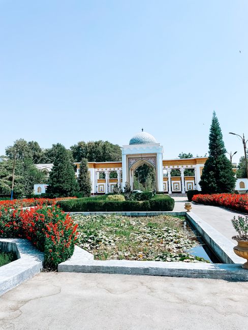
Tajikistan is the most mountainous country in Central Asia, a land of colossal peaks, glaciers, turquoise lakes and high desert plateaus where more than 90% of the territory is mountains and half lies above 3,000 m (9,800 ft). It is the heartland of Persian culture in Central Asia, with a language close to Farsi, poetry, ancient Sogdian cities and a deep tradition of hospitality. The capital, Dushanbe, is a green city of grand boulevards and new monuments, the starting point for two of the great road trips of Asia: west into the Fann Mountains, with the lakes of Iskanderkul and the Seven Lakes, and east along the Pamir Highway, which climbs through the Gorno-Badakhshan region, follows the Panj River along the Afghan border in the Wakhan Valley and crosses passes of more than 4,000 m (13,000 ft) on the “Roof of the World.” In the north, Khujand and Istaravshan in the Fergana Valley, and Penjikent with its Sogdian ruins, reveal the Silk Road past. Tajikistan needs more planning than its neighbors: citizens of dozens of countries can visit visa-free for 30 days, others need an e-visa, and everyone needs a special permit for the Pamirs; roads are rough, altitudes extreme, and some border areas sensitive.
Right now in Tajikistan
- Wed 12–23°C 53–74°F Cloudy
- Thu 16–26°C 61–78°F Clear
- Fri 15–24°C 58–75°F Clear
Weather: MET Norway (CC BY 4.0) · Air quality: OpenAQ
Multi-day tours of Tajikistan
Multi-day tours from local operators. You check dates and book on Viator, our partner; we may earn a commission at no extra cost to you. How we earn money
Tajikistan at a glance
The Republic of Tajikistan has a population of about 10.5 million and covers about 143,000 km² (55,300 sq miles), slightly larger than Greece. Its highest peak, Ismoil Somoni (formerly Communism Peak), reaches 7,495 m (24,590 ft). It borders Uzbekistan, Kyrgyzstan, China and Afghanistan. The country is divided into the Sughd region in the north, Khatlon in the southwest, the Gorno-Badakhshan Autonomous Region (GBAO) in the east, the districts around Dushanbe, and the capital itself. Tajik, a Persian language written in Cyrillic, is the state language; Russian is widely used, and the Pamiri peoples of Badakhshan speak their own languages. Most Tajiks are Sunni Muslims, while most Pamiris are Ismaili Shia Muslims, followers of the Aga Khan.
Tajikistan uses UTC+5 all year, with no daylight saving time. Electricity is 220 V, with round two-pin sockets (types C and F). The currency is the somoni (TJS).
A short history
The lands of today’s Tajikistan were part of ancient Sogdiana and Bactria, crossed by Alexander the Great and the Silk Road; Penjikent and Sarazm are among the oldest towns in Central Asia. The Samanid dynasty of the 9th and 10th centuries, whose ruler Ismoil Somoni is now the national hero, made Bukhara and Samarkand centers of Persian culture. After centuries under Turkic, Mongol and Uzbek rulers, the region came under Russian control in the 19th century; in the Soviet era, the Tajik SSR was created in 1929, but Samarkand and Bukhara, with large Tajik-speaking populations, remained in Uzbekistan. After independence in 1991, a civil war from 1992 to 1997 killed tens of thousands of people before a peace agreement. Since then, the country has rebuilt, with new roads, tunnels and hydropower dams.
Tajikistan’s regions
- Dushanbe and the center: the capital, the Hissar fortress, the Varzob gorge and the Romit valley.
- The Fann Mountains and the Zarafshan valley: Iskanderkul, the Seven Lakes (Haft Kul), the Alauddin lakes, Penjikent and Sarazm.
- The north (Sughd): Khujand on the Syr Darya, the old town of Istaravshan, and the Fergana Valley.
- The south (Khatlon): the Nurek reservoir, the tugay forests of Tigrovaya Balka, and towns near the Afghan border, some requiring permits.
- The Pamirs (GBAO): Khorog, the Bartang Valley, the Wakhan Valley, Murghab, Karakul lake and the Pamir Highway.
Where to go: the Pamirs, the Fann Mountains and the Silk Road
Most visitors start in Dushanbe and head either west to the Fann Mountains or east to the Pamirs, or both. See our guide to the capital:
- Dushanbe: the capital, with Rudaki Avenue, the National Museum, the Museum of Antiquities with its giant reclining Buddha, the Hissar fortress and the mountains of the Varzob gorge.
The Pamir Highway (M41) runs about 1,200 km (750 miles) from Dushanbe through Kalaikhum and Khorog, the friendly capital of Badakhshan, across the high plateau of the eastern Pamirs via Murghab and the lake of Karakul to the Kyrgyz border and Osh. The most popular detour is the Wakhan Valley, which follows the Panj River opposite the Afghan villages and the Hindu Kush peaks, with ancient fortresses at Yamchun and Khaakha, Buddhist stupas, hot springs at Bibi Fatima and Garm Chashma, and homestays in traditional Pamiri houses. The remote Bartang Valley is wilder still. Allow at least 7–10 days for the Pamirs. On the high, treeless eastern Pamir plateau, the landscape changes completely: Kyrgyz herders live in yurts and stone houses around Murghab, wild Marco Polo sheep and yaks graze the valleys, and the vast salt lake of Karakul, at about 3,900 m (12,800 ft), lies in a meteorite crater below snowy peaks. The Bartang Valley, reached by a rough track from Rushan, has some of the most remote villages in Central Asia and treks to the Grumchevir and Geisev valleys, while the Shokh Dara and Gunt valleys near Khorog offer quieter alternatives to the main road.
The Fann Mountains, about 2–4 hours northwest of Dushanbe, are a compact range of jagged peaks and turquoise lakes, ideal for trekking. Iskanderkul, a lake at about 2,200 m (7,200 ft) named after Alexander the Great, has a waterfall and guesthouses, and the Seven Lakes of the Marguzor valley near Penjikent change color from one to the next. Penjikent has the ruins of a Sogdian city with famous murals, and nearby Sarazm, a Bronze Age settlement, is a UNESCO World Heritage Site.
In the north, Khujand, Tajikistan’s second city on the Syr Darya, has a fortress, a large bazaar and a museum, and Istaravshan has one of the region’s best-preserved old towns and craft workshops.
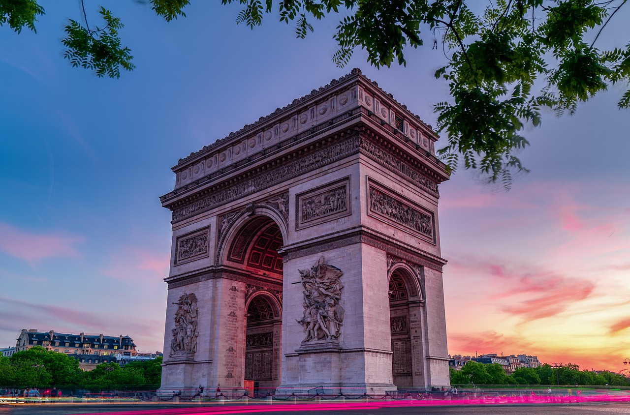
Dushanbe Travel Guide
Plan a trip to Dushanbe: where to stay, Rudaki Avenue and Park, the Ismoil Somoni monument, the National Museum and the giant Buddha of…
Best time to visit Tajikistan
Tajikistan’s climate depends on altitude. In the lowlands, around Dushanbe and Khujand, summers are hot and dry, with highs around 35 °C (95 °F) or more in July and August, and winters are mild to cold, with rain and snow. In the mountains, summers are short and cool, and winters long and severe; the eastern Pamir plateau around Murghab, at about 3,600 m (11,800 ft), is one of the coldest inhabited places in Central Asia, with winter temperatures far below −20 °C (−4 °F).
- Pamir Highway and high treks: late June to mid-September, when the passes are open and the homestays are running; July and August are the peak months.
- Fann Mountains: June to September for trekking.
- Dushanbe and the lowlands: April to May and September to October, avoiding the summer heat.
- Winter: from November to March, many mountain roads are closed or dangerous, and travel in the Pamirs is for the well-prepared only.
Tajikistan’s stations are not included in the World Meteorological Organization’s 1991–2020 normals archive. The table shows long-term averages for Dushanbe compiled from Tajik Hydromet’s station records by a climate reference service (flagged as a secondary source), and for the high Pamir approach, the 1991–2020 WMO normals of the Sary-Tash station of Kyrgyzhydromet, at 3,150 m (10,330 ft) on the Kyrgyz side of the Pamir Highway, which records only average temperatures.
| Area (station) | January | July | Precipitation a year | Wettest months |
|---|---|---|---|---|
| Dushanbe, 800 m (2,620 ft) | high 9 °C (48 °F) / low −1 °C (30 °F) | high 36 °C (98 °F) / low 19 °C (66 °F) | about 620 mm (24 in) | February to April |
| Pamir approach: Sary-Tash, 3,150 m (10,330 ft) | average −15.5 °C (4 °F) | average 10.2 °C (50 °F) | not published | Summer showers and storms |
Tajikistan month by month
| Month | Weather | Highlights | Crowds and prices |
|---|---|---|---|
| January | Cold; snow in the mountains | Quiet Dushanbe; skiing at Safed Dara | Low |
| February | Cold and wet | Winter in the capital | Low |
| March | Mild lowlands, wet | Navruz (March 21–24), with feasts and music | Low |
| April | Warm and green | Blossom in the valleys; good for Dushanbe and the north | Moderate |
| May | Warm; snow on the passes | Lowland travel; lower Fann valleys | Moderate |
| June | Hot lowlands; mountains opening | Fann treks begin; Pamir Highway opens | Moderate to high |
| July | Hot lowlands; best mountain weather | Pamir Highway, Wakhan and high treks | High |
| August | Hot lowlands; cool mountains | Peak season in the Pamirs; harvest | High |
| September | Warm days; cold nights up high | Excellent for the Pamirs and Fanns; Independence Day (September 9) | Moderate |
| October | Cool; first snow on the passes | Autumn colors; lowland markets | Low |
| November | Cold | Mountain roads closing | Low |
| December | Cold | Quiet season | Low |
Festivals and holidays
- Navruz: the Persian New Year, a public holiday from March 21 to 24, with family feasts, sumanak (wheat pudding), music, buzkashi (horseback games) and fairs.
- Independence Day: September 9, with concerts and celebrations in Dushanbe.
- Eid al-Fitr and Eid al-Adha: public holidays whose dates move about 11 days earlier each year.
- Roof of the World Festival: a music and culture festival in Khorog in some summers; check dates locally.
Altitude on the Pamir Highway
The Pamir Highway climbs to the Ak-Baital Pass at about 4,655 m (15,270 ft), and towns such as Murghab, at about 3,600 m (11,800 ft), and Karakul, at about 3,900 m (12,800 ft), are high enough to cause altitude sickness in anyone. Travel from the west, where the climb is more gradual, spend nights at intermediate altitudes in the Wakhan or Khorog before going higher, drink plenty of water, avoid alcohol, and descend at once if you develop severe headache, vomiting, breathlessness at rest or confusion. Nights on the plateau are freezing even in summer.
How long to stay: sample itineraries
- 5–6 days: Dushanbe (2 nights), then Iskanderkul and the Seven Lakes (3), with Penjikent, leaving via the border to Samarkand.
- 10–12 days: Dushanbe, then the Pamir Highway via Kalaikhum and Khorog, the Wakhan Valley (3 days), Murghab and Karakul, crossing to Osh in Kyrgyzstan.
- Two to three weeks: combine the Fann Mountains and the Pamirs, adding the Bartang Valley or treks in the Wakhan, and continue to Kyrgyzstan or Uzbekistan.
Entry, permits and money
Visa-free entry (last reviewed October 2026)
According to Tajikistan’s Ministry of Foreign Affairs, citizens of more than 70 countries can visit without a visa for up to 30 days under a unilateral visa-free regime introduced in 2022 and expanded in 2024, among them the United States, Canada, Australia, New Zealand, Japan, South Korea, Germany, France, Italy, Spain, the Netherlands, Switzerland, Austria, the Nordic and Baltic countries, Poland, Ireland, Malaysia, Singapore, Indonesia, Thailand, the Philippines, Brazil, Mexico, the United Arab Emirates and Saudi Arabia. Visa-free visitors must register with the Ministry of Internal Affairs within 10 working days of arrival. Citizens of China, Vietnam and some other countries aged 55 and over can visit visa-free for up to 14 days. The United Kingdom is not on the visa-free list: according to the UK government, British citizens need a visa.
The e-visa
Visitors who need a visa can apply for an e-visa on the official portal, evisa.tj, run by the Ministry of Foreign Affairs. According to the ministry, the e-visa is valid for 90 days and allows a stay of up to 60 days (some ministry pages still say 45, so check the portal when you apply); it cannot be extended, and e-visa holders do not need to register. The fees widely quoted are about US$30 for a single-entry e-visa and US$20 more for the GBAO permit, paid online by card and not refunded if rejected. The UK government recommends allowing at least two weeks for processing and says an e-visa is valid for 60 days after approval, while the ministry’s guidance gives 90 days, so read the validity dates on your e-visa carefully. Tourist visas cannot be extended in Tajikistan, and overstaying means a fine and an exit visa before you can leave. Your passport must be valid for at least six months after arrival, with two blank pages.
The GBAO permit for the Pamirs
To enter the Gorno-Badakhshan Autonomous Region, including Khorog, the Wakhan, Bartang and Murghab, you need a separate GBAO permit in addition to your visa or visa-free entry. According to the Ministry of Foreign Affairs, the permit covers the districts of Khorog, Darvoz, Vanj, Rushon, Ishkoshim and Murghob. You can request it as an option on the e-visa, at a Tajik embassy, or from the Consular Department of the Ministry of Foreign Affairs in Dushanbe; travel agencies can arrange it. Border guards check permits at checkpoints along the Pamir Highway, particularly near the Afghan border, so carry it with your passport. According to the UK government, the authorities sometimes stop issuing permits at short notice for security reasons. A separate permit is needed for areas within 20 km (12 miles) of the Afghan border in the Khatlon region, and a protected-area fee is charged in the Tajik National Park.
Customs and rules to know
According to the UK government, you can bring up to US$10,000 in cash without declaring it, and must declare larger amounts. You must carry your passport or a notarized copy at all times. Smoking in the street is illegal and can bring a fine. It is illegal to photograph or fly drones near military and security sites, border checkpoints and police stations, and drones need permission from the State Committee for National Security. Possession of drugs brings long prison sentences.
Money and cards
The currency is the somoni (TJS). On October 5, 2026, the National Bank of Tajikistan’s official rate was about 9.2 somoni to the US dollar. Tajikistan is mainly a cash economy: ATMs are found in Dushanbe and larger towns, mostly accepting Visa, but there are none in rural areas or along most of the Pamir Highway, so bring enough US dollars or somoni for the whole trip. US dollars are easiest to exchange; official booths reject damaged notes and bills printed before 2013.
Tipping
Tipping is not traditional, but in Dushanbe’s restaurants, 10% is appreciated, and drivers, guides and homestay hosts welcome a tip at the end of a trip.
What a trip costs
Prices are approximate, for October 2026, converted at about 9.2 somoni to the US dollar.
| Item | Typical cost |
|---|---|
| Plate of plov or kurutob | 30–60 TJS (about US$3.25–6.50) |
| Dinner in a mid-range restaurant in Dushanbe | 100–250 TJS (about US$11–27) per person |
| Taxi across Dushanbe by app | 15–40 TJS (about US$1.60–4.35) |
| Shared 4×4 seat, Dushanbe to Khorog | 400–700 TJS (about US$43–76) |
| Private 4×4 with driver on the Pamir Highway, per day | 1,400–2,300 TJS (about US$150–250) |
| Pamiri homestay with dinner and breakfast | 250–400 TJS (about US$27–43) per person |
| GBAO permit with the e-visa | US$20 |
| Mid-range hotel double in Dushanbe, per night | 600–1,200 TJS (about US$65–130) |
A comfortable mid-range trip with a private 4×4 shared by two to four people costs roughly 900–1,500 TJS (about US$98–163) per person per day; backpackers using shared taxis and homestays can manage on 350–550 TJS (about US$38–60).
Getting there and getting around
Airports
Dushanbe International Airport (DYU) has flights from Istanbul, Dubai, Moscow, Almaty, Tashkent, Urumqi and other cities; see our Istanbul and Russia guides. Khujand (LBD) also has international flights. Domestic flights from Dushanbe to Khorog are irregular and weather-dependent.
Shared taxis and 4x4s
Most travel is by shared taxi or shared 4×4, leaving from set points in Dushanbe and other towns when full, or by a private car with a driver. The Pamir Highway is mostly paved but with long rough and broken sections, river crossings and landslides; a 4×4 with an experienced driver is essential in the mountains. Tour operators and homestay networks in Khorog and Murghab arrange vehicles and drivers.
Choosing a driver for the Pamirs
For the Pamir Highway, most travelers hire a 4×4 (often a Toyota Land Cruiser or an old Soviet UAZ) with a driver who knows the road and the homestays, either through a Dushanbe or Khorog agency or through the community tourism network in Murghab. Agree in advance on the route, the number of days, what the price includes (fuel, the driver’s food and lodging, detours to the Wakhan or Bartang) and whether the driver speaks English. Shared 4x4s between Dushanbe and Khorog are cheaper but crowded, leave when full and can take 12–16 hours. Ask your driver to check the latest road conditions, as landslides and repairs change the situation from week to week.
Cycling and driving
The Pamir Highway is one of the world’s classic cycling routes, best from June to September; cyclists must be self-sufficient, with food and water for long stretches. Tajiks drive on the right. Driving yourself is possible with an international driving permit, but roads are challenging, fuel is scarce, and there are no breakdown services. See our cycling guide.
Land borders
Crossings lead to Uzbekistan (Penjikent–Samarkand and near Khujand), Kyrgyzstan (Kyzyl-Art on the Pamir Highway, toward Osh), and China (Kulma), though they can close at short notice. The border with Afghanistan is sensitive. Check before you travel. See our Uzbekistan and Kyrgyzstan guides.
National parks and World Heritage Sites
Tajikistan’s UNESCO World Heritage Sites include:
- Proto-urban site of Sarazm: a settlement from the 4th to 2nd millennium BC near Penjikent, inscribed in 2010.
- Tajik National Park (Mountains of the Pamirs): a vast area of peaks, glaciers and high plateaus, including the Fedchenko Glacier, one of the longest outside the polar regions, inscribed in 2013.
- Silk Roads: Zarafshan–Karakum Corridor: caravan routes and towns inscribed in 2023, shared with Uzbekistan and Turkmenistan.
- Cold Winter Deserts of Turan: including the tugay riverside forests of Tigrovaya Balka, inscribed in 2023.
Trekking in the Fann Mountains
The Fann Mountains are Tajikistan’s most accessible trekking area, with more than a hundred lakes and peaks above 5,000 m (16,400 ft) in a compact range between Dushanbe and Penjikent. Popular routes include the walk from Artuch to the Kulikalon lakes and over the Alauddin Pass to the Alauddin lakes, usually four to six days; day hikes and short treks around Iskanderkul; and the road and trails through the Seven Lakes of the Marguzor valley. Trails are not marked, and passes reach 3,600–3,900 m (11,800–12,800 ft), so go with a guide or an experienced group, or hire a donkey driver for your gear. Basic guesthouses and camps operate in the main valleys from June to September.
See our hiking guide.
Culture, food and everyday etiquette
Food
Tajik food is rich and generous. The national dish is kurutob, layers of flatbread soaked in a sauce of dried yogurt (kurut), topped with onions, tomatoes and herbs, eaten with the hands from a shared wooden platter. Plov (osh) is served at celebrations; other favorites are shashlik, sambusa from the tandoor, mantu dumplings, shurbo soup and non bread. Green tea is drunk throughout the day, and fruit and nuts from the valleys are superb. In the Pamirs, food is simpler: bread, dairy, soups and potatoes, with sheer chai (tea with milk, salt and butter).
Pamiri homes and homestays
In Badakhshan, staying in a homestay is the norm. Traditional Pamiri houses (chid) are built around a central room with raised platforms and a roof lantern supported by five pillars, symbolizing the holy figures of Ismaili Islam. Facilities are simple, with outdoor toilets, but hospitality is warm, and meals are shared with the family.
Music, crafts and Ismaili heritage
Tajikistan has a rich musical tradition, from the classical shashmaqam shared with Uzbekistan to falak, the mournful songs of the mountains, and the Pamiri lutes, the rubab and setor. Women’s embroidery is a living art: suzani wall hangings and chakan, embroidered fabric used for dresses and headscarves, which UNESCO lists as intangible cultural heritage. In Badakhshan, the Ismaili community is guided by the Aga Khan, whose development network has funded schools, health care, the University of Central Asia campus in Khorog and the Serena hotel in Dushanbe; Ismaili prayer houses are called jamoatkhona, and Pamiri culture is more liberal than in the rest of the country.
A few words of Tajik
Russian is widely understood, and English by young people in Dushanbe and the tourist trade. A few words of Tajik are appreciated: assalomu alaykum (hello), rahmat or tashakkur (thank you), khayr (goodbye), ha (yes), ne (no) and chand pul? (how much?).
Responsible travel
Stay in homestays and use local drivers and guides, which keeps tourism income in the mountains. Carry out your trash, use water purification instead of bottled water where possible, and don’t bathe with soap in lakes and rivers. Ask before photographing people, especially women. Don’t photograph checkpoints or soldiers.
Etiquette
Hospitality is central: you may be invited for tea and offered far more food than you can eat; accept a little of everything. Remove your shoes before entering homes, sit cross-legged or with your feet tucked away, and don’t step on the tablecloth (dastarkhan). Dress modestly, covering shoulders and knees, especially in rural areas and the conservative south. Respect Ramadan, when many people fast.
Safety, health and connectivity
Tajikistan’s people are welcoming and crime against visitors is low, but the mountains and border areas need care. These are the main things to know:
- Altitude: the Pamir Highway and many treks go above 4,000 m (13,100 ft); acclimatize gradually and descend if symptoms of altitude sickness appear.
- GBAO and border areas: carry your GBAO permit and passport at all checkpoints. According to the UK government, there have been violent clashes in and around Khorog since 2022, some roads in Khorog and Rushan are sometimes closed, and there is an increased security presence; check the situation before you go. Armed clashes and cross-border incidents have occurred on the Afghan side of the border, most recently in Darvoz in August 2026; stay alert near the border and follow instructions.
- Landmines: there are marked and unmarked minefields near the Afghan border and in the Tavildara region, and unexploded ordnance near the Kyrgyz border in the Batken area; stay on roads and established paths.
- Roads and natural hazards: landslides, mudflows, avalanches and floods close roads, especially in spring and early summer; earthquakes are frequent in the east.
- Health: drink boiled or filtered water, and take care with food hygiene; medical care is basic outside Dushanbe, and evacuation from the Pamirs can be slow, so have insurance that covers it.
- Photography: don’t photograph military sites, checkpoints, border posts, police or government buildings.
- Emergencies: call 101 for fire, 102 for police and 103 for an ambulance; the Tourist Police in Dushanbe can be reached on +992 37 231 80 36.
Mobile coverage is good in Dushanbe and the towns and along much of the Pamir Highway, but absent in many valleys. SIM cards from Tcell, Megafon, Babilon-M and ZET-Mobile are sold with your passport. Wi-Fi is available in Dushanbe hotels and some homestays.
Things to do: lakes, passes and Pamiri villages
Drive the Pamir Highway over the Ak-Baital Pass, follow the Wakhan Valley past ancient fortresses and Afghan villages, soak in the hot springs of Bibi Fatima, trek between the turquoise lakes of the Fann Mountains, camp at Iskanderkul, explore the Sogdian ruins of Penjikent, wander the old town of Istaravshan, and eat kurutob in a Dushanbe teahouse. See our hiking, cycling and city sightseeing guides. Tajikistan combines naturally with Uzbekistan and Kyrgyzstan, and many visitors arrive via Turkey.
Tajikistan travel FAQ
Do I need a visa to visit Tajikistan?
Citizens of more than 70 countries, including the United States, Canada, Australia, Japan and most of the EU, can visit visa-free for up to 30 days. Others, including British citizens, need a visa or an e-visa.
How do I get a Tajikistan e-visa?
Apply online at evisa.tj, the official portal of the Ministry of Foreign Affairs, and pay by card. Allow at least two weeks; the e-visa is valid for 90 days and allows a stay of up to 60 days.
What is the GBAO permit?
A permit required, in addition to your visa or visa-free entry, to visit the Gorno-Badakhshan Autonomous Region, including Khorog, the Wakhan, Bartang and Murghab. You can add it to your e-visa or get it through an embassy, the Ministry of Foreign Affairs in Dushanbe or a travel agency.
How much is the GBAO permit?
About US$20 when added to the e-visa, according to widely published fees; embassies may charge more. Check the e-visa portal.
Do I need to register in Tajikistan?
Visa-free visitors must register within 10 working days of arrival; e-visa holders do not need to register.
When is the best time to drive the Pamir Highway?
Late June to mid-September, when the passes are open and the homestays are running.
How high does the Pamir Highway go?
The highest point is the Ak-Baital Pass at about 4,655 m (15,270 ft), and towns such as Murghab lie at about 3,600 m (11,800 ft).
Is Tajikistan safe for tourists?
Crime against visitors is low and people are very welcoming. The main risks are altitude, rough roads, natural hazards and occasional unrest or incidents in GBAO and near the Afghan border.
What currency is used in Tajikistan?
The somoni, about 9.2 to the US dollar in October 2026. It is a cash economy, with no ATMs in most of the Pamirs.
Can I visit the Fann Mountains without a permit?
Yes. The Fann Mountains are not in GBAO, so no special permit is needed, though protected areas may charge small fees.
How many days do I need for the Pamir Highway?
At least 7–10 days from Dushanbe to Osh, including the Wakhan Valley; more if you want to trek or explore the Bartang.
Can I cross from Tajikistan to Kyrgyzstan on the Pamir Highway?
Yes, through the Kyzyl-Art Pass toward Sary-Tash and Osh, when the border is open; check before you travel.
Can I smoke in the street in Tajikistan?
No. Smoking in the street is illegal and can bring a fine.
Sources and last review
Researched and last reviewed on 4 October 2026. The 30-day visa-free list, its 2024 expansion, the 10-working-day registration rule and the 14-day regime for over-55s: the Ministry of Foreign Affairs of Tajikistan (embassy pages on mfa.tj); e-visa validity, the 60-day stay, non-extension, registration exemption for e-visa holders and the GBAO districts: the Ministry of Foreign Affairs’ e-visa guidance; the UK visa requirement, processing time, passport validity, the GBAO and Khatlon permits and their suspension at short notice, cash rules, ID, smoking, drones, photography, the Tourist Police, money, roads, landmines and the situation in GBAO and on the Afghan border: the UK government’s factual entry and safety pages; the exchange rate: the National Bank of Tajikistan. The e-visa and GBAO permit fees are from secondary sources, as evisa.tj could not be read automatically. Tajik stations are not in the WMO 1991–2020 normals archive: the Dushanbe climate figures are from a climate reference service compiling Tajik Hydromet records (secondary), and Sary-Tash is from Kyrgyzhydromet’s WMO normals. Population, area, history, UNESCO inscriptions, altitudes, distances, holidays and typical prices are general references or estimates, flagged for checking. Rules change, so check the official sites before you go.
Plan your trip
Partner links: TravelerCenter may earn a commission if you book, at no extra cost to you.
🇷🇺 Useful Russian phrases for Tajikistan
All 38 Russian phrases: restaurant, hotel, emergencies, romance (printable) →