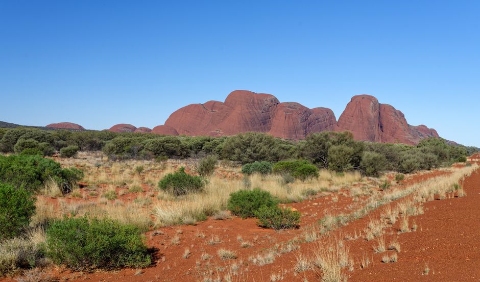
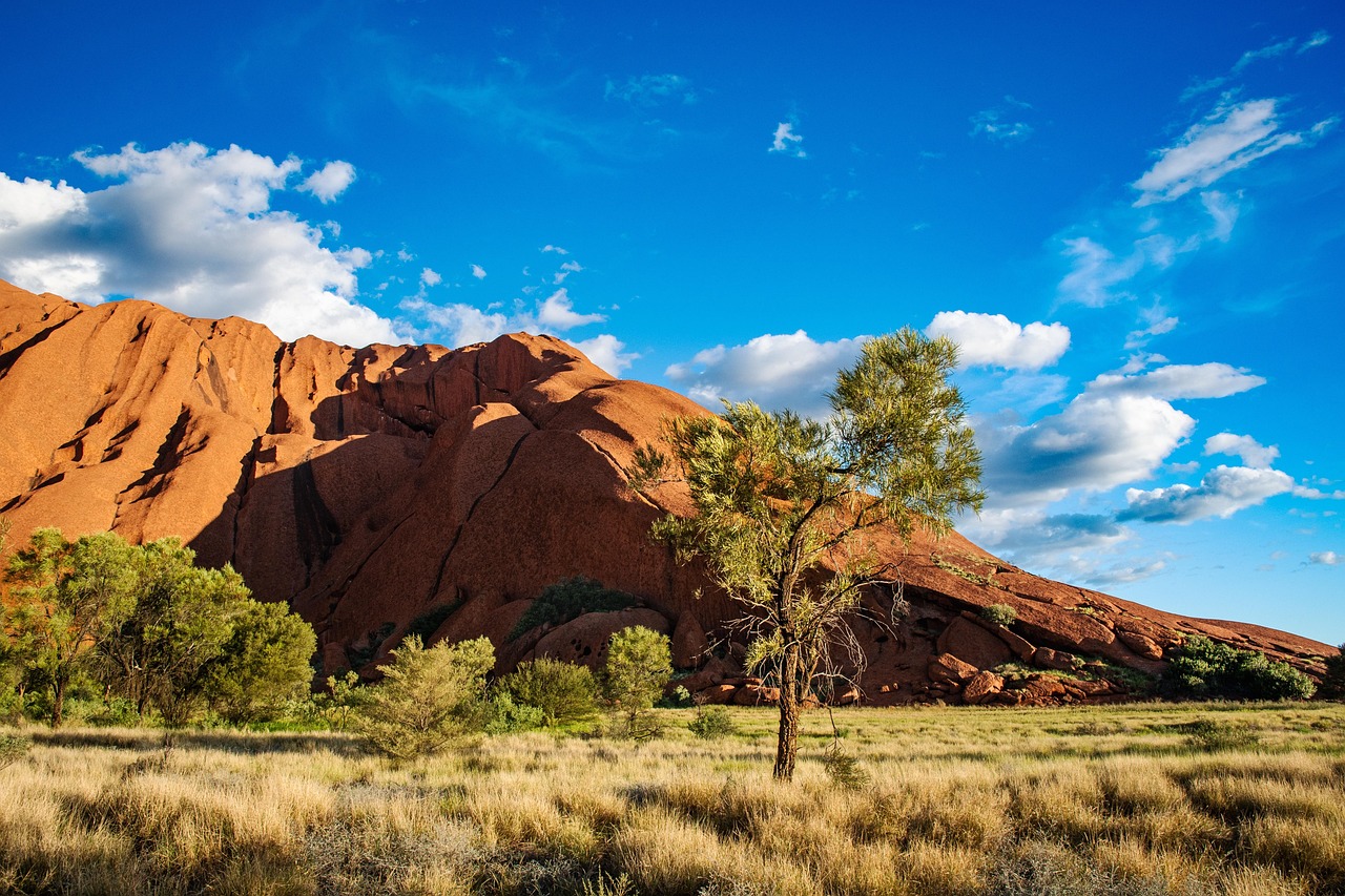
Uluṟu-Kata Tjuṯa National Park protects two of the world’s most famous natural landmarks in the red heart of Australia: Uluṟu, the vast sandstone monolith that glows orange and crimson at sunrise and sunset, and Kata Tjuṯa, a cluster of 36 steep-sided domes 50 km away by road. The park, about 1,330 km² (515 square miles) of desert in the southwest of the Northern Territory, is the homeland of the Aṉangu, the Pitjantjatjara and Yankunytjatjara people, for whom both places are sacred and full of Tjukurpa, the creation stories and law that guide their lives. Since the 1985 Handback, the park has been owned by Aṉangu and jointly managed with Parks Australia, and it is on the UNESCO World Heritage List for both its natural and its cultural values. Visitors walk around the base of Uluṟu rather than over it: the climb closed permanently in October 2019. All accommodation is at Yulara (Ayers Rock Resort), just outside the park. The desert has hot summers and mild, sunny winters; in the southern hemisphere, the coolest and most comfortable months are May to September, while from October to March temperatures regularly top 35 °C (95 °F).
Right now in Uluru-Kata Tjuta National Park (Yulara)
- Thu19–35°C66–95°F1 mm rain
- Fri21–33°C69–92°FClear
- Sat16–32°C61–90°F1 mm rain
Top tours in Uluru-Kata Tjuta National Park
See all tours for Uluru-Kata Tjuta National Park →
From local operators, with prices and reviews; you check availability and book on Viator, our partner. We may earn a commission at no extra cost to you. How we earn money
Uluṟu-Kata Tjuṯa at a glance
- Best months: May to September, when daytime highs are usually 20–30 °C (68–86 °F) and nights are cold; August and September bring wildflowers. October to March is very hot, with summer storms that can set waterfalls running down Uluṟu.
- Time needed: two full days for the base walk, the Cultural Centre, Kata Tjuṯa’s Valley of the Winds and both a sunrise and a sunset; three days to slow down and add tours.
- Getting there: fly to Ayers Rock (Connellan) Airport (AYQ) from Sydney, Melbourne, Brisbane or Cairns, or drive 465 km (289 miles) from Alice Springs, about 5.5 hours.
- Park pass (as of October 2026): $38 per adult for 3 days (about US$26), or $50 for an annual pass; under-18s enter free.
- Before you go: entry rules for Australia (ETA, eVisitor or visa) and biosecurity are covered in our Australia travel guide.
Park pass, opening hours and rules
Park passes
Everyone visiting the park needs a park pass. Buy it online before you arrive, then scan the QR code at the entry station (use the left-hand lane), or buy one at the entry station on the way in. Passes are valid only for Uluṟu-Kata Tjuṯa; Kakadu National Park needs its own pass, and other Northern Territory parks are booked through the NT Government.
| Park pass (as of October 2026) | Price | About US dollars |
|---|---|---|
| Adult (18 and over), valid 3 days | $38 | $26 |
| Adult annual pass | $50 | $35 |
| Children and teenagers under 18 | Free | Free |
| Vehicle registered in the Northern Territory, annual (driver and passengers) | $109 | $75 |
A quarter of park-pass revenue goes directly to Aṉangu Traditional Owners through lease payments; the rest funds park operations, rangers, cultural programs and conservation. If you join a tour, the operator may include the pass in your ticket.
Opening hours
The park is open every day of the year but closes at night; all visitors must leave by closing time. The Cultural Centre is open daily from 7 a.m. to 5:45 p.m.
| Months | Park opening hours |
|---|---|
| December to February | 5 a.m. to 9 p.m. |
| March | 5:30 a.m. to 8:30 p.m. |
| April | 5:30 a.m. to 8 p.m. |
| May | 6 a.m. to 7:30 p.m. |
| June and July | 6:30 a.m. to 7:30 p.m. |
| August | 6 a.m. to 7:30 p.m. |
| September | 5:30 a.m. to 7:30 p.m. |
| October | 5 a.m. to 8 p.m. |
| November | 5 a.m. to 8:30 p.m. |
The Uluṟu climb closure and cultural respect
Climbing Uluṟu was never generally permitted under Tjukurpa, and Aṉangu long asked visitors not to climb. After the share of visitors climbing fell below 20%, the park’s Board of Management voted unanimously to close the climb, and it closed permanently on 26 October 2019, the 34th anniversary of Handback. Climbing Uluṟu is now a breach of the Environment Protection and Biodiversity Conservation Act, and penalties apply. Aṉangu also ask visitors to stay on marked tracks, not to take rocks or sand, and to respect photography restrictions at sensitive sites. Signs and maps show places on the base walk and at Kata Tjuṯa where you should not photograph or film the rock; on the Valley of the Winds walk, a men’s sacred area, you are asked not to photograph Kata Tjuṯa’s domes at all. Always ask before photographing Aṉangu people. Commercial photography needs a media permit.
Top things to see in the park
The Cultural Centre
Start here, 10 to 15 minutes’ drive from the entry station. The mud-brick Cultural Centre explains Tjukurpa, Aṉangu life and joint management through the Tjukurpa Tunnel and multilingual displays, and has two Aboriginal-owned art galleries, Maruku Arts and Walkatjara Art, plus the Ininti cafe, the only place in the park to buy food and drinks. Allow at least two hours. A picnic area behind it has views of Uluṟu, and Outback Cycling rents bikes nearby for riding around the base.
The Uluṟu base walk
The full base walk is 10.6 km (6.6 miles), graded 3, and takes about 3.5 hours, circling the whole rock past caves, rock art, waterholes and surprising pockets of green. You can walk the whole loop or choose sections; some tracks close in the afternoon in summer because of the risk of heat stroke, so start early and finish by 11 a.m. in hot weather. The north-east face is especially sacred; follow the signs about where not to take photographs.
Mala walk and Kaṉtju Gorge
The Mala walk, 2 km (1.2 miles) return and about 1.5 hours, follows the base from the Mala car park to Kaṉtju Gorge, past rock art and caves linked to the Mala (rufous hare-wallaby) Tjukurpa. Park rangers lead a free guided Mala walk on most days; check the times at the Cultural Centre. The gorge is busy with tours in mid-morning and late afternoon but surprisingly quiet at sunset.
Kuniya walk and Muṯitjulu Waterhole
On the south side, the short Kuniya walk, about 1 km (0.6 miles) and 30 to 45 minutes, leads to Muṯitjulu Waterhole, one of the few permanent water sources around Uluṟu, shaded by river red gums, with a rock-art cave nearby. It tells the story of Kuniya, the woma python, and Liru, the poisonous snake. Wallabies are sometimes seen in the grass.
Kata Tjuṯa: Valley of the Winds and Waḻpa Gorge
Kata Tjuṯa, meaning “many heads,” is 50 km (31 miles) by road west of Uluṟu, about 45 minutes’ drive from Yulara; its highest dome rises well above Uluṟu’s summit. The Valley of the Winds walk, graded 4, is a steep, rocky 7.4 km (4.6-mile) loop between the domes taking about 3 to 4 hours; shorter options go to Karu lookout (2.2 km return, 1 hour) or Karingaṉa lookout (5.4 km return, 2.5 hours). Drinking water is available halfway. From 11 a.m., when the forecast or actual temperature reaches 36 °C (97 °F) or more, the walk is closed beyond Karu lookout. The easier Waḻpa Gorge walk, 2.6 km (1.6 miles) return and about 1 hour, enters a narrow gorge between two domes; keep both sides of the gorge in any photo. The Kata Tjuṯa dune viewing area is a superb sunrise spot.
Sunrise and sunset
The park has five dedicated viewing areas. At Talinguṟu Nyakunytjaku, about 30 minutes from the resort, a sunrise platform looks at Uluṟu and Kata Tjuṯa together. For sunset, use the Uluṟu car sunset viewing area (the bus area is for coaches) or the Kata Tjuṯa sunset viewing area. Arrive early, bring a warm layer in winter and expect crowds in peak season; check the park’s opening time so you are at the gate when it opens.
Other things to do
- Ranger and cultural programs: free ranger talks and the guided Mala walk run from the Cultural Centre; Aṉangu-owned tour companies offer dot-painting workshops and bush food walks.
- Field of Light and dinners under the stars: Ayers Rock Resort runs a large light installation near Yulara and outdoor dinners with views of Uluṟu; book ahead.
- Cycling: rent a bike from Outback Cycling at the Cultural Centre to ride the flat base track.
- Camel rides, scenic flights and stargazing: camel tours at dawn and dusk, helicopter and small-plane flights over both landmarks, and astronomy tours in the clear desert skies run from the resort.
Getting there and getting around
Flying in
Ayers Rock (Connellan) Airport (AYQ) is about 10 minutes from Ayers Rock Resort. Virgin Australia, Qantas and Jetstar fly direct from Sydney (about 3 hours), Melbourne (2 hours 40 minutes), Brisbane (3 hours 15 minutes) and Cairns (2 hours 50 minutes); from overseas or other cities you will usually connect through one of these. The resort runs a free shuttle meeting flights.
Driving from Alice Springs and the Red Centre Way
Uluṟu is 465 km (289 miles) from Alice Springs, about 5.5 hours on sealed roads via the Stuart and Lasseter highways, with roadhouses for fuel at Erldunda and Curtin Springs. Many visitors combine the park with Watarrka National Park (Kings Canyon) and the West MacDonnell Ranges on the multi-day Red Centre Way road trip. Rental cars are available at the airport, in Yulara and in Alice Springs, but the number in Yulara is limited, so book a few weeks ahead.
Getting around the park
There are no taxis or public transport in the park. To get around, you need a rental car, an organized tour or a hop-on, hop-off bus pass. Approximate drive times from the resort: 20 minutes to Uluṟu, 30 minutes to Talinguṟu Nyakunytjaku, 45 minutes to Kata Tjuṯa and 10 minutes to the airport. Inside Yulara, a free shuttle loops between the hotels and the town square.
When to go and how long to stay
Uluṟu has a hot desert climate. In winter (June to August), days are sunny and pleasant, around 20–24 °C (69–75 °F), but nights are cold, often near or below freezing at dawn; bring warm clothes for sunrise. Spring (September to November) warms quickly and brings wildflowers in August and September. Summer (December to February) is extremely hot, with average highs of 36–38 °C (97–101 °F) and many days above 40 °C (104 °F), as well as storms; when rain falls, waterfalls cascade down Uluṟu, a rare and spectacular sight. Summer also brings swarms of flies, so many visitors wear a head net. Autumn (March to May) cools steadily.
| Month | Average high | Average low | Rain | Rain days (≥1 mm) |
|---|---|---|---|---|
| Jan | 38 °C (101 °F) | 23 °C (73 °F) | 30 mm (1.2 in) | 4 |
| Feb | 37 °C (99 °F) | 22 °C (72 °F) | 41 mm (1.6 in) | 3 |
| Mar | 34 °C (94 °F) | 20 °C (67 °F) | 29 mm (1.1 in) | 2 |
| Apr | 30 °C (86 °F) | 15 °C (58 °F) | 16 mm (0.6 in) | 2 |
| May | 24 °C (76 °F) | 9 °C (49 °F) | 11 mm (0.4 in) | 1 |
| Jun | 20 °C (69 °F) | 6 °C (42 °F) | 17 mm (0.7 in) | 2 |
| Jul | 21 °C (69 °F) | 4 °C (40 °F) | 17 mm (0.7 in) | 2 |
| Aug | 24 °C (75 °F) | 6 °C (43 °F) | 5 mm (0.2 in) | 1 |
| Sep | 29 °C (84 °F) | 11 °C (52 °F) | 8 mm (0.3 in) | 1 |
| Oct | 32 °C (90 °F) | 15 °C (59 °F) | 23 mm (0.9 in) | 3 |
| Nov | 35 °C (95 °F) | 18 °C (65 °F) | 34 mm (1.3 in) | 4 |
| Dec | 36 °C (98 °F) | 21 °C (70 °F) | 46 mm (1.8 in) | 5 |
| Year | 30 °C (86 °F) | 14 °C (58 °F) | 278 mm (11 in) | 29 |
Figures are the Bureau of Meteorology’s 1991–2020 statistics for Yulara Airport, next to the resort. Rainfall varies hugely from year to year.
How long to stay: 2 and 3 days
- Day 1: the Cultural Centre, the Mala and Kuniya walks or the full base walk in the morning, and sunset at the Uluṟu car viewing area.
- Day 2: sunrise at Talinguṟu Nyakunytjaku or the Kata Tjuṯa dune viewing area, the Valley of the Winds walk early, Waḻpa Gorge, and sunset at Kata Tjuṯa.
- Day 3: a cultural tour, a scenic flight or a cycle around the base, and the Field of Light or a stargazing tour in the evening. With longer, add Kings Canyon and Alice Springs.
Where to stay: Ayers Rock Resort and Yulara
All accommodation is in the town of Yulara, run as Ayers Rock Resort, about 20 minutes from Uluṟu, from campsites and the Outback Lodge’s dorms to the Outback Hotel, Desert Gardens Hotel, Emu Walk Apartments, The Lost Camel Hotel and Sails in the Desert; the luxury Longitude 131° tented camp sits in the dunes with views of the rock. The Ayers Rock Campground has powered sites and cabins, and Curtin Springs cattle station, about 80 km (50 miles) east, has budget rooms and camping. The town square has a supermarket, restaurants, a post office, fuel and medical services. Book early for the cooler months and Australian school holidays; prices are high because everything must be brought in from far away.
Typical costs
| Item (as of October 2026) | Australian dollars | About US dollars |
|---|---|---|
| Park pass, adult, 3 days | $38 | $26 |
| Park pass, adult, annual | $50 | $35 |
| Under-18s | Free | Free |
| Rental car, per day | about $120–200 | about $85–140 |
| Hop-on, hop-off bus pass | about $100–200 | about $70–140 |
| Resort hotel room, per night | about $350–700 | about $240–480 |
| Campsite, per night | about $50–70 | about $35–50 |
Park passes are official Parks Australia prices; car hire, bus passes and accommodation are typical ranges, not official prices. Conversions use about US$0.69 to A$1.
Safety: heat, walking and outback driving
- Extreme heat: temperatures regularly reach 30 °C (86 °F) or more and can exceed 40 °C (104 °F) in summer. Heat exhaustion, dehydration and hyponatremia (low blood sodium) are real dangers. Walk only in the cooler parts of the day, avoid walking between 2:30 p.m. and 6:30 p.m., and in summer don’t walk after 11 a.m. Carry and drink at least one liter of water per person per hour, use an electrolyte product, eat regularly, walk with someone and never walk on tracks closed because of heat.
- Sun and UV: wear a broad-brimmed hat, sunglasses, sunscreen and sturdy walking shoes.
- Wildlife: king brown snakes (liru) are venomous; keep your distance. Dingoes are wild; never feed or touch them.
- Emergencies: call 000 (or 112 from a mobile). Emergency radios stand on most walks to call rangers. Mobile coverage is limited in parts of the park.
- Outback driving: distances are long and services sparse. Fill up whenever you can, carry plenty of water, don’t drive at dawn, dusk or night, when kangaroos, cattle and camels wander onto roads, and watch for road trains (trucks with several trailers). If your car breaks down, stay with it. Check road conditions after rain.
- Bushfire: fires can occur in the spinifex grasslands; follow park closures and warnings.
Practical tips
- Time zone: Australian Central Standard Time (UTC+9:30) all year; the Northern Territory has no daylight saving, so in summer the park is 1.5 hours behind Sydney.
- Food and water: the Ininti cafe at the Cultural Centre is the only place to buy food in the park; refill water bottles at the Cultural Centre and car parks.
- Money and connectivity: cards are accepted at the resort; Wi-Fi and mobile coverage are best in Yulara.
- Official app: Parks Australia has an official park app with maps and walk information; download it before you arrive.
What to pack
A broad-brimmed hat, sunglasses, SPF 50+ sunscreen, sturdy closed walking shoes, a reusable water bottle (or a hydration pack holding several liters), electrolyte sachets and a fly net for summer. In winter, pack a warm jacket, beanie and gloves for sunrise and evenings, when temperatures drop sharply, and layers for warm afternoons.
Uluṟu-Kata Tjuṯa travel FAQ
How much is the Uluṟu park pass?
$38 per adult (18 and over) for a 3-day pass, or $50 for an annual pass. Children and teenagers under 18 enter free. Buy online and scan the QR code at the entry station.
Can you still climb Uluṟu?
No. The climb closed permanently on 26 October 2019 at the request of the Aṉangu Traditional Owners, and climbing is now an offense with penalties.
What are the park’s opening hours?
They vary by month, from 5 a.m. to 9 p.m. in December to February to 6:30 a.m. to 7:30 p.m. in June and July. The Cultural Centre is open daily from 7 a.m. to 5:45 p.m.
How long is the Uluṟu base walk?
10.6 km (6.6 miles), about 3.5 hours. In hot weather, start at opening time and finish by 11 a.m.; some sections close in summer afternoons.
Why does the Valley of the Winds walk close?
When the forecast or actual temperature reaches 36 °C or more, the walk closes beyond Karu lookout from 11 a.m. to prevent heat stroke on its steep, exposed sections.
What is the best time to visit Uluṟu?
May to September, when days are usually 20–30 °C. Summer is extremely hot, though storms can create rare waterfalls on the rock.
How do I get to Uluṟu?
Fly to Ayers Rock Airport from Sydney, Melbourne, Brisbane or Cairns, or drive 465 km from Alice Springs, about 5.5 hours. There is no public transport in the park, so rent a car or join a tour.
Where do you stay when visiting Uluṟu?
At Ayers Rock Resort in Yulara, just outside the park, which has everything from a campground to luxury hotels, or at Curtin Springs station, 80 km east.
Can I photograph Uluṟu everywhere?
No. Aṉangu ask visitors not to photograph certain sacred sites, marked by signs, and not to photograph Kata Tjuṯa’s domes on the Valley of the Winds walk. Ask before photographing people.
Is one day enough at Uluṟu?
One day lets you see the Cultural Centre, part of the base walk and a sunset, but two days are needed to add Kata Tjuṯa and a sunrise; three days is more relaxed.
Plan your trip
Partner links: TravelerCenter may earn a commission if you book, at no extra cost to you.
Sources · last reviewed 5 October 2026
Researched and last reviewed on 5 October 2026. Park pass prices, the 3-day validity, free entry for under-18s, how to buy and use passes, where pass revenue goes, opening hours, Cultural Centre hours and facilities, the climb closure and its legal status, walk distances, grades, times and heat closures, photography protocols, sunrise and sunset areas, flights and flight times, the drive from Alice Springs, getting around, drive times, accommodation names, heat-safety guidance, wildlife and emergency information all come from Parks Australia (parksaustralia.gov.au/uluru); climate from the Bureau of Meteorology’s 1991–2020 statistics for Yulara Airport; area and coordinates from Wikidata. The free ranger Mala walk schedule, the Field of Light, camel and stargazing tours, roadhouse names, Curtin Springs distance, Kata Tjuṯa’s height, outback driving tips and typical prices are general references and flagged for checking. For entry rules, biosecurity and money, see our Australia travel guide.
Data: Weather: MET Norway (CC BY 4.0) · Rates: ECB · Costs: World Bank ICP and price levels · Wikidata (CC0)