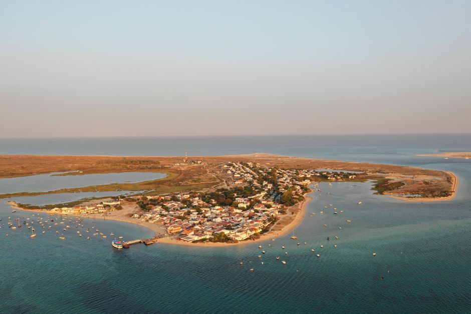
The Ria Formosa is a lagoon of channels, salt marshes and sandy barrier islands along about 60 km of the eastern Algarve, from Faro past Olhão to Tavira and Manta Rota, protected as a natural park. Most of it is free to explore: take a small ferry to the islands’ wild beaches, join a boat or birdwatching tour through the channels, or walk the park’s short nature trails, where flamingos and spoonbills feed at low tide. The park’s Marim centre near Olhão has a 2.5 km trail past a tide mill and Roman ruins.
Right now in Ria Formosa Natural Park
- Thu18–26°C64–80°FMostly clear
- Fri19–26°C66–78°FClear
- Sat17–25°C63–77°FPartly cloudy
Tickets and tours for Ria Formosa Natural Park
See all tours for Ria Formosa Natural Park →
From local operators, with prices and reviews; you check availability and book on Viator, our partner. We may earn a commission at no extra cost to you. How we earn money
What it is
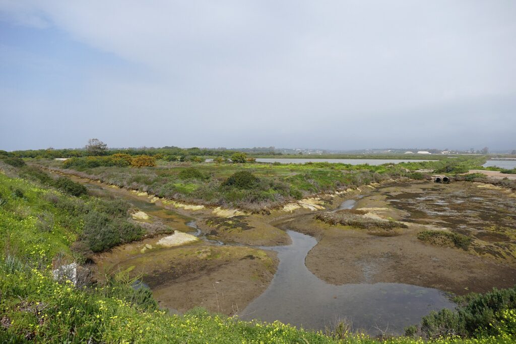
A chain of sandy islands and peninsulas runs roughly parallel to the coast, sheltering a shallow lagoon (on average only 2 metres deep) with a maze of channels that are partly uncovered at low tide. Behind the islands lie mudflats, salt marsh, islets and salt pans. The natural park covers about 18,400 hectares in the municipalities of Loulé, Faro, Olhão, Tavira and Vila Real de Santo António; about 11,000 hectares of that is the lagoon itself. The barrier islands include Barreta (also called Ilha Deserta), Culatra, Armona, Tavira and Cabanas, and the sea gets in through several inlets between them. Their shape keeps changing with the tides and storms.
It was first protected as a nature reserve in 1978, to save the lagoon from the unplanned tourist building of the 1960s and 70s, and became a natural park in 1987. It is a Ramsar wetland of international importance (since 1981) and part of the EU’s Natura 2000 network. It is the largest wetland in southern Portugal. On Barreta island is Cabo de Santa Maria, the southernmost point of mainland Portugal.
Wildlife
More than 200 bird species have been recorded here, and in winter over 20,000 waterbirds gather, many on their way between northern Europe and Africa. Look for flamingos and spoonbills on the Ludo marshes near Faro, little egrets and black-winged stilts in the salt pans, and the purple swamphen, the park’s emblem, chosen in the 1970s when the Ria Formosa was the only place in Portugal where it lived. Under the water there are more than a hundred fish species, and the lagoon is home to both European seahorse species. In the pine woods near the shore lives the Mediterranean chameleon, which in Portugal is found only on the Algarve coast. The lagoon also feeds people: its clams, razor clams and oysters are an important local harvest.
Things to do
Ferry to the islands
Small passenger ferries cross the lagoon from Faro, Olhão, Fuseta, Tavira and Cabanas. From Olhão you can reach Armona, Culatra village and Farol (with its lighthouse), with one-way fares of about €2–2.50; from Tavira a short crossing goes to Ilha de Tavira; and from Faro boats go to Ilha Deserta. The sea side of the islands has long, wide, mostly empty beaches; the lagoon side is shallow and calm, good for small children. Summer timetables are frequent, winter ones thin, so always check the last boat back.
Walk the nature trails
- Marim (CEAM), Olhão: a 2.5 km circular trail with 23 stops through salt marsh, dunes, shellfish beds and pine wood, past a waterwheel, a tide mill and the Roman fish-salting tanks of the Marim villa, with two bird hides. Easy, 1½–2 hours.
- Ludo, Faro: two linear paths through the marshes and salt pans (5–7 km and 5 km return), the best spot for flamingos and spoonbills.
- São Lourenço, near Quinta do Lago: about 3 km return, a classic birdwatching walk.
- Ilha Deserta: a 3 km circular boardwalk trail over beach, dunes and salt marsh, reached by boat from Faro.
- Praia do Barril (Ilha de Tavira): 3 km return from Pedras d’El Rei through salt marsh to the old tuna-fishing station, with its “anchor cemetery” on the beach.
Boat and birdwatching tours
Licensed operators in Faro, Olhão and Tavira run boat trips through the channels, birdwatching outings and kayak or paddleboard tours. Calm water makes the lagoon ideal for beginners. Choose an operator who keeps away from roosting and nesting birds.
How to visit
- Park entry: the lagoon, islands and most trails are free and open.
- Marim Environmental Education Centre (CEAM), Quelfes, Olhão: weekdays 8:00–20:00, weekends and holidays 10:00–20:00; closed 1 January, 1 May and 24–25 December (from the park’s official guide). Entry is reported as €3 (as of October 2026).
- Park headquarters and interpretation centre (at Marim): 9:00–17:00.
- Ferries: buy tickets at the pier; fares are a few euros each way.
- Conduct: stay on the trails, don’t pick plants, don’t disturb animals, and don’t smoke or light fires.
When to go
Island beaches are at their best from June to September. For birds, autumn and winter bring the big flocks of wintering waders and ducks, from about October to March, and spring is nesting time. Time your walks with the tide: low tide uncovers the mudflats where the waders feed. Mornings are cooler and calmer for walking and paddling.
Getting there
Faro airport is next to the lagoon, so the park is close to most arrivals. Faro, Olhão and Tavira are on the Algarve railway line and have the main ferry piers. To reach the Marim centre by car, take the EN125 from Faro towards Vila Real de Santo António and turn right at the “parque natural” sign about 1 km after Olhão, then follow the road across the railway line.
Combine it with
Spend a day on the islands from Olhão, with its Saturday market, and another in Tavira and Cacela Velha, the clifftop village looking over the eastern end of the lagoon. For the golden cliffs of the western Algarve, head to Benagil, Praia da Marinha and Ponta da Piedade. Our Algarve travel guide has the full plan.
Ria Formosa FAQ
How do I visit the Ria Formosa islands?
By small passenger ferry from Faro, Olhão, Fuseta, Tavira or Cabanas, or on a boat tour. Check the last boat back, especially outside summer.
Where can I see flamingos in the Ria Formosa?
The Ludo marshes and salt pans near Faro are the best-known spot. Flamingos and spoonbills are present for much of the year, depending on the season.
Is the Ria Formosa free to visit?
Yes, the lagoon, islands and trails are free. You pay for ferries and tours, and a small fee is reported for the Marim centre.
Which Ria Formosa island is best for a beach day?
Ilha de Tavira and Armona are the easiest to reach; Ilha Deserta, with only a beach restaurant and fishermen’s huts, feels wildest. The lagoon side of any island is calm and shallow for children.
Can you see seahorses in the Ria Formosa?
Both European seahorse species live in the lagoon, but they are small, well camouflaged and protected. You are unlikely to spot one without a specialist guide.