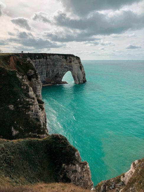
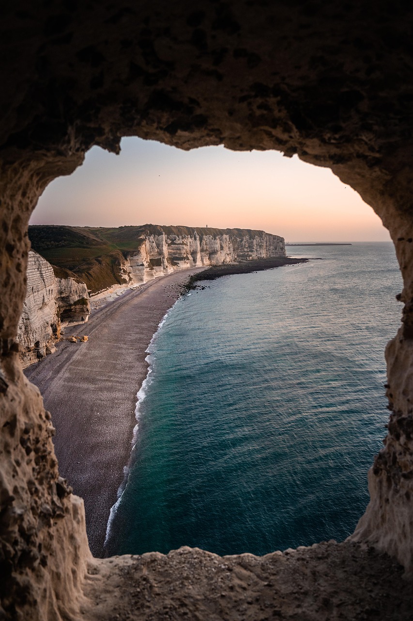
The cliffs of Étretat are white chalk walls on Normandy’s Alabaster Coast, carved by the sea into arches and a free-standing needle, on either side of a small resort’s pebble beach. Two clifftop walks give the views: the Falaise d’Aval to the west, with the arch, the needle and the Manneporte, and the Falaise d’Amont to the east, with its chapel. Both are free and open all year. Since April 2025 a town order closes the beaches below the cliffs, the tunnels and caves, and the ground within 5 metres of the cliff edges, because of rockfalls.
Right now in Étretat Cliffs
- Thu13–15°C55–58°F1 mm rain
- Fri14–17°C58–63°F10 mm rain
- Sat14–16°C57–60°F5 mm rain
Tickets and tours for Étretat Cliffs
See all tours for Étretat Cliffs →
From local operators, with prices and reviews; you check availability and book on Viator, our partner. We may earn a commission at no extra cost to you. How we earn money
What it is and why it matters
Étretat’s cliffs rise roughly 70 to 85 metres above the Channel, and the sea has cut its softer layers into three arches: the Porte d’Aval, the huge Manneporte beyond it, and the Porte d’Amont to the east. Off the Porte d’Aval stands the Aiguille, a needle of chalk that Maurice Leblanc made the hiding place of his gentleman thief Arsène Lupin. Claude Monet painted these cliffs dozens of times in the 1880s, and Courbet and Boudin worked here before him.
Today the site is so popular that the town has been classed a tourist zone of exceptional visitor numbers and takes part in a national “Grand Site” programme with the coast’s other communes to manage the crowds. For the region as a whole, see our Normandy travel guide.
What you’ll see
Falaise d’Aval: the arch and the needle
From the west end of the seafront promenade, steps and a path climb onto the cliff, past the edge of the golf course. Within 15 to 20 minutes you look down on the Porte d’Aval and the Aiguille, the classic photograph. Carry on along the top to see the Manneporte, the largest arch, and the coves beyond. Paths are grassy and open, with no railings in most places.
Falaise d’Amont: the chapel and the view west
At the east end of the beach, a steep path and steps lead up to the little chapel of Notre-Dame-de-la-Garde and the monument to Nungesser and Coli, the French aviators who vanished trying to fly the Atlantic in 1927. From here you see the whole bay and the Falaise d’Aval opposite, best in the late afternoon and at sunset.
The beach and the town
The town beach, in front of the sea wall, is shingle, with fishing boats, cafés and the half-timbered market hall nearby. It is the only part of the shore that stays open.
Rules and safety (as of October 2026)
Rockfalls are frequent and the coast is retreating, so the town order no. 180/2025 of 28 April 2025 sets strict limits:
- Closed below the cliffs: all beaches along the town’s coast except the stretch in front of the promenade; the tunnels through the cliff points, including the one to the Trou à l’Homme; the cave called the Chambre des Demoiselles; and the descent to the Chaudron.
- Clifftop distance: walking within at least 5 metres of the edge is banned on both the Aval and Amont plateaus. Do not cross fences or barriers.
- Penalties: breaking the order is a petty offence with a fine, and the fire and rescue service (SDIS 76) can charge for non-urgent call-outs.
- Tides: the Channel’s tides are big; check them before any beach walk, and don’t get cut off.
Getting there and parking
Étretat is about 30 km north of Le Havre. Nomad regional coaches link the two; check timetables, as services are thin on Sundays and out of season. By car, parking is paid all year from 9:00 to 19:00, weekends and holidays included, on rates in force since 1 January 2025: in the central red zone €3 an hour, up to €15 for five hours; in the outer orange zone (Fréfossé, Grand Val, route de Criquetot, the station) €7.50 for five hours or €15 for the day.
On busy days, when the centre’s car parks are 90% full, the town now closes the centre to cars, with barriers at four entrances between 10:00 and 19:00 at most (town order no. 261/2026 of 20 August 2026). For the rest of 2026 this may apply on school holidays, weekends and long weekends from September to November, depending on the weather. Residents, guests with a booking at a hotel or rental, holders of a disability parking card, cyclists and emergency services can still get in. Park in the outer car parks and walk in.
When to go and how long to allow
Allow two to three hours for both cliffs, or half a day with lunch. Come early in the morning or in the late afternoon to avoid the coach crowds, and choose a dry day: the chalk paths turn slippery in rain, and sea mist can hide the arches. Spring and September are calmer than July and August.
Combine it with
Walk on along the coastal path, the GR 21, which follows the clifftops towards Fécamp; our hiking guide has more ideas. Honfleur and Le Havre are less than an hour away by road, and the D-Day beaches are under two hours west by car. Coming from Paris, Rouen’s old town makes a good stop on the way.
Étretat cliffs FAQ
Can you walk on the beach under the cliffs at Étretat?
No. Since April 2025 only the town beach in front of the promenade is open. The beaches at the foot of the cliffs, the tunnels, the Chambre des Demoiselles and the Chaudron are closed because of rockfalls.
Is it free to visit the Étretat cliffs?
Yes. The clifftop paths and viewpoints are free and always open. You pay only for parking, €3 an hour in the centre or €15 a day in the outer car parks.
Which cliff is best at Étretat?
The Falaise d’Aval, to the west, for the famous arch and needle up close. The Falaise d’Amont, to the east, for the chapel and the best view of the Aval cliff at sunset. Do both if you can.
How close to the edge can I go?
No closer than 5 metres, under the town’s order. The edges are undercut and crumble without warning, and there are no railings on most of the path.
Can I drive into Étretat in summer?
Not always. On busy days barriers close the centre to visitors’ cars between 10:00 and 19:00. Use the outer car parks such as Grand Val or Fréfossé and walk in.
How do I get to Étretat without a car?
Take a Nomad coach from Le Havre, which has trains from Paris and Rouen. Check the timetable first, especially on Sundays and out of season.
Sources
Researched and last reviewed by TravelerCenter on 4 October 2026. Cliff access rules, traffic and parking: the town of Étretat’s municipal orders and parking page; the site’s history and art: general references, listed on the sources page. Rules and rates change, so check etretat.fr before you go.
Data: Weather: MET Norway (CC BY 4.0) · Air quality: OpenAQ · Rates: ECB · Costs: World Bank ICP and price levels · Wikidata (CC0)