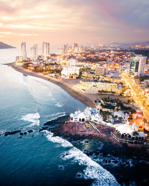
Mazatlán is a Pacific port city and beach resort in the state of Sinaloa, near the mouth of the Gulf of California. Unlike purpose-built resorts, it is a real working city with a restored 19th-century historic center, one of Mexico’s longest seafront promenades, a big shrimp and fishing fleet, and beaches that run for kilometers north through the Golden Zone. Visitors come for sunsets on the malecón, the hilltop El Faro lighthouse, seafood, open-air pulmonía taxis, island trips and one of the country’s biggest Carnival celebrations in February. The dry, mild months from November to May are the best time to visit.
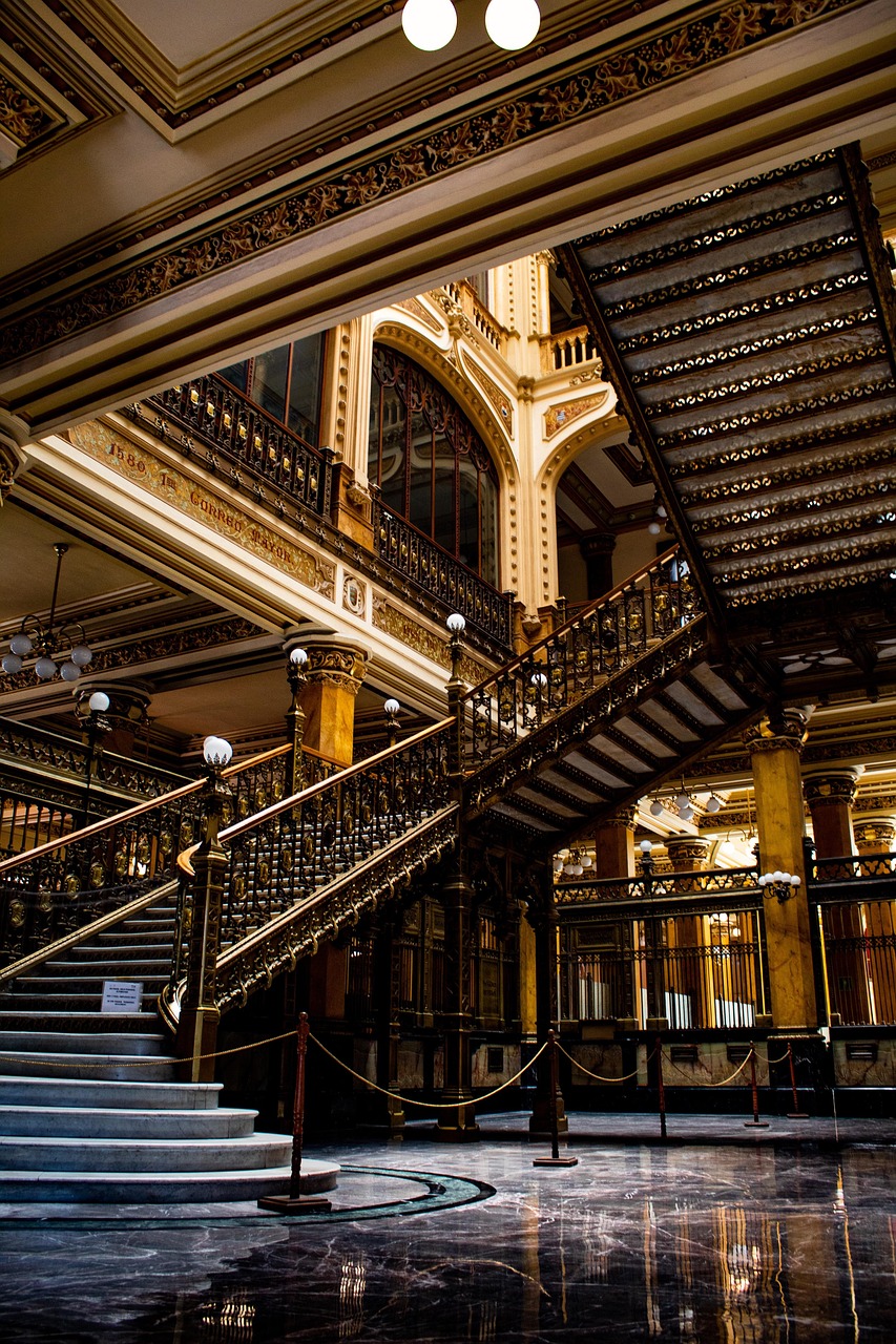
Right now in Mazatlán
- Wed26–31°C79–88°F1 mm rain
- Thu26–32°C80–90°F3 mm rain
- Fri26–31°C79–88°F1 mm rain
Top tours in Mazatlán
See all tours for Mazatlán →
From local operators, with prices and reviews; you check availability and book on Viator, our partner. We may earn a commission at no extra cost to you. How we earn money
Mazatlán at a glance
- Best for: a beach city with real history, sunsets, seafood, walking and cycling the malecón, island day trips and good-value hotels.
- How long: 3 days for the center, the malecón and an island; 5–6 days to add the Pueblos Mágicos inland or a sport-fishing trip.
- Best time: November to May, with highs of 26–30 °C (78–86 °F), cool evenings and little rain. July to October is hot, humid and rainy, and it is hurricane season.
- Getting there: Mazatlán International Airport (MZT), about 20 km (12 miles) south-east of the city; ferries from La Paz in Baja California Sur; buses from Guadalajara and Durango.
- Getting around: walking, city buses along the seafront, pulmonías (open-air taxis), regular taxis and ride-hailing apps.
- Before you go: entry rules, money and general safety are in our Mexico travel guide; for Baja California, see our Los Cabos guide.
Mazatlán’s areas: where things are
The city sits on a peninsula, with the port and the historic center at its southern end and the beaches running north. The malecón (seafront promenade) links the center with the hotel areas along the Paseo Claussen and the Avenida del Mar.
Centro Histórico (Old Mazatlán)
The historic center is a grid of restored 19th-century houses painted in pastel colors, with the Plazuela Machado and its café terraces, the Teatro Ángela Peralta, the cathedral, the central market and many small restaurants and galleries. It is the most atmospheric place to stay, and the evenings around the Plazuela are lively.
Olas Altas and the malecón
Just west of the center, the Olas Altas bay was Mazatlán’s first beach area, with old hotels and seafood terraces. From here the malecón runs north for many kilometers past monuments, the cliff divers’ platform and the beaches of the city, popular with walkers, joggers and cyclists at sunset.
Zona Dorada (the Golden Zone)
About 6 km (4 miles) north of the center, around Playa Gaviotas and Playa Sábalo, the Golden Zone has most of the beach hotels, shops, bars and restaurants. The beaches are long and wide, with views of the three offshore islands.
Marina and Nuevo Mazatlán
Further north, the Marina Mazatlán area and Cerritos have newer condos and resorts, and south of the port, across the harbor, Nuevo Mazatlán has large resorts on long, open beaches near the road to the airport.
Top things to see in Mazatlán
Prices and hours below were checked on the official sites in October 2026, unless we say otherwise; check again before you go.
The historic center and Teatro Ángela Peralta
Start at the Plazuela Machado, the heart of Old Mazatlán, surrounded by colonnaded buildings and restaurants. On one side stands the Teatro Ángela Peralta, a 19th-century opera house named after a famous Mexican soprano, restored after years of neglect and now home to the city’s cultural programs. A few blocks away, the cathedral, the Basílica de la Inmaculada Concepción, has twin yellow towers and a gilded interior, and the Pino Suárez market sells fruit, seafood and local snacks.
The malecón and the cliff divers
Mazatlán’s seafront promenade is one of the longest in Mexico and the city’s favorite place for an evening walk, a bike ride or a sunset beer. Along it you will see statues such as the Monumento a la Mujer Mazatleca and the Monumento al Pescador, and, at El Mirador near Olas Altas, divers who jump from a rocky platform into the shallow surf when the tide is high, collecting tips from the crowd.
El Faro lighthouse
At the southern tip of the peninsula, a lighthouse sits on top of the Cerro del Crestón, about 157 meters (515 feet) above the sea, one of the highest natural lighthouses in the world. A stepped path leads up in about 30–45 minutes, with wide views over the port, the city and the islands; go early or late to avoid the heat, and bring water. A glass-floored viewpoint near the top adds a small fee.
Isla de Venados and the other islands
Three rocky islands off the Golden Zone, Venados, Pájaros and Lobos, are part of the protected area of the Islands of the Gulf of California. Isla de Venados has small sandy beaches, hiking trails and good snorkeling. According to the National Commission of Natural Protected Areas (CONANP), the protected-area fee is MXN 225 (about US$12) per person per day, and Isla de Venados can be visited from 9 a.m. to 5 p.m.; CONANP suggests keeping visits to a maximum of four hours. Boat and kayak trips leave from the Golden Zone, usually with the fee included.
Isla de la Piedra
Not actually an island but a long peninsula across the harbor, Isla de la Piedra has a wide sandy beach lined with palapa restaurants serving grilled fish. Small water taxis cross from the Playa Sur pier near the ferry terminal in a few minutes, and the beach is good for a lazy lunch and a swim when the sea is calm.
More to see
- Gran Acuario Mar de Cortés: a large aquarium near the center, opened in 2022, devoted to the marine life of the Gulf of California.
- Museo Arqueológico de Mazatlán: a small museum of the region’s pre-Hispanic cultures near Olas Altas.
- Plaza Revolución and the central market: local life, cheap eats and fresh shrimp.
- Pacífico brewery: the city is the birthplace of Pacífico beer, brewed here since 1900; look for the brewery’s museum and visitor area.
- Teatro Ángela Peralta
Activities and best months
- Boat tripsIsla Venados, off Mazatlán, is part of CONANP's Islas del Golfo de California protected area: visits 9:00-17:00, recommended no longer than 4 hours, MXN 225 per person per day.
Other things to do in Mazatlán
Beaches and water sports
All beaches in Mexico are public by law. The beaches of the Golden Zone and Cerritos are long and open to the Pacific; waves and currents can be strong, so swim near lifeguards and respect the flags. Surfers head to Olas Altas, Playa Bruja and Cerritos, and kayaks, paddleboards and banana boats are available in the Golden Zone. See our beaches and surfing guides.
Sport fishing and wildlife
Mazatlán calls itself a sport-fishing capital: charters leave from the marina and the port for marlin, sailfish and dorado, mostly on a catch-and-release basis. In winter, boat tours look for humpback whales and dolphins offshore, and the estuaries and mangroves south of the city have herons, pelicans and frigatebirds. See our boat trips guide.
Carnival and food
Mazatlán’s Carnival, held in the days before Ash Wednesday in February, is one of the oldest and largest in Mexico, with parades along the malecón, a fireworks show over the sea and concerts. Book months ahead. All year, try aguachile, shrimp in every form, pescado zarandeado and marlin tacos, washed down with a cold Pacífico.
Day trips from Mazatlán
- Concordia and Copala: colonial mountain towns about an hour east on the road to Durango, known for furniture-making, a baroque church and banana cream pie in Copala.
- El Quelite: a pretty village about 40 minutes north, with cobbled streets, a cockfighting and rodeo tradition, and good regional cooking.
- El Rosario and Cosalá: Pueblos Mágicos (Mexico’s official list of heritage towns), with mining history and colonial churches, each a long day trip.
- The Durango highway and the Baluarte Bridge: the road east climbs the Sierra Madre and crosses the Baluarte Bridge, one of the highest cable-stayed bridges in the world.
Nearby destinations
- Riviera Nayarit295 km
Getting there and getting around
By air
Mazatlán International Airport (MZT), General Rafael Buelna, run by the airport group OMA, lies about 20 km (12 miles) south-east of the city. It has flights from Mexico City, Monterrey, Guadalajara, Tijuana and, especially in winter, from several US and Canadian cities; check which airlines currently fly your route. Authorized taxis and shuttles take about 30 minutes to the Golden Zone.
By ferry and by road
Ferries link Mazatlán with La Paz in Baja California Sur on an overnight crossing of the Gulf of California, carrying passengers and vehicles; check the operator’s current timetable. First-class buses run to Mazatlán from Guadalajara, Tepic, Culiacán and Durango, and toll roads link the city with all of them.
Getting around Mazatlán
The center, Olas Altas and the malecón are walkable, and bikes are a good way to cover the promenade. City buses run along the seafront between the center and the Golden Zone for a small cash fare. Pulmonías, open-air taxis built on small pickup chassis, are a local icon; agree on the fare before you get in, as you should with regular taxis. Ride-hailing apps also work.
When to go and how long to stay
Mazatlán is warm most of the year and hot in summer. The table uses the National Meteorological Service’s (SMN-Conagua) 1981–2010 climate normals for the Mazatlán observatory (the newest normals published for this city station): average daily highs and lows, and days with rain.
| Season | Average high / low | Rainy days per month | What it’s like | Good for |
|---|---|---|---|---|
| Winter (Dec–Feb) | 26–27 °C (78–80 °F) / 15–16 °C (59–61 °F) | 1–2 | Dry, sunny days and cool evenings; Carnival in February | City walks, whale tours, Carnival |
| Spring (Mar–May) | 26–30 °C (80–86 °F) / 16–21 °C (61–70 °F) | 0–1 | Dry and sunny, warming up; busy at Easter | Beaches, fishing, islands |
| Summer (Jun–Aug) | 32–33 °C (90–92 °F) / 25–26 °C (77–78 °F) | 2 in June, 12–13 in July and August | Hot and humid, with heavy storms from July | Warm sea, lower prices |
| Fall (Sep–Nov) | 33 °C falling to 30 °C (92 to 86 °F) / 25 °C falling to 19 °C (77 to 67 °F) | 12 in September, 2 in November | Wet and humid until September, then drier and pleasant | Quiet beaches from late October |
The station records about 850 mm (34 in) of rain a year, almost all of it from July to October; August is the wettest month, with about 225 mm (9 in).
Hurricane season: according to NOAA’s National Hurricane Center, the eastern Pacific hurricane season runs from May 15 to November 30. If a storm threatens, follow the instructions of Sinaloa’s civil protection authorities and your hotel, and check Mexico’s National Meteorological Service (SMN) and the National Hurricane Center; island boats and ferries stop in rough seas.
3 days in Mazatlán
Day one, the historic center: the cathedral, the market, the Teatro Ángela Peralta and dinner on the Plazuela Machado. Day two, climb El Faro early, then walk or cycle the malecón to the Golden Zone for sunset. Day three, a boat to Isla de Venados, or lunch on Isla de la Piedra.
5 to 6 days in Mazatlán
Add the aquarium, a fishing charter or whale tour in winter, and day trips to Concordia and Copala or El Quelite. With a sixth day, visit El Rosario or Cosalá, or drive part of the Durango highway to the Baluarte Bridge.
Where to stay in Mazatlán and the hotel taxes
- Centro Histórico: boutique hotels and guesthouses in restored houses, near the Plazuela Machado; the most charming base.
- Olas Altas: older seafront hotels with sunset views, between the center and the malecón.
- Zona Dorada: beach hotels and resorts, shops and nightlife; the classic holiday base.
- Marina, Cerritos and Nuevo Mazatlán: newer condos and large all-inclusive resorts, quieter and further from the center.
Room rates are often quoted before tax. Sinaloa’s state finance law sets a lodging tax of 3% on the price of the room, and federal VAT (IVA) of 16% is added on top. VISITAX does not apply here; it is a Quintana Roo fee only. Prices and minimum stays rise sharply during Carnival, Easter and Christmas.
Practical tips for Mazatlán
- Time zone: Sinaloa uses Pacific time (UTC−7 all year), one hour behind Mexico City and Guadalajara.
- Cash: carry pesos for pulmonías, buses, water taxis, markets and beach restaurants; use ATMs inside banks or malls.
- Pulmonías: agree on the fare before you set off; prices are per vehicle, not per person.
- Tipping: 10–15% in restaurants; tip the cliff divers and boat crews if you enjoyed the show.
- Safety: the tourist areas of the center, the malecón and the Golden Zone are busy and patrolled by tourist police. Sinaloa has had serious organized-crime violence, concentrated mainly around the state capital, Culiacán, and rarely aimed at visitors. Travel between cities by day on toll roads, use app or hotel taxis at night, keep valuables out of sight and don’t buy drugs.
- Emergencies: call 911.
What to pack for Mazatlán
Bring light beachwear, a hat, sunglasses and reef-friendly sunscreen, comfortable shoes for the El Faro climb and the cobbled center, and a light sweater or jacket for winter evenings on the malecón. Add insect repellent, a rain jacket from July to October, and a costume or something colorful if you are coming for Carnival. Plugs are the US type.
What to pack
- Dry bags and phone pouchesSpray soaks phones and cameras on open boats to the Algarve caves and on whale-watching trips.
- Fleeces and warm layersIt is cooler at sea than on land, especially on morning whale-watching trips.
- Rain jacketsA windproof, waterproof shell keeps you warm on open boats, where wind and spray cool you quickly.
- Reef-friendly sunscreenSun reflects off the water on cruises and cave tours.
- Water shoesKayak and small-boat trips to the Algarve grottoes land on rock and wet sand.
Mazatlán travel FAQ
What is Mazatlán known for?
Its long malecón and sunsets, a restored 19th-century historic center, El Faro lighthouse, seafood and shrimp, pulmonía taxis, Pacífico beer and one of Mexico’s biggest Carnivals.
How much does it cost to visit Isla de Venados?
CONANP’s protected-area fee is MXN 225 (about US$12) per person per day as of October 2026, usually included in the boat tour. Visits run from 9 a.m. to 5 p.m.
How do you get to Isla de la Piedra?
By small water taxi from the Playa Sur pier near the ferry terminal, a crossing of a few minutes. It is a peninsula with a long beach and palapa restaurants.
How high is El Faro in Mazatlán?
The lighthouse stands on the Cerro del Crestón, about 157 meters (515 feet) above the sea. The walk up takes about 30–45 minutes on a stepped path.
When is Mazatlán’s Carnival?
In the days before Ash Wednesday, usually in February. It is one of Mexico’s largest, with parades on the malecón and fireworks over the sea; book hotels early.
What time zone is Mazatlán in?
Pacific time, UTC−7 all year, one hour behind Mexico City. Mexico no longer uses daylight saving time outside the US border area.
Is there a ferry from Mazatlán to La Paz?
Yes. Ferries cross the Gulf of California between Mazatlán and La Paz overnight, carrying passengers and vehicles; check the operator’s current timetable.
What is the best time to visit Mazatlán?
November to May, when it is dry with highs of 26–30 °C (78–86 °F). Summer is hot and rainy, and hurricane season runs to November 30.
What taxes are added to Mazatlán hotel bills?
Sinaloa’s 3% lodging tax plus 16% IVA. There is no VISITAX in Sinaloa.
What are pulmonías?
Open-air taxis unique to Mazatlán, built on small pickup trucks. Agree on the fare before you get in; they are fun for short rides along the malecón.
Plan your trip
Partner links: TravelerCenter may earn a commission if you book, at no extra cost to you.
🇪🇸 Useful Spanish phrases for Mazatlán
All 38 Spanish phrases: restaurant, hotel, emergencies, romance (printable) →
Sources · last reviewed 4 October 2026
Researched and last reviewed on 4 October 2026. Isla de Venados and the islands’ fees and hours: the National Commission of Natural Protected Areas (CONANP); the lodging tax: the State of Sinaloa’s finance law (Ley de Hacienda del Estado de Sinaloa), as compiled by Mexico’s National Human Rights Commission; hurricane season: NOAA’s National Hurricane Center; climate: SMN-Conagua 1981–2010 normals for the Mazatlán observatory. Distances, the lighthouse height, the airport’s routes, ferry details, Carnival dates, local history and the general safety summary come from secondary sources or general knowledge and are flagged for checking. Prices and timetables change, so check the official sites before you go. For entry rules, money and general safety, see our Mexico travel guide.
Also: descubreanp.conanp.gob.mx
Data: Weather: MET Norway (CC BY 4.0) · Sea temperature: NOAA CoastWatch · Rates: ECB · Costs: World Bank ICP and price levels · © OpenStreetMap contributors (ODBL) · Wikidata (CC0)