Short answer: California packs much of the American West into one state: big cities on the Pacific, a dramatic coast road, wine valleys, giant trees, granite cliffs and the hottest, lowest desert in North America. Start with San Francisco or Los Angeles, drive the coast through Big Sur, and add Yosemite for the mountains. Ten days covers one half of the state well; two to three weeks lets you see the north, the coast and the south on one trip.
California is the most populous US state, with about 39.4 million people according to the US Census Bureau’s 2025 estimates, and the third largest by area after Alaska and Texas. It stretches roughly 800 miles from the redwood forests on the Oregon border to the Mexican border at San Diego, and from the Pacific coast to the Sierra Nevada and the deserts along Nevada and Arizona. Travel is a huge part of its economy: Visit California, the state’s tourism office, reports that visitors spent a record $158.9 billion in the state in 2025. Distances are long, so most trips focus on one or two regions rather than trying to see everything. For entry rules, ESTA, money and tipping, see our United States travel guide.
Where to go in California
Think of California in three parts: Northern California around San Francisco, with wine country, Lake Tahoe and Yosemite within a few hours; the Central Coast, with Monterey, Big Sur and Santa Barbara; and Southern California, with Los Angeles, Disneyland, San Diego and the deserts. A classic first trip flies into San Francisco, drives south along the coast and flies home from Los Angeles or San Diego, or the other way round.
San Francisco and the Bay Area
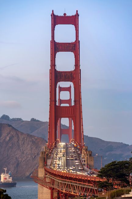
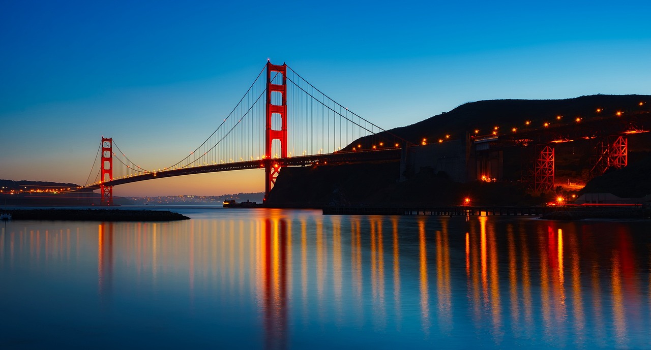
Compact, hilly and endlessly photogenic, San Francisco is the easiest California city to enjoy without a car. Walk or cycle across the Golden Gate Bridge, ride a cable car over Nob Hill, take the ferry to Alcatraz, and eat your way through the Ferry Building, North Beach and the Mission District. Golden Gate Park holds the California Academy of Sciences and the de Young Museum, and across the bridge in Marin County, Muir Woods has old-growth redwoods half an hour from downtown. BART, Muni and Caltrain link the city with Oakland, Berkeley and Silicon Valley. Our San Francisco travel guide has tickets, neighborhoods and airport transport.
Wine country and Lake Tahoe
An hour or so north of San Francisco, Napa Valley is the country’s best-known wine region, a 30-mile valley of vineyards, tasting rooms and excellent restaurants from the town of Napa through Yountville and St. Helena to the hot springs of Calistoga. Neighboring Sonoma County is more spread out and relaxed, with redwoods and the coast close by. Further east, high in the Sierra Nevada on the Nevada border, Lake Tahoe is a deep, clear alpine lake with beaches and hiking in summer and some of the West’s biggest ski resorts in winter. Emerald Bay, on the California shore, is the classic viewpoint.
Yosemite, Sequoia and the Sierra Nevada
The Sierra Nevada runs down the eastern side of the state, and its national parks are the reason many people come to California. Yosemite has the sheer granite walls of El Capitan and Half Dome, waterfalls that roar in spring, and giant sequoias in the Mariposa Grove; it is about four to five hours’ drive from San Francisco. Further south, Sequoia and Kings Canyon protect the General Sherman Tree, the world’s largest tree by volume, and deep glacial canyons. Mount Whitney, the highest peak in the contiguous United States, rises on the Sierra’s eastern edge, above the Owens Valley.
The Central Coast: Monterey, Big Sur and Santa Barbara
Highway 1 along the Central Coast is one of the world’s great drives. Monterey has Cannery Row and the Monterey Bay Aquarium, with sea otters often visible in the bay, and the neighboring village of Carmel-by-the-Sea is all cottages and white sand. South of Carmel, Big Sur is a wild stretch of cliffs, redwood canyons and the Bixby Creek Bridge, with McWay Falls dropping onto a beach in Julia Pfeiffer Burns State Park. Further south, past Hearst Castle and San Luis Obispo, Santa Barbara is a red-tiled Spanish-style town between mountains and the sea, with an old mission, a lively waterfront and wine country in the Santa Ynez Valley behind it. From Santa Barbara and Ventura, boats run to Channel Islands National Park.
Los Angeles and Orange County
Los Angeles is less a city than a region of neighborhoods joined by freeways: Hollywood and its Walk of Fame, the Griffith Observatory with its view of the Hollywood Sign, the Getty Center on its hilltop, the beaches and piers of Santa Monica and Venice, and the museums of Downtown and the Miracle Mile. Studio tours at Warner Bros. and Universal Studios Hollywood show how films are made. Just south, in Orange County, Anaheim is home to the Disneyland Resort, the original Disney park, opened in 1955, while Huntington Beach, Newport Beach and Laguna Beach are classic Southern California surf towns.
San Diego
California’s second-largest city has the mildest weather in the state and a relaxed, outdoor feel. San Diego is known for Balboa Park, with its Spanish-style museums and the San Diego Zoo; the USS Midway aircraft carrier museum on the waterfront; the Gaslamp Quarter; Old Town; and the beaches and sea lions of La Jolla. Coronado Island and its Victorian hotel are a short ferry ride across the bay, and the Pacific Surfliner train runs up the coast to Los Angeles.
The deserts: Palm Springs, Joshua Tree and Death Valley
Inland, Southern California turns to desert. Palm Springs is a resort town of mid-century modern houses, pools and golf courses below the San Jacinto Mountains, with an aerial tramway up to the pine forest. Next door, Joshua Tree National Park has spiky Joshua trees, piles of golden boulders and very dark night skies. Further north, Death Valley is the hottest, driest and lowest national park in the country, with salt flats, sand dunes and colorful badlands; it is often combined with a trip to Las Vegas, just across the Nevada line.
The North Coast and the redwoods
North of San Francisco, Highway 1 and US 101 lead to the quiet towns of Mendocino and the redwood forests of Humboldt and Del Norte counties. The Avenue of the Giants and Redwood National and State Parks protect some of the tallest trees on Earth. Redwood National Park itself charges no entrance fee and has no entrance stations, according to the National Park Service, although the three state parks inside the area charge day-use fees at their campground entrances, and there is a fee to drive to Gold Bluffs Beach and Fern Canyon.
Top things to do in California
Drive the Pacific Coast Highway
The coast road, Highway 1 for most of its length, is California’s signature road trip. The most famous stretch runs about 90 miles from Carmel to San Simeon through Big Sur, with no towns of any size, few gas stations and pull-outs above the ocean at every bend. After three years of repairs to two large landslides, Caltrans fully reopened Highway 1 between Cambria and Carmel in January 2026. Coastal roads here are often under repair, with one-way traffic control and occasional overnight closures, so check Caltrans QuickMap before you set off. Allow at least a full day for Big Sur alone, and drive north to south if you want the ocean on your side of the road.
Visit the national parks
California has nine national parks, more than any other state. As of October 2026, entry to Yosemite and to Sequoia and Kings Canyon costs $35 per private vehicle for seven days, and Yosemite does not require a vehicle reservation to enter in 2026, according to the National Park Service. Since January 2026, visitors aged 16 and over who are not US residents pay an additional $100 per person at 11 popular national parks, including Yosemite and Sequoia and Kings Canyon, unless they hold an America the Beautiful annual pass, which costs $250 for non-residents and $80 for US residents. Death Valley ($30 per vehicle) and Joshua Tree ($30 per vehicle) are not on that list. Fees are cashless at most park entrances, and you can buy a digital pass in advance on Recreation.gov.
In Yosemite, the classic day is Yosemite Valley, Tunnel View and Glacier Point; in summer, the high Tioga Road crosses the park to Tuolumne Meadows. Hiking Half Dome needs a permit, issued by lottery. In Sequoia, walk to the General Sherman Tree and climb the steps of Moro Rock. In Death Valley, see Badwater Basin, at 282 feet below sea level, and the view from Zabriskie Point.
See San Francisco’s icons
Walk the Golden Gate Bridge (cars pay a cashless toll southbound only, from $10.25 with FasTrak since July 2026), ride a cable car ($9 for a single ride), and book Alcatraz early: the only authorized ferry, Alcatraz City Cruises, sells day tours for $47.95 for adults as of October 2026, and tickets often sell out weeks ahead in summer and during holidays. At Muir Woods, every vehicle needs a parking reservation and adults 16 and over pay a $15 entrance fee.
Theme parks and studio tours
Southern California is theme-park country. At the Disneyland Resort in Anaheim, each guest aged 3 and over needs both a ticket and a park reservation for the same date and park, and prices vary by date, so book ahead on the official Disneyland site, especially for holidays and summer. The resort’s holiday season runs from 13 November 2026 to 6 January 2027. Universal Studios Hollywood combines rides with a studio tram tour, and the Warner Bros. Studio Tour in Burbank starts at $79. San Diego adds the San Diego Zoo and Safari Park, where a one-day adult ticket costs $78.
Taste the wine country
California is America’s best-known wine state. In Napa Valley, most wineries now ask you to book tastings in advance. Sonoma County, Paso Robles on the Central Coast, the Santa Ynez Valley near Santa Barbara and Temecula near San Diego are often more relaxed and better value. Plan a driver, a tour or the local Vine buses in Napa; the hills and back roads are made for slow afternoons.
Ride up a mountain, ski or hike
The Palm Springs Aerial Tramway climbs more than 2.5 miles in a rotating car to its Mountain Station at 8,516 feet; as of October 2026, adult tickets cost $36.95. In winter, Lake Tahoe and Mammoth Mountain are the big ski areas, and the snowy Sierra roads require chains or snow tires at times. From spring to autumn, there are trails for every level, from the short Big Trees loop in Sequoia to sections of the Pacific Crest Trail.
Watch wildlife on the coast
The California coast is rich in marine life. Sea otters float in the kelp off Monterey and Moss Landing, sea lions bark on the rocks at La Jolla and Pier 39 in San Francisco, elephant seals haul out on the beaches near San Simeon, and whale-watching boats sail from Monterey, Santa Barbara and San Diego. Inside the Monterey Bay Aquarium, adult tickets cost $65 as of October 2026; buy them on the aquarium’s own website.
When to go to California
California has a Mediterranean climate along the coast: mild, wet winters and dry summers. But the state is so varied that the right time depends on where you go. The coast around San Francisco and Monterey is often cool and foggy in summer and sunniest in September and October; Los Angeles and San Diego are mild all year; the deserts are pleasant from October to April and extremely hot in summer; and the Sierra Nevada is snowy in winter, with high roads such as Yosemite’s Tioga Road open only from late spring to autumn. Most rain falls between November and March: about 23 inches a year in San Francisco, 14 inches in Los Angeles and just 5 inches in Palm Springs. The figures below are 1991–2020 averages from NOAA.
| Season | San Francisco: average high / low | Los Angeles: average high / low | Palm Springs: average high / low | Good for |
|---|---|---|---|---|
| Winter (Dec–Feb) | 58–60 °F (14–16 °C) / 47–48 °F (8–9 °C) | 67–68 °F (19–20 °C) / 48–50 °F (9–10 °C) | 69–73 °F (21–23 °C) / 45–49 °F (7–9 °C) | Deserts, skiing at Tahoe and Mammoth, whale watching, city museums |
| Spring (Mar–May) | 62–64 °F (17–18 °C) / 49–51 °F (9–11 °C) | 70–74 °F (21–23 °C) / 52–58 °F (11–14 °C) | 80–94 °F (27–34 °C) / 54–65 °F (12–18 °C) | Yosemite’s waterfalls, desert wildflowers, green hills on the coast |
| Summer (Jun–Aug) | 66–68 °F (19–20 °C) / 53–56 °F (12–13 °C) | 77–84 °F (25–29 °C) / 61–65 °F (16–18 °C) | 103–108 °F (39–42 °C) / 72–79 °F (22–26 °C) | Beaches in the south, the high Sierra, Lake Tahoe; foggy San Francisco |
| Autumn (Sep–Nov) | 70 °F falling to 64 °F (21 to 18 °C) / 56 °F falling to 51 °F (13 to 11 °C) | 83 °F falling to 73 °F (28 to 23 °C) / 64 °F falling to 53 °F (18 to 12 °C) | 102 °F falling to 78 °F (39 to 26 °C) / 73 °F falling to 54 °F (23 to 12 °C) | Warmest, clearest weather on the coast, wine harvest, fewer crowds in the parks |
Best overall: April to early June and September to October, when the coast is clear, the deserts are not yet too hot and the national parks are open but less crowded than in midsummer. For Yosemite’s waterfalls: April to June. For the deserts: October to April; in summer Death Valley’s average July high is about 117 °F (47 °C). For skiing: December to March. Hotels are busiest and most expensive in summer, on holiday weekends and during school spring breaks.
Getting there and getting around
Airports
Los Angeles International (LAX) and San Francisco International (SFO) are the main gateways, with nonstop flights from across the world. SFO has its own BART station in the International Terminal for trains into San Francisco; at LAX, a free shuttle links the terminals with the LAX/Metro Transit Center, and FlyAway buses run to Union Station. San Diego, San Jose, Oakland, Sacramento, Burbank, Long Beach, Orange County (John Wayne) and Palm Springs have busy domestic airports, and Fresno and Merced are the closest airports for Yosemite and Sequoia. Flying into one city and out of another usually costs little more and saves a long drive back.
Trains and buses
Amtrak runs three state-supported routes in California: the Pacific Surfliner along the coast between San Diego, Los Angeles and Santa Barbara, the Capitol Corridor between Sacramento, Oakland and San Jose, and the San Joaquins through the Central Valley to Fresno and Bakersfield, with bus links to Yosemite. The long-distance Coast Starlight runs daily between Los Angeles and Seattle via Santa Barbara, the Bay Area and Sacramento, one of the most scenic train rides in the country. Within the cities, San Francisco’s BART and Muni, LA Metro and San Diego’s trolley are useful, and YARTS buses run from Merced and other gateway towns into Yosemite Valley.
Driving
For most of California, a car is the best way to travel: the national parks, Big Sur, wine country and the deserts have little or no public transport. Distances are large: San Francisco to Los Angeles is about six hours on Interstate 5, or a full two days if you take the coast road. Traffic in Los Angeles and the Bay Area can be heavy at rush hour, and parking in San Francisco is expensive, so many travelers pick up a rental car only when they leave the city. Some Bay Area bridges, including the Golden Gate, have cashless tolls; ask your rental company how it charges them. In winter, chains may be required on Sierra roads, and some high passes close until late spring. Check Caltrans QuickMap for road conditions and closures before long drives, and fill up before entering Death Valley and the other desert parks.
Food and drink in California
California cooking is built on fresh produce from the Central Valley, seafood from the Pacific and the influence of Mexican, Asian and Mediterranean cooks. Farmers markets run year-round, and “farm to table” was practically invented here, at restaurants in Berkeley and Napa Valley. In San Francisco, try sourdough bread, clam chowder in a bread bowl, Dungeness crab in season and the giant Mission-style burritos of the Mission District; Chinatown, one of the oldest in North America, is great for dim sum.
Southern California is the place for tacos, from fish tacos in San Diego to the taco trucks and Oaxacan restaurants of Los Angeles, where you can also eat some of the best Korean, Thai, Armenian and Japanese food in the country. Avocado toast, the California roll and the Cobb salad all have Californian roots, and drive-through burger chains are part of road-trip culture. Date shakes are a desert specialty around Palm Springs. To drink, there is wine from Napa, Sonoma, Paso Robles and the Santa Ynez Valley, a huge craft beer scene, especially in San Diego, and excellent coffee everywhere. Vegetarian and vegan food is easy to find in every city.
Plan your trip
Tell our AI trip planner how many days you have and what you enjoy, and it will build a California itinerary from our guides, for example San Francisco, Yosemite and Lake Tahoe, or a coast road trip from San Francisco to San Diego. Check the forecast and monthly averages for each stop with our Destination weather tool, and use the packing list: layers and a warm jacket for the foggy coast and the mountains, sun protection and plenty of water for the deserts.
Frequently asked questions
What is the best time to visit California?
April to early June and September to October are the best all-round months: clear weather on the coast, comfortable temperatures in the deserts and open roads in the mountains. Come in spring for Yosemite’s waterfalls and desert wildflowers, and from October to April for Palm Springs, Joshua Tree and Death Valley.
How many days do you need in California?
Ten days is enough for San Francisco, Yosemite and the coast down to Los Angeles. With two to three weeks, you can add San Diego, Palm Springs and Joshua Tree, or Lake Tahoe and wine country in the north.
Do I need a reservation to visit Yosemite?
Not in 2026: the National Park Service announced that Yosemite would not require vehicle reservations this year. You still pay the $35 vehicle entrance fee, and non-US residents aged 16 and over pay an additional $100 unless they hold an America the Beautiful pass. Hotels and campsites in the park book up months ahead.
Is Highway 1 through Big Sur open?
Caltrans fully reopened Highway 1 between Cambria and Carmel in January 2026 after landslide repairs. Repair work still brings one-way traffic control and occasional overnight closures, so check Caltrans QuickMap on the day you drive.
Can you get around California without a car?
Partly. San Francisco, and to a lesser degree Los Angeles and San Diego, can be explored by public transport, and Amtrak trains link San Diego, Los Angeles, Santa Barbara, the Bay Area and Sacramento. YARTS buses reach Yosemite. For Big Sur, the deserts and most national parks, a car or a tour is much easier.