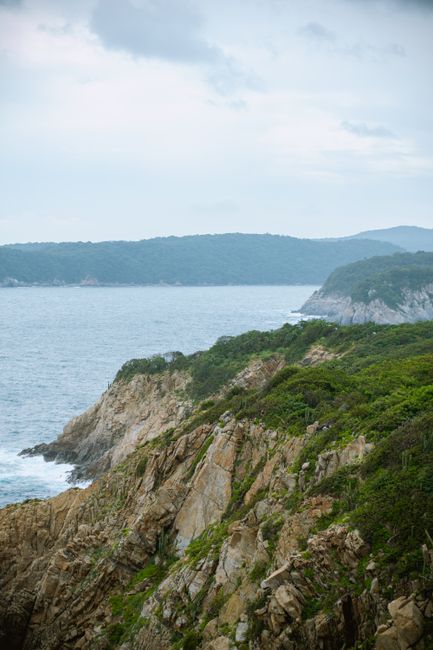
Huatulco, officially Bahías de Huatulco, is a planned resort on the Pacific coast of Oaxaca, where the forested foothills of the Sierra Madre del Sur meet a string of sheltered bays with clear water and golden-sand beaches. Developed by Mexico’s national tourism fund (Fonatur) from the 1980s, it is low-rise, green and calm compared with Mexico’s bigger resorts, and much of the coastline is protected as a national park. Visitors come for boat trips from bay to bay, snorkeling on coral, quiet beaches, the Copalita archaeological park, coffee farms and waterfalls in the hills, and easy access to the surf and hippie villages of the Oaxaca coast. The dry season from November to April is the best time to go.

Right now in Huatulco (Santa Cruz Huatulco)
- Wed24–27°C75–80°F14 mm rain
- Thu23–27°C73–80°F11 mm rain
- Fri23–27°C73–80°F21 mm rain
Top tours in Huatulco
See all tours for Huatulco →
From local operators, with prices and reviews; you check availability and book on Viator, our partner. We may earn a commission at no extra cost to you. How we earn money
Huatulco at a glance
- Best for: calm bays and beaches, snorkeling, boat trips, family resorts, nature, and a relaxed base for the Oaxaca coast.
- How long: 4–5 days for the bays, a boat tour and Copalita; a week to add the coffee hills, Mazunte and Zipolite.
- Best time: November to April, when it is dry and sunny; the sea is calmest and clearest in these months. June to October is hot and rainy, and the Pacific hurricane season runs from May 15 to November 30.
- Getting there: Bahías de Huatulco International Airport (HUX), about 15 km (9 miles) west of La Crucecita, with flights from Mexico City and, in winter, from Canada and the United States.
- Getting around: taxis and colectivos between the bays and town, boats to the beaches without roads, and a car for the hills.
- Before you go: entry rules, money and general safety are in our Mexico travel guide; for the state capital, see our Oaxaca guide.
Huatulco’s areas: where things are
The resort stretches along about 35 km (22 miles) of coast between the Coyula and Copalita rivers. The town of La Crucecita sits slightly inland, the port of Santa Cruz lies on the bay below it, and the main hotel zones follow the bays to the east and west.
La Crucecita
The town center, a few minutes inland, has a leafy main square, the Iglesia de la Virgen de Guadalupe with a huge painted Virgin on its ceiling, a market, banks and most of the affordable restaurants and hotels. It is where local life happens.
Santa Cruz
On the bay below La Crucecita, Santa Cruz has the marina, where boat tours leave, a cruise-ship pier, a small beach and seafront restaurants. Its chapel faces the sea.
Chahué and Tangolunda
East of Santa Cruz, Chahué Bay has a wide beach and a marina, and Tangolunda Bay has the large resorts and the golf course. Further east, Conejos Bay and the Copalita river mark the end of the developed area.
The western bays
West of Santa Cruz, the bays of El Órgano, Maguey, Cacaluta, Chachacual and San Agustín are inside the national park; some are reached by road, others only by boat or on foot.
Top things to see in Huatulco
Prices and hours below were checked on the official sites in October 2026, unless we say otherwise; check again before you go.
Huatulco National Park
The park protects forest, beaches and the reefs of the western bays. According to the National Commission of Natural Protected Areas (CONANP), it is open every day from 7 a.m. to 7 p.m. (night diving is not allowed), and the fee is MXN 125 (about US$7) per person per day, with exemptions for seniors, people with disabilities and children under 12. Boat tours usually include it. Beaches inside the park have rules on fires, camping and anchoring; take your trash with you.
Bay-hopping boat tours
The classic way to see Huatulco is a boat tour from the Santa Cruz marina, stopping at several bays for swimming, snorkeling and a fish lunch. Popular stops include La Entrega, a calm, shallow beach with coral close to shore; Cacaluta, a wild beach in the park; and San Agustín, at the western end, with a reef, simple seafood restaurants and a fishing community. You can also hire a private boat from the marina’s official booth by the hour. See our boat trips guide.
Bocana del Río Copalita
This archaeological park at the mouth of the Copalita river, near Tangolunda, has a small museum and the remains of a pre-Hispanic settlement with a ball court and temples above the sea, connected by forest trails to a lookout over the ocean. According to the National Institute of Anthropology and History (INAH), it opens Tuesday to Sunday, 8 a.m. to 4 p.m., and entry is free.
Huatulco’s beaches
All beaches in Mexico are public by law. The bays are sheltered, so the water is usually calm, although a few beaches facing the open sea have strong waves. La Entrega and Maguey are good for families and snorkeling; Tangolunda and Chahué are long and convenient; Cacaluta and San Agustín feel wilder. Several of Huatulco’s beaches have Blue Flag certification for water quality and services. See our beaches guide.
More to see
- Iglesia de la Virgen de Guadalupe: La Crucecita’s church, with a ceiling painting of the Virgin among the largest in Mexico.
- El Faro and the viewpoints: lookouts on the coastal road with views of several bays at once, best at sunset.
- Bufadora del Morro: a blowhole near the El Arrocito area where waves spray through the rocks.
- Huatulco National Park
Activities and best months
- Beaches and swimmingCONANP's Huatulco National Park, which takes in several of the bays, is open every day 7:00-19:00, MXN 125 per person per day; INAH's Bocana del Río Copalita site near Tangolunda bay is free.
Other things to do in Huatulco
Snorkeling and diving
Huatulco’s bays have coral communities in shallow water, with parrotfish, angelfish and, sometimes, turtles and rays. La Entrega, San Agustín and Riscalillo are popular for snorkeling; dive shops in Santa Cruz and Tangolunda visit deeper reefs and rock formations. Visibility is best in the dry season. See our snorkeling and diving guides.
Rafting, waterfalls and coffee farms
In the rainy season and early dry season, the Copalita river has rafting runs for beginners and intermediates. Inland, the coffee-growing hills around Pluma Hidalgo have old fincas where you can tour the plantations and taste coffee, and waterfalls such as the Cascadas Mágicas and Copalitilla. Go with a local operator, as the mountain roads are steep and winding.
Food
Oaxacan food is excellent here: try tlayudas, moles, quesillo (string cheese), fresh fish a la talla, shrimp and the local coffee. La Crucecita’s market and the restaurants around its square are cheaper and more local than the hotel zone.
Day trips from Huatulco
- Mazunte, San Agustinillo and Zipolite: about an hour west, a chain of relaxed beach villages; Mazunte has Mexico’s national turtle center, a museum and aquarium of sea turtles, and Punta Cometa, a headland famous for sunsets. Zipolite’s surf is dangerous for swimming.
- Puerto Ángel: a small fishing port with a calm bay, on the way to Zipolite.
- Barra de la Cruz: a village east of Huatulco with a long, consistent right-hand point break for experienced surfers; see our surfing guide.
- Puerto Escondido: the surf town about two hours west by road, with a lively beach scene.
- Oaxaca City: the state capital in the mountains; a short flight, or about five to six hours by road. See our Oaxaca guide.
Nearby destinations
- Puerto Escondido102 km
- Oaxaca de Juárez158 km
Getting there and getting around
By air
Bahías de Huatulco International Airport (HUX), run by the airport group ASUR, lies about 15 km (9 miles) west of La Crucecita. It has year-round flights from Mexico City and, mostly in winter, seasonal flights from Canada and the United States; check which airlines currently fly your route. Authorized taxis and shared vans take about 20 minutes to La Crucecita and Tangolunda.
By road
Highway 200 runs along the coast from Puerto Escondido (about two hours west) and Salina Cruz (about three hours east). From Oaxaca City, the quickest route is now the Barranca Larga–Ventanilla highway to the coast near Puerto Escondido, opened in 2024, then Highway 200 east; the older mountain road via Pochutla is slower. First-class buses run to La Crucecita from Oaxaca City, Puerto Escondido and Mexico City.
Getting around Huatulco
Taxis are plentiful and have set fares between the zones; ask before you get in. Colectivos (shared taxis) and local buses link La Crucecita with Santa Cruz, Tangolunda and the airport for a small cash fare. Boats from the Santa Cruz marina go to the beaches without road access. A rental car is useful for the coffee hills and day trips along the coast; avoid driving mountain roads at night.
When to go and how long to stay
Huatulco is hot all year, with a dry season from November to April and a rainy season from June to October. SMN-Conagua does not publish recent climate normals for a station in the resort itself; the table uses the 1991–2020 normals for the nearest coastal-zone station with published normals, Santiago Astata, about 55 km (34 miles) east and 300 meters (1,000 feet) inland, so the bays are usually a degree or two cooler by day.
| Season | Average high / low | Rainy days per month | What it’s like | Good for |
|---|---|---|---|---|
| Winter (Dec–Feb) | 34 °C (93–94 °F) / 20 °C (68 °F) at the station | 0–2 | Dry and sunny, with the calmest, clearest sea | Beaches, snorkeling, boat tours |
| Spring (Mar–May) | 35 °C (95–96 °F) / 21–23 °C (69–73 °F) | 1 in March, 5 in May | Dry and hot; storms begin in late May | Beaches, diving, Easter holidays |
| Summer (Jun–Aug) | 34 °C (92–93 °F) / 22 °C (71–72 °F) | 11–13 | Hot, humid and green, with heavy storms | Waterfalls, rafting, lower prices |
| Fall (Sep–Nov) | 33–34 °C (91–94 °F) / 21–22 °C (70–71 °F) | 14 in September, 1 in November | Wet until October, then dry | Quiet beaches from November |
The station records about 1,200 mm (47 in) of rain a year, almost all of it from May to October; June is the wettest month, with about 300 mm (12 in).
Hurricane season: according to NOAA’s National Hurricane Center, the eastern Pacific hurricane season runs from May 15 to November 30. In June 2025, Hurricane Erick made landfall as a category 3 hurricane in the far west of Oaxaca, well west of Huatulco, which had hurricane watches during the storm. If a storm threatens, follow the instructions of Oaxaca’s civil protection authorities and your hotel, and check Mexico’s National Meteorological Service (SMN) and the National Hurricane Center; boat trips stop in rough seas.
4 days in Huatulco
Day one, La Crucecita’s square, church and market, and sunset at a viewpoint. Day two, a bay-hopping boat tour with snorkeling at La Entrega and lunch at San Agustín or Cacaluta. Day three, the Copalita archaeological park in the morning and an afternoon on Tangolunda or Chahué. Day four, a beach day at Maguey or a dive.
6 to 7 days in Huatulco
Add a day in the coffee hills and waterfalls, a trip to Mazunte, San Agustinillo and Zipolite with sunset at Punta Cometa, and rafting on the Copalita in season. With a week, continue to Puerto Escondido or fly to Oaxaca City.
Where to stay in Huatulco and the hotel taxes
- La Crucecita: small hotels and guesthouses near the square; the best value and most local feel.
- Santa Cruz: mid-range hotels near the marina and boat tours.
- Tangolunda and Conejos: large all-inclusive resorts on the beach and near the golf course.
- Chahué and the hills: condos, villas and boutique hotels with sea views.
Room rates are often quoted before tax. The State of Oaxaca charges a lodging tax reported at 3% under its state finance law (we could not confirm the rate on the state’s site, so we flag it for checking), and federal VAT (IVA) of 16% is added on top. VISITAX does not apply here; it is a Quintana Roo fee only. Prices rise at Christmas, New Year and Easter.
Practical tips for Huatulco
- Cash: carry pesos for colectivos, boat captains, beach restaurants and markets; ATMs are in La Crucecita and Santa Cruz.
- Boats: hire boats at the marina’s official booth, agree on the price and return time, and make sure there are life jackets.
- Protect the reefs: use biodegradable sunscreen, don’t touch or stand on coral, and don’t feed fish.
- Tipping: 10–15% in restaurants; tip boat crews and guides.
- Safety: Huatulco is one of Mexico’s calmer resorts. Take normal precautions with valuables on the beach, use authorized taxis, drive by day on mountain roads, and swim only where the sea is calm.
- Emergencies: call 911.
What to pack for Huatulco
Bring swimwear, a hat, sunglasses and biodegradable, reef-friendly sunscreen, a mask and snorkel if you prefer your own, water shoes for rocky entries and a dry bag for boat trips. Add insect repellent, light long sleeves for the evenings, sturdy sandals or sneakers for Copalita’s trails and the coffee farms, and a rain jacket from June to October. Plugs are the US type.
What to pack
- Day packs and anti-theft bagsCarries water, towel and sunscreen down the long stairways to Algarve coves.
- Dry bags and phone pouchesProtects phones and cameras from sand and spray on beaches reached by ferry or steep paths.
- Quick-dry beach towelsA sand-shedding quick-dry towel packs small for beach days and lido visits.
- Reef-friendly sunscreenSummer UV is strong on Portuguese beaches and there is little shade below the cliffs.
- Water shoesRocky coves, lava pools and weever fish in shallow sand make water shoes useful.
- WetsuitsOn the west and north coasts the sea stays around 16–18 °C even in summer, so a thin suit helps for long swims.
Huatulco travel FAQ
How many bays does Huatulco have?
Huatulco is known for its nine bays and more than 30 beaches, spread along about 35 km (22 miles) of coast; several of the western bays are in the national park.
How much is the Huatulco National Park fee?
CONANP charges MXN 125 (about US$7) per person per day as of October 2026; boat tours usually include it. The park opens daily from 7 a.m. to 7 p.m.
Is the Copalita archaeological site free?
Yes. According to INAH, the Bocana del Río Copalita site is free and opens Tuesday to Sunday, 8 a.m. to 4 p.m.
What is the best beach for snorkeling in Huatulco?
La Entrega, with coral close to shore in calm water; San Agustín and Riscalillo are also good, usually reached on boat tours.
How do I get to Huatulco?
Fly into Bahías de Huatulco International Airport (HUX), about 20 minutes from town, or come by road from Puerto Escondido (about two hours) or Oaxaca City.
How far is Huatulco from Puerto Escondido?
About two hours by road on Highway 200, passing the turnoffs to Mazunte and Zipolite.
What is the best time to visit Huatulco?
November to April, when it is dry and the sea is calm and clear. June to October is rainy and hurricane season.
Is Huatulco good for families?
Yes. The sheltered bays have calm water, the resort is low-key, and La Entrega and Maguey are easy beaches for children.
What taxes are added to Huatulco hotel bills?
16% IVA plus Oaxaca’s state lodging tax, reported at 3%. There is no VISITAX here.
Can you visit Mazunte from Huatulco?
Yes, it is about an hour west by car or colectivo. Mazunte has Mexico’s national turtle center and Punta Cometa, famous for its sunsets.
Plan your trip
Partner links: TravelerCenter may earn a commission if you book, at no extra cost to you.
🇪🇸 Useful Spanish phrases for Huatulco
All 38 Spanish phrases: restaurant, hotel, emergencies, romance (printable) →
Sources · last reviewed 4 October 2026
Researched and last reviewed on 4 October 2026. Huatulco National Park hours and fee: the National Commission of Natural Protected Areas (CONANP); Bocana del Río Copalita: the National Institute of Anthropology and History (INAH); Hurricane Erick: the US National Hurricane Center’s tropical cyclone report; the Barranca Larga–Ventanilla highway: the federal government’s projects portal; hurricane season: NOAA’s National Hurricane Center; climate: SMN-Conagua 1991–2020 normals for the Santiago Astata station. The lodging tax rate, the number of bays and beaches, Blue Flag beaches, the airport’s routes, distances, travel times and local sights come from secondary sources or general knowledge and are flagged for checking. Prices and timetables change, so check the official sites before you go. For entry rules, money and general safety, see our Mexico travel guide.
Also: descubreanp.conanp.gob.mx
Data: Weather: MET Norway (CC BY 4.0) · Sea temperature: NOAA CoastWatch · Rates: ECB · Costs: World Bank ICP and price levels · © OpenStreetMap contributors (ODBL) · Wikidata (CC0)