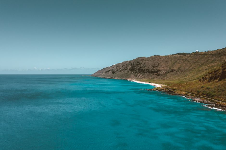
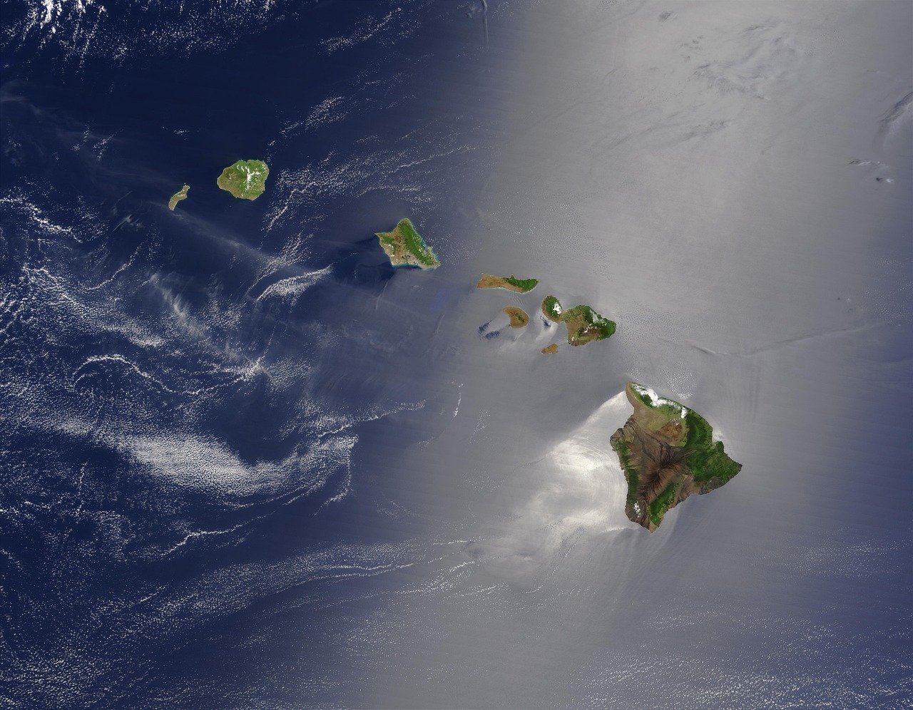
Hawaiʻi Island, usually called the Big Island, is larger than all the other Hawaiian islands combined and still growing. Five volcanoes built it, and two of them, Kīlauea and Mauna Loa, are among the most active on Earth. In a single day you can drive from black-sand beaches and coral reefs to snow-dusted summits above 13,000 feet (4,000 m), from the dry lava fields and resorts of the Kona and Kohala coasts to the rainforest, waterfalls and old plantation towns around Hilo. Most people come for Kīlauea’s eruption in Hawaii Volcanoes National Park, the stargazing on Mauna Kea, snorkeling with manta rays at night off Kona, and the history at Kealakekua Bay and Puʻuhonua o Hōnaunau. Distances are long, so plan to split your stay between the two sides of the island.
Right now in Hawaii Island (Kailua-Kona)
- Wed23–29°C73–85°FClear
- Thu26–30°C78–86°FMostly clear
- Fri26–28°C78–82°F2 mm rain
- Mon 12 Oct Columbus Day
- Mon 12 Oct Indigenous Peoples' Day · regional holiday in Hawaii
Top tours in Hawaii Island
See all tours for Hawaii Island →
From local operators, with prices and reviews; you check availability and book on Viator, our partner. We may earn a commission at no extra cost to you. How we earn money
Hawaii Island at a glance
- Best months: April to June and September to October for good weather and fewer visitors; winter (December to March) is whale season and the busiest time.
- Time needed: 5–7 days to see both sides, with nights in Kona or Kohala and in Hilo or Volcano; 10 days for a slower pace.
- Getting there: Ellison Onizuka Kona International Airport (KOA) on the west side, with nonstop flights from the US mainland, and Hilo International Airport (ITO) on the east side, mainly with inter-island flights from Honolulu.
- Costs (as of October 2026): Hawaii Volcanoes National Park $30 per car for 7 days; Puʻuhonua o Hōnaunau $20 per car; ʻAkaka Falls $5 per person plus $10 parking for non-residents; the Mauna Kea Visitor Information Station is free; hotel bills add about 18.7% in taxes.
- Before you go: entry rules (ESTA or visa), money, driving and general safety are in our United States travel guide.
The island’s regions and who each suits
Kona: Kailua-Kona and the coffee coast
The sunny, dry west side has the most hotels and condos, a lively seafront town in Kailua-Kona, coffee farms on the slopes above, snorkeling bays and the night manta ray dives. Good for first-timers, divers and anyone wanting sun.
The Kohala Coast
North of the airport, luxury resorts and golf courses sit like oases on black lava fields, beside some of the island’s best white-sand beaches, such as Hāpuna and Kaunaʻoa. Farther north, the green hills of North Kohala lead to the historic town of Hāwī and the Pololū Valley lookout.
Waimea and the Hāmākua Coast
Upcountry Waimea is ranch country, cool and green, with paniolo (Hawaiian cowboy) history and good restaurants. The Hāmākua Coast to the east is a dramatic drive past gulches, waterfalls and old sugar towns toward Hilo, with the lookout over Waipiʻo Valley at its northern end.
Hilo and Puna
Hilo, on the wet windward side, is an unhurried old town with a farmers market, the Pacific Tsunami Museum, Japanese gardens and waterfalls nearby. It is the closest town to Mauna Kea and, with the village of Volcano, the best base for Hawaii Volcanoes National Park. Puna to the south is rural and shaped by recent lava flows.
Kaʻū and the south
The island’s quiet southern district has Punaluʻu’s black-sand beach, Ka Lae (South Point), the southernmost point in the United States, and the Kahuku Unit of the national park.
Kīlauea and Hawaii Volcanoes National Park
Hawaii Volcanoes National Park, 30 miles (48 km) from Hilo and about 95 miles (153 km) from Kailua-Kona, is the island’s highlight. According to the US Geological Survey’s Hawaiian Volcano Observatory, Kīlauea has been erupting in episodes inside Halemaʻumaʻu crater since 23 December 2024, with 54 lava-fountaining episodes by early October 2026, each lasting a few hours and separated by pauses of two weeks or more. On 3 October 2026 the volcano was in a pause with glowing vents, and the alert level was WATCH (aviation code ORANGE); all activity has stayed inside a closed area of the park. Mauna Loa was at the normal level. Entrance costs $30 per car for 7 days as of October 2026, there is no $100 non-resident fee and no reservation, and the $55 Hawaiʻi Tri-Park pass also covers Haleakalā on Maui and Puʻuhonua o Hōnaunau. The main visitor center is closed for renovation in 2026, with a temporary Welcome Center at Kilauea Military Camp. See our Hawaii Volcanoes National Park guide for eruption viewing, vog, Chain of Craters Road and Kahuku in detail.
Volcanic gas from Kīlauea forms vog, a haze that drifts with the wind and often reaches the Kona side in the afternoons. People with asthma or heart conditions should check air quality forecasts and limit time outdoors when vog is heavy.
Mauna Kea: summit access and stargazing
At 13,796 feet (4,205 m), Mauna Kea is Hawaiʻi’s highest mountain, a sacred place for Native Hawaiians and the site of some of the world’s major telescopes. The road leaves the Daniel K. Inouye Highway (Saddle Road) at mile marker 28. According to the University of Hawaiʻi at Hilo, which runs it, the Visitor Information Station (Onizuka Center) at 9,200 feet (2,800 m) is open 9 a.m. to 9 p.m. every day of the year, with no entrance, parking or registration fee; it has exhibits, a gift shop, toilets, rangers, and a short walk up Puʻukalepeamoa hill for sunset.
- Summit rules: above the station the road is steep and unpaved in places, and only four-wheel-drive vehicles are allowed; use low range to save your brakes on the way down. Many rental contracts do not allow driving to the summit, so check yours, or join a licensed tour.
- Hours: the summit area closes to visitors from 30 minutes after sunset to 30 minutes before sunrise. You can stay on the mountain for stargazing, but below the summit area.
- Health: at 14,000 feet there is about 40% less oxygen than at sea level. Stop at the station for at least 30 minutes to acclimatize. Children under 13, pregnant women and people in poor health should not go above the station.
- Stargazing: the station’s free, once-a-month telescope evening needs a reservation; on other nights you can bring binoculars and enjoy the sky on your own. No open flames or camping stoves are allowed.
- Closures: the Humuʻula Trail to the summit was closed after Hurricane Nolo in September 2026, until further notice.
Arrive 1.5 to 2 hours before sunset to acclimatize. It is often below freezing at the summit and windy after dark, even when the coast is hot.
Top things to see on Hawaii Island
Prices, hours and access rules below were checked on the official sites in October 2026; check again before you go.
Puʻuhonua o Hōnaunau National Historical Park
On the Kona coast south of Kealakekua, this restored puʻuhonua (place of refuge) was where people who broke kapu (sacred laws) could find safety. Carved wooden kiʻi, a reconstructed temple and the massive Great Wall stand among palms on a lava shoreline, with turtles resting on the rocks. As of October 2026 the National Park Service charges $20 per car, $15 per motorcycle or $10 per person; the Tri-Park pass is accepted. The bay next door, known as Two Step, is a favorite snorkeling spot.
Kealakekua Bay and the Captain Cook Monument
A marine life conservation district with clear water and spinner dolphins, Kealakekua Bay is where Captain James Cook arrived in 1779 and was killed the same year. According to the Hawaiʻi Division of State Parks, there are only two ways to land at Kaʻawaloa Flat, by the Cook monument: hike the steep Kaʻawaloa Trail from the upland road, or join a guided kayak tour with one of the permitted companies. All vessels, including rented kayaks and paddleboards, need a State Parks permit to cross the bay, and permitted kayaks may not land at Kaʻawaloa or launch from Nāpōʻopoʻo wharf. Hikiau Heiau on the shore at Nāpōʻopoʻo is a sacred site; do not climb on it. Many visitors see the bay on a boat snorkel tour from Kona.
Manta ray night snorkel
Off Kona, giant manta rays gather after dark to feed on plankton drawn to lights shone into the water, one of the most memorable wildlife encounters in Hawaiʻi. Licensed boats leave Honokōhau Harbor and Keauhou in the evening; you float at the surface holding a light board while the mantas glide below. Do not touch the mantas, kick them or dive down, and choose an operator that follows the industry’s manta-viewing guidelines. Seasickness tablets help on rough nights.
Waipiʻo Valley
The “valley of the curving water” at the end of the Hāmākua Coast is a deep, sacred valley with taro fields, waterfalls and a black-sand beach. The lookout at the end of Highway 240 is open to all, but the steep road into the valley has been restricted by Hawaiʻi County emergency rules since 2022 because of rockfall and road damage. Under those rules, pedestrians and horseback riders may not use the road, and only Hawaiʻi County residents, permitted licensed tour operators and Native Hawaiians exercising traditional rights may drive down, in low-range four-wheel-drive vehicles. Enjoy the view from the lookout, or ask a permitted tour company; check the county’s latest rule before you go. The Muliwai Trail and Waimanu campground beyond the valley were closed after the September 2026 storms.
Pololū Valley
At the end of the road in North Kohala, a lookout gazes down into the green Pololū Valley and along a coast of sea cliffs. A short but very steep trail descends to a boulder beach. The trail is often muddy and slippery, the ocean is dangerous for swimming, and the area has cultural sites to respect; park only in marked spaces and follow posted rules from local stewards.
ʻAkaka Falls and the Hāmākua Coast
A loop path through a rainforest garden leads to views of ʻAkaka Falls, which plunges 442 feet (135 m) into a gorge, and smaller Kahūnā Falls. According to the Division of State Parks, the park is open from 8:30 a.m. to 5 p.m.; as of October 2026 non-residents pay $5 per person and $10 per vehicle. Part of the trail remained closed after fallen trees from the September 2026 storms.
Hilo
Walk the bayfront and Liliʻuokalani Gardens, browse the farmers market, and visit Rainbow Falls on the edge of town. Hilo’s ʻImiloa Astronomy Center explains Mauna Kea’s science and Hawaiian navigation and is open Tuesday to Sunday.
Peaks and mountains
- Mauna Kea
Nature
- Pololū Valley
- Rainbow Falls
Parks and gardens
- Akaka Falls State Park
- Hapuna Beach State Recreation Area
- Liliuokalani Park and Gardens
Protected areas
- Puʻuhonua o Hōnaunau National Historical Park
Beaches
- Waipiʻo Valley
Beaches and ocean safety
The best swimming beaches are on the Kohala Coast, including Hāpuna Beach State Recreation Area, where the Waialea section remained closed in October 2026 because of fallen trees, plus Kaunaʻoa and ʻAnaehoʻomalu. Kona has small coves and rocky snorkeling entries such as Kahaluʻu; the east side has few safe swimming spots. Punaluʻu’s black sand is for looking, not for taking. Green sea turtles rest on many beaches; NOAA asks people to stay at least 10 feet (3 m) away. Check with lifeguards where there are any, watch for high surf, and use mineral sunscreen, as Hawaiʻi bans the sale of sunscreens with oxybenzone and octinoxate. See our snorkeling, diving and beaches guides.
Other things to do on Hawaii Island
- Hiking: Kīlauea Iki and the summit trails in the national park, the Kahuku Unit’s ranch trails, Pololū and Mauna Kea’s lower slopes. See our hiking guide.
- Boat trips: snorkel cruises to Kealakekua Bay, the manta ray night snorkel, and whale watching from December to April. See our boat trips guide.
- Kona coffee: tour a farm and taste the harvest, which runs mainly from late summer to winter.
- Historic sites: Puʻukoholā Heiau near Kawaihae, built by Kamehameha I, and Hulihee Palace in Kailua-Kona.
- Cycling: quiet coastal roads in North Kohala; this is the island of the Ironman World Championship. See our cycling guide.
- Surfing: lessons on gentle breaks near Kona; most of the island’s surf is for experienced surfers. See our surfing guide.
Getting there and getting around
Most visitors fly into Kona (KOA), which has nonstop flights from many West Coast cities; Hilo (ITO) has mostly inter-island flights from Honolulu, so it pays to fly into one and out of the other. Hawaiian Airlines and Southwest Airlines fly between the islands. A rental car is essential: Hawaiʻi County’s Hele-On buses link the main towns but are infrequent, and rideshare cars are scarce outside Kona and Hilo. The Daniel K. Inouye Highway (Route 200, formerly Saddle Road) crosses the island between Mauna Kea and Mauna Loa, the quickest way between the coasts.
| From Kailua-Kona to | Distance | Driving time |
|---|---|---|
| Kohala Coast resorts | about 25–30 miles (40–48 km) | 35–45 minutes |
| Puʻuhonua o Hōnaunau | about 22 miles (35 km) | 40 minutes |
| Mauna Kea Visitor Information Station | about 60 miles (97 km) | about 1.5 hours via Route 200 |
| Hilo | about 75 miles (121 km) via Route 200 | about 1.75–2 hours |
| Hawaii Volcanoes National Park | 95 miles (153 km) | 2–2.5 hours via Highway 11 |
| Waipiʻo Valley Lookout | about 65 miles (105 km) | about 1.5 hours via Waimea |
Fill up before long drives: gas stations are far apart in Kaʻū, on Route 200 and in North Kohala. Night driving on rural roads is dark, and cattle and nēnē can be on the road.
Around Hawaii Island and other islands
- Volcano Village: the gateway to the national park, with B&Bs in the rainforest.
- Ka Lae (South Point) and the green-sand beach: windswept cliffs at the southern tip of the country; the walk to Papakōlea beach is long and hot.
- Maui: Haleakalā and the Road to Hāna, a short flight away (see our Maui guide).
- Oʻahu and Kauaʻi: Waikīkī and Pearl Harbor, or the Nā Pali Coast (see our Honolulu and Kauai guides).
Nearby destinations
- Hawaii Volcanoes National Park39 km
- Maui157 km
When to go and how long to stay
The island has many climates. The Kona and Kohala coasts are sunny and dry all year, Hilo is one of the wettest towns in the United States, and the high summits are cold. The table uses NOAA’s 1991–2020 climate normals for Kona’s airport: average daily highs and lows, and days with at least 0.10 in (2.5 mm) of rain.
| Season | Average high / low | Rainy days per month | What it’s like | Good for |
|---|---|---|---|---|
| Winter (Dec–Feb) | 81–82 °F (27–28 °C) / 68–70 °F (20–21 °C) | 1–2 | Warm and dry in Kona; rain in Hilo; snow possible on the summits | Whale watching, stargazing; peak prices |
| Spring (Mar–May) | 82–84 °F (28–29 °C) / 70–73 °F (21–23 °C) | 1–2 | Sunny, with calmer seas | Snorkeling, hiking, manta night snorkel |
| Summer (Jun–Aug) | 85–87 °F (29–31 °C) / 74–76 °F (23–24 °C) | 1–2 | Hot and dry on the coast; afternoon clouds upslope | Beaches, family trips |
| Fall (Sep–Nov) | 87 °F falling to 84 °F (31 to 29 °C) / 75 °F falling to 72 °F (24 to 22 °C) | 1–2 | Warm and quiet; Kona coffee harvest; hurricane season ends 30 November | Fewer crowds, calm seas |
Kona’s airport averages only about 9.9 in (251 mm) of rain a year on about 19 days, while Hilo’s airport gets about 120 in (3,058 mm) on 186 days, so pack for both. The Central Pacific hurricane season runs from 1 June to 30 November. In 2026, Lala in August and Nolo in September brought down trees in several state parks: as of 30 September 2026, the Hawaiʻi Department of Land and Natural Resources reported Lapakahi State Historical Park and the Waialea section of Hāpuna closed, part of the ʻAkaka Falls trail closed, and camping and cabins closed at Hāpuna, Kīholo and Kalōpā, while most other parks had reopened.
Weather month by month
Hawaii Island in 5 days
Day one, settle in Kona and snorkel at Kahaluʻu or Two Step, then the manta ray night snorkel. Day two, Kealakekua Bay by boat or kayak tour and Puʻuhonua o Hōnaunau. Day three, drive the Kohala Coast to Pololū and Waimea, then cross Route 200 to the Mauna Kea Visitor Information Station for sunset and stars. Day four, Hilo, ʻAkaka Falls and the Waipiʻo Valley Lookout, and on to Volcano. Day five, Hawaii Volcanoes National Park, with the caldera glow after dark if Kīlauea is active.
A week or more
Add a second day in the national park for Chain of Craters Road and Kahuku, a Kona coffee farm tour, a day at Hāpuna or Kaunaʻoa beach, South Point and Punaluʻu, and a winter whale-watching cruise.
Where to stay on Hawaii Island and the hotel taxes
- Kailua-Kona and Keauhou: hotels and condos in town, the best value on the sunny side.
- The Kohala Coast: large luxury resorts on the island’s best beaches.
- Hilo: older hotels and B&Bs, close to Mauna Kea and the national park.
- Volcano Village: rainforest cottages and B&Bs at the park entrance, plus Volcano House inside the park.
Hotel taxes: room rates in Hawaiʻi are quoted before tax. Since 1 January 2026, under Act 96 of 2025, the state transient accommodations tax (TAT) is 11%, up from 10.25%. Hawaiʻi County adds its own 3% transient accommodations tax, and hotels usually pass on the general excise tax at up to 4.712%. Together that is about 18.7% on top of the room rate. The same 2025 law tried to tax cruise fares, but a federal appeals court blocked that part and the state is not enforcing it until further notice. Resorts often add a daily resort fee and parking charge; under the Federal Trade Commission’s fees rule in force since May 2025, mandatory fees must be included in the advertised total price.
Practical tips for Hawaii Island
- Split your stay: two bases, one on each side, save hours of driving.
- Check volcano and park updates: the HVO daily update for Kīlauea and the DLNR park notices for storm closures.
- Respect sacred places: Mauna Kea, Kīlauea, Waipiʻo and the heiau are deeply important to Native Hawaiians; stay on paths and do not take rocks or sand.
- Altitude: going from the beach to Mauna Kea in a few hours can cause altitude sickness; descend if you feel unwell.
- Time zone: Hawaiʻi Standard Time (UTC−10), no daylight saving time; after 1 November 2026, the island is 2 hours behind California.
- Emergencies: call 911; phone signal is patchy in Kaʻū, on Mauna Kea and in deep valleys.
What to pack for Hawaii Island
Pack for summer and for winter: swimwear, a rash guard, mineral sunscreen and sandals for the coast, plus a warm jacket, hat and gloves for Mauna Kea at sunset and a fleece and rain jacket for Volcano and Hilo. Add sturdy closed shoes for lava and muddy trails, a headlamp for night viewing and stargazing, binoculars, a dry bag, seasickness tablets for night boat trips and a reusable water bottle.
Hawaii Island travel FAQ
Should I stay in Kona or Hilo?
Both, if you can: Kona or the Kohala Coast for beaches and sun, and Hilo or Volcano for the national park, waterfalls and Mauna Kea. The drive between them takes about two hours.
Is Kīlauea erupting?
It has been erupting in episodes inside Halemaʻumaʻu since 23 December 2024, with 54 episodes by early October 2026. On 3 October 2026 the alert level was WATCH (aviation code ORANGE); check HVO’s daily update before you go.
Can I drive to the top of Mauna Kea?
Only in a four-wheel-drive vehicle above the Visitor Information Station at 9,200 feet, and the summit area closes 30 minutes after sunset. Children under 13 and pregnant women should not go above the station.
Is the Mauna Kea Visitor Information Station free?
Yes. It is open 9 a.m. to 9 p.m. daily with no entrance or parking fee; the monthly telescope evening needs a reservation.
Can I hike down into Waipiʻo Valley?
Not on the valley road as of October 2026: county emergency rules ban pedestrians and limit driving to residents, permitted tour operators and Native Hawaiian practitioners. The lookout is open to everyone.
How do I get to the Captain Cook Monument?
Hike the Kaʻawaloa Trail or join a guided kayak tour with a State Parks–permitted company; boats from Kona also snorkel in the bay. Individual kayaks may not land at Kaʻawaloa.
Do I need a reservation for Hawaii Volcanoes National Park?
No. Entry is $30 per car for 7 days with no reservation and no $100 non-resident fee, as of October 2026.
What is the hotel tax on Hawaii Island?
About 18.7% as of October 2026: the 11% state transient accommodations tax, Hawaiʻi County’s 3% and up to 4.712% general excise tax. Resort fees come on top.
Which airport should I fly into?
Kona (KOA) for the sunny west side and most mainland flights; Hilo (ITO) for the east side and the national park. Many visitors fly into one and out of the other.
When can I see manta rays in Kona?
All year, on evening snorkel and dive trips from Honokōhau Harbor and Keauhou, weather permitting. Never touch the mantas.
Plan your trip
Partner links: TravelerCenter may earn a commission if you book, at no extra cost to you.
Sources · last reviewed 4 October 2026
Researched and last reviewed on 4 October 2026. Kīlauea and Mauna Loa status: US Geological Survey Hawaiian Volcano Observatory; Hawaii Volcanoes National Park and Puʻuhonua o Hōnaunau fees: National Park Service; Mauna Kea Visitor Information Station hours and summit rules: University of Hawaiʻi at Hilo; Kealakekua Bay rules, ʻAkaka Falls fees and storm closures: Hawaiʻi Department of Land and Natural Resources; Waipiʻo Valley Road rules: County of Hawaiʻi emergency rules (read through a search summary, as the county site blocked our tools); hotel taxes: Hawaiʻi Department of Taxation and Hawaiʻi County; resort fees: Federal Trade Commission; climate: NOAA’s 1991–2020 normals for Kona and Hilo airports. Pololū trail conditions, the manta ray snorkel, ʻAkaka Falls’ height, driving distances and the coffee harvest are general knowledge, flagged for checking. Rules and closures change, so check the official sites before you go. For entry rules, money and general safety, see our United States travel guide.
Also: NOAA NCEI normals 1991–2020, Kona International Airport (Keāhole) (climate)
Data: Weather: MET Norway (CC BY 4.0) · Sea temperature: NOAA CoastWatch · Rates: ECB · Holidays: Nager.Date · Costs: World Bank ICP and price levels · © OpenStreetMap contributors (ODBL) · Wikidata (CC0)