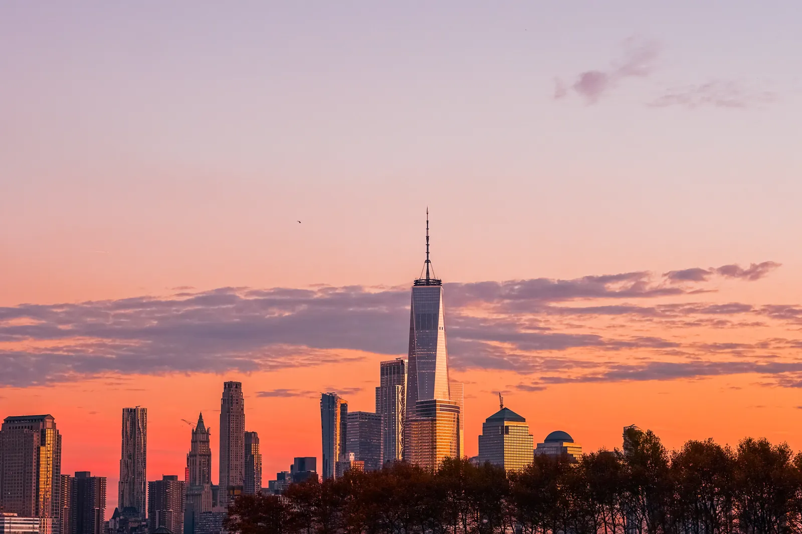
Short answer: with 7 days, stay in the Northeast and go by train: four nights in New York City, a stop in Philadelphia, and two nights in Washington, D.C. With 10 days, fly to Las Vegas and drive the great national parks loop: Zion, Bryce Canyon, the Grand Canyon and Sedona, ending in Phoenix. With 14 days, drive California from San Francisco and Yosemite down the coast through Monterey and Big Sur to Los Angeles and San Diego, or pair New York and Washington with Miami, the Everglades and Key West. Distances are huge, so pick one region and fly between regions.
This guide turns the sample trips on our United States travel guide into day-by-day plans, with travel times between stops and the best area to sleep each night. To pick your month, see the best time to visit the United States, and for the places themselves, our top 10 places to visit in the United States. For a plan built around your dates and interests, use our AI trip planner. Everything was checked as of October 2026.
The three routes at a glance
| Route | Days | Stops (nights) | Best for |
|---|---|---|---|
| New York, Philadelphia and Washington | 7 | New York City 4, Washington, D.C. 2 | First trip, cities, museums, no car |
| Southwest national parks loop | 10 | Las Vegas 2, Zion 2, Bryce Canyon 1, Grand Canyon 2, Sedona 2 | Road trippers, hikers, desert scenery |
| California coast and Yosemite | 14 | San Francisco 3, Yosemite 2, Monterey 2, Santa Barbara 1, Los Angeles 3, San Diego 2 | The classic West Coast road trip |
| East Coast and Florida | 14 | New York City 4, Philadelphia 1, Washington, D.C. 3, Miami 3, Key West 2 | Cities first, then beaches and the Everglades |
Flying from New York to Los Angeles takes about six hours, the same as crossing the Atlantic, so don’t try to see both coasts in a week. Book “open-jaw” tickets, flying into one city and home from another: into New York and out of Washington, into Las Vegas and out of Phoenix, into San Francisco and out of San Diego. A car is unnecessary, even a nuisance, in New York, Washington, Philadelphia and Boston, and essential for the national parks and California’s coast.
Travel times between the main stops
Distances below come from the National Park Service and our destination guides; driving times are approximate, without stops or traffic. Amtrak train times are typical figures, as we could not read journey times on Amtrak’s own site; Amtrak lists the full Acela run from Boston to Washington at about 7 hours.
| Leg | How | Time | Source |
|---|---|---|---|
| New York – Philadelphia | Amtrak | about 1 h 15 (approximate) | Typical schedules |
| Philadelphia – Washington, D.C. | Amtrak | about 1 h 45–2 h (approximate) | Typical schedules |
| New York – Washington, D.C. | Amtrak (Acela or Northeast Regional) | about 3–3 h 30 (approximate) | Typical schedules |
| New York – Boston | Amtrak | about 3 h 30–4 h (approximate) | Typical schedules |
| Las Vegas airport – Zion | Car, 170 miles (274 km) | about 2 h 30–3 h | Our Zion guide |
| Zion – Bryce Canyon | Car, about 85 miles (137 km) | about 1 h 45 (approximate) | Our Bryce Canyon guide |
| Bryce Canyon – Grand Canyon South Rim | Car | about 4 h 30–5 h (our estimate) | Estimate |
| Las Vegas – Grand Canyon South Rim | Car, 278 miles (447 km) | about 4 h 30 | NPS (distance) |
| Grand Canyon South Rim – Sedona | Car | about 2 h 30 | Our Sedona guide |
| Sedona – Phoenix airport | Car | about 2 h | Our Sedona guide |
| San Francisco – Yosemite Valley | Car, 195 miles (314 km) | about 4–5 h | Our Yosemite guide |
| Yosemite Valley – Monterey | Car | about 4 h (our estimate) | Estimate |
| San Francisco – Monterey | Car, about 120 miles (193 km) | about 2 h 30 | Our Monterey guide |
| Monterey – Santa Barbara via Big Sur (Highway 1) | Car | a full day with stops (approximate) | Caltrans road status |
| Santa Barbara – Los Angeles | Car (US 101) or Amtrak Pacific Surfliner, 95 miles | about 2 h by car | Our Santa Barbara guide |
| Los Angeles – San Diego | Car or Amtrak Pacific Surfliner, 120 miles (193 km) | about 2 h 30 by car (approximate) | Our Los Angeles guide |
| Miami – Key West | Car, Overseas Highway (113 miles from Key Largo) | 4 h or more (approximate) | Florida Keys tourism board (distance) |
| Washington, D.C. – Miami | Flight | about 2 h 30 (approximate) | Flight schedules |
Amtrak fares rise as trains fill, so book the Northeast Corridor early; seats are guaranteed on reserved trains. In national parks, give yourself more time than the map suggests: viewpoints, shuttles and traffic at entrance stations add up.
7 days: New York, Philadelphia and Washington, D.C.
All by subway, Metro and train. Fly into New York and home from Washington.
- Day 1, New York City: Arrive at JFK, LaGuardia or Newark and head to Manhattan. Evening in Times Square or on an observation deck. Sleep: Midtown Manhattan.
- Day 2, Lower Manhattan: The ferry to the Statue of Liberty and Ellis Island (book ahead), the 9/11 Memorial, Wall Street, then a walk across the Brooklyn Bridge to Dumbo at sunset. Sleep: same.
- Day 3, Central Park and the museums: The Metropolitan Museum of Art or the American Museum of Natural History, a walk through Central Park, and a Broadway show. Sleep: same.
- Day 4, neighborhoods: The High Line, Chelsea Market, Greenwich Village and SoHo, or MoMA and Fifth Avenue; the subway costs $3 a ride, tapping a contactless card or phone. Sleep: same.
- Day 5, Philadelphia and on to Washington: Amtrak to Philadelphia (about 1 h 15). Independence Hall and the Liberty Bell, a cheesesteak for lunch, then the train on to Washington (about 1 h 45–2 h). Sleep: downtown Washington or near the Mall.
- Day 6, the National Mall: The Capitol, the Smithsonian museums (almost all free), the Washington Monument and the Lincoln Memorial at dusk. A one-day Metro pass costs $13.50. Sleep: same.
- Day 7, Georgetown and home: A morning in Georgetown or at Arlington National Cemetery, then fly from Reagan National (DCA) or Dulles (IAD), both on Metrorail.
Swap it: prefer New England? Replace Philadelphia and Washington with Boston (about 3 h 30–4 h by train) for two nights, and add Cape Cod in summer. More on each stop: New York City, Philadelphia, Washington, D.C., Boston and Cape Cod.
10 days: the Southwest national parks loop
Red rock canyons, hoodoos and the Grand Canyon by car. Fly into Las Vegas and home from Phoenix (or loop back to Las Vegas). The best months are April to May and late September to November; summer days in the desert pass 100 °F (38 °C).
- Day 1, Las Vegas: Arrive, pick up your car and walk the Strip, with the Bellagio fountains at night. Sleep: the Strip or Downtown.
- Day 2, Red Rock or Hoover Dam: A morning drive through Red Rock Canyon (timed reservation in busy months) or out to Hoover Dam, then a show. Sleep: same.
- Day 3, to Zion: About 2 h 30–3 h northeast. Afternoon walk on the Pa’rus Trail or to the Emerald Pools. Sleep: Springdale, at the park’s South Entrance.
- Day 4, Zion Canyon: Ride the free shuttle up the Scenic Drive (closed to private cars in shuttle season) to hike the Riverside Walk and wade into The Narrows, or climb to Scout Lookout. Angels Landing needs a permit. Sleep: same.
- Day 5, to Bryce Canyon: Through the Zion–Mount Carmel tunnel (about 85 miles). Sunset over the Bryce Amphitheater, then the Queen’s Garden and Navajo Loop, the park’s most popular hike (about 2.9 miles, 2–3 hours). Sleep: near the park entrance.
- Day 6, to the Grand Canyon: Sunrise at Bryce, then the long drive south to the South Rim (about 4 h 30–5 h), with a stop at Horseshoe Bend near Page. Sleep: Tusayan, 6 miles south of the park (see note below).
- Day 7, the South Rim: Walk the Rim Trail, ride the free shuttles to Hermit Road’s viewpoints, and drive Desert View Drive east to the Watchtower. Don’t hike to the river and back in a day. Sleep: same.
- Day 8, to Sedona: About 2 h 30 south via Flagstaff and Oak Creek Canyon. Sunset at Airport Mesa or below Cathedral Rock. Sleep: Uptown, West Sedona or the Village of Oak Creek.
- Day 9, the red rocks: Hike to Bell Rock and Courthouse Butte or Cathedral Rock (take the free Sedona Shuttle to busy trailheads, Thursday to Sunday), and buy a Red Rock Pass for national forest sites. Sleep: same.
- Day 10, home: About 2 hours to Phoenix Sky Harbor airport.
Grand Canyon note: after a deadly flash flood on 29 August 2026 damaged the South Rim’s water supply, all overnight lodging inside the park has been suspended since 31 August and campgrounds allow dry camping only; the park stays open for day visits. Sleep in Tusayan, Williams or Flagstaff until the National Park Service announces that lodges have reopened. Non-US residents aged 16 and over now pay a $100 surcharge on top of the entrance fee at 11 of the busiest parks, including Zion, Bryce Canyon and the Grand Canyon, unless they hold the $250 non-resident America the Beautiful annual pass, which pays off on this route. More: Las Vegas, Zion, Bryce Canyon, Grand Canyon, Sedona, Phoenix and Monument Valley.
14 days: California coast and Yosemite
Fly into San Francisco and home from San Diego (rental companies charge a one-way fee). May, June, September and October are best: Yosemite’s high roads are usually open, and San Francisco is at its warmest in September and October.
- Days 1–3, San Francisco: BART from the airport. Cable cars, Chinatown and North Beach, the ferry to Alcatraz (book ahead), a walk or bike ride over the Golden Gate Bridge, Golden Gate Park. Pick up your car on day 4, not before. Sleep: Union Square, Nob Hill or Fisherman’s Wharf (3 nights).
- Day 4, to Yosemite: About 4–5 hours east. Tunnel View and Bridalveil Fall on the way into the valley. Sleep: Yosemite Valley or a gateway town such as El Portal, Mariposa or Groveland (2 nights).
- Day 5, Yosemite Valley: The Mist Trail to Vernal Fall, El Capitan and Half Dome from the meadows, and, if the road is open, sunset at Glacier Point. In 2026 no vehicle reservation was needed.
- Day 6, to Monterey: About 4 hours west. Cannery Row and the harbor’s sea otters and sea lions. Sleep: Monterey or Carmel-by-the-Sea (2 nights).
- Day 7, Monterey Peninsula: The Monterey Bay Aquarium, the 17-Mile Drive, Carmel’s beach and mission, or a whale-watching boat.
- Day 8, Big Sur to Santa Barbara: Highway 1 south past Bixby Bridge and McWay Falls in Julia Pfeiffer Burns State Park, then on to Santa Barbara. Check Caltrans road conditions the day before: the road had a long closure in late summer 2026 and overnight works in October, and some state parks were closed after fires. Sleep: Santa Barbara (1 night).
- Day 9, to Los Angeles: Morning on Stearns Wharf, then about 2 hours to LA. Sunset at Santa Monica Pier. Sleep: Santa Monica, West Hollywood or Downtown (3 nights).
- Days 10–11, Los Angeles: Griffith Observatory and the Hollywood sign, the Getty Center, Venice Beach, a studio tour, or Disneyland in Anaheim. Allow 30–60 minutes for most cross-town drives.
- Day 12, to San Diego: Drive or take the Amtrak Pacific Surfliner along the coast. The Gaslamp Quarter and the harbor. Sleep: Downtown, Little Italy or La Jolla (2 nights).
- Day 13, San Diego: Balboa Park and the San Diego Zoo, the sea lions and coves of La Jolla, sunset at Coronado.
- Day 14, home: San Diego’s airport is only about 3 miles from Downtown.
Want the desert too? Cut San Diego and drive from Los Angeles to Las Vegas (about four to five hours) for the Grand Canyon or Joshua Tree. More: San Francisco, Yosemite, Monterey, Big Sur, Santa Barbara, Los Angeles, San Diego, Napa Valley and our California guide.
14 days: East Coast and Florida
The 7-day city route plus a week in the subtropics. Fly into New York and home from Key West or Miami. Late October to early November and April suit both ends: the cities are mild, and Florida is warm and past or before its rainy season (hurricane season runs from 1 June to 30 November).
- Days 1–4, New York City: As in the 7-day route. Sleep: Midtown Manhattan (4 nights).
- Day 5, Philadelphia: Amtrak (about 1 h 15). Independence Hall, the Liberty Bell and the Reading Terminal Market. Sleep: Old City or Center City (1 night).
- Days 6–8, Washington, D.C.: Train south (about 1 h 45–2 h). The Mall, the Smithsonian, the Capitol, Georgetown, and a day at Mount Vernon. Sleep: downtown (3 nights).
- Day 9, to Miami: A morning flight (about 2 h 30). Metrorail links the airport with downtown. Evening in Little Havana. Sleep: Miami Beach or Brickell (3 nights).
- Day 10, Miami Beach: The Art Deco Historic District and South Beach, and the Wynwood Walls murals.
- Day 11, the Everglades: Cycle or ride the tram on the 15-mile loop at Shark Valley, about 25 miles west of the Turnpike, with alligators along the way (arrive early in the dry season), or head to the Homestead entrance for the Anhinga Trail.
- Day 12, the Overseas Highway: Drive south over 42 bridges (4 hours or more), with stops in Key Largo and at Bahia Honda’s beach. Sleep: Key West’s Old Town (2 nights).
- Day 13, Key West: Duval Street, the Hemingway House, sunset at Mallory Square, or a day trip by boat or seaplane to Dry Tortugas National Park, about 70 miles west.
- Day 14, home: Fly from Key West’s airport, about 3 miles from Old Town, or drive back to Miami.
More: Miami, Miami Beach, Everglades National Park, Florida Keys, Key West and our Florida guide. For theme parks, swap the Keys for Orlando.
Where to sleep, by stop
| Stop | Best area for a short stay | Why |
|---|---|---|
| New York City | Midtown Manhattan | Subway lines to everything, Penn Station for Amtrak |
| Philadelphia | Old City or Center City | Walk to Independence Hall; 30th Street Station nearby |
| Washington, D.C. | Downtown, Penn Quarter or Dupont Circle | Walk or Metro to the Mall; Union Station for trains |
| Las Vegas | The Strip (shows) or Downtown (value) | Easy airport access and car pick-up |
| Zion | Springdale | Free town shuttle to the park entrance |
| Bryce Canyon | Near the park entrance (Bryce Canyon City) | Sunrise and sunset at the rim |
| Grand Canyon | Tusayan (6 miles from the South Entrance); Williams or Flagstaff | In-park lodging suspended since 31 August 2026 |
| Sedona | Uptown, West Sedona or the Village of Oak Creek | Trailheads and shuttles close by |
| San Francisco | Union Square, Nob Hill or Fisherman’s Wharf | Cable cars, BART, walkable sights |
| Yosemite | Yosemite Valley, or El Portal, Mariposa or Groveland | The valley saves hours of driving; book months ahead |
| Los Angeles | Santa Monica, West Hollywood or Downtown | Choose by plans: beaches, nightlife or museums |
| San Diego | Downtown, Little Italy or La Jolla | Near the airport, harbor and beaches |
| Miami | Miami Beach (South Beach) or Brickell | Beach and Art Deco, or the city and Metrorail |
| Key West | Old Town | Walk to Duval Street and Mallory Square |
Hotel taxes and sales taxes vary by city and are added at checkout; most US prices are shown before tax. Our city guides list each city’s hotel tax.
Alternatives by interest
National park lovers
From late June to mid-September, fly to Jackson or Bozeman for five or six days in Yellowstone and Grand Teton; there is no public transport inside Yellowstone. In spring and fall, extend the Southwest loop with Arches and Moab. Some parks need timed-entry or vehicle reservations in peak season, so check nps.gov and recreation.gov first. See our hiking guide.
Music and food lovers
Fly to New Orleans for three or four nights of jazz and Creole cooking, then on to Nashville and Memphis, linked by about three hours of interstate. Chicago is a short flight from either coast.
Beach lovers
Winter is the season for south Florida (November to April), Hawaii and Southern California’s sunshine. For a beach-and-volcano week, base yourself on Maui; for the Gulf, try Sarasota or Naples. See our beach guides.
Fall foliage
From late September to mid-October, follow the 7-day route north instead: New York, Boston and the coast of Maine, with Acadia; or drive Skyline Drive in Shenandoah, about two hours west of Washington.
Families
Orlando’s theme parks plus a few days on the Gulf beaches, or Southern California with Disneyland in Anaheim, San Diego’s zoo and beaches. Avoid national holiday weeks for prices and lines.
Tips for planning your route
- Match the region to the season. April to June and September to October suit cities and desert parks; summer suits the northern parks, Alaska and New England; winter suits Florida, Hawaii and the deserts.
- Sort out entry first. Most visitors need an ESTA or a visa before they fly; apply only on the official CBP or State Department sites.
- Book park lodging and cars early. Lodges, campgrounds and rental cars near the big parks sell out months ahead for summer.
- Check road status on driving days. Highway 1 in Big Sur, Yosemite’s Tioga and Glacier Point roads and the Grand Canyon’s North Rim close for slides, fires or snow; Caltrans and nps.gov post updates.
- Use trains in the Northeast, cars in the West. Don’t rent a car for New York or Washington; parking is expensive and transit is good.
- Watch the time zones. Most of Arizona, including the Grand Canyon, does not change its clocks, while Utah and Nevada do; daylight saving time ends on 1 November 2026.
United States itinerary FAQ
Is 7 days enough for the United States?
Enough for one region: New York with Philadelphia and Washington, or the Southwest parks, or California’s coast in a hurry. Combining both coasts needs two weeks or more.
East Coast or West Coast for a first trip?
East Coast for cities, history and museums without a car; West Coast for national parks, the Pacific coast and road trips. Both make a great first trip; pick by what you want to see, and by the season.
How long is the train from New York to Washington, D.C.?
About 3 to 3 hours 30 minutes, center to center, on Amtrak’s Acela or Northeast Regional trains. Philadelphia is about an hour and a quarter from New York.
Do I need a car in the United States?
Not in New York, Washington, Boston, Philadelphia, Chicago or San Francisco. Yes for national parks, California’s coast, the Southwest and most of Florida outside Miami.
Can I still stay inside the Grand Canyon?
Not as of October 2026: all overnight lodging inside the park has been suspended since 31 August 2026 because of damage to the water supply, and the park is open for day visits. Tusayan, 6 miles south, is the closest base; check nps.gov for reopening news.
How many national parks can I see in 10 days?
Three or four comfortably, as in the Southwest loop: Zion, Bryce Canyon and the Grand Canyon, with Sedona’s red rocks. For non-US residents, the $250 non-resident America the Beautiful pass costs less than paying the $100 surcharge that Zion, Bryce Canyon and the Grand Canyon each charge on top of their entrance fees.
What is the best month for a US road trip?
May or late September to October: mild in the deserts and cities, with high roads in the mountains still open. July and August are best for the northern parks, but busiest. See the best time to visit the United States.
Sources
Researched and last reviewed by TravelerCenter on 8 October 2026. Park distances, shuttles, lodging status, fees and the non-resident surcharge come from the National Park Service (nps.gov); Highway 1 conditions from Caltrans and California State Parks; the Overseas Highway from the Florida Keys tourism board; Sedona’s shuttle and Red Rock Pass from the operators and the US Forest Service; the full Acela run from Amtrak; city transit fares from our city guides. Amtrak journey times between cities, flight times and several driving times are approximate, from typical schedules, general reference and our own estimates, and are flagged for checking. Road conditions, park rules and timetables change, so check with the operator or the park before you travel.
Data: Natural Earth (PUBLIC DOMAIN) · © OpenStreetMap contributors (ODBL) · Wikidata (CC0)